The best road cycling routes around Beauzelle
4.3
(1135)
23,093
riders
1,210
rides
Road cycling routes around Beauzelle are primarily characterized by flat to gently rolling terrain, making the area suitable for various skill levels. The landscape is shaped by the Garonne River, offering scenic riverbanks and access to natural parks like Base de loisirs des Quinze Sols. An extensive network of dedicated cycling paths, including the "Voie Verte" (Greenway), connects Beauzelle to neighboring towns and the Bouconne forest. This environment provides a mix of open paths, forested sections, and routes alongside waterways.
Best road cycling routes around Beauzelle
- The most popular road cycling route is View from Castéra – Chappe Telegraph Tower loop from Beauzelle, a 32.2 miles (51.8 km) trail that takes 2 hours 12 minutes to complete. This moderate route offers varied scenery, including views towards the Chappe Telegraph Tower.
- Another top favourite among local road cyclists is Grenade – Aeroscopia Museum loop from Beauzelle, an easy 31.4 miles (50.6 km) path. This route connects Beauzelle with Grenade and passes by the Aeroscopia Museum, offering a mix of cultural and natural sights.
- Local road cyclists also love the View from Castéra – Le Castéra loop from Beauzelle, a 33.6 miles (54.1 km) trail leading through rural landscapes, often completed in about 2 hours 23 minutes.
- Road cycling around Beauzelle is defined by greenways, river valleys, and agricultural plains. The network offers options for different ability levels, from easy rides to more challenging moderate routes.
- The routes in Beauzelle are highly rated by the komoot community with an average score of 4.3 stars from over 900 reviews. More than 19,000 road cyclists have used komoot to explore Beauzelle's varied terrain.
Last updated: October 18, 2026
4.7
(6)
169
riders
51.4km
02:16
410m
410m
Moderate road ride. Good fitness required. Some segments of this route may be unpaved and difficult to ride.
5.0
(1)
79
riders
48.8km
01:58
220m
220m
Easy road ride. Great for any fitness level. Mostly well-paved surfaces and easy to ride.

3.7
(3)
93
riders
62.2km
02:41
440m
440m
Moderate road ride. Good fitness required. Some segments of this route may be unpaved and difficult to ride.
30
riders
27.2km
01:18
120m
120m
Moderate road ride. Great for any fitness level. Some segments of this route may be unpaved and difficult to ride.
4.0
(2)
52
riders
26.8km
01:13
80m
80m
Moderate road ride. Great for any fitness level. Some segments of this route may be unpaved and difficult to ride.
Get access to more routes and recommendations from other explorers.
Already have an account?
Our route recommendations are based on thousands of hikes, rides, and runs completed by other people on komoot.
Start today with a free account
Your next adventure awaits.
Tips from the Community

The Lalande lock is a single lock located in Toulouse (Haute-Garonne), about a 35-minute walk from the Lacourtensourt station, not to be confused with the other lock of the same name with double basins located in Carcassonne, 98.2 km from Toulouse.
0
0
The port de l’Embouchure is the starting point of the Canal du Midi! A keystone of the three Toulouse canals, it is also the mouth of the Canal latéral à la Garonne and the Canal de Brienne. It is also one of Toulouse's two river ports; the second is the port Saint-Sauveur. A strategic and emblematic site of the Canal du Midi, the port de l’Embouchure bears witness to all the ingenuity deployed on the construction site of the Canal du Midi.
0
0
The creation of the parish of Saint-Aubin is decided in 1843 and a competition is launched by the City for the construction of the church. This begins in 1847, according to the plans of Auguste Delort. After the construction of a first underground church, known as the "low church", and the crypts, the work continues depending on financial resources for almost 90 years. In 1929, the building is almost finished. However, the vaults of the nave and the bell tower were never built. Built on an elongated plan without a prominent transept, this church is accessible by a monumental raised porch and ends with an axial chapel topped with a dome. The eclectic style of this construction borrows from Romanesque, Gothic, and Byzantine styles.
0
0
This magnificent open-air market is set up on the square and around the Saint Aubin Church located on Boulevard Michelet. This market is a true mix of scents and colors. From organic producers to artisan creators, including book or jewelry stands, there is something for everyone. Lovers of world cuisine will be seduced by the stalls of Moroccan pastries or good Indian dishes.
0
0
The Canal du Midi, formerly the Royal Canal, is a 17th-century technical feat designed by Pierre-Paul Riquet to connect the Atlantic to the Mediterranean. Today, it is above all a place for relaxation and discovery, where heritage, nature, and conviviality blend together.
0
0

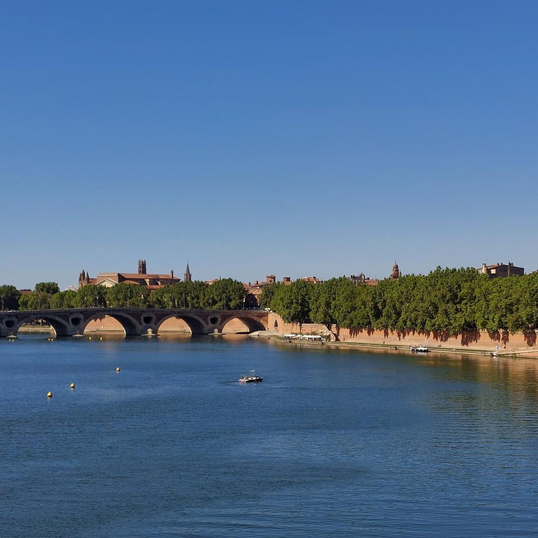
The Henri-Martin promenade is a public road. It is located in the Capitole district. It begins as an extension of the François-Gauzy promenade, which follows the bank of the Garonne at the bottom of the quai de Tounis, precisely under the first arch of the Pont-Neuf. It runs along the course of the river and successively meets the port of La Daurade and the square of the same name, then the port Saint-Pierre and the square of the same name. It ends at the level of the first arch of the Saint-Pierre bridge. It belongs to a pedestrian area. There is no cycling facility. The Henri-Martin promenade is crossed by the long-distance hiking trail 86 (GR 86), which goes from Toulouse to Bagnères-de-Luchon, and by the long-distance hiking trail 861 (GR 861), which goes from Toulouse to Saint-Bertrand-de-Comminges. They are extended to the northeast by the streets Jean-Suau and Léon-Gambetta to the place du Capitole, where they originate, and to the southeast, by the François-Gauzy promenade to join the quai de Tounis at the level of the place Maître-Jean-Maubec.
1
0

The view must be amazing, would there be a gentle slope or path/road that goes up? Please from Colomiers
0
0

It's great that the cycle path goes through the planes👍🏻
0
0
Frequently Asked Questions
How many road cycling routes are available around Beauzelle?
There are over 10 road cycling routes around Beauzelle, offering a variety of experiences for different skill levels. The komoot community has explored these routes over 19,000 times, providing an average rating of 4.3 stars.
What kind of terrain can I expect on road cycling routes in Beauzelle?
Road cycling in Beauzelle primarily features flat to gently rolling terrain, making it accessible for many. You'll find extensive dedicated cycling paths, including the 'Voie Verte' (Greenway), scenic riverbanks along the Garonne, and routes through agricultural plains and forested sections like the Bouconne Forest.
Are there road cycling routes suitable for beginners or families in Beauzelle?
Yes, Beauzelle offers 3 easy road cycling routes perfect for beginners or families. These routes typically follow the region's flat greenways and river paths, providing a relaxed and enjoyable experience away from heavy traffic.
Are there any circular road cycling routes in Beauzelle?
Many of the road cycling routes around Beauzelle are designed as loops, allowing you to start and finish in the same location. For example, the View from Castéra – Chappe Telegraph Tower Tour loop from Beauzelle is a popular moderate circular route covering 32.2 miles (51.8 km).
What are some scenic highlights or attractions I can see while road cycling in Beauzelle?
While cycling, you can enjoy picturesque views along the Garonne River and explore natural parks like the Base de loisirs des Quinze Sols. Routes also pass by cultural sights such as the Aeroscopia Museum. For example, the Grenade – Aeroscopia Museum loop from Beauzelle offers a mix of natural and cultural sights. You can also visit attractions like Capitole Square or Saint-Sernin Basilica in nearby Toulouse.
What is the best time of year for road cycling in Beauzelle?
The spring and autumn months generally offer the most pleasant conditions for road cycling in Beauzelle, with mild temperatures and less rainfall. Summer can be warm, but the region's shaded greenways and river paths provide some relief. Winter cycling is possible, but be prepared for cooler temperatures.
Are there any local cycling clubs or communities in Beauzelle?
Yes, the local Cyclo Club Beauzelle actively organizes non-competitive road cycling excursions. They typically have Sunday rides covering 60 to 120 km, catering to various skill levels. You can find more information about their activities on veloenfrance.fr.
Are there longer or more challenging road cycling routes for advanced cyclists?
While the region is known for its gentle terrain, some routes offer longer distances and slightly more elevation gain for advanced cyclists. For instance, the Lévignac – View from Castéra loop from Beauzelle is a moderate 34.4 miles (55.5 km) trail that takes about 2 hours 26 minutes to complete, providing a good workout through rural landscapes.
Can I access road cycling routes in Beauzelle using public transport?
Beauzelle is well-connected to nearby towns, and some routes are accessible via public transport options in the wider Toulouse metropolitan area. It's advisable to check local bus or tram routes for connections to specific starting points, especially for routes that begin or end in neighboring communities like Blagnac.
What makes the Occitanie region, where Beauzelle is located, special for outdoor activities?
The Occitanie region is exceptionally diverse, boasting eight regional nature parks and two national parks (the Pyrenees National Park and Cévennes National Park). These protected areas offer a wealth of varied landscapes, from mountains and forests to wetlands, providing ample opportunities for cycling and other outdoor pursuits. You can learn more about the region's nature parks on visit-occitanie.com.
Are there any routes that pass by the famous Canal du Midi?
While the Canal du Midi is not directly within Beauzelle, it is easily accessible from the wider Toulouse area. This UNESCO World Heritage site offers 360 km of navigable waterways and dedicated paths, providing additional opportunities for scenic cycling and exploring historical landscapes near Beauzelle.
What is the 'Voie Verte' and how does it enhance road cycling in Beauzelle?
The 'Voie Verte' (Greenway) is an extensive network of dedicated cycling paths that significantly enhances road cycling in Beauzelle. It connects the town to neighboring areas like Cornebarrieu and Blagnac, and extends towards the tranquil Bouconne Forest, offering safe and pleasant routes away from vehicle traffic.
Most popular attractions around Beauzelle

Get inspired with the komoot mobile app


Explore more
Browse the best Road cycling routes in other regions.
