The best walks and hikes around Montouliers
4.5
(465)
1,991
hikers
103
hikes
Hiking around Montouliers offers access to a diverse natural environment in the Hérault department of southern France. The region is characterized by extensive vineyards and olive groves, typical of the Minervois wine region. Rolling hills and Mediterranean scrubland, known as garrigue, provide varied terrain and panoramic views. Montouliers is also part of a naturally remarkable area, including a Natura 2000 site.
Best hiking trails around Montouliers
- The most popular hiking route is Défilé de Marie-Coquette – loop from Cruzy,…
Last updated: October 12, 2026
4.3
(13)
48
hikers
9.62km
02:39
160m
160m
Moderate hike. Good fitness required. Easily-accessible paths. Suitable for all skill levels.
4.7
(9)
35
hikers
9.59km
02:40
170m
170m
Moderate hike. Good fitness required. Easily-accessible paths. Suitable for all skill levels.

4.5
(12)
30
hikers
5.89km
01:34
70m
70m
Easy hike. Great for any fitness level. Easily-accessible paths. Suitable for all skill levels.
4.7
(15)
51
hikers
6.60km
01:48
90m
90m
Easy hike. Great for any fitness level. Easily-accessible paths. Suitable for all skill levels.
4.5
(4)
28
hikers
14.8km
04:19
390m
390m
Moderate hike. Good fitness required. Easily-accessible paths. Suitable for all skill levels.
Get access to more routes and recommendations from other explorers.
Already have an account?
Our route recommendations are based on thousands of hikes, rides, and runs completed by other people on komoot.
Start today with a free account
Your next adventure awaits.

Tips from the Community

Several walking options are available. Either an out-and-back on the paved road starting from Cruzy (7.4km, 130m elevation gain), or a loop that turns towards Villespassans without actually reaching it, skirting around L'Estagnol and descending to the right to the Chapel of Sainte Foi (10km, 210m elevation gain). A small correction regarding the incorrect names: The first gorge at Roquefourcade (the village spring) is called Marie-Coquette, the ruined building after the small Chapel of Sainte Foi is called the Sainte Foi Sheepfold, and the second gorge that climbs towards Les Gyssières (Platières) is called Marie-Close. This walk is especially recommended after the spring rains when there is water in the Nazoure River and waterfalls at Marie-Close.
0
0

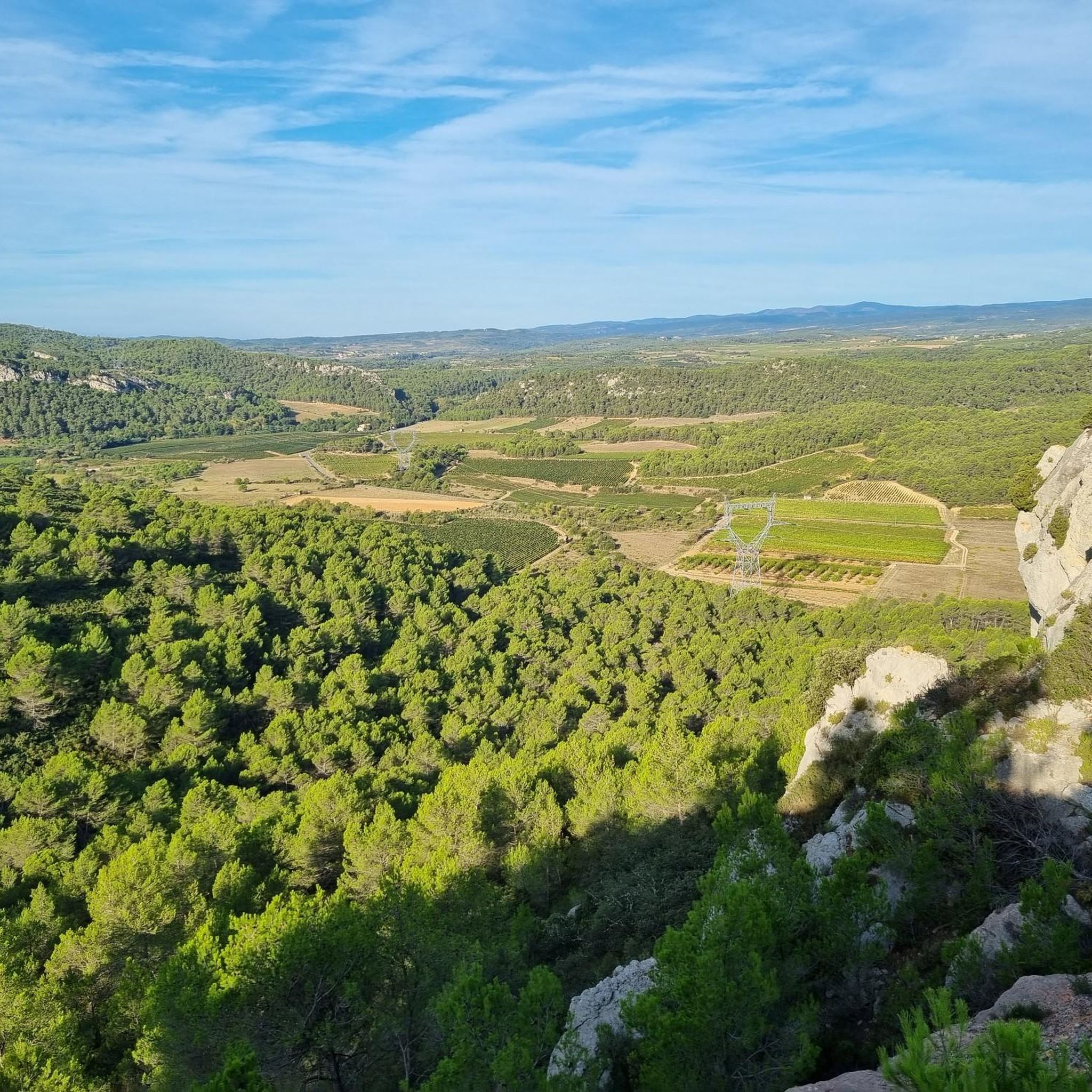
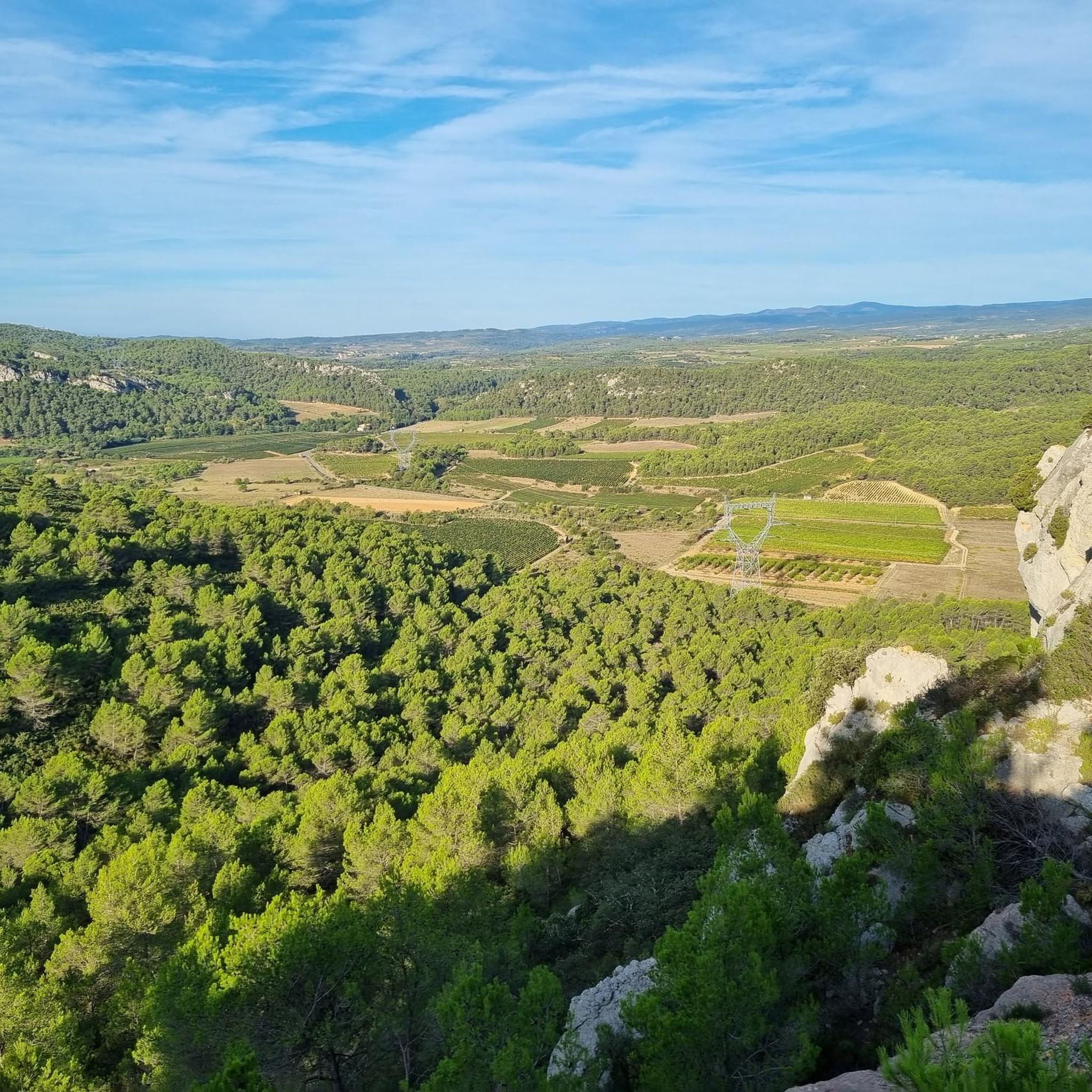
Viewpoint overlooking the Minervois region and paragliding launch site
0
0

Nice place, unfortunately not always open in March
0
0

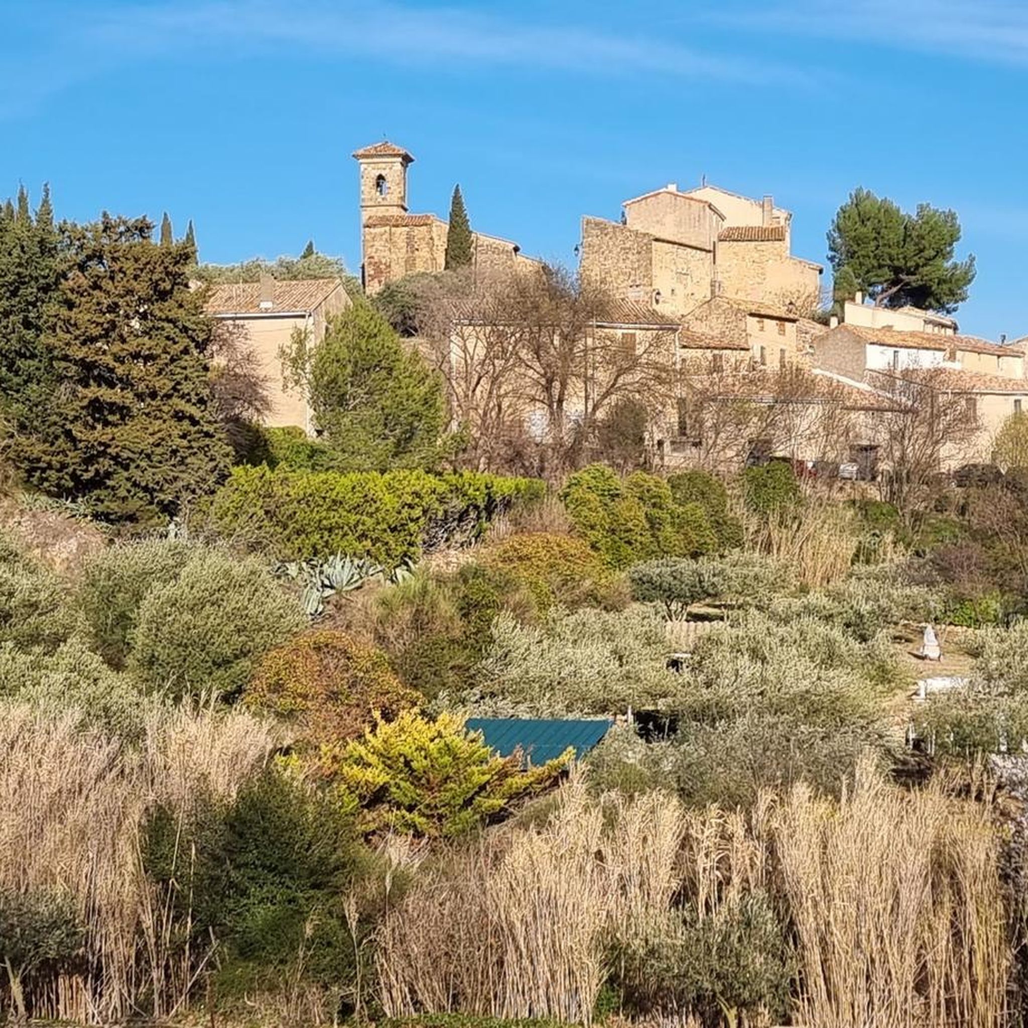
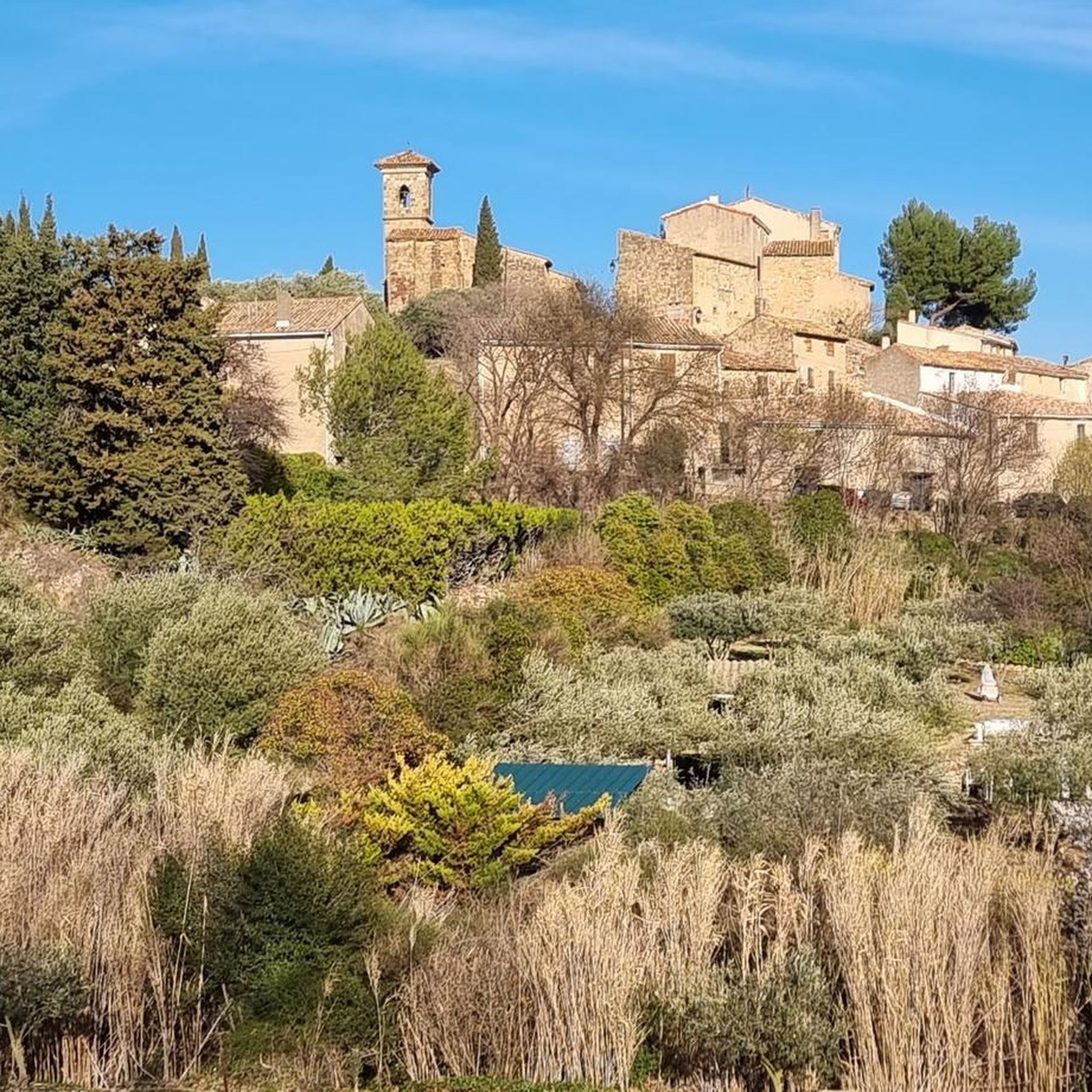
Superb view of the village of Montouliers as well as the Biterrois valley.
0
1

Pretty valley. From Cruzy, once out of the parade (after 3.9km), it is possible to turn left for a return via Montplo le Bas, or right to go around Estagnol and return a little before entering the parade (at the level of the Chapel of Sainte-Foi).
2
0
Frequently Asked Questions
What kind of terrain can I expect on hiking trails around Montouliers?
Hiking around Montouliers offers a diverse landscape. You'll find extensive vineyards and olive groves, characteristic of the Minervois wine region, providing picturesque scenery. The area also features rolling hills and Mediterranean scrubland, known as 'garrigue,' which is rich in aromatic plants like thyme and rosemary. For more challenging routes, there are ascents to viewpoints like Rocher Blanc, offering panoramic views over the Languedoc landscape.
Are there many easy hiking trails suitable for beginners or families in Montouliers?
Yes, Montouliers is considered a 'walker's paradise' with options for various ability levels. There are over 35 easy trails available. For example, the Olive grove – In the maquis loop from Bize-Minervois is an easy 4.0 miles (6.4 km) trail that takes about 1 hour 45 minutes, perfect for a leisurely stroll through the groves.
What are some notable natural features or landmarks to see while hiking near Montouliers?
The region boasts several natural and historical features. You can explore the spectacular Gorges d'Heric, which offer paths alongside a crystal-clear river. The UNESCO World Heritage site, Canal du Midi, is also easily accessible for picturesque walks. Within Montouliers itself, hikers can discover the Roman fountain, a historical feature providing water year-round. Nearby attractions include The Port of Somail and the Junction of the Canal du Midi and the Canal de la Robine.
Are there any circular hiking routes around Montouliers?
Yes, many of the trails around Montouliers are designed as loops, allowing you to start and end in the same location. For instance, the Défilé de Marie-Coquette – loop from Cruzy is a moderate 6.0 miles (9.6 km) circular route exploring the local landscape. Another option is the Gym Bize-Minervois – In the maquis loop from Bize-Minervois, which leads through the characteristic Mediterranean scrubland.
What is the best time of year to go hiking in Montouliers?
Montouliers experiences a Mediterranean climate, with hot, dry summers and mild winters. Spring and autumn are generally the most pleasant seasons for hiking, offering comfortable temperatures and vibrant landscapes. During warmer months, trails near water, like those in the Gorges d'Heric, can be particularly appealing for picnics or swimming.
Can I bring my dog on the hiking trails in Montouliers?
While specific regulations for each trail may vary, many natural areas in France are generally dog-friendly, especially if dogs are kept on a leash. The diverse terrain of vineyards, olive groves, and garrigue offers plenty of opportunities for walks with your canine companion. It's always advisable to check local signage or specific trail information for any restrictions before heading out.
Are there any longer or more challenging hikes for experienced hikers?
Yes, for more adventurous hikers, there are routes like the 'Boucle du Rocher Blanc,' a moderate almost 10-kilometer hike leading to the summit of Rocher Blanc with impressive panoramic views. Another option is the Gym Bize-Minervois – Mont Redon Cross loop from Bize-Minervois, a moderate 14.8 km trail with significant elevation gain, offering a more strenuous experience.
What do other hikers say about the trails in Montouliers?
The hiking routes in Montouliers are highly rated by the komoot community, with an average score of 4.5 stars from over 300 reviews. Hikers often praise the varied terrain, from vineyards to garrigue, and the beautiful panoramic views. The well-maintained trails and the charm of the surrounding villages are also frequently highlighted.
Are there any options for wild swimming along the hiking trails?
Yes, the Gorges d'Heric, located nearby, offer paths running alongside a crystal-clear river, which is ideal for picnics or swimming during warmer months. This provides a refreshing break during your hike.
Is public transport available to access hiking trailheads around Montouliers?
Montouliers is a small commune, and while local bus services might connect to larger towns, direct public transport to specific trailheads can be limited. It's often recommended to have a car for greater flexibility in accessing the diverse range of hiking routes and natural attractions in the wider Minervois region. Parking is generally available in and around the villages that serve as starting points for hikes.
What kind of flora and fauna can I expect to see while hiking?
The garrigue landscape is rich in Mediterranean essences like thyme, rosemary, and broom, offering a fragrant hiking experience. The area is also part of a Natura 2000 site, indicating its ecological importance. You might encounter various bird species, insects, and small mammals typical of the Mediterranean scrubland and vineyards.
Are there any historical points of interest along the trails?
Beyond the Roman fountain in Montouliers, the region is steeped in history. The Canal du Midi, a UNESCO World Heritage site, offers historical locks and structures like the Gailhousty Lock and Spillway. The charming village architecture of Montouliers itself, with its narrow cobbled streets, provides a glimpse into rural French life and historical architecture as you begin or end your hike.
Most popular routes around Montouliers
Most popular attractions around Montouliers

Get inspired with the komoot mobile app


Explore more
Browse the best Hikes in other regions.
