The best walks and hikes around La Meilleraie-Tillay
4.5
(167)
832
hikers
158
hikes
Hiking around La Meilleraie-Tillay offers diverse landscapes within the "Haut-Bocage" Vendéen in western France. The region is characterized by its hilly and undulating terrain, featuring rolling hills and local "puys" that create varied elevation. This bocage countryside presents a mosaic of fields, hedgerows, wooded valleys, and the meandering River Lay, which forms the commune's southern border. Hikers can explore preserved environments of forests, fields, and waterways, including areas around lakes like Lac de l'Espérance and Lake Rochereau.
Best hiking trails…
Last updated: July 5, 2026
4.7
(3)
8
hikers
6.96km
01:58
150m
150m
Easy hike. Great for any fitness level. Easily-accessible paths. Suitable for all skill levels.
4.8
(5)
20
hikers
12.5km
03:27
210m
210m
Moderate hike. Good fitness required. Easily-accessible paths. Suitable for all skill levels.

Sign up for free
4.7
(3)
11
hikers
12.0km
03:18
200m
210m
Moderate hike. Good fitness required. Easily-accessible paths. Suitable for all skill levels.
4.5
(2)
12
hikers
13.0km
03:36
240m
230m
Moderate hike. Good fitness required. Easily-accessible paths. Suitable for all skill levels.
4.7
(3)
12
hikers
21.1km
05:40
260m
260m
Hard hike. Very good fitness required. Easily-accessible paths. Suitable for all skill levels.
Get access to more routes and recommendations from other explorers.
Sign up for free
Already have an account?
Our route recommendations are based on thousands of hikes, rides, and runs completed by other people on komoot.
Start today with a free account
Your next adventure awaits.
Login or Signup




Tips from the Community

And its watercress farm just above
0
0

Long before the discovery of electricity and the inventions associated with it, our ancestors discovered the possibility of harnessing the power of the elements for various purposes - which were useful on the one hand, but could also be a threat as a force of nature on the other. A good example of the human inventiveness of earlier generations is such a mill: the heavy millstones used to grind grain or press oil, for example, could be powered by water or - as here - the wind. Hardly any of them still fulfil their original functions today, but fortunately some have at least survived as evidence of the old days.
3
0


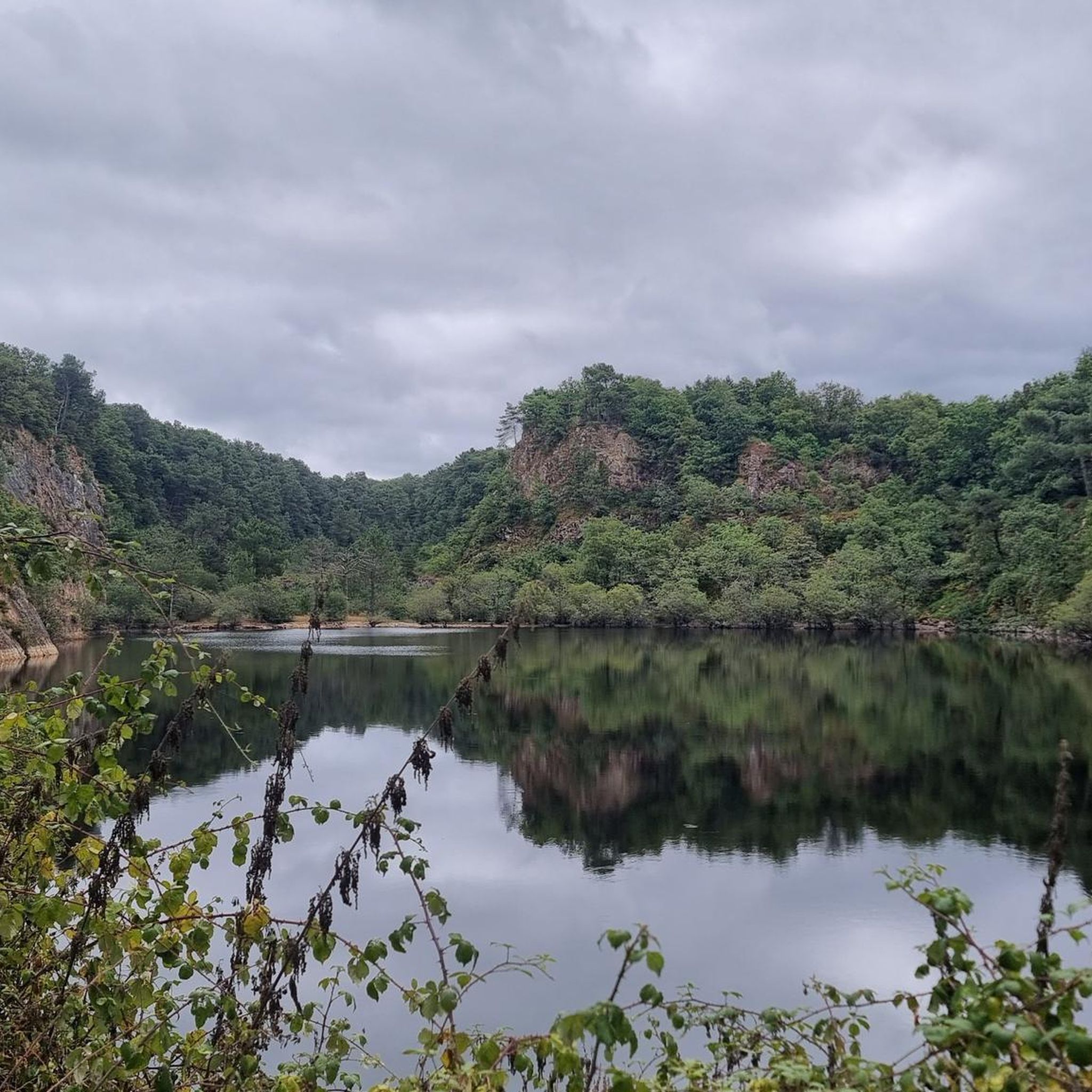
With a beach and walking path around the perimeter, this lake is the perfect place to visit and spend time hiking.
2
0
Fantastic twin windmills where flour is still made and where events are held regularly.
3
0
The ruins of this 11th century castle are worth visiting. Located on the heights of the village of Pouzanges, the castle offers a spectacular view.
2
0

Inner courtyard and ramparts within walking distance.
0
0
3rd summit of the Vendée hills with its 269m (after Mont Mercure and Bois de la Folie). Capped by an old mill transformed into an inn with panoramic views. But it has been closed for many years.
1
0
Frequently Asked Questions
How many hiking trails are available around La Meilleraie-Tillay?
There are over 140 hiking trails in the La Meilleraie-Tillay area, offering a wide range of options for all skill levels. This includes 53 easy routes, 82 moderate routes, and 11 difficult routes, ensuring there's a path for every hiker.
What kind of landscapes can I expect to see while hiking in La Meilleraie-Tillay?
The region is characterized by its diverse 'Haut-Bocage' Vendéen landscape. You'll encounter rolling hills, local 'puys' (summits) offering panoramic views, and a mosaic of fields delineated by hedgerows. The area also features wooded valleys, the meandering River Lay, and several lakes like Lake Rochereau and Lake of Hope, providing a rich natural environment.
Are there any easy or family-friendly hikes in the area?
Yes, La Meilleraie-Tillay offers many easy and family-friendly options. An excellent choice is the Pouzauges Castle and Lake of Hope Loop, an easy 7 km trail that takes about 2 hours to complete, exploring scenic areas around the castle and lake. The local 'Les Métairies' trail (4.5 km) is also described as an easy and bucolic walk suitable for discovering the village and surrounding bocage.
What are some longer or more challenging hiking options?
For those seeking a greater challenge, the region offers several longer routes. The Sainte-Marie chapel – LE LAVOIR MARIE VINCENDEAU loop from Montournais is a difficult 21 km trail, typically taking around 5 hours 40 minutes. Additionally, the Pays de Pouzauges features Grand Randonnée (GRP) circuits like the 'Boucle des Fiefs' (64 km over 3 days) and the 'Boucle des Puys' (59 km over 3 days), which explore the region's diverse terrain and historical sites.
Can I find circular hiking routes in La Meilleraie-Tillay?
Absolutely. Many of the trails in the area are circular, allowing you to start and end at the same point. Popular loop trails include the Pouzauges Castle and Lake of Hope Loop and the Étang de la Cibretière loop from Pouzauges, which winds through the bocage landscape.
What historical or cultural points of interest can I discover on a hike?
Beyond natural beauty, the trails often lead to elements of local heritage. You can encounter chapels, old farms, and washhouses. The area is home to several castles, such as Pouzauges Castle and Saint-Mesmin Castle. The Saint-Michel-Mont-Mercure bell tower, the highest point in Vendée, also offers a breathtaking 360° view.
What do other hikers enjoy most about hiking in La Meilleraie-Tillay?
The hiking routes in La Meilleraie-Tillay are highly rated by the komoot community, with an average score of 4.5 stars from over 140 reviews. Hikers often praise the varied terrain, the quiet woodlands, and the well-preserved natural environments that make for an immersive outdoor experience.
Are there opportunities for wildlife spotting?
Yes, the diverse bocage countryside, wooded areas, and river valleys provide excellent habitats for local flora and fauna. The presence of the River Lay and lakes like Lake Rochereau, known for its diverse fish species, suggests good opportunities for observing wildlife in its natural setting.
What is the best time of year to go hiking in this region?
The 'Haut-Bocage' Vendéen offers pleasant hiking conditions throughout much of the year. Spring and autumn provide mild temperatures and vibrant colors, while the extensive wooded areas offer shaded paths during warmer summer months. Always check local weather conditions before heading out.
Are there any specific trails that follow the River Lay?
Yes, the River Lay forms the southern border of the commune, and its presence adds significantly to the scenic beauty. Circuits like 'Les Moulins – Réaumur' are known to offer wild landscapes along the Lay river, allowing hikers to enjoy its meandering course and associated valleys.
What are the typical durations for hikes in La Meilleraie-Tillay?
Hike durations vary widely depending on the route's length and difficulty. Easy trails like the Pouzauges Castle and Lake of Hope Loop can be completed in under 2 hours. Moderate routes, such as the Sainte-Marie chapel – Moulin Crouton site loop from Réaumur (11.2 km), typically take around 3 hours. Longer, more difficult routes can extend to 5-6 hours or even multiple days for the Grand Randonnée circuits.
Most popular routes around La Meilleraie-Tillay
Most popular attractions around La Meilleraie-Tillay

Get inspired with the komoot mobile app


Explore more
Browse the best Hikes in other regions.
