The best walks and hikes around Montady
4.5
(573)
3,189
hikers
172
hikes
Hiking around Montady offers diverse trails through a landscape shaped by historical waterways and agricultural plains. The region is characterized by the circular Etang de Montady, the Canal du Midi, and the Malpas Tunnel, providing varied terrain for exploration. Trails often feature gentle gradients, making them accessible for different fitness levels. The area combines open views across the former lakebed with paths alongside the canal.
Best hiking trails around Montady
- The most popular hiking route is Etang de Montady viewpoint…
Last updated: October 8, 2026
4.4
(19)
114
hikers
8.36km
02:14
100m
100m
Moderate hike. Good fitness required. Easily-accessible paths. Suitable for all skill levels.
4.4
(7)
9
hikers
3.29km
00:54
50m
50m
Easy hike. Great for any fitness level. Easily-accessible paths. Suitable for all skill levels.

4.5
(6)
8
hikers
Easy hike. Great for any fitness level. Easily-accessible paths. Suitable for all skill levels.
5.0
(2)
30
hikers
3.24km
00:54
60m
60m
Easy hike. Great for any fitness level. Easily-accessible paths. Suitable for all skill levels.
4.3
(3)
17
hikers
27.2km
07:04
170m
170m
Hard hike. Very good fitness required. Easily-accessible paths. Suitable for all skill levels.
Get access to more routes and recommendations from other explorers.
Already have an account?
Our route recommendations are based on thousands of hikes, rides, and runs completed by other people on komoot.
Start today with a free account
Your next adventure awaits.

Tips from the Community

Clinging to the banks of the Canal du Midi, the village of Poilhes (pronounced Poïlle) immediately seduces with its tranquil charm and authenticity. Here, the canal is not just a backdrop: it shapes the soul of the village and makes it an essential stopover for both boaters and travelers curious about history and heritage.
0
0
The Canal du Midi, formerly the Royal Canal, is a 17th-century technical feat designed by Pierre-Paul Riquet to connect the Atlantic to the Mediterranean. Today, it is above all a place for relaxation and discovery, where heritage, nature, and conviviality meet.
0
0
At the place called « Le Malpas » (bad passage in Occitan), the Canal du Midi crosses a hill separating the valleys of the Aude and the Orb. The importance of the relief led Pierre-Paul Riquet to dig a 160 m long tunnel for the canal to pass through. It is the oldest navigation tunnel in Europe. Carried out in 1679-1680, this construction site is one of the most emblematic of Riquet's undertaking.
0
0
At the place called « Le Malpas » (bad passage in Occitan), the Canal du Midi crosses a hill that separates the valleys of the Aude and the Orb. The importance of the relief led Pierre-Paul Riquet to have a 160 m long tunnel dug for the passage of the canal. It is the oldest navigation tunnel in Europe. Carried out in 1679-1680, this construction site is one of the most emblematic of Riquet's undertaking.
0
0
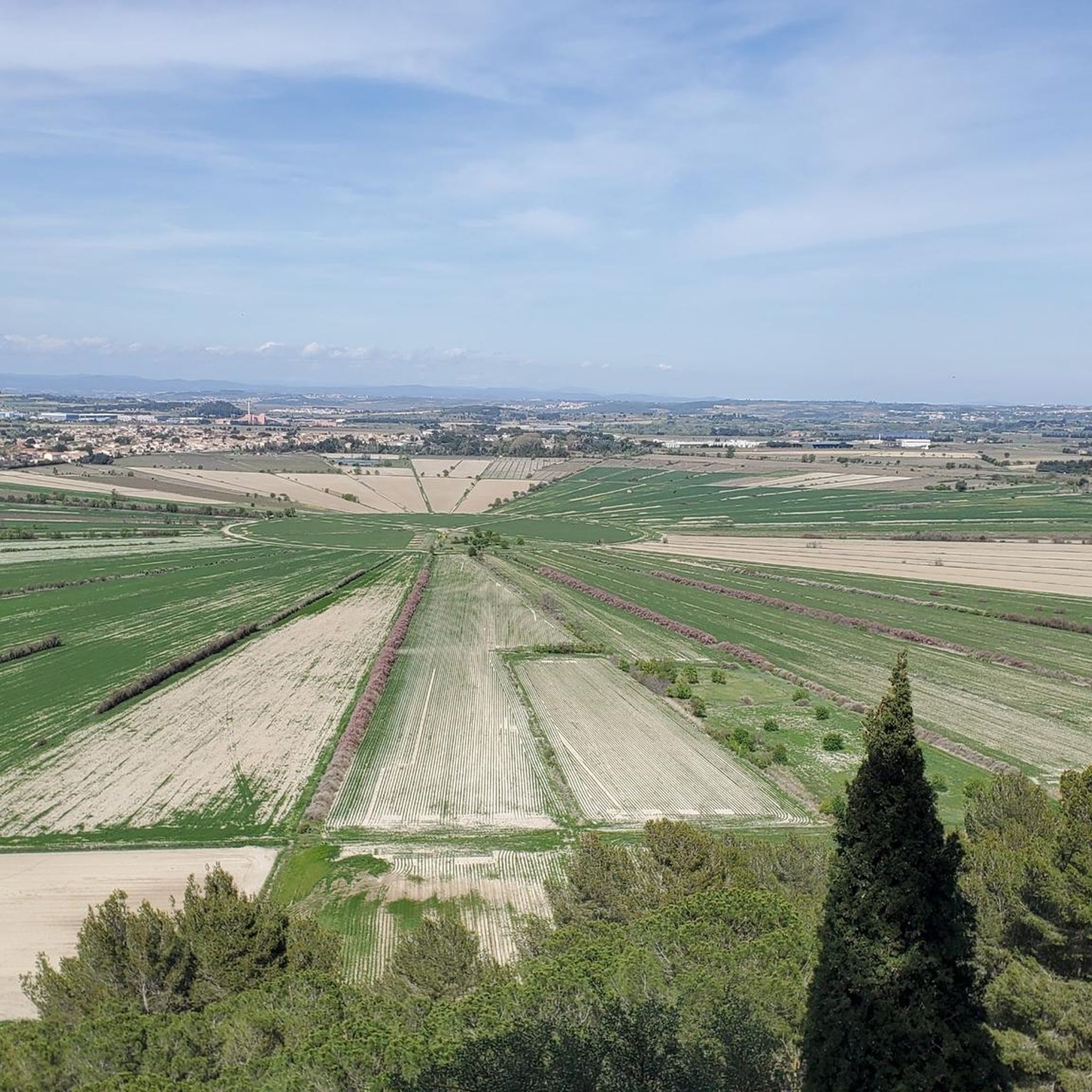
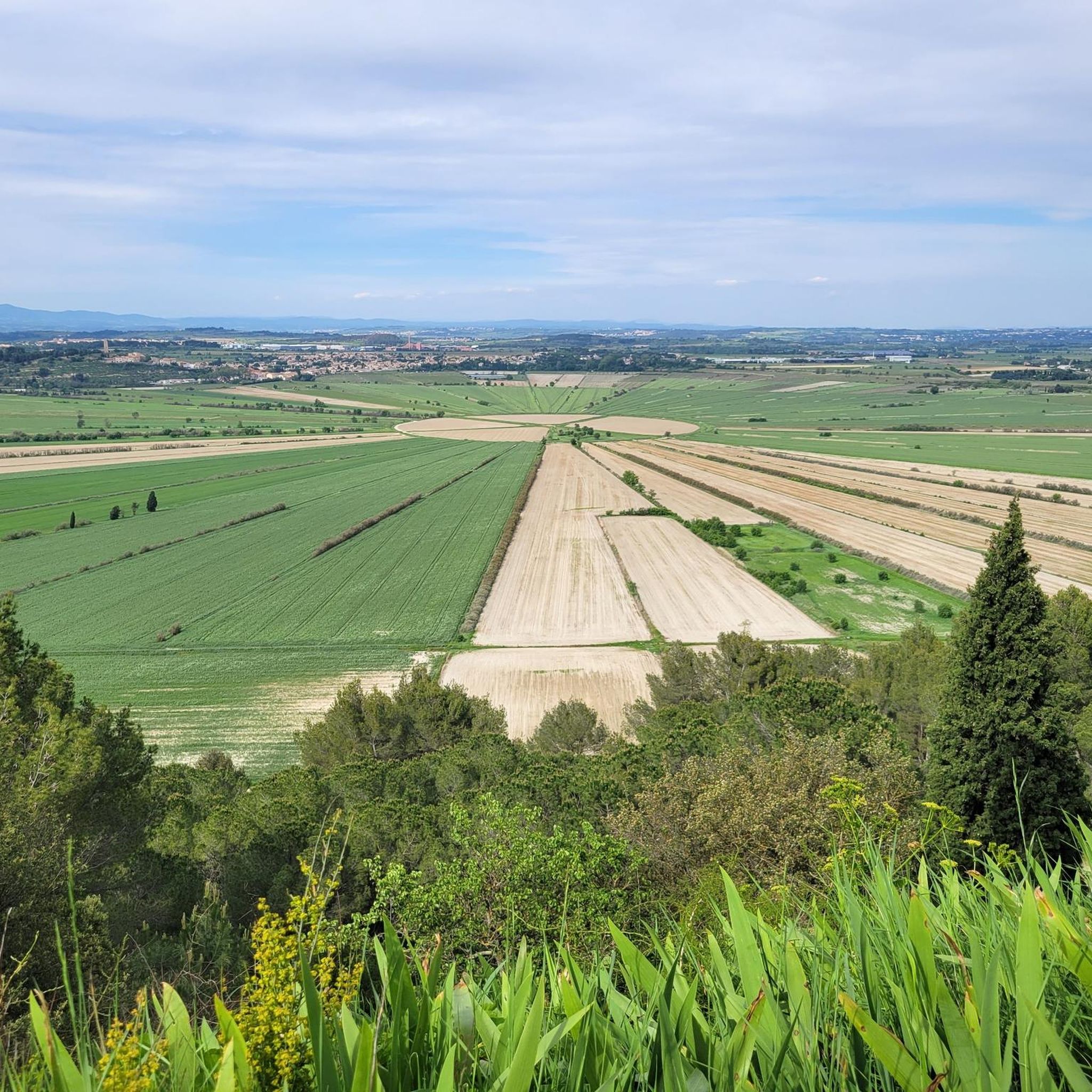
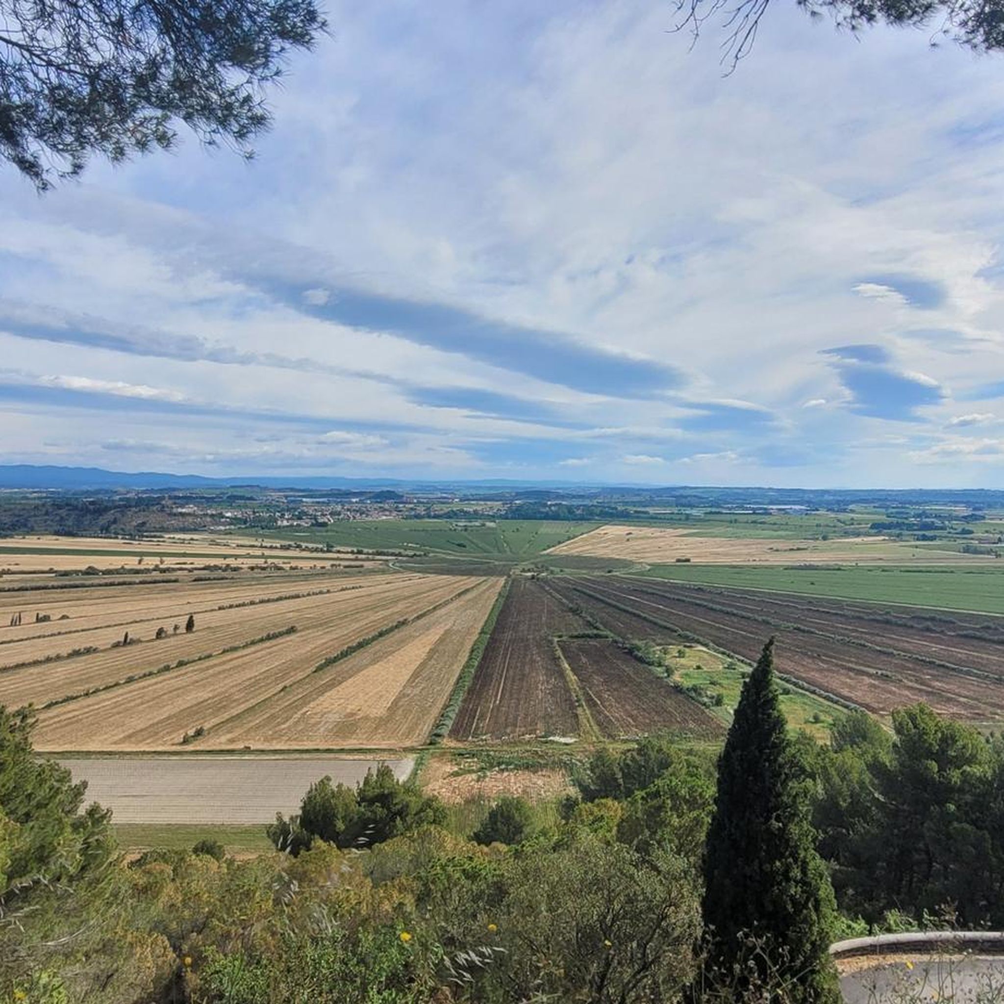
The étang de Montady, now dried up, is one of France's most famous landscapes. This natural basin of 400 ha was dug by the winds, like many others in the Biterrois. The reliefs that surround it, occupied by the oppidum of Ensérune and the old village of Montady, correspond to two valleys from the tertiary era dug by erosion and then filled with hard materials at the end of the Miocene (- 5 million years ago).
0
0

From the Ensérune plateau, the landscape opens widely onto the Montady plain and its Green Sun. This site was not chosen by chance: the oppidum occupied a dominant strategic position, both for monitoring traffic routes and for enjoying exceptional visibility to the distant reliefs. In clear weather, one understands here why this promontory has been occupied since Antiquity: it offers natural control over the entire surrounding basin.
2
0

The Montady pond is a former pond, drained during the Middle Ages, located in the western part of the French department of Hérault, between Béziers and Narbonne. Thanks to drainage canals, the water is channeled towards a central collector, which explains the star-shaped layout of the fields and vineyards. This canal system dates back to the 13th century. Sixty drainage ditches converge at the circular ditch, called the Redondel, in the center of the former pond. The water is then carried away by a counter-sloping ditch towards the Capestang pond and through a tunnel under the Ensérune hill and the Malpas tunnel. The tunnel is located at a depth of 29.5 meters below the Malpas pass and 16 meters below the Canal du Midi tunnel. The pond is visible from the Montady tower, a remnant of the former 12th-century castle, and from the top of the hill, the Ensérune oppidum. Heavy rainfall, like that at the end of October 2019, can cause it to reappear. (Wikipedia)
0
0

Frequently Asked Questions
How many hiking trails are there in Montady?
Montady offers a wide variety of hiking opportunities, with over 150 routes available. These trails cater to different fitness levels, ranging from easy strolls to more challenging excursions.
Are there easy hiking trails suitable for beginners in Montady?
Yes, Montady is an excellent area for beginners, with 77 easy trails. Many routes feature gentle gradients, especially those along the Canal du Midi or around the Etang de Montady. An example is the Malpas Tunnel – Malpas Tunnel loop from Colombiers, which is 2.2 miles (3.5 km) and typically takes less than an hour.
What about more challenging hikes for experienced hikers in Montady?
While the region is known for its gentle terrain, there are a couple of more difficult routes for those seeking a challenge. One such option is the Malpas Tunnel – Bridge over the Canal du Midi loop from Montady, which covers a significant distance of 17.3 miles (27.8 km).
Can I find circular hiking routes in the Montady area?
Yes, many of the trails around Montady are designed as circular routes, allowing you to start and end at the same point. The Etang de Montady viewpoint – Malpas Tunnel loop from Colombiers is a popular circular option offering diverse scenery.
Are hiking trails around Montady dog-friendly?
Most hiking trails in the Montady area are dog-friendly, especially those through open countryside and along the Canal du Midi. It's always advisable to keep dogs on a leash, particularly near agricultural areas or when passing other hikers and cyclists. Remember to bring water for your dog, especially during warmer months.
What interesting sights can I see while hiking near Montady?
The Montady area is rich in historical and natural landmarks. You can explore the unique circular Etang de Montady, the historic Malpas Tunnel, and the famous Canal du Midi. Other notable attractions include the Orb Canal Bridge (Pont-canal de l'Orb) and the impressive Fonseranes Locks, both accessible from various hiking paths.
When is the best time of year to go hiking in Montady?
The best time for hiking in Montady is typically during spring (April-May) and autumn (September-October) when the weather is mild and pleasant. Summer can be very warm, so early morning or late afternoon hikes are recommended if visiting then. Winters are generally mild but can be damp.
Are there places to eat or drink along the hiking routes?
While many routes pass through rural areas, trails along the Canal du Midi or near villages like Colombiers and Montady often have access to cafes, restaurants, or small shops where you can refuel. It's always a good idea to carry sufficient water and snacks, especially on longer routes.
What do other hikers say about the trails in Montady?
The hiking trails in Montady are highly regarded by the komoot community, with an average rating of 4.5 stars from over 500 reviews. Hikers often praise the unique landscapes, the historical significance of sites like the Malpas Tunnel, and the well-maintained paths along the Canal du Midi.
Are there family-friendly hiking options around Montady?
Absolutely. Many of the easy and moderate trails are suitable for families. The flat paths along the Canal du Midi are particularly good for children, offering safe and engaging walks with plenty of opportunities to see boats and historical structures. The Beautiful view of the plain – Etang de Montady loop from Colombiers is a shorter, easy option that families might enjoy.
Where can I find parking for hiking trails near Montady?
Parking is generally available in or near the villages that serve as starting points for many trails, such as Montady and Colombiers. Look for designated parking areas, especially near popular attractions like the Malpas Tunnel or along the Canal du Midi, where you can often find free or paid parking options.
Can I reach hiking trails in Montady using public transport?
While some local bus services connect Montady and surrounding villages, direct access to all trailheads via public transport might be limited. It's advisable to check local bus schedules in advance or consider using a car for more flexibility in reaching specific starting points for your hikes.
Most popular attractions around Montady

Get inspired with the komoot mobile app


Explore more
Browse the best Hikes in other regions.
