The best walks and hikes around Cerisy-Belle-Étoile
4.7
(61)
326
hikers
58
hikes
Hiking around Cerisy-Belle-Étoile offers access to diverse landscapes centered around the Mont de Cerisy, a 264-265 meter granite massif. This area features extensive forests of pines, oaks, and chestnut trees, alongside open bocage and thousands of rhododendrons. The region is also characterized by rivers such as the Noireau and Visance, and includes a conservatory orchard.
Best hiking trails around Cerisy-Belle-Étoile
- The most popular hiking route is Hiking loop from Cerisy-Belle-Étoile, a 5.0 miles (8.0 km) moderate trail that takes 2 hours 17 minutes to complete. This route explores the forested slopes of Mont de Cerisy.
- Another top favourite among local hikers is Mount Cerisy loop from Cerisy-Belle-Étoile, a moderate 5.1 miles (8.2 km) path. This trail offers views of the surrounding bocage and the distinctive granite formations.
- Local hikers also love the Lavoirs Walk 1/2 loop from Saint-Georges-des-Groseillers, a 3.5 miles (5.7 km) easy trail leading through local apple orchards and along the Visance river, often completed in about 1 hour 29 minutes.
- Hiking around Cerisy-Belle-Étoile is defined by its granite hills, dense rhododendron forests, and the pastoral bocage landscape. The network offers options for easy, moderate, and challenging ability levels.
- The routes in Cerisy-Belle-Étoile are highly rated by the komoot community with an average score of 4.6 stars from more than 50 reviews. Nearly 300 hikers have used komoot to explore Cerisy-Belle-Étoile's varied terrain.
Last updated: July 9, 2026
5.0
(1)
9
hikers
8.18km
02:20
180m
180m
Moderate hike. Good fitness required. Easily-accessible paths. Suitable for all skill levels.
4.3
(3)
10
hikers
4.26km
01:12
90m
90m
Easy hike. Great for any fitness level. Easily-accessible paths. Suitable for all skill levels.

Sign up for free
5.0
(1)
9
hikers
4.89km
01:17
40m
40m
Easy hike. Great for any fitness level. Easily-accessible paths. Suitable for all skill levels.
5.0
(2)
8
hikers
11.6km
03:12
200m
200m
Moderate hike. Good fitness required. Easily-accessible paths. Suitable for all skill levels.
5.0
(1)
3
hikers
17.9km
04:56
280m
280m
Moderate hike. Good fitness required. Easily-accessible paths. Suitable for all skill levels.
Get access to more routes and recommendations from other explorers.
Sign up for free
Already have an account?
Our route recommendations are based on thousands of hikes, rides, and runs completed by other people on komoot.
Start today with a free account
Your next adventure awaits.
Login or Signup



Tips from the Community

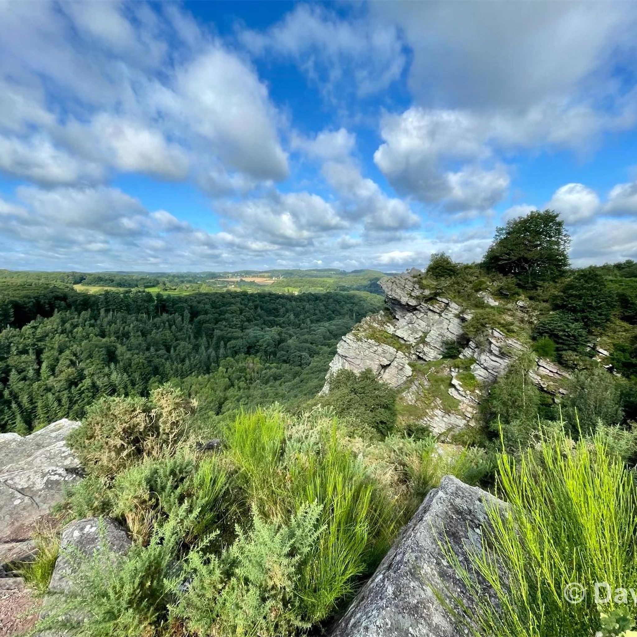
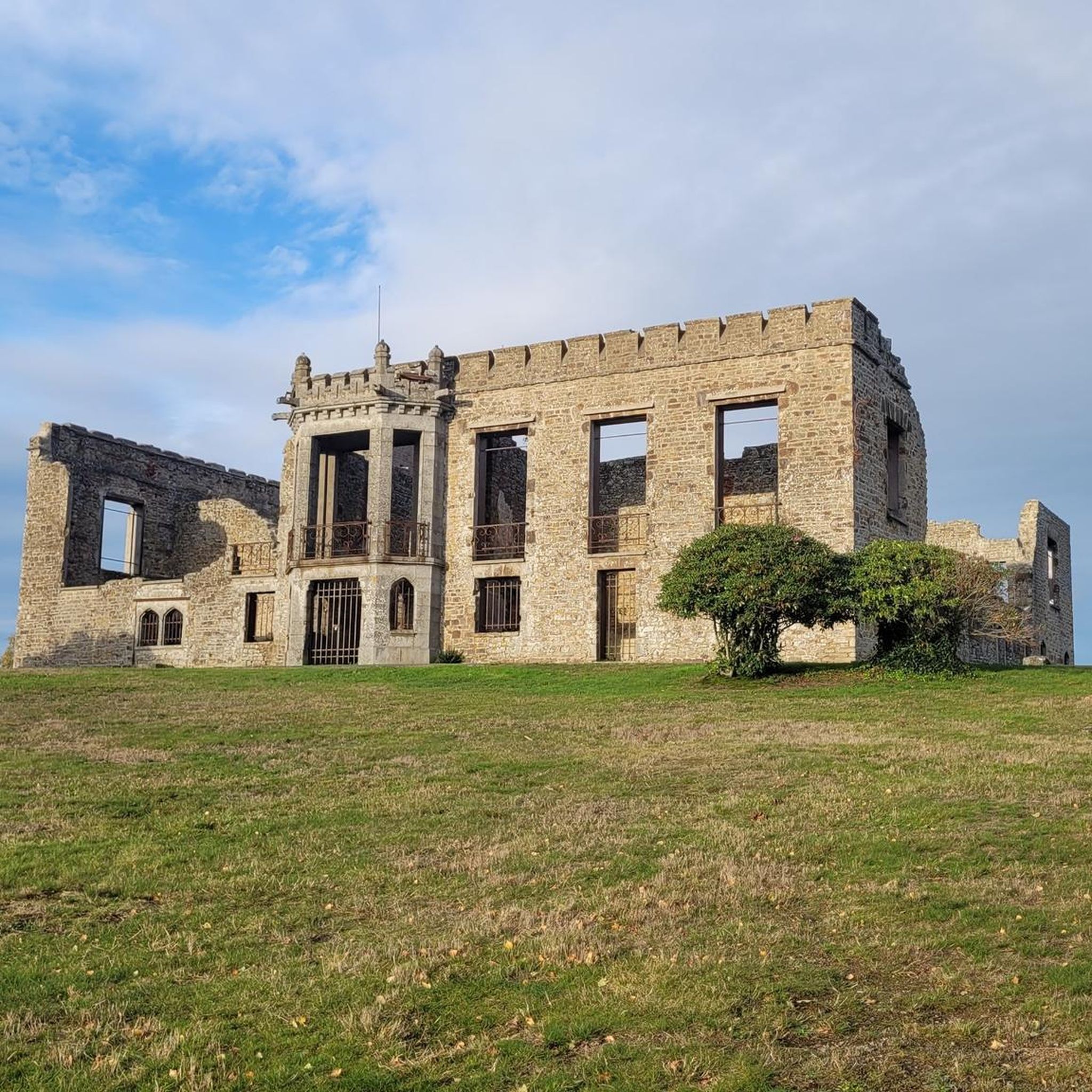
Mont de Cerisy is a wooded hill and the highest point in the region. From the top of the tower, you can enjoy breathtaking views of the surrounding countryside and the ruins of an ancient castle. You can also admire the colorful rhododendrons which bloom in May and June, creating a spectacular contrast with the green foliage. Mont de Cerisy is an ideal place for a walk. You will find more information on this site on the Normandie Tourisme website or the Pays de Vire Tourist Office.
2
0

Beautiful site with a view of the Normandy bocage.
0
0

Imagine a mountain made of pink granite culminating at 276 meters above sea level, a 100-hectare forest massif, thousands of rhododendrons that spectacularly color the mountain with a shade of pink and purple in May! Admire the remains of a castle built in 1895 and bombed in World War II
0
0
Frequently Asked Questions
How many hiking trails are available around Cerisy-Belle-Étoile?
There are over 50 hiking routes available around Cerisy-Belle-Étoile, catering to various skill levels. You'll find a good mix of easy, moderate, and a few more challenging options to explore the region's unique landscapes.
What makes hiking in Cerisy-Belle-Étoile unique?
Hiking in Cerisy-Belle-Étoile offers a distinctive experience centered around the Mont de Cerisy, a prominent granite massif. The area is famous for its thousands of rhododendrons, which bloom spectacularly in May and June, alongside ancient oak and chestnut trees. You'll also encounter the picturesque Norman bocage, rivers like the Noireau and Visance, and even a conservatory orchard.
Are there easy hiking trails suitable for beginners or families?
Yes, Cerisy-Belle-Étoile has over 20 easy hiking trails. A great option for families or beginners is the Lavoirs Walk 1/2 loop from Saint-Georges-des-Groseillers, which is 5.7 km long and takes about 1 hour 29 minutes. This trail leads through local apple orchards and along the Visance river, offering a gentle introduction to the area's natural beauty. There's also a 2 km educational nature trail on Mont de Cerisy designed for families.
Can I find circular hiking routes in Cerisy-Belle-Étoile?
Yes, many of the trails around Cerisy-Belle-Étoile are circular, allowing you to start and end at the same point. For example, the Hiking loop from Cerisy-Belle-Étoile is a moderate 8 km route that explores the forested slopes of Mont de Cerisy.
What kind of wildlife can I expect to see while hiking?
The diverse landscapes of Cerisy-Belle-Étoile, including forests, marshes, and rivers, support rich biodiversity. While hiking, you might spot various birds, small mammals, and insects. The conservatory orchard and marsh areas provide habitats for wild fauna, making it a good spot for nature observation.
Are there any historical sites or landmarks to see along the trails?
Yes, the area combines natural beauty with historical interest. You can explore the remains of a 19th-century castle on the Mont de Cerisy, which offers panoramic views from its tower. The former Abbey of Belle-Étoile, a 13th-century national heritage site, is also within the commune. For specific points of interest, consider visiting the Mont de Cerisy and Castle Ruins or the Saint-Clair-de-Halouze Iron Mine.
What is the best time of year to go hiking in Cerisy-Belle-Étoile?
The blooming season for the thousands of rhododendrons on Mont de Cerisy, typically in May and June, offers a particularly spectacular experience with vibrant pink and violet hues. However, the region's forests and bocage provide pleasant hiking conditions throughout spring, summer, and autumn.
Are the hiking trails in Cerisy-Belle-Étoile dog-friendly?
Many trails in natural areas like Cerisy-Belle-Étoile are generally dog-friendly, especially if dogs are kept on a leash to protect local wildlife and respect other hikers. It's always a good idea to check specific trail regulations or local signage, but the extensive forest and open areas are usually welcoming for walks with your canine companion.
What do other hikers enjoy most about Cerisy-Belle-Étoile?
The area is highly rated by the komoot community, with an average score of 4.6 stars from over 50 reviews. Hikers often praise the diverse terrain, from dense rhododendron forests to open bocage, and the clear views from elevated points. The well-maintained trails and the tranquil atmosphere are frequently highlighted.
Are there any longer or more challenging hikes available?
While most routes are easy to moderate, there are longer options for those seeking more challenge. For instance, the Mount Cerisy loop from Cerisy-Belle-Étoile is a moderate 12.2 km route with over 300 meters of elevation gain, taking around 3 hours 34 minutes. Another option is the Hiking loop from Saint-Pierre-d'Entremont, which is 11.6 km long.
Is there parking available at the trailheads?
Yes, the Mont de Cerisy area, which serves as a central point for many trails, functions as a comprehensive recreational park. It typically offers designated parking facilities for visitors accessing the hiking trails and other amenities. Specific parking details might vary by trailhead, but general access is well-provided.
Most popular routes around Cerisy-Belle-Étoile
Most popular attractions around Cerisy-Belle-Étoile

Get inspired with the komoot mobile app


Explore more
Browse the best Hikes in other regions.
