The best running trails around Menetou-Râtel
4.5
(28)
1,982
runners
117
runs
Jogging routes around Menetou-Râtel traverse a landscape characterized by extensive vineyards and rolling hills, offering varied terrain for runners. The region features elevations typically ranging from 200 to 400 meters, providing both gentle slopes and more challenging inclines. Forested areas are interspersed with open vineyard trails, contributing to a diverse running experience. The broader natural environment is influenced by the nearby Loire River, shaping the local climate.
Best jogging routes around Menetou-Râtel
- The most popular jogging route is Vineyards Loop…
Last updated: July 3, 2026
14
runners
15.6km
01:57
320m
320m
Hard run. Very good fitness required. Mostly paved surfaces. Suitable for all skill levels.
4
runners
17.8km
02:10
480m
480m
Hard run. Very good fitness required. Mostly paved surfaces. Suitable for all skill levels.

Sign up for free
6
runners
14.9km
01:50
350m
350m
Hard run. Very good fitness required. Mostly paved surfaces. Suitable for all skill levels.
7
runners
8.92km
01:06
210m
210m
Moderate run. Good fitness required. Mostly paved surfaces. Suitable for all skill levels.
10
runners
34.6km
03:45
240m
240m
Hard run. Very good fitness required. Mostly paved surfaces. Suitable for all skill levels.
Get access to more routes and recommendations from other explorers.
Sign up for free
Already have an account?
Our route recommendations are based on thousands of hikes, rides, and runs completed by other people on komoot.
Start today with a free account
Your next adventure awaits.
Login or Signup

Tips from the Community


It's not uncommon to find a Monument aux Morts in the immediate vicinity of the local church, which here boasts a very defensive-looking facade – the church's two massive, round towers could easily be imagined as part of a castle's fortifications. These monuments, found in almost every town, still serve an important dual function in the 21st century: They keep the memory of the victims of war and tyranny alive and thus serve as a constant reminder of peace.
0
0
Rivers and canals crisscross the country, the latter in particular being a crucial part of the transport infrastructure in earlier times. Later, first rail, and later again trucks, took over the task of transporting goods. In the competition between different modes of transport, they were faster and cheaper than barges – and thus more efficient. When building the artificial waterways, however, it had to be taken into account that differences in elevation always had to be overcome, and so locks are often lined up along the canals – at varying intervals, depending on the local situation. Only with their help was shipping possible.
0
0
It is presumably a former "chemin de halage" (in German "treidelpfad" or "leinpfad"), which runs alongside the canal's bed. In earlier times, such a path was an essential part of the transport infrastructure. Before ships could be powered by motors, horses walked along the bank, pulling the boat against the current. This was called "treideln" (pulling), and this is how the towpaths got their name, which has been passed down to this day. Where these paths, which run close to the bank, have been preserved, they are popular with hikers, walkers, joggers, and cyclists.
1
0

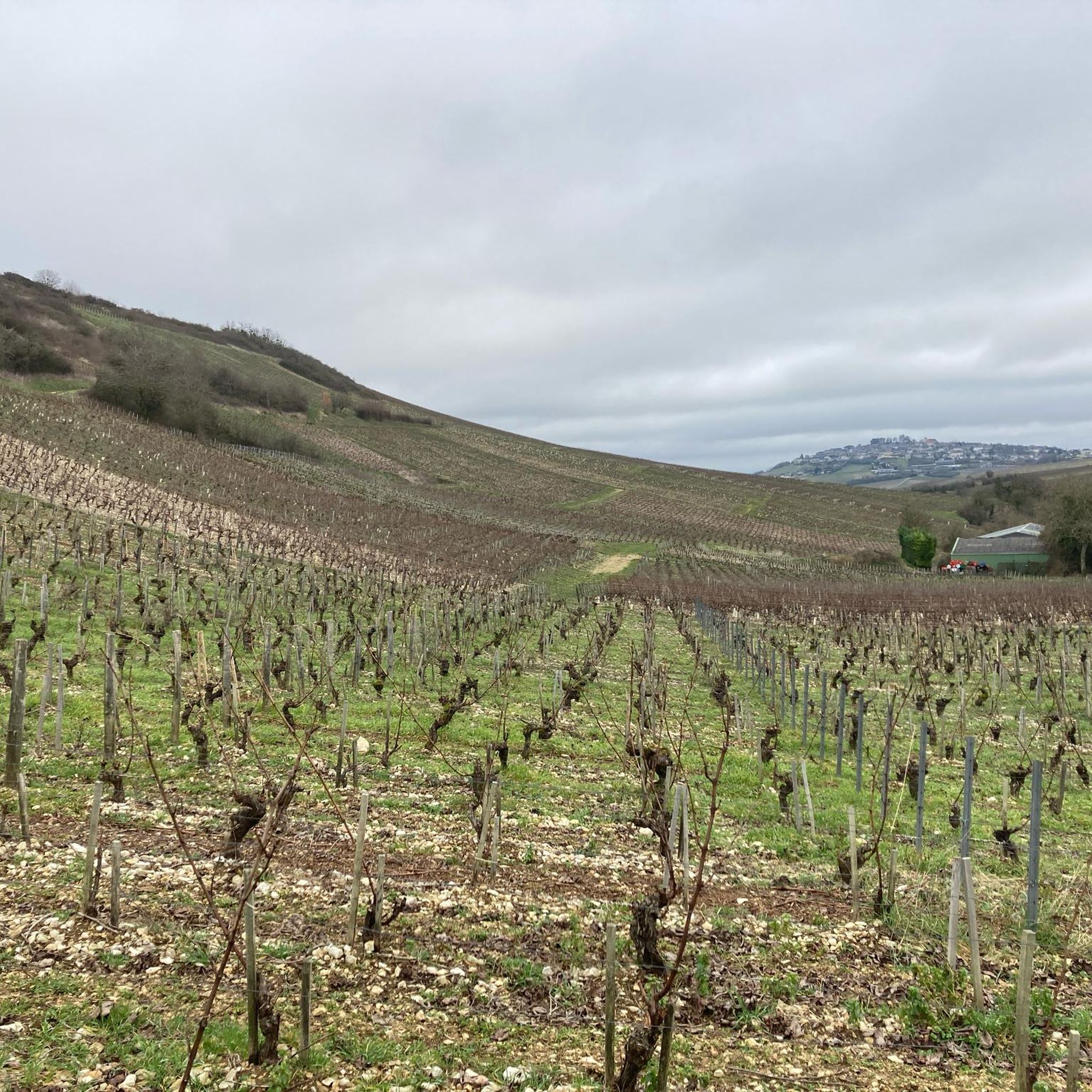
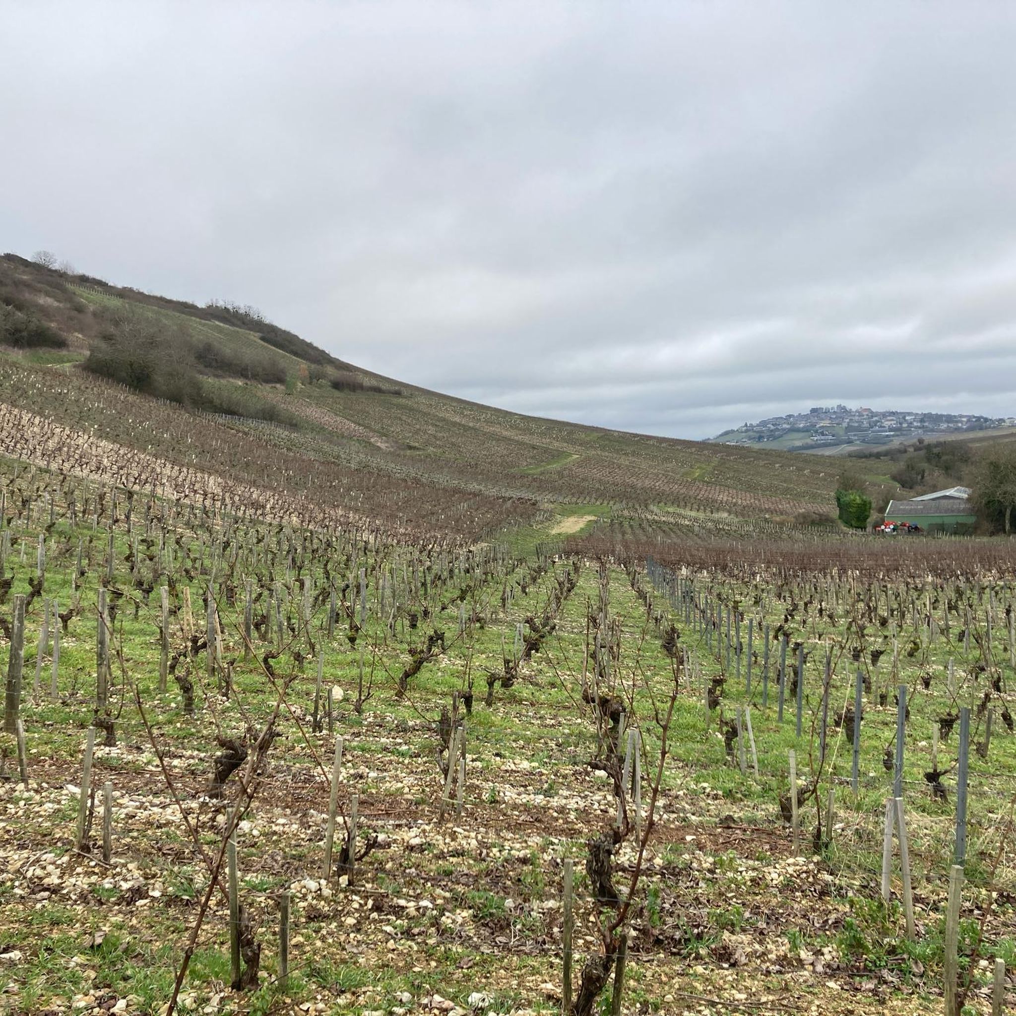
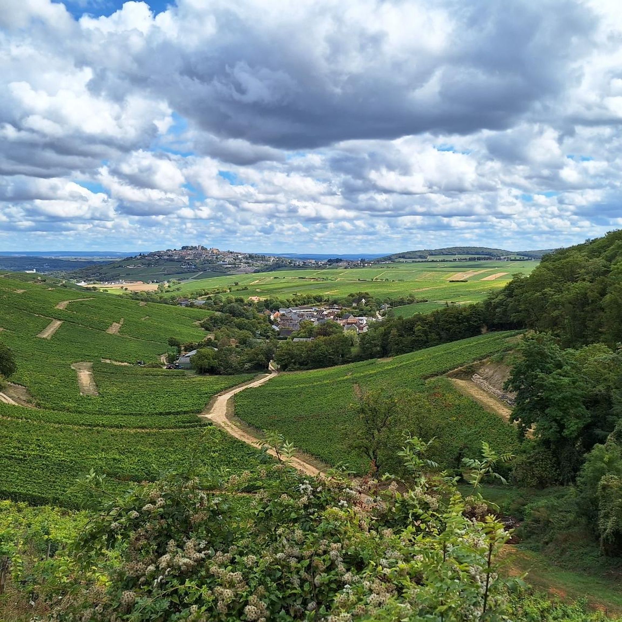
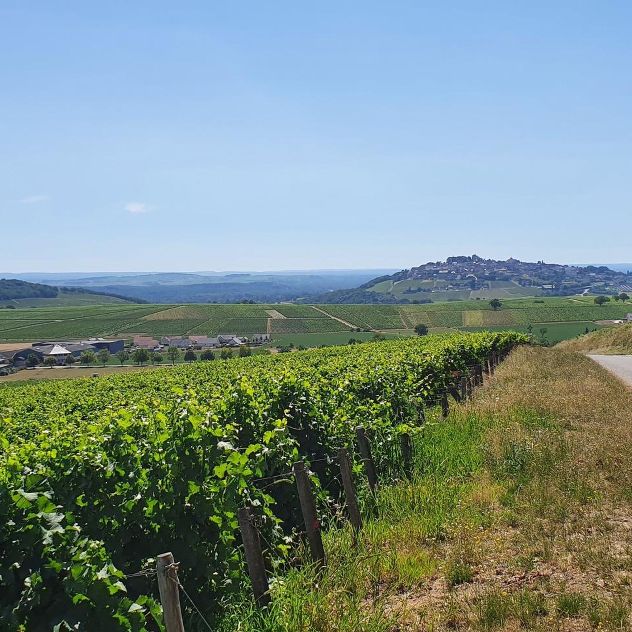
The Sancerre vineyard covers the hills of 14 communes in the Loire Valley. The paths that cross it allow you to discover this terroir up close, well-suited to growing vines thanks to its exposure and orientation. Here, you'll find peace and quiet, perfect for cycling and admiring the scenery.
0
0

The trip along the canal is a meditation - at least as relaxing as one.
1
0

It's all in the title... Incredible panorama
1
0
Frequently Asked Questions
How many running routes are available around Menetou-Râtel?
There are over 100 running routes around Menetou-Râtel, offering a wide variety of options for all skill levels. The komoot community has mapped 117 trails in total, ensuring you'll find plenty of paths to explore.
What are the difficulty levels of the jogging trails in this area?
The running trails around Menetou-Râtel offer a good mix of difficulty levels. You'll find 3 easy routes perfect for a gentle jog, 64 moderate trails for a good workout, and 50 difficult routes for those seeking a more challenging run with significant elevation changes.
What do other runners say about the trails in Menetou-Râtel?
The running routes in Menetou-Râtel are highly rated by the komoot community, with an average score of 4.5 stars from over 13 reviews. More than 1600 runners have used komoot to explore the varied terrain, often praising the picturesque vineyards, rolling hills, and shaded forests that define the area.
What interesting sights or landmarks can I see while jogging near Menetou-Râtel?
Many running routes offer scenic views and pass by notable landmarks. You might catch glimpses of the historic Sancerre area, or run near the impressive Saint-Satur Viaduct. There are also beautiful viewpoints over the Sancerre valley, offering stunning panoramic vistas.
Are there any circular running routes in Menetou-Râtel?
Yes, many of the running routes in Menetou-Râtel are circular, allowing you to start and finish at the same point. For example, the challenging Sancerre – Kirch- und Rathausplatz loop from Verdigny is a 14.8 km circular path that takes you through diverse landscapes.
What is the best time of year for running in Menetou-Râtel?
Menetou-Râtel offers a pleasant environment for running throughout much of the year. Spring and autumn provide mild temperatures and beautiful scenery, especially with the changing colors of the vineyards. The Loire River's influence helps moderate the local climate, making even warmer months enjoyable, particularly on routes that traverse shaded forests.
Are there family-friendly running options in Menetou-Râtel?
While many routes feature varied terrain and elevation, you can find easier sections suitable for families. Look for routes categorized as 'easy' or 'moderate' on komoot, which typically have less challenging inclines and shorter distances. These often pass through charming vineyard landscapes and forests.
Can I bring my dog on the running trails?
Generally, dogs are welcome on many outdoor trails in France, especially in rural areas like Menetou-Râtel. However, it's always best to keep your dog on a leash, especially when passing through vineyards or near livestock, and to check for any specific local regulations or signage on individual routes.
Is parking available near the running routes?
Yes, many running routes in Menetou-Râtel start from villages or designated trailheads where parking is typically available. For specific routes, you can check the route details on komoot, which often provide information on starting points and nearby parking facilities.
What kind of terrain can I expect on the running trails?
The running trails around Menetou-Râtel are characterized by a diverse terrain. You'll encounter paths winding through extensive vineyards, rolling hills with both gentle slopes and more challenging inclines, and refreshing forested areas. The presence of limestone and clay soils contributes to the distinct landscape.
Are there any longer, more challenging running routes for experienced runners?
Absolutely. Experienced runners will find several challenging options. The Saint-Satur Viaduct – Viaduct of Saint-Satur loop from Sury-en-Vaux is a difficult 17.8 km path with significant elevation changes. Another demanding option is the Vineyards Loop from Verdigny, a 15.6 km trail offering panoramic views through expansive vineyards.
Are there any easier running routes for beginners?
Yes, while many routes feature varied terrain, there are easier options suitable for beginners. Komoot lists 3 easy routes in the area. These typically have shorter distances and less significant elevation gain, allowing new runners to enjoy the beautiful scenery without excessive challenge.
Most popular routes around Menetou-Râtel
Most popular attractions around Menetou-Râtel

Get inspired with the komoot mobile app


Explore more
Browse the best Running Trails & Routes in other regions.
