The best walks and hikes around Saint-Cyr-Du-Doret
4.4
(145)
714
hikers
55
hikes
Hiking trails around Saint-Cyr-Du-Doret traverse a landscape characterized by dense woodlands, such as the Foret de Benon, and the waterways of the Marais Poitevin. The region features generally flat terrain with minimal elevation changes, making it accessible for various activity levels. Paths often follow rivers like the Sèvre Niortaise, providing opportunities to explore the local countryside and natural areas.
Best hiking trails around Saint-Cyr-Du-Doret
- The most popular hiking route is Foret de Benon – loop, a 6.8 miles (10.9 km) trail that takes 2 hours 49 minutes to complete. This moderate route leads through the Foret de Benon.
- Another top favourite among local hikers is Hiking loop from Lidon, an easy 4.5 miles (7.3 km) path. This route offers views of the local countryside with minimal elevation gain.
- Local hikers also love the Bazoin Lock – Lock of the Marais Poitevin loop from La Sèvre Niortaise, a 5.1 miles (8.2 km) trail leading through the Marais Poitevin, often completed in about 2 hours 4 minutes.
- Hiking around Saint-Cyr-Du-Doret is defined by dense woodlands, riverside paths, and the waterways of the Marais Poitevin. The network offers options for easy, moderate, and some more challenging routes.
- The routes in Saint-Cyr-Du-Doret are highly rated by the komoot community with an average score of 4.3 stars from over 100 reviews. More than 500 hikers have used komoot to explore Saint-Cyr-Du-Doret's varied terrain.
Last updated: July 2, 2026
3.6
(5)
23
hikers
10.9km
02:49
60m
60m
Moderate hike. Good fitness required. Easily-accessible paths. Suitable for all skill levels.
4.3
(6)
33
hikers
7.27km
01:50
10m
10m
Easy hike. Great for any fitness level. Easily-accessible paths. Suitable for all skill levels.

Sign up for free
4.2
(5)
19
hikers
Moderate hike. Good fitness required. Easily-accessible paths. Suitable for all skill levels.
5.0
(2)
14
hikers
Easy hike. Great for any fitness level. Easily-accessible paths. Suitable for all skill levels.
4.4
(5)
16
hikers
Easy hike. Great for any fitness level. Easily-accessible paths. Suitable for all skill levels.
Get access to more routes and recommendations from other explorers.
Sign up for free
Already have an account?
Our route recommendations are based on thousands of hikes, rides, and runs completed by other people on komoot.
Start today with a free account
Your next adventure awaits.
Login or Signup



Tips from the Community

The Jean Guilloux chain ferry allows you to cross the Sèvre Niortaise River from Saint Jean de Liversay (Charente-Maritime) to Vix (Vendée). It is free to access and is operated manually. The chain ferry can be used independently by pedestrians and cycle tourists, with a maximum of 6 people per crossing. Cyclists' bicycles may be taken on board the ferry. Operating and safety regulations are posted on each bank. This type of boat was once a common means of crossing canals and channels in the Marais Poitevin. Free access is limited to 6 people or a maximum weight of 450 kg. Pets are allowed. Accessibility dates are from April 5 to October 31, from 9 a.m. to 9 p.m. The acquisition of the "Jean Guilloux" chain ferry was made possible thanks in part to the support of the European Union.
0
0

Beautiful lock with picnic area
0
0

To cross here, take a bike ride or walk. Grab the chain and pull, this way you will be on the opposite bank.
1
0

Area on private property, route to be deleted
0
0

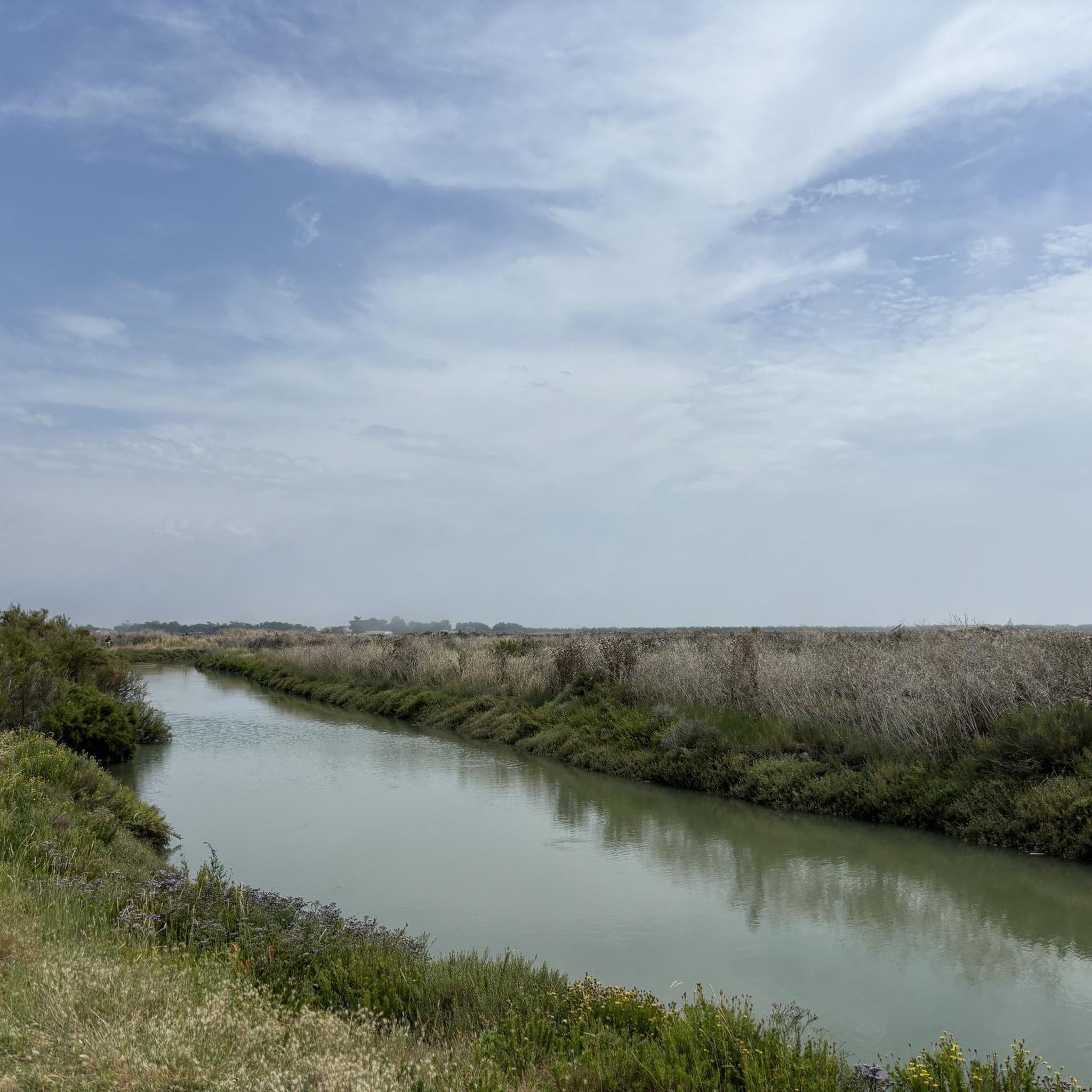
The Bazoin lock is located on the Pomère Canal. It's a nice place to take a break and watch the boats.
1
1

Crossing the canal with a chain boat! Top ! The camping bar Ô p'tit marais top also, good zik!
1
1


Here you can / must be your own ferryman to cross the Sèvre Niortaise. However, it takes some time to study the instructions for using the boat, to be able to handle the chain, and - for the first time - to have self-confidence. On the west side is a campsite, at the counter you can reward yourself before or after the crossing with a café.
2
0
Frequently Asked Questions
How many hiking trails are available around Saint-Cyr-Du-Doret?
There are over 50 hiking trails around Saint-Cyr-Du-Doret, offering a variety of options for different skill levels. You'll find routes ranging from easy strolls to more moderate excursions through the region's woodlands and waterways.
Are there easy or family-friendly hiking routes in Saint-Cyr-Du-Doret?
Yes, Saint-Cyr-Du-Doret is well-suited for easy and family-friendly hikes, with 21 routes classified as easy. Many paths feature minimal elevation gain, making them accessible for all ages. A good example is the Hiking loop from Lidon, which is 4.5 miles (7.3 km) and offers pleasant views of the local countryside.
What is the typical length and duration of hikes in this area?
Hikes around Saint-Cyr-Du-Doret vary in length, with many routes falling between 3 to 7 miles (5 to 11 km). An average hike might take between 1.5 to 3 hours to complete, depending on your pace and the specific trail. For instance, the Foret de Benon – loop is 6.8 miles (10.9 km) and typically takes around 2 hours 49 minutes.
Are there any circular hiking routes in Saint-Cyr-Du-Doret?
Yes, many of the hiking trails in Saint-Cyr-Du-Doret are circular, allowing you to start and end at the same point. This is convenient for those using personal transport. The Bazoin Lock – Lock of the Marais Poitevin loop from La Sèvre Niortaise is a popular circular option, covering 5.1 miles (8.2 km) through the Marais Poitevin.
What kind of terrain can I expect on the trails?
The terrain around Saint-Cyr-Du-Doret is generally flat, characterized by dense woodlands like the Foret de Benon and riverside paths along waterways of the Marais Poitevin. You can expect well-maintained paths, often unpaved, suitable for walking and enjoying the natural environment.
What can I see along the hiking trails in Saint-Cyr-Du-Doret?
Along the trails, you can explore the natural beauty of the Marais Poitevin, often referred to as 'Green Venice,' with its canals and lush landscapes. You might also encounter interesting local landmarks such as the Port d'Arçais or the historic Pichonnière Mill. Many routes offer scenic views, including the View of the Marais Poitevin.
Is Saint-Cyr-Du-Doret a good place for wildlife spotting?
The Marais Poitevin, which borders Saint-Cyr-Du-Doret, is a designated regional natural park known for its rich biodiversity. Hikers often have the chance to spot various bird species, otters, and other wetland wildlife, especially along the river paths and canals.
Are the hiking trails in Saint-Cyr-Du-Doret dog-friendly?
Many trails in the Saint-Cyr-Du-Doret area are suitable for dogs, especially those through woodlands and along riverbanks. It's always recommended to keep dogs on a leash, particularly in areas with wildlife or near agricultural land, and to check specific trail regulations if available.
What do other hikers enjoy most about hiking in Saint-Cyr-Du-Doret?
The area is highly rated by the komoot community, with an average score of 4.3 stars from over 100 reviews. Reviewers often praise the peaceful atmosphere, the beauty of the Marais Poitevin, and the well-maintained, accessible paths that make for enjoyable walks through nature.
Are there any longer distance hiking options for experienced hikers?
While most routes are moderate, the region offers possibilities to combine shorter trails or explore longer sections of the Marais Poitevin's extensive network. For example, the Foret de Benon – loop is one of the longer individual routes at nearly 7 miles, and you can often extend your hike by exploring connecting paths.
Is there parking available at the trailheads?
Many of the trailheads and starting points for hikes in Saint-Cyr-Du-Doret, especially those in villages or near popular natural sites, offer designated parking areas. It's generally easy to find parking, particularly in less urbanized areas, making access convenient for hikers.
What is the best time of year to go hiking in Saint-Cyr-Du-Doret?
Spring and autumn are generally the best times for hiking in Saint-Cyr-Du-Doret. The weather is mild, and the natural scenery is vibrant with blooming flowers or rich autumn colors. Summer can be pleasant, but it's advisable to hike in the mornings or late afternoons to avoid the midday heat, especially in open areas.
Most popular routes around Saint-Cyr-Du-Doret
Most popular attractions around Saint-Cyr-Du-Doret

Get inspired with the komoot mobile app


Explore more
Browse the best Hikes in other regions.
