The best walks and hikes around Île-De-Bréhat
4.6
(1307)
7,884
hikers
26
hikes
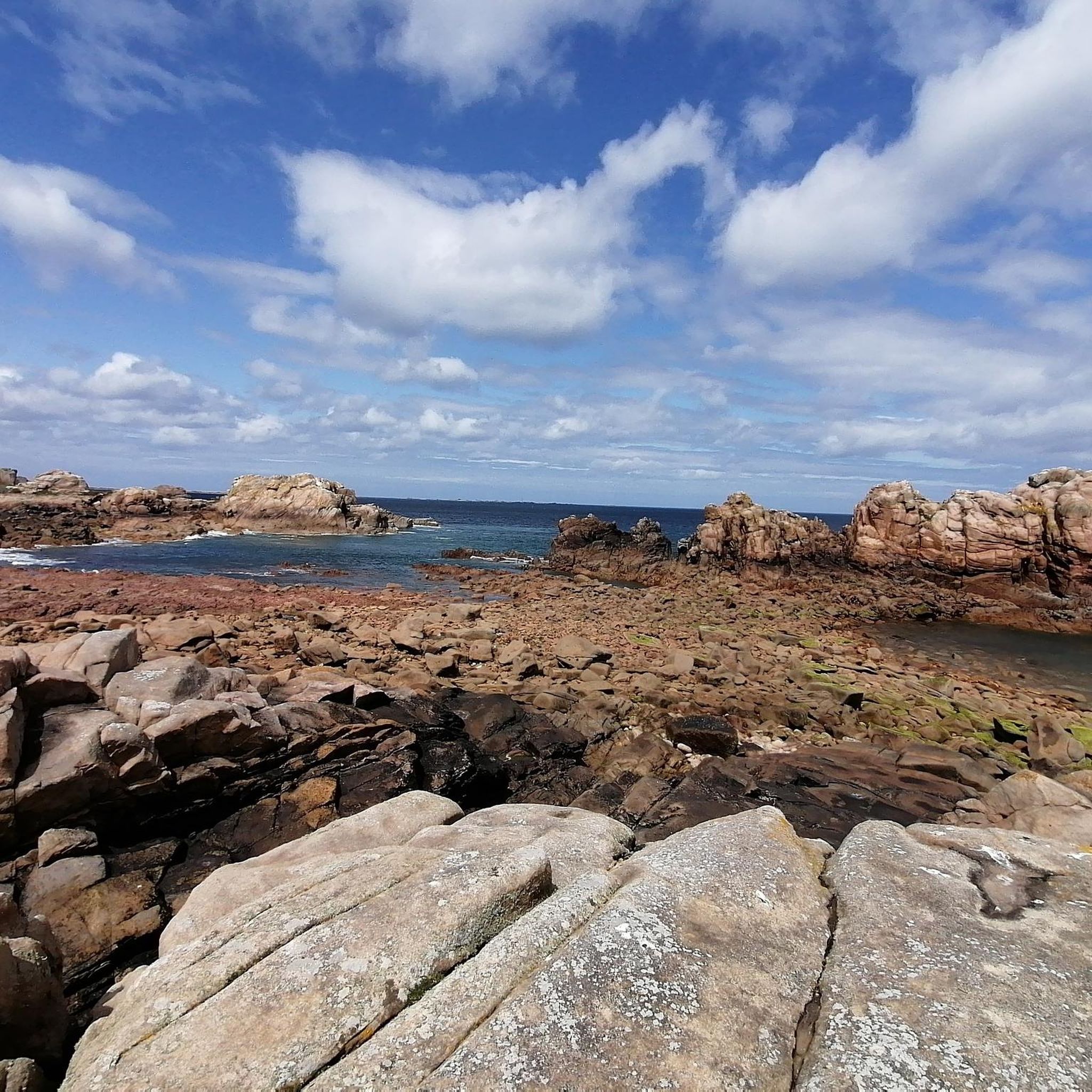
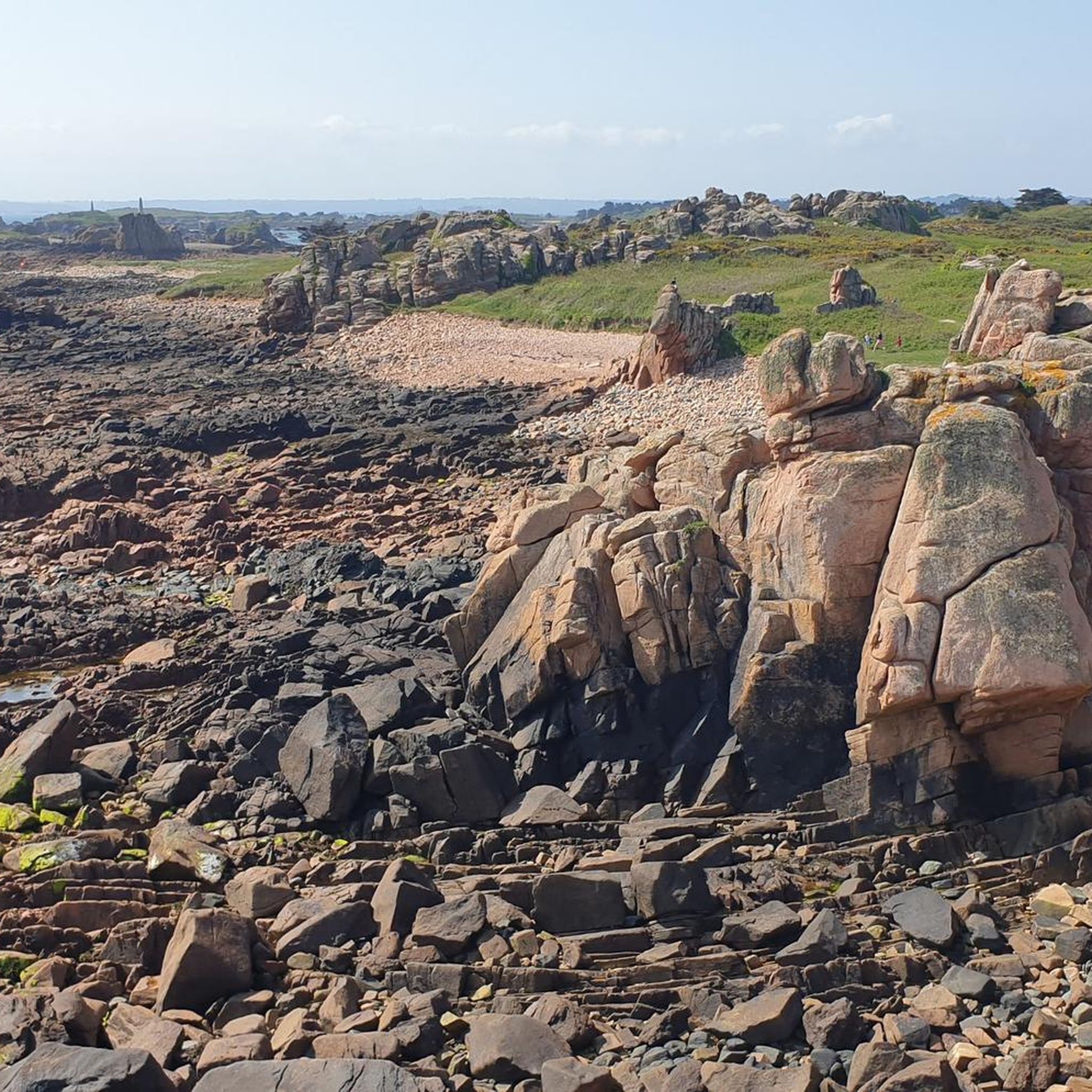
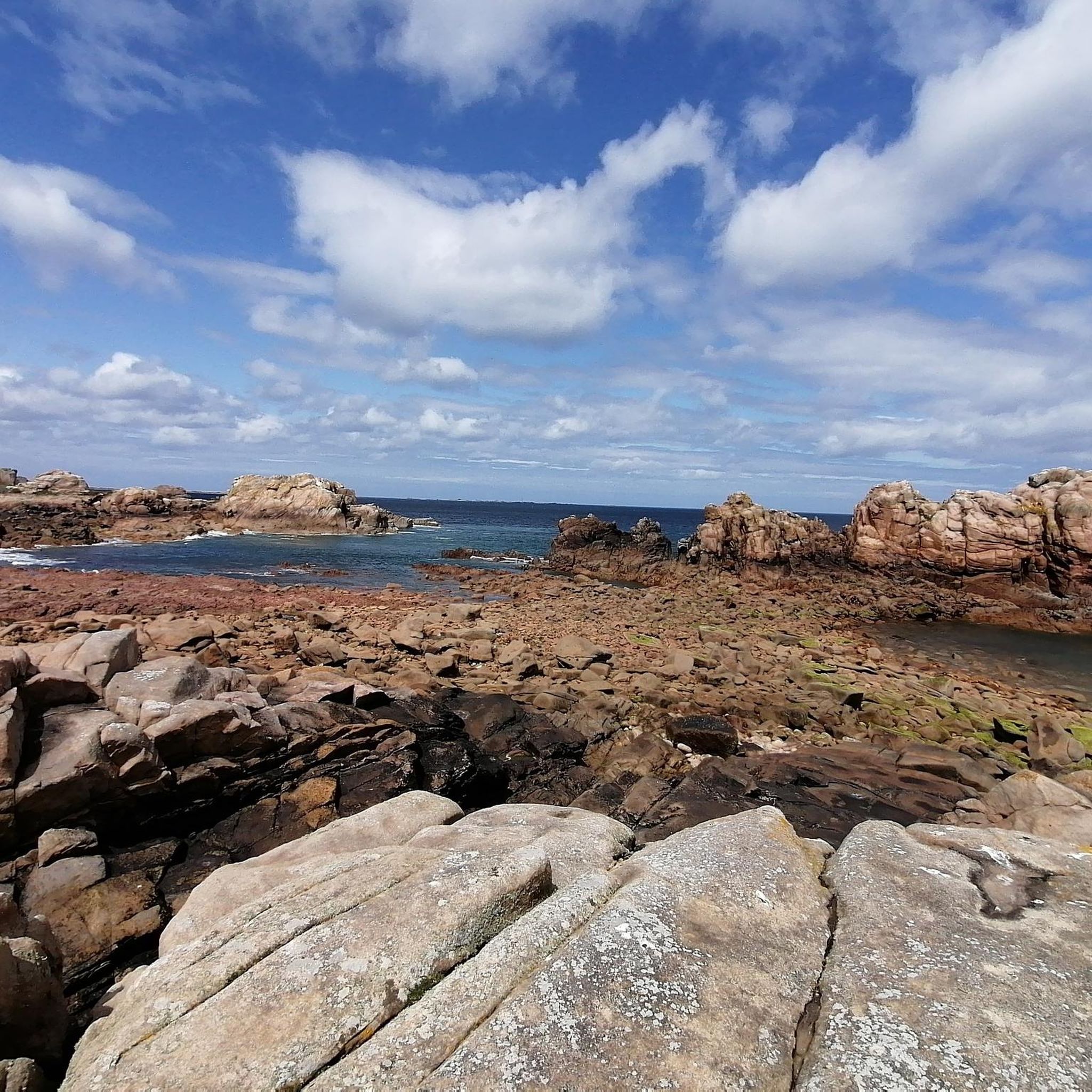
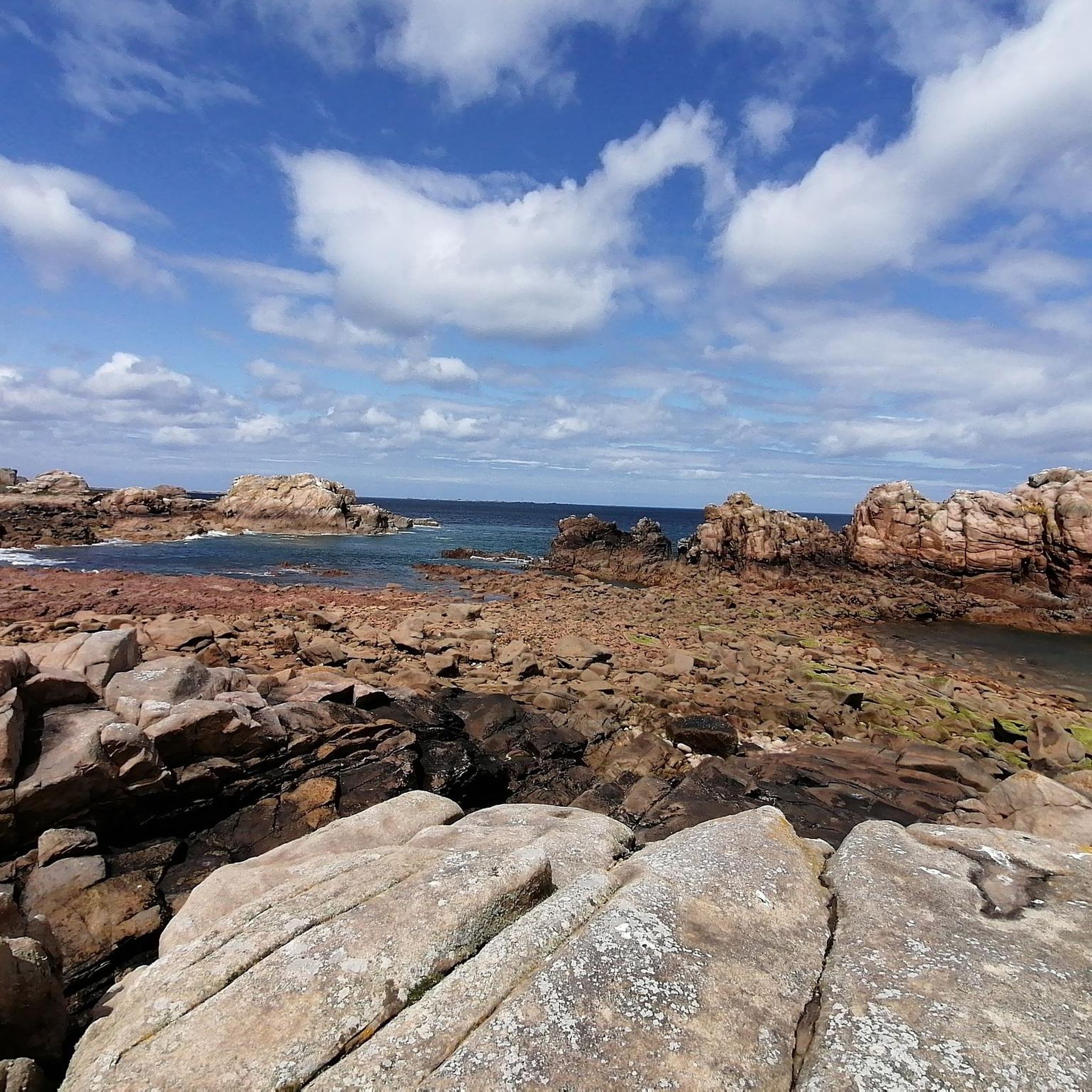
Hiking around Île-De-Bréhat offers exploration of a car-free archipelago characterized by pink granite rocks, diverse flora, and a mild microclimate. The island's terrain features coastal paths, small hills, and varied vegetation, including Mediterranean plants. This classified natural site provides a tranquil setting for walking, with routes crossing both its northern and southern parts.
Best hiking trails around Île-De-Bréhat
- The most popular hiking route is Tour of the island of Bréhat, a 9.5 miles (15.3 km) moderate trail that takes 4 hours to complete. This route circles the entire car-free island, providing comprehensive views of its varied landscapes.
- Another top favourite among local hikers is Pont Ar Prat Causeway – Paon Lighthouse loop from Île-de-Bréhat, a moderate 5.9 miles (9.6 km) path. This trail leads to the northern tip of the island, featuring coastal scenery and the iconic Paon Lighthouse.
- Local hikers also love the Baie de Saint-Brieuc – Western rocky coast loop from Île-de-Bréhat, a 3.8 miles (6.2 km) trail leading through the western rocky coast, often completed in about 1 hour 37 minutes.
- Hiking around Île-De-Bréhat is defined by coastal paths, pink granite formations, and a rich diversity of flora. The network offers options for various ability levels, from easy strolls to moderate island circuits.
- The routes in Île-De-Bréhat are highly rated by the komoot community with an average score of 4.7 stars from over 1000 reviews. More than 7000 hikers have used komoot to explore Île-De-Bréhat's varied terrain.
Last updated: August 19, 2026
4.8
(418)
2,665
hikers
15.3km
04:01
130m
130m
Moderate hike. Good fitness required. Mostly accessible paths. Sure-footedness required.
14
hikers
4.61km
01:14
50m
50m
Easy hike. Great for any fitness level. Easily-accessible paths. Suitable for all skill levels.

Sign up for free
9
hikers
4.21km
01:09
70m
70m
Easy hike. Great for any fitness level. Easily-accessible paths. Suitable for all skill levels.
7
hikers
3.30km
00:53
40m
40m
Easy hike. Great for any fitness level. Easily-accessible paths. Suitable for all skill levels.
5.0
(1)
7
hikers
1.43km
00:24
30m
30m
Easy hike. Great for any fitness level. Easily-accessible paths. Suitable for all skill levels.
Get access to more routes and recommendations from other explorers.
Sign up for free
Already have an account?
Our route recommendations are based on thousands of hikes, rides, and runs completed by other people on komoot.
Start today with a free account
Your next adventure awaits.
Login or Signup
Tips from the Community

Worthwhile destination on the circular route.
0
0
It's on the circular trail. Great view from up there.
0
0
Small but nice, here there is a restaurant and whatever else you need as a day tourist.
0
0
A rewarding destination that lies on the circular route.
0
0
At the northern tip of the island, a rewarding destination
0
0
Dreamlike beautiful island with many stone houses, great gardens, a colorful and diverse plant world, and dreamlike coasts from sandy beaches to roaring rocky coasts. The island radiates a pleasant tranquility, is car-free. From the mainland by ship in 10 minutes and every half hour. Anyone nearby should definitely visit the island.
0
0

Sheltered area to the east of Bréhat which provides good shelter for boats
0
0

the west is hiding 😁
0
0
Frequently Asked Questions
What is the general hiking experience like on Île-de-Bréhat?
Île-de-Bréhat offers a unique car-free hiking experience, characterized by its tranquil atmosphere and diverse landscapes. You'll find coastal paths, small hills, and varied vegetation, including Mediterranean plants, all set against a backdrop of distinctive pink granite rocks. The island's mild microclimate contributes to its nickname, the 'Island of Flowers'.
How many hiking trails are available on Île-de-Bréhat?
There are over 20 hiking routes available on Île-de-Bréhat. The majority, around 18, are classified as easy, while 4 are considered moderate, offering options for various fitness levels.
Are there any easy hiking routes suitable for beginners or families?
Yes, Île-de-Bréhat has many easy routes. For instance, the Pont Ar Prat Causeway – Le Paradis Rose Takeaway loop from Île-de-Bréhat is an easy 3.1-mile (4.9 km) path. Another great option is the Brehat Island – Guerzido Beach loop from Île-de-Bréhat, which is 3.7 miles (6.0 km) and also rated easy.
What are some notable landmarks or natural features to see while hiking?
Hikers can discover several iconic landmarks and natural features. Don't miss the Chapel Saint-Michel for panoramic views, the historic Moulin à Marée du Birlot (Tidal Mill), and the distinctive pink granite rock formations, especially along the North Coast of Île de Bréhat. The Paon Lighthouse at the northern tip is also a popular sight.
Are there any circular walks on the island?
Yes, many routes on Île-de-Bréhat are circular, allowing you to explore different parts of the island without retracing your steps. The most comprehensive is the Tour of the island of Bréhat, a 9.5-mile (15.3 km) moderate trail that circles the entire island.
What is the best time of year to go hiking on Île-de-Bréhat?
Thanks to its mild microclimate influenced by the Gulf Stream, Île-de-Bréhat is pleasant for hiking for much of the year. Spring and summer are ideal for experiencing the island's 'Island of Flowers' nickname, with vibrant flora. Autumn also offers beautiful scenery with fewer crowds.
What do other hikers enjoy most about hiking on Île-de-Bréhat?
The hiking routes on Île-de-Bréhat are highly rated by the komoot community, with an average score of 4.7 stars from over 1000 reviews. Reviewers often praise the tranquil, car-free environment, the stunning coastal views, the unique pink granite landscapes, and the rich diversity of flora.
Can I reach Île-de-Bréhat using public transport?
Access to Île-de-Bréhat typically involves a ferry from Pointe de l'Arcouest, near Paimpol. While the island itself is car-free, you can reach Paimpol by public transport, and then take a local bus or taxi to the ferry departure point.
Are there any beaches or swimming spots along the hiking trails?
Yes, you'll find several beaches and coves. Guerzido Beach is a well-known spot, and you can incorporate it into a hike like the Brehat Island – Guerzido Beach loop from Île-de-Bréhat. The coastline also features numerous rocky beaches perfect for exploration or a refreshing dip.
What kind of flora can I expect to see on the island?
Île-de-Bréhat is renowned for its exceptional flora, earning it the 'Island of Flowers' title. You'll encounter a vibrant botanical tapestry, including Mediterranean plants like mimosas, hydrangeas, eucalyptus, and agapanthus, thriving due to the mild microclimate. The northern island also features heather and gorse.
Is there parking available for visitors taking the ferry to Île-de-Bréhat?
Yes, parking is available at Pointe de l'Arcouest, the ferry departure point for Île-de-Bréhat. There are designated parking areas where you can leave your vehicle before taking the short boat trip to the island.
What is the longest hiking route on the island?
The longest hiking route is the Tour of the island of Bréhat, covering approximately 9.5 miles (15.3 km). This moderate trail typically takes around 4 hours to complete and offers a comprehensive exploration of the island's diverse landscapes.
Most popular attractions around Île-De-Bréhat

Get inspired with the komoot mobile app


Explore more
Browse the best Hikes in other regions.
