The best walks and hikes around Saint-Martin-En-Haut
4.7
(406)
2,023
hikers
66
hikes
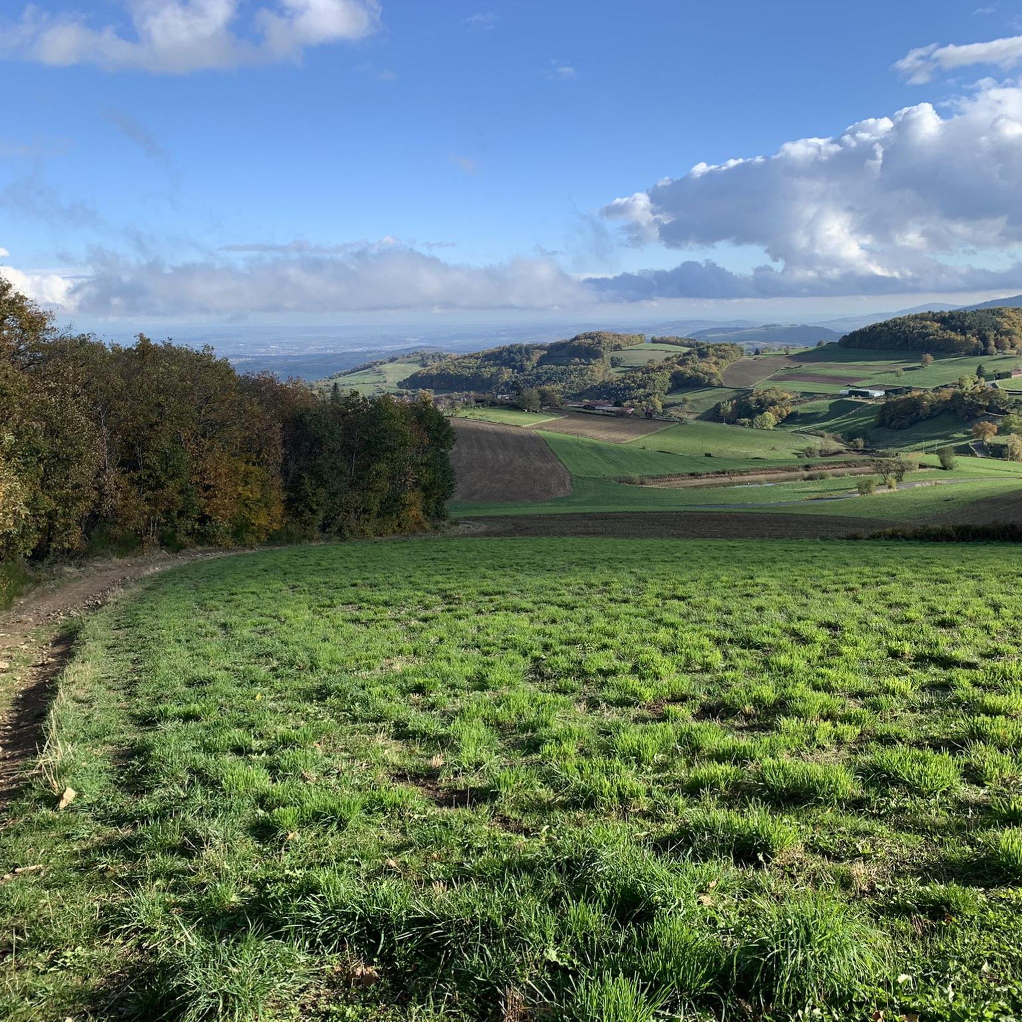
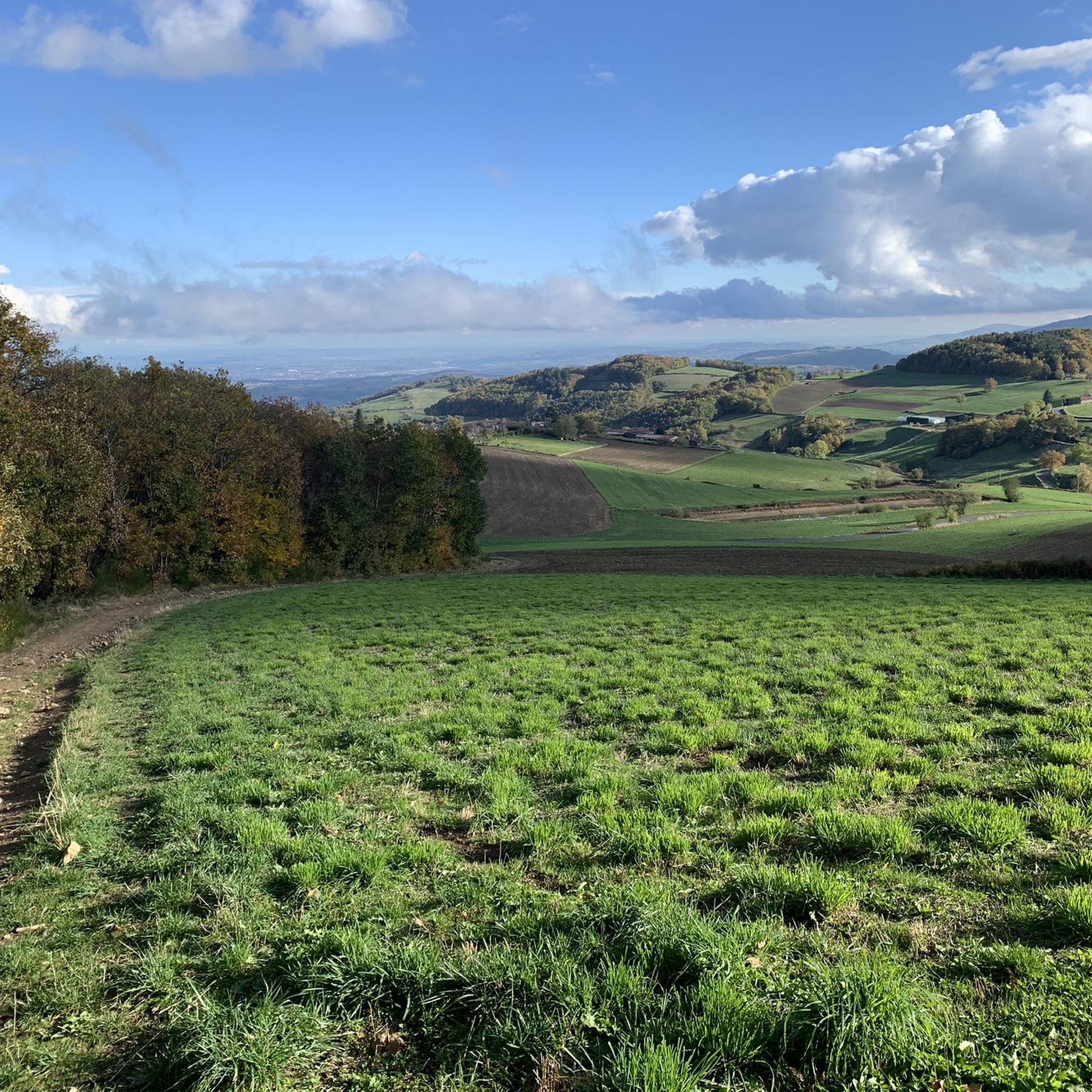
Hiking trails around Saint-Martin-En-Haut traverse the varied landscapes of the Monts du Lyonnais, characterized by wooded hills, dense forests, and serene valleys. The region features a mix of open meadows and cultivated fields, offering diverse scenery for hikers. Panoramic views are accessible from various points, including the Signal Saint-André, which is the highest point in the Monts du Lyonnais.
Best hiking trails around Saint-Martin-En-Haut
- The most popular hiking route is Le Signal de Saint André – Signal St André (at…
Last updated: July 9, 2026
4.4
(20)
68
hikers
Moderate hike. Good fitness required. Easily-accessible paths. Suitable for all skill levels.
4.6
(12)
31
hikers
Moderate hike. Good fitness required. Easily-accessible paths. Suitable for all skill levels.

Sign up for free
5.0
(4)
23
hikers
21.0km
06:14
630m
630m
Hard hike. Very good fitness required. Easily-accessible paths. Suitable for all skill levels.
5.0
(2)
39
hikers
4.01km
01:13
140m
140m
Easy hike. Great for any fitness level. Easily-accessible paths. Suitable for all skill levels.
4.6
(10)
44
hikers
Moderate hike. Good fitness required. Easily-accessible paths. Suitable for all skill levels.
Get access to more routes and recommendations from other explorers.
Sign up for free
Already have an account?
Our route recommendations are based on thousands of hikes, rides, and runs completed by other people on komoot.
Start today with a free account
Your next adventure awaits.
Login or Signup

Tips from the Community

Beautiful walk with friends, in the freshness of May
0
0

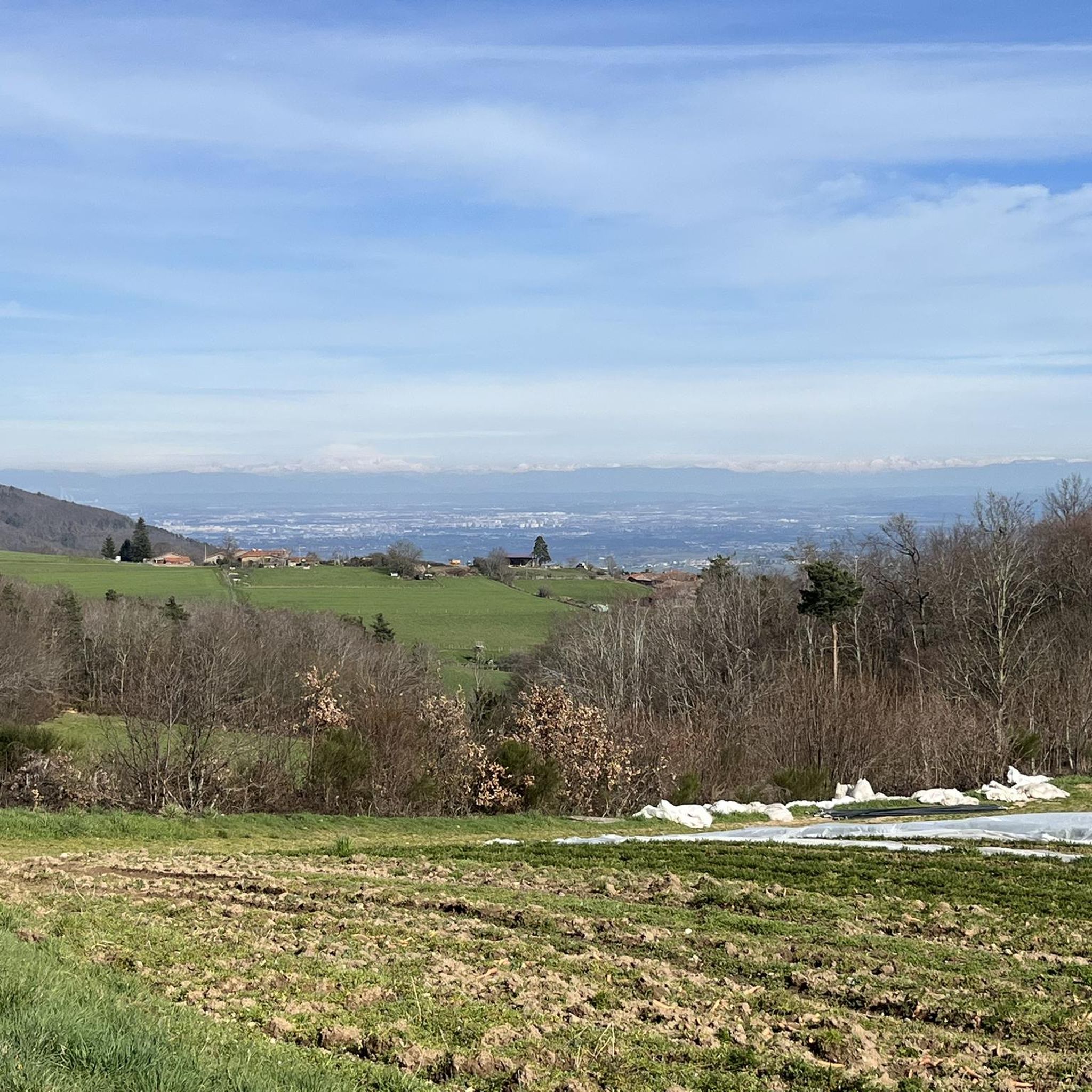
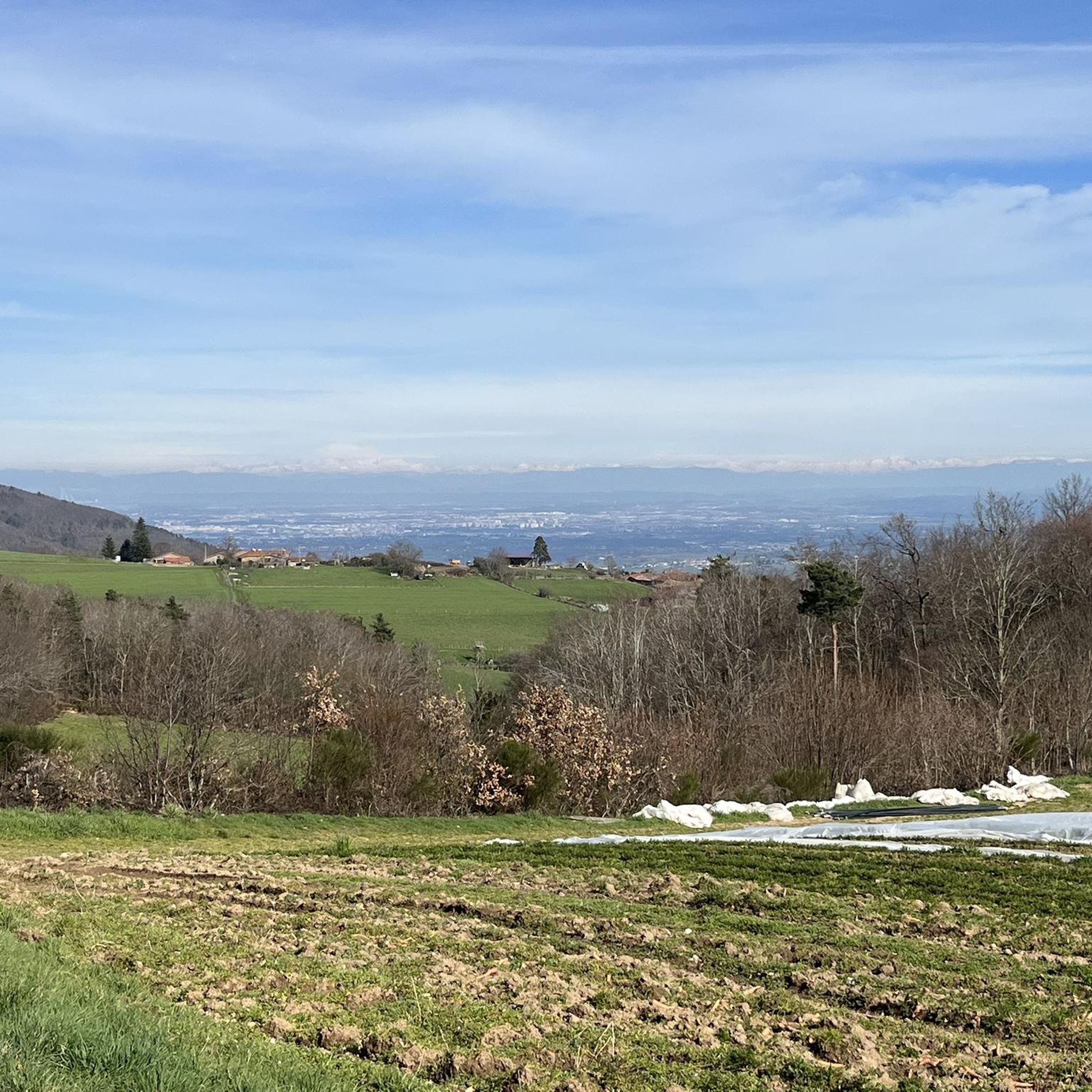
The hamlet of Rochefort, a medieval site including a Romanesque chapel and the remains of a keep. Panoramic views of the Alps and Lyon, with a viewpoint indicator along the path.
0
0

Around the dam we are in peace, far from the world to recharge our batteries and picnic in the sun with family or friends. After all, happiness is only worth it if it is shared😀.
0
0

High point of the Monts du Lyonnais
0
0

Small town in the Monts du Lyonnais located 30 km from Lyon, beautiful view of the Lyon metropolitan area on a clear day. See the medieval site of Rochefort
0
0

The Signal site, an emblematic highest point in the Monts du Lyonnais, located at 934 meters, equipped with a belvedere and an orientation table.
0
0
Interesting is the Cassini terminal, where the first surveys were carried out in 1758 to draw up the map of Lyon, a moment in history.
0
0
Frequently Asked Questions
How many hiking trails are available around Saint-Martin-En-Haut?
There are over 60 hiking trails around Saint-Martin-En-Haut, catering to various difficulty levels. You'll find a mix of easy, moderate, and difficult routes, ensuring options for every hiker.
Are there easy hiking trails suitable for beginners or casual walkers in Saint-Martin-En-Haut?
Yes, Saint-Martin-En-Haut offers several easy hiking trails perfect for beginners or those looking for a relaxed walk. For example, the Hiking loop from La Vaure is an easy 4 km route that provides a pleasant experience through the local landscapes.
Can I find circular hiking routes in Saint-Martin-En-Haut?
Absolutely. Many of the trails in Saint-Martin-En-Haut are circular, allowing you to start and end your hike in the same location. This is ideal for exploring the diverse landscapes of the Monts du Lyonnais, from wooded hills to open meadows.
Are the hiking trails in Saint-Martin-En-Haut suitable for families with children?
Yes, Saint-Martin-En-Haut is a great destination for family hikes. The region's well-marked trails and varied terrain, including charming wooded hills and open meadows, offer enjoyable experiences for all ages. There are several easy routes that are perfect for families.
Are dogs allowed on the hiking trails in Saint-Martin-En-Haut?
Generally, dogs are welcome on hiking trails in the Monts du Lyonnais, but it's always recommended to keep them on a leash, especially when passing through cultivated fields or near livestock. This ensures the safety and enjoyment of all trail users and local wildlife.
What are some interesting historical sites or natural landmarks to see while hiking?
Hiking in Saint-Martin-En-Haut offers a rich blend of nature and history. You can explore the Medieval Site of Rochefort, which includes the remains of a keep and a chapel. Other notable features include sections of ancient Roman aqueducts and the tranquil Lac du Ronzey. Don't miss the panoramic views from the Signal Saint-André, the highest point in the Monts du Lyonnais.
What is the best time of year to go hiking in Saint-Martin-En-Haut?
Saint-Martin-En-Haut is enjoyable for hiking throughout much of the year. Spring and autumn offer pleasant temperatures and vibrant scenery, with blooming flowers or colorful foliage. Summer provides warm weather for exploring, while winter can offer a unique, peaceful experience in the snow, though some trails might be more challenging.
Are there options for public transport to reach hiking trailheads in Saint-Martin-En-Haut?
While Saint-Martin-En-Haut is primarily accessed by car, some local bus services might connect to nearby towns. However, for direct access to many trailheads within the Monts du Lyonnais, personal transport is often the most convenient option.
Is parking available at the trailheads in Saint-Martin-En-Haut?
Yes, parking is generally available at or near the main trailheads and in the village of Saint-Martin-En-Haut. Many routes conveniently start by crossing a leisure park or from accessible points within the commune, making it easy to find a starting spot for your hike.
What do other hikers say about the trails in Saint-Martin-En-Haut?
The hiking routes in Saint-Martin-En-Haut are highly rated by the komoot community, with an average score of 4.6 stars from over 350 reviews. Hikers often praise the diverse landscapes, the well-maintained paths, and the stunning panoramic views, particularly from viewpoints like the Signal Saint-André.
Where can I find places to eat or stay near the hiking trails?
Saint-Martin-En-Haut and the surrounding picturesque villages like Duerne and Yzeron offer various options for dining and accommodation. You'll find local restaurants serving regional cuisine and charming guesthouses or hotels for an overnight stay, allowing you to fully immerse yourself in the Monts du Lyonnais experience.
Are there any less crowded hiking options in Saint-Martin-En-Haut?
While popular trails like the Signal Saint-André can see more visitors, the extensive network of paths in the Monts du Lyonnais means you can often find quieter routes. Exploring some of the longer or slightly more challenging trails, such as the Thurins Dam – Medieval Site of Rochefort loop, can lead to a more solitary experience amidst the serene valleys and forests.
Can I find trails that pass by lakes or water features?
Yes, the region around Saint-Martin-En-Haut features several beautiful water bodies. You can find trails that lead to or pass by the tranquil Lac du Ronzey or the Thurins Dam, offering picturesque views and a refreshing change of scenery during your hike.
Most popular routes around Saint-Martin-En-Haut
Most popular attractions around Saint-Martin-En-Haut

Get inspired with the komoot mobile app


Explore more
Browse the best Hikes in other regions.
