Attractions and Places To See around Marolles-En-Brie - Top 20
Best attractions and places to see around Marolles-En-Brie include a blend of historical sites, natural landscapes, and cultural points of interest. This commune, situated in a rural setting between forests and a river, is part of the Plateau Briard, offering green spaces and a rich heritage. Located approximately 20 kilometers from Paris, it provides opportunities for exploring both historical landmarks and extensive natural features like the Forêt Notre-Dame.
Best attractions and places to see around Marolles-En-Brie
- The most popular attractions…
Last updated: July 1, 2026
Saint-Martin de Doue church
Highlight • Other
Translated by Google •
Tip by

Aire de picnic + lavoir
Highlight • Other
Translated by Google •
Tip by

Sign up now to discover places like this
Get recommendations on the best single tracks, peaks, & plenty of other exciting outdoor places.
Sign up for free
Cascade Saint-Augustin
Highlight • Other
Translated by Google •
Tip by

The Templar Commandery
Highlight • Historical Site
Translated by Google •
Tip by
Doue mountain
Highlight • Other
Tip by

Sign up for free to discover even more attractions around Marolles-En-Brie.
Sign up for free
Already have an account?
Start today with a free account
Your next adventure awaits.
Login or Signup




Tips from the Community

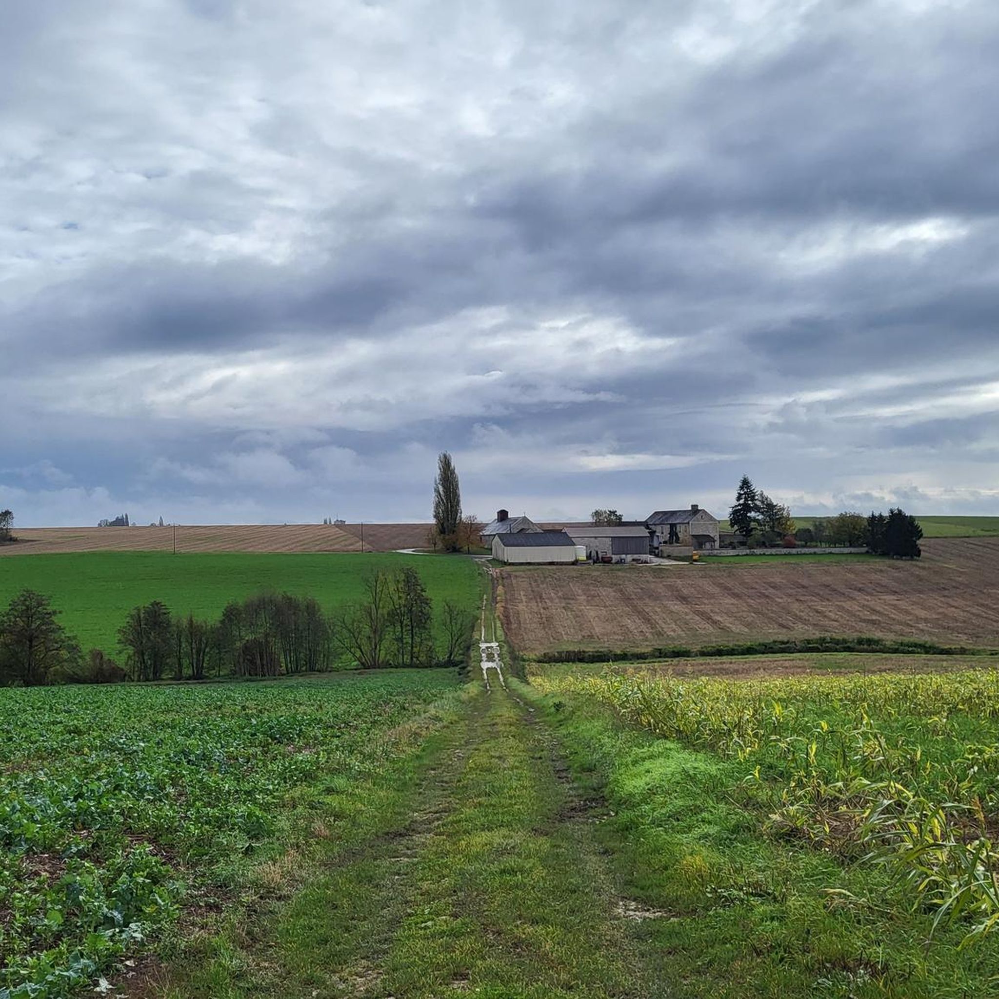
Very beautiful view that is well worth it!!! My Wahoo is seeing red!
0
0

Treat yourself to a well-deserved break at the picnic area near the Montcet washhouse, on the banks of the Aubetin. With its three tables set in a calm and natural setting, this space is the ideal place to eat in complete tranquility. Enjoy the serenity of the place, between the murmur of the water and the freshness of the environment, to regain your strength before continuing on your way.
0
0

13% on one side and 9% on the other because it is located on a hill.
0
0
Built between the 12th and 15th centuries, the Commanderie des Templiers constitutes the best preserved Templar ensemble north of the Loire. The Templar and then Hospitaller Commandery experienced eight centuries of incessant human occupation. The current buildings, remodeled over the centuries, are arranged around a large rectangular courtyard where the tithe barn, the dovecote, the commander's dwelling and the Sainte Anne chapel, decorated with 13th century murals, are located. Listed in the supplementary inventory of Historic Monuments in 1932 and classified as a Historic Monument in 1994 due to its rarity, it is today the subject of much attention. There is also a medieval garden designed in 1993 in collaboration with the Yves Rocher Foundation. This 4000m² space is organized around four themed squares including vegetable garden, bouquet flowers, medicinal and technical plants.
0
0

Située en hauteur, au sommet de la célèbre butte de Doue, l'église Saint-Martin de Doue se dresse sur un lieu de culte déjà utilisé du temps des Celtes. La fondation de l'église daterait elle de l'époque de Saint-Martin (VIe siècle), même si aucune trace n'en subsiste aujourd'hui. Le bâtiment actuel de l'église Saint-Martin date du XIIIe siècle et n'a subit que peu de modification au fil du temps. A la nef, basse et classique à charpente de bois, succède une nef élevée - comparable à celle de Vaudoy-en-Brie - dont les hautes baies vitrées fournissent une importante lumière au bâtiment. Les transepts sont eux aussi agrémenté de larges ouvertures et complète l'aspect monumental de l'édifice. Seul élément ultérieur au XIIe siècle, le clocher porche de l'église est construit vers 1827 en remplacement d'un flèche qui surmontait le transept et frappée par la foudre. Il abrite les cloches de l'église. A l'intérieur, la décoration de l'édifice est riche, et surtout marqué par certains chapiteaux de colonne sculptés et peints de la fin de l'époque romane. Les boiseries du choeur, datées du XVIIIe siècle, ont la particularité d'avoir été offerte à sanctuaire par Louis XVI en personne, encore Dauphin de France, à l'occasion d'une chasse dans les forêts environnantes. Eglise du ; XIIIe siècle, clocher-porche du XIXe siècle Architecture ; Gothique. Visite le Dimanche Après Midi : http://www.balades-en-brie.com/brie/doue/eglise-saint-martin.html] Redescendons la butte par la route nous sommes toujours sur le GR 11. Nous débouchons face au château (grosse propriété que j’ai pris pour une ferme). Nous débouchons sur une route que nous prenons à gauche, laissons une rue sur la droite puis coupons la D 37 poursuivons en face par un chemin dans les champs nous buttons sur une parcelle et notre chemin tourne à gauche. Nous longeons la Chevrie ferme ou ancienne ferme devenue chambre d’hôte et nous prenons la route sur la droite, nous sommes toujours sur le GR 11. Après les vallons du Petit & du Grand Morin nous retrouvons le plateau de brie avec ses betteraves. Laissons les routes que nous rencontrons et traversons les Petits Montgoins, nous coupons la D 204 et prenons le chemin après avoir longé un dépôt de pierre faisant rapidement fourche ou nous prenons la branche de gauche. Nous descendons sur un chemin caillouteux faisant souffrir les chevilles dans le bois Marcou. Nous débouchons sur un chemin que nous prenons à gauche toujours le GR 11 et retrouvons un balisage jaune. Heureusement que je ne suis pas le GR de Saint Jacques de Compostelle la branche Reims – Paris, je ne vois que des croix bleu et jaune mais aucune balises indiquant l’itinéraire à suivre. Cela doit dérouter les Jacquaires il est si bien tracé, et matérialisé par des chambres d’hôtes dans les Ardennes, qu’ici on a un désert de balise. Après un virage longeons le ru Choisel (dans ce lieu j’ai l’impression d’être dans les Monts d’Ambazac). Dans mon topo oral le PR ne porte pas ce nom là, il porte le nom du hameau le Ru de Vrou situé en limite du plateau. Quittons une branche du jaune remontant sur la gauche traversons le ru et poursuivons le GR 11 notre chemin fait fourche nous rencontrons encore des croix jacquaires, nous prenons à gauche. Nous longeons une aire de mobil-homes et de petits chalets. Nous débouchons sur un chemin formant Té et prenons la branche de Gauche, nous grimpons la colline et ce n’est pas facile sur ses cailloux de meulières et cette marne qui glisse sous les chaussures. Traversons la D 204 poursuivons en face. Le chemin fait fourche laissons la branche de droite à la seconde fourche il y a un trou dans le balisage du GR, il passe d’après la carte par la D 114, seulement je n’ai pas vu de balisage. Je suis donc redescendu les quelques mètres pour suivre le balisage jaune (sur la droite lorsque l’on monte) le chemin n’est pas facile en automne ; ornières pleines d’eau et terrain très glissant, mais c’est mieux que le bitume. Nous longeons des prairies et laissons les chemins descendant sur la droite desservant des propriétés privés. Après une énième fourche nous prenons à gauche. Nous débouchons malgré tout sur la D 114 ou nous retrouvons les marques du GR à l’entrée de Romeny, que nous prenons à droite sur quelques centaines de mètres rue grande puis à gauche la rue du cloud. nous prenons ensuite à droite le sentier intra muros qui devient à son extrémité rue Albert Besnard nous sommes toujours à Romeny. Traversons la Grande Rue (D114) puis la rue de la mare, prenons en face le chemin alternant entre champs et bois. Après un virage nous débouchons sur un chemin formant Té et prenons à droite, puis à la rencontre de la fourche encore la branche de droite, On aperçois sur la gauche Jouarre [La ville est située sur un plateau à 150 m d'altitude. Avec 4 219 hectares, c'est en termes de superficie la seconde commune de Seine-et-Marne après celle de Fontainebleau. La racine toponymique de Jouarre renvoie sans doute à une ancienne occupation celte, peut-être le gaulois duro, "porte" d'où "forteresse", ou divoduro, "forteresse divine"".Domus Dei de Jotro - Jouerre-en-Brie - Juere - Jouarre-Balleau et Courcelles. Au cours de la Révolution française, la commune porte le nom de Jouarre-la-Montagne. l’essor jotrancien est à rechercher dans la première moitié du VIIe siècle, lorsque saint Adon fonde à cet endroit une abbaye, encore en activité à l’heure actuelle. Les invasions normandes du IXe siècle, les dégradations de la guerre de Cent Ans au XVe siècle, la Révolution française, autant d’événements majeurs qui ont touché cette commune. Mais le patrimoine local est resté intact, et si chaque époque a laissé sa trace, c’est pour mieux révéler ce qui avait été fait antérieurement… Ainsi Jouarre reste l’une des rares communes de la région à conserver autant de vestiges des temps révolus. Joyau du patrimoine et de l’art mérovingien, les cryptes de Jouarre demeurent un ensemble unique en Europe de par leur conservation et de par leur âge. En 1915, les bâtiments de l'abbaye de Jouarre sont réquisitionnés pour servir d'hôpital militaire à l'arrière du front.
0
0

Located on a high point, lovely view guaranteed
1
0

This church is distinguished by its location at the top of the Butte de Doue. In addition to offering beautiful views, this place of particular geological interest allows you to learn about the sedimentary layers of the region.
0
0

These rapids on the Aubetin offer a refreshing watering hole surrounded by nature. They are worth seeing if you pass by, if only to stop and take a breather for a few minutes!
4
0
Frequently Asked Questions
What natural features can I explore around Marolles-en-Brie?
Marolles-en-Brie is surrounded by rich natural landscapes. You can discover the extensive Forêt Notre-Dame, one of the largest forest areas in Île-de-France, perfect for walking and cycling. The Réveillon river flows through the commune, offering pleasant walking paths. Don't miss the Cascade Saint-Augustin, a refreshing natural spot on the Aubetin river. The area is also part of the Plateau Briard, known for its rural charm and green spaces.
Are there historical sites to visit in Marolles-en-Brie?
Yes, Marolles-en-Brie boasts several historical sites. The Templar Commandery is one of the best-preserved Templar ensembles north of the Loire, featuring 13th-century murals and a medieval garden. The La Halle aux Fromages, built in 1887, testifies to the city's historical cheese production. You can also find the ancient Église Saint-Julien de Brioude, with origins from the 9th century, showcasing Romanesque and Gothic architecture.
What kind of outdoor activities are available near Marolles-en-Brie?
The region offers diverse outdoor activities. You can enjoy gravel biking, cycling, and mountain biking on various routes. For example, explore the area with routes like the 'Jouarre Abbey – Fromagerie Ganot loop' for gravel biking or the 'Butte de Doue – Saint-Martin de Doue church loop' for cycling. Find more details on routes in the Gravel biking around Marolles-En-Brie, Cycling around Marolles-En-Brie, and MTB Trails around Marolles-En-Brie guides.
Are there any family-friendly attractions in the area?
Absolutely. The Templar Commandery is categorized as family-friendly and offers an engaging historical experience. The Aire de picnic + lavoir provides a tranquil setting for families to relax and enjoy a meal outdoors. Additionally, the Golf Blue Green de Marolles-en-Brie is known for its family-friendly atmosphere, and the Centre hippique Les Bagaudes offers equestrian activities for all levels.
Where can I enjoy a picnic or relax outdoors?
The Aire de picnic + lavoir is an ideal spot for a picnic, located near the Montcet washhouse on the banks of the Aubetin river, offering three tables in a calm, natural setting. You can also find numerous serene spots within the Forêt Notre-Dame or along the Réveillon river for a peaceful outdoor break.
What is the best time of year to visit Marolles-en-Brie for outdoor activities?
Spring and autumn are generally ideal for outdoor activities in Marolles-en-Brie, offering pleasant temperatures and beautiful scenery. Spring brings blooming nature, while autumn showcases vibrant foliage in the forests. Summer is also suitable, especially for activities near the river or in shaded forest areas, though it can be warmer.
Can I find cycling routes around Marolles-en-Brie?
Yes, Marolles-en-Brie and its surroundings offer a variety of cycling routes. You can explore options like the 'Butte de Doue – Saint-Martin de Doue church loop' or the 'Bike loop from Chauffry'. For a comprehensive list of routes and their difficulties, refer to the Cycling around Marolles-En-Brie guide.
Are there opportunities for mountain biking?
Indeed, there are several mountain biking trails near Marolles-en-Brie. Routes such as the 'Cascade Saint-Augustin – Aire de picnic + lavoir loop' and the 'Capucins Park – Templar Commandery loop' provide excellent opportunities for mountain biking. More detailed routes can be found in the MTB Trails around Marolles-En-Brie guide.
What cultural points of interest does Marolles-en-Brie offer?
Beyond historical landmarks, Marolles-en-Brie has cultural points like the annual Salon des Métiers d'Art, featuring over 70 exhibitors. You can also observe old farms, such as La Ferme Vaurichard (now the Town Hall) and Ferme de Combault (transformed into a Dojo and House of Arts), reflecting the region's agricultural heritage. The town also has a historical connection to numerous wells, with over 35 once existing in the area.
What is the 'Plateau Briard' and its significance to the region?
The Plateau Briard is the geographical area where Marolles-en-Brie is located. It is characterized by its rural landscape, extensive green spaces, and rivers. This plateau is known for its agricultural heritage, including the revival of traditional viticulture with the 'Le Clos de l'Amitié' vineyard, and its historical cheese production, as evidenced by La Halle aux Fromages.
Are there any equestrian activities available?
Yes, the Centre hippique Les Bagaudes, located within the Bois Notre-Dame, offers various equestrian activities. It caters to all levels, providing a great opportunity to explore the natural surroundings on horseback.
What is the significance of the Église Saint-Julien de Brioude?
The Église Saint-Julien de Brioude is a significant historical landmark in the region, recognized as the oldest church in Val-de-Marne. Its origins date back to a 9th-century chapel, with the main structure from the 12th century. It's notable for showcasing an interesting transition from Romanesque to Gothic architectural styles.
Most popular routes around Marolles-En-Brie

Get inspired with the komoot mobile app


Explore more
Still not found the Highlight you’re looking for? See guides of the top attractions in other regions:
