The best road cycling routes around Saulnières
4.3
(59)
1,940
riders
303
rides
Road cycling routes around Saulnières traverse a landscape characterized by rolling hills and rural roads, offering varied terrain for cyclists. The region features moderate elevation gains across its routes, indicating a mix of ascents and descents. Cyclists can expect to encounter open countryside and potentially forested sections, providing a diverse backdrop for rides. The area's topography supports both shorter, easier rides and longer, more challenging excursions.
Best road cycling routes around Saulnières
- The most popular road cycling route is Saint-Senoux Church – La Halte loop from Chanteloup, a 28.6 miles (46.1 km) trail that takes 2 hours 10 minutes to complete. This moderate route offers a balanced ride through the local countryside.
- Another top favourite among local road cyclists is Chateau de Chateaubriant – Torche Pond loop from La Bosse-de-Bretagne, a moderate 43.7 miles (70.3 km) path. This route explores the area's historical landmarks and natural ponds, providing scenic views.
- Local road cyclists also love the Millennium Park loop from Chanteloup, a 20.9 miles (33.6 km) trail leading through local parklands and rural settings, often completed in about 1 hour 27 minutes.
- Road cycling around Saulnières is defined by rolling hills, rural roads, and varied elevation profiles. The network offers options for different ability levels, from easy loops to more challenging moderate routes.
- The routes in Saulnières are highly rated by the komoot community with an average score of 4.2 stars from over 50 reviews. More than 1,700 road cyclists have used komoot to explore Saulnières's varied terrain.
Last updated: July 6, 2026
16
riders
46.1km
02:10
540m
540m
Moderate road ride. Good fitness required. Some segments of this route may be unpaved and difficult to ride.
15
riders
71.4km
03:03
570m
570m
Moderate road ride. Good fitness required. Mostly well-paved surfaces and easy to ride.

Sign up for free
5.0
(2)
12
riders
33.6km
01:27
250m
250m
Easy road ride. Great for any fitness level. Mostly well-paved surfaces and easy to ride.
6
riders
42.3km
02:02
420m
420m
Moderate road ride. Good fitness required. Some segments of this route may be unpaved and difficult to ride.
8
riders
31.8km
01:26
310m
310m
Moderate road ride. Good fitness required. Mostly well-paved surfaces and easy to ride.
Get access to more routes and recommendations from other explorers.
Sign up for free
Already have an account?
Our route recommendations are based on thousands of hikes, rides, and runs completed by other people on komoot.
Start today with a free account
Your next adventure awaits.
Login or Signup




Tips from the Community


The church of Saint-Senoux, rebuilt in 1896 in a Romanesque-Byzantine style, is distinguished by its onion-domed bell tower and vaulted nave. It reuses elements from the old church and retains the original altars, baptistery and confessionals.
1
0
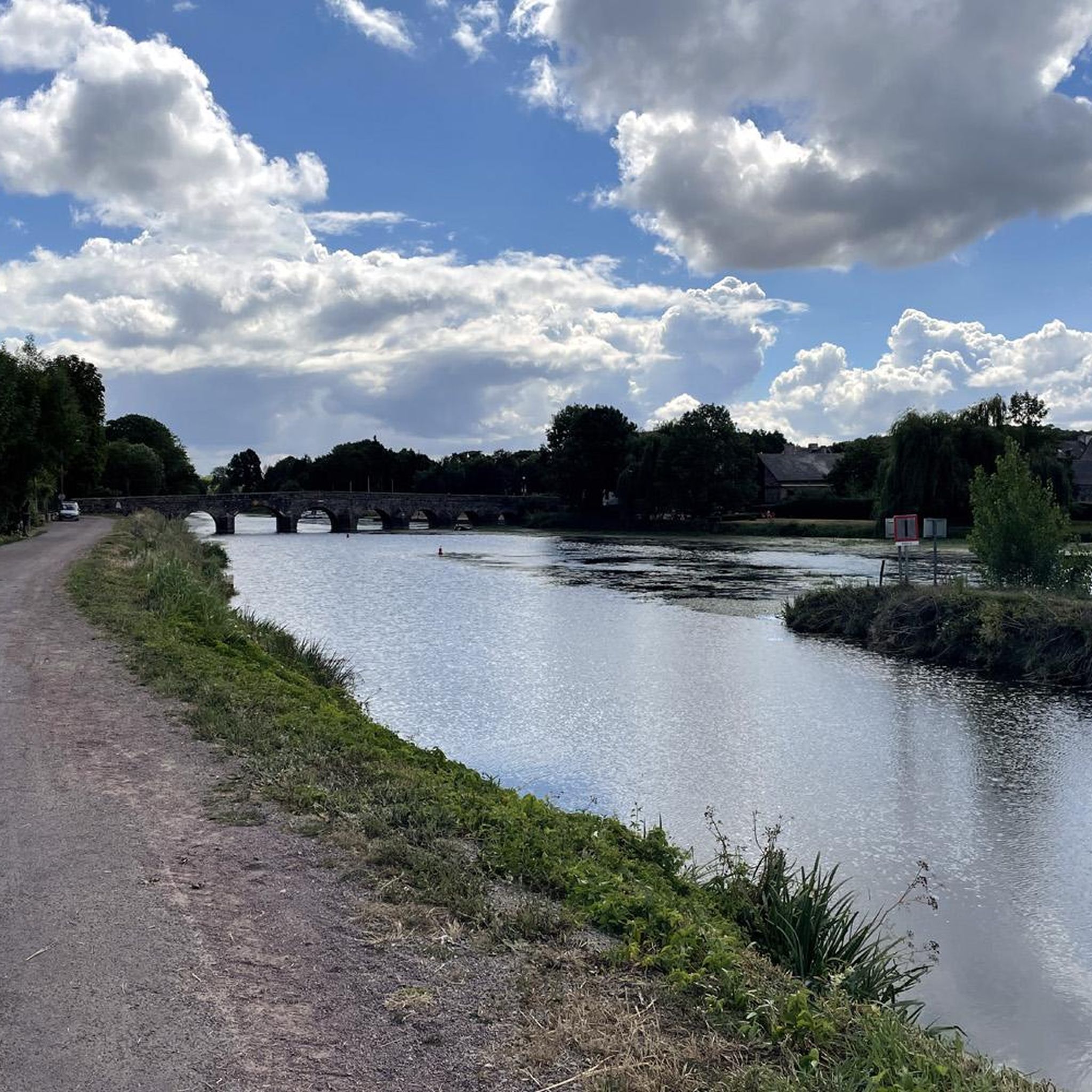
Located at the confluence of the Vilaine and Semnon rivers, this picturesque little village is surrounded by valley landscapes in a verdant setting. The village boasts a charming local heritage with its old houses and its bridge over the river.
1
0

Very beautiful passage in the forest
0
0

The church, which consists of a large nave and two six-bay aisles, a transept, and a three-bay choir without an ambulatory, is 65 meters long. The transept is 26.50 m long, and the naves are 17.5 m wide. The bell tower is 65 meters high without the cross. It has a set of five bells made in 1895 by the Bollée foundry in Le Mans: Saint-Nicolas (the bourdon), weighing 4027 kg, playing the A of octave 2 Anne, weighing 1552 kg, playing the D of octave 3 Marie, weighing 1067 kg, playing the M of octave 3 Joséphine-Jeanne, weighing 726 kg, playing the F sharp of octave 3 Henriette-Victorienne, weighing 450 kg, playing the A of octave 3
0
0
The original chapel, initially dedicated to Notre-Dame, was built by Geoffroy IV, Baron of Châteaubriant, on the site where the cattle market was held from May to October until 1763. A text attests to its existence in 1263. [Threatening to fall into ruin, it was demolished in 1518, leaving only the choir of the old chapel standing. The place of worship was immediately rebuilt in a more spacious form using Châteaubriant schist (Nozay stone), based on the plans of Jean Delorme, brother of Philibert Delorme, thanks to the demolition of a neighboring house and the financial support of Jean de Laval. However, the latter's poor financial situation meant that by 1530, only the nave of the building had been built. At the death of Françoise de Foix in 1537 and Jean de Laval in 1543, the Notre-Dame chapel still lacked a framework. It was not until 1551 that the final work was undertaken by Baron Anne de Montmorency. The dedication of the new place of worship took place ten years later, on November 5, 1561, in the presence of the coadjutor of the Bishop of Nantes, and the name of Notre-Dame was changed to Saint-Nicolas, for an unknown reason. On the same day, the body of Jean de Laval, then encased in a lead reliquary, was transported from the castle chapel to the new building. Jean de Laval had wished to see the chapel erected as a collegiate church, but this wish was not granted. However, the building, as vast as a church, shared the honors of worship with the Church of Saint-Jean de Béré, which was then the parish church of the town, until the Revolution. Indeed, the Saint-Nicolas chapel, although of undeniable architectural value, was not suitable for worship in a parish as large as that of Châteaubriant. Nevertheless, in the 15th and 16th centuries, masses, vespers, and many ceremonies were held in the chapel for reasons of convenience, as it was closer to the town of Châteaubriant, while baptisms were all celebrated at Saint-Jean de Béré. At the end of the 19th century, the church, which became the parish seat in 1801, was completely rebuilt. The architect Eugène Boismen drew up the plans, inspired by those of the Saint-Nicolas basilica in Nantes, one of the first neo-Gothic projects in France, which was beginning to inspire architects throughout the west of the country. The foundation stone was blessed on April 25, 1875, by Bishop Fournier of Nantes. The choir, sacristies, transept, and five bays were only completed at the time of the consecration, which was performed by his successor, Bishop Le Coq, on February 1, 1881. The foundations of the bell tower and the remaining bay began in June 1892, based on plans by architect François Bougoüin. The tower and spire were completed in August 1894.
0
0

This recently built church (end of the 19th century) is visible from afar with its 65 meters in height.
0
0
Frequently Asked Questions
How many road cycling routes are available around Saulnières?
There are over 290 road cycling routes available around Saulnières, offering a wide variety of options for different skill levels and preferences.
What is the best time of year for road cycling in Saulnières?
The region's rolling hills and rural roads are generally pleasant for cycling from spring through autumn. Summer offers longer daylight hours, ideal for exploring the open countryside and forested sections.
What are the general road cycling conditions like in Saulnières?
Road cycling around Saulnières is characterized by rolling hills, rural roads, and varied elevation profiles. You can expect a mix of ascents and descents, providing a diverse backdrop for rides through open countryside and potentially forested areas.
Are there easy road cycling routes suitable for beginners in Saulnières?
Yes, Saulnières offers 53 easy road cycling routes. An example is the Millennium Park loop from Chanteloup, a 20.9-mile (33.6 km) trail that leads through local parklands and rural settings, perfect for a more relaxed ride.
What kind of challenges can advanced road cyclists expect in Saulnières?
Advanced cyclists will find 12 difficult routes, along with 234 moderate routes that offer significant elevation gains and longer distances. These routes provide ample opportunity to test endurance on the region's varied terrain.
Are there circular road cycling routes around Saulnières?
Many routes in Saulnières are designed as loops, allowing you to start and finish at the same point. For instance, the Nickel Slope loop from Chanteloup is a moderate 45.3 km route that offers a circular journey through the landscape.
Can I find family-friendly road cycling routes in Saulnières?
While specific family-friendly routes are not explicitly categorized, the 53 easy routes available are generally suitable for families looking for less strenuous rides. These often feature gentler terrain and shorter distances.
Are there scenic road cycling routes with good viewpoints in Saulnières?
Yes, many routes offer scenic views of the local countryside. The Chateau de Chateaubriant – Torche Pond loop from La Bosse-de-Bretagne, for example, explores historical landmarks and natural ponds, providing picturesque vistas along the way.
Are there road cycling routes that pass by cafes or places to stop for refreshments?
While specific cafes are not listed for every route, many routes traverse rural villages and towns where you can find local establishments for refreshments. Planning your route to pass through larger settlements will increase your chances of finding suitable stops.
Is parking available for road cyclists in Saulnières?
Parking availability varies by starting point. Many routes begin near villages or public areas where parking can be found. It's advisable to check specific starting locations for designated parking facilities.
How accessible are road cycling routes in Saulnières by public transport?
Public transport access to specific route starting points in Saulnières can be limited due to its rural nature. It's recommended to research local bus services or train connections to nearby towns and plan your ride accordingly.
What interesting landmarks or attractions can I see along the road cycling routes in Saulnières?
You can discover various points of interest. Highlights include the Saint-Maximilien-Kolbé Church, the Mill trail, and the charming settlement of Corps-Nuds. Some routes, like the Chateau de Chateaubriant loop, specifically pass by historical landmarks.
What do other road cyclists enjoy most about road cycling in Saulnières?
The area is highly rated by the komoot community, with an average score of 4.2 stars from over 50 reviews. Reviewers often praise the varied terrain, the peaceful rural roads, and the diverse backdrop of open countryside and forested sections that make for engaging rides.
Most popular routes around Saulnières
Most popular attractions around Saulnières

Get inspired with the komoot mobile app


Explore more
Browse the best Road cycling routes in other regions.
