The best walks and hikes around Châtenois
4.4
(53)
207
hikers
44
hikes
Hiking around Châtenois offers access to a landscape characterized by gentle hills, agricultural fields, and areas of woodland. The region provides a network of paths suitable for exploring the local countryside. Elevation changes are generally moderate, making many routes accessible. The terrain primarily consists of well-maintained trails and rural tracks.
Best hiking trails around Châtenois
- The most popular hiking route is Drinking water wells – Fort de Boulonmont loop from Aérodrome de Neufchâteau, a 3.6 miles (5.8 km) trail…
Last updated: October 8, 2026
4.4
(5)
12
hikers
5.82km
01:34
70m
70m
Easy hike. Great for any fitness level. Easily-accessible paths. Suitable for all skill levels.
4.8
(5)
24
hikers
29.1km
07:41
270m
270m
Hard hike. Very good fitness required. Easily-accessible paths. Suitable for all skill levels.

4.5
(4)
9
hikers
10.6km
02:52
140m
140m
Moderate hike. Good fitness required. Easily-accessible paths. Suitable for all skill levels.
4.0
(2)
6
hikers
9.12km
02:27
110m
110m
Moderate hike. Good fitness required. Easily-accessible paths. Suitable for all skill levels.
7
hikers
5.55km
01:26
30m
30m
Easy hike. Great for any fitness level. Easily-accessible paths. Suitable for all skill levels.
Get access to more routes and recommendations from other explorers.
Already have an account?
Our route recommendations are based on thousands of hikes, rides, and runs completed by other people on komoot.
Start today with a free account
Your next adventure awaits.


Tips from the Community

Several connections daily towards Nancy.
0
0
Pilgrims can get a stamp here. Very friendly staff.
0
0
One of the oldest bourgeois houses in Neuchâtel, from the year 1583. Now the seat of the town hall.
0
0
Beautiful mosaic on a house corner, showing the national saint Joan of Arc.
0
0

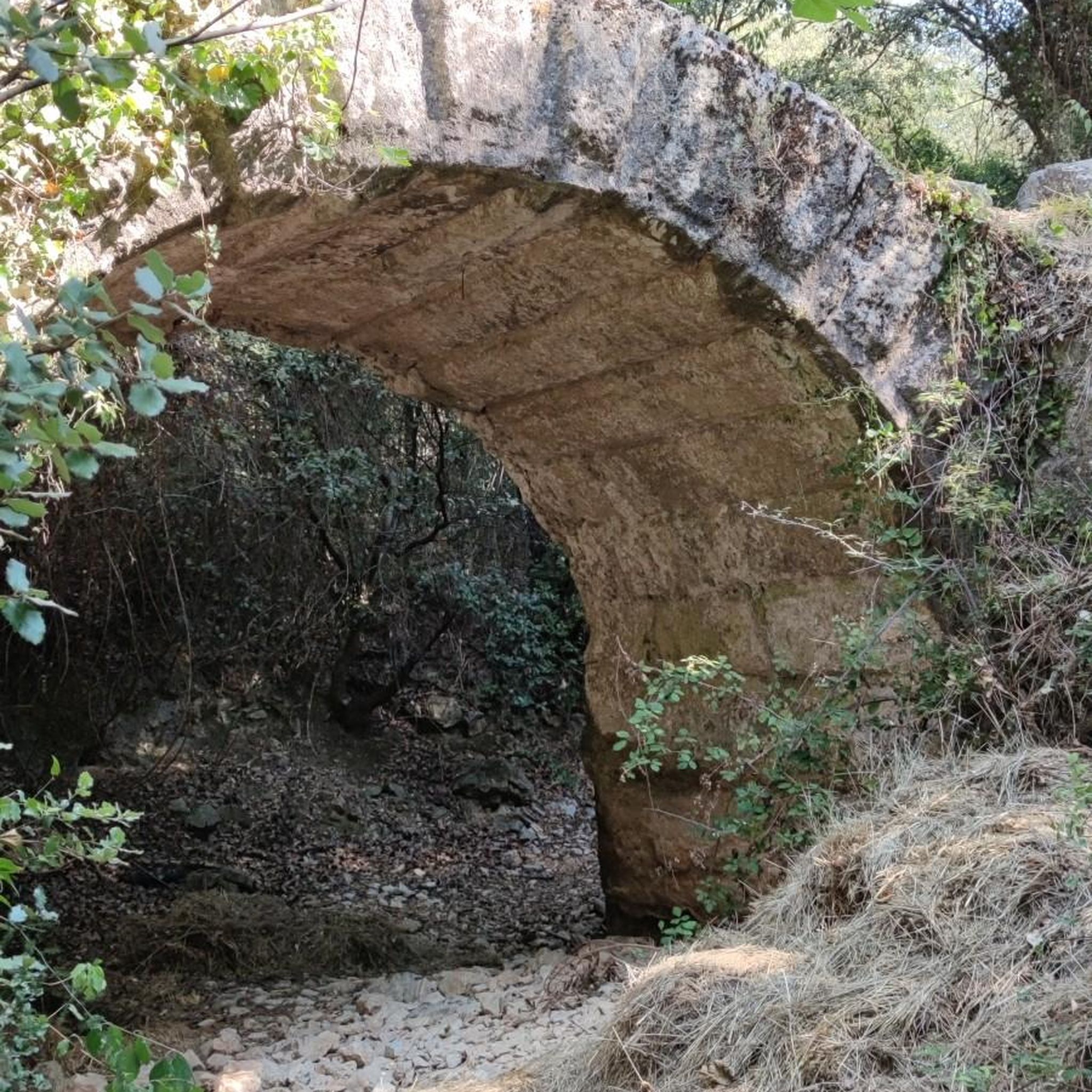
Unusual: Here, the road runs directly through the stream—cars drive through the water, while pedestrians use the historic stone bridge. A hidden highlight in an idyllic village.
0
0

The Lacs de la Folie site in Contrexéville covers 12 hectares of greenery in the heart of the Vosges Plain, as well as: • its free, supervised outdoor swimming pool and grassy solarium, in July and August (Facebook page Piscine de plein air des Lacs de la Folie), (Swimming prohibited in the lakes) • For families, couples, and athletes, or solo, the tour of the lakes is accessible on foot, by bike, with a stroller, or in a wheelchair • It's also the starting point for numerous marked and shaded trails, including the Sentier des Lacs at the Vittel Thermal Park, which is 6 km long and accessible on foot or by bike • its pedal boat and paddleboard rentals with "Pedal'Eau mentalo" • its "Accrofolie" treetop adventure park with courses and zip lines for children and adults (children from 1 m tall) and where you'll also find an escape game • It's also a paradise for Fishing, particularly for carp, trout, tench, roach, and other gudgeon, is available from the banks only (fishing fees per day and per line, collected on site by the fish warden). • The ideal place for a picnic, a drink, an ice cream, or a meal on the terrace overlooking the lakes, and there are also playgrounds for children. • Free parking. Everything you need for a relaxing family time! The Upper Lake Created in 1929, it is elongated, nearly 400 meters long and covers an area of 4.5 hectares. The Lower Lake Created in 1960, it is separated from the former only by a dike through which a road runs. The 200-meter-long straight dam gives it an area of 5.5 hectares.
0
0
Sandaucourt Castle was probably built by Aloff de Beauvau or by his half-brother Claude, Lord of Sandaucourt from 1549 to 1553.
0
0

Frequently Asked Questions
How many hiking trails are available around Châtenois?
There are over 35 hiking routes in the Châtenois region, offering a variety of options for different skill levels and preferences.
Are there easy hiking trails suitable for beginners or families?
Yes, Châtenois offers 11 easy hiking trails. A good option for a relaxed outing is the Drinking water wells – Fort de Boulonmont loop from Rollainville, which is 5.2 km long and takes about 1 hour 25 minutes.
What are some moderate hiking options in Châtenois?
The region features 23 moderate trails. For a pleasant hike, consider the Drinking water wells – Fort de Boulonmont loop from Neufchâteau, a 7.5 km route, or the Bench with Buen Camino – Ford and stone bridge loop from Rollainville, which is 10.6 km.
Are there any challenging long-distance hikes in the area?
Yes, for those seeking a more demanding experience, there is one difficult trail. The Pedal boat rental – Beautiful single trail loop from Auzainvilliers is a challenging 29.1 km route that includes a single trail section.
What kind of terrain can I expect on hikes around Châtenois?
The terrain around Châtenois is characterized by gentle hills, open agricultural fields, and sections of woodland. Trails are generally well-maintained, consisting of rural tracks and paths with moderate elevation changes.
Are there circular walks available in Châtenois?
Many of the trails in Châtenois are circular. Examples include the Drinking water wells – Fort de Boulonmont loop from Aérodrome de Neufchâteau and the Drinking water wells – Fort de Boulonmont loop from Rollainville, both offering convenient loop options.
What can I see along the hiking trails or nearby Châtenois?
Hikers can explore several points of interest. You might encounter historical sites like the Neufchâteau Old Town or the Saint-Christophe Church of Neufchâteau. There are also scenic spots such as the Place Jeanne d'Arc and Views of Circourt-sur-Mouzon.
Is Châtenois a good destination for family-friendly hikes?
Yes, with 11 easy routes and generally moderate terrain, Châtenois is suitable for families. The shorter loop trails are particularly good for outings with children.
What do other hikers enjoy the most about hiking in Châtenois?
The area is highly rated by the komoot community, with an average score of 4.5 stars from over 39 reviews. Reviewers often praise the varied local scenery, including gentle hills, open fields, and forested sections, as well as the well-maintained paths.
When is the best time of year to hike in Châtenois?
Given the temperate climate and varied landscape of gentle hills and woodlands, spring and autumn are generally ideal for hiking in Châtenois, offering pleasant temperatures and beautiful scenery. Summer is also suitable, though some trails may be more exposed to the sun.
Are there any trails with good viewpoints in Châtenois?
While specific viewpoint trails aren't highlighted, the region's gentle hills and open agricultural fields often provide expansive views of the surrounding countryside. Look for routes that traverse higher ground or open areas for the best panoramas, such as the Views of Circourt-sur-Mouzon.
Most popular attractions around Châtenois

Get inspired with the komoot mobile app


Explore more
Browse the best Hikes in other regions.
