The best walks and hikes around Villiers-Le-Mahieu
4.6
(321)
1,709
hikers
198
hikes
Hiking around Villiers-Le-Mahieu offers access to tranquil countryside, characterized by fields, valleys, and the scenic Vaucouleurs river. The region, located in the Yvelines department, provides a blend of natural landscapes and historical sites. Villiers-Le-Mahieu hiking trails often traverse through serene, bucolic settings, with some routes passing by historical landmarks.
Best hiking trails around Villiers-Le-Mahieu
- The most popular hiking route is Thoiry Castle – Section of the Avre Aqueduct loop from Thoiry, an easy 3.8 miles (6.1 km) trail that…
Last updated: July 2, 2026
4.4
(8)
17
hikers
6.27km
01:40
60m
60m
Easy hike. Great for any fitness level. Easily-accessible paths. Suitable for all skill levels.
5.0
(1)
17
hikers
7.82km
02:05
90m
90m
Moderate hike. Good fitness required. Easily-accessible paths. Suitable for all skill levels.

Sign up for free
5.0
(1)
11
hikers
11.3km
02:54
50m
50m
Moderate hike. Good fitness required. Easily-accessible paths. Suitable for all skill levels.
6
hikers
6.19km
01:37
40m
40m
Easy hike. Great for any fitness level. Easily-accessible paths. Suitable for all skill levels.
4.5
(2)
6
hikers
8.21km
02:06
30m
30m
Moderate hike. Good fitness required. Easily-accessible paths. Suitable for all skill levels.
Get access to more routes and recommendations from other explorers.
Sign up for free
Already have an account?
Our route recommendations are based on thousands of hikes, rides, and runs completed by other people on komoot.
Start today with a free account
Your next adventure awaits.
Login or Signup

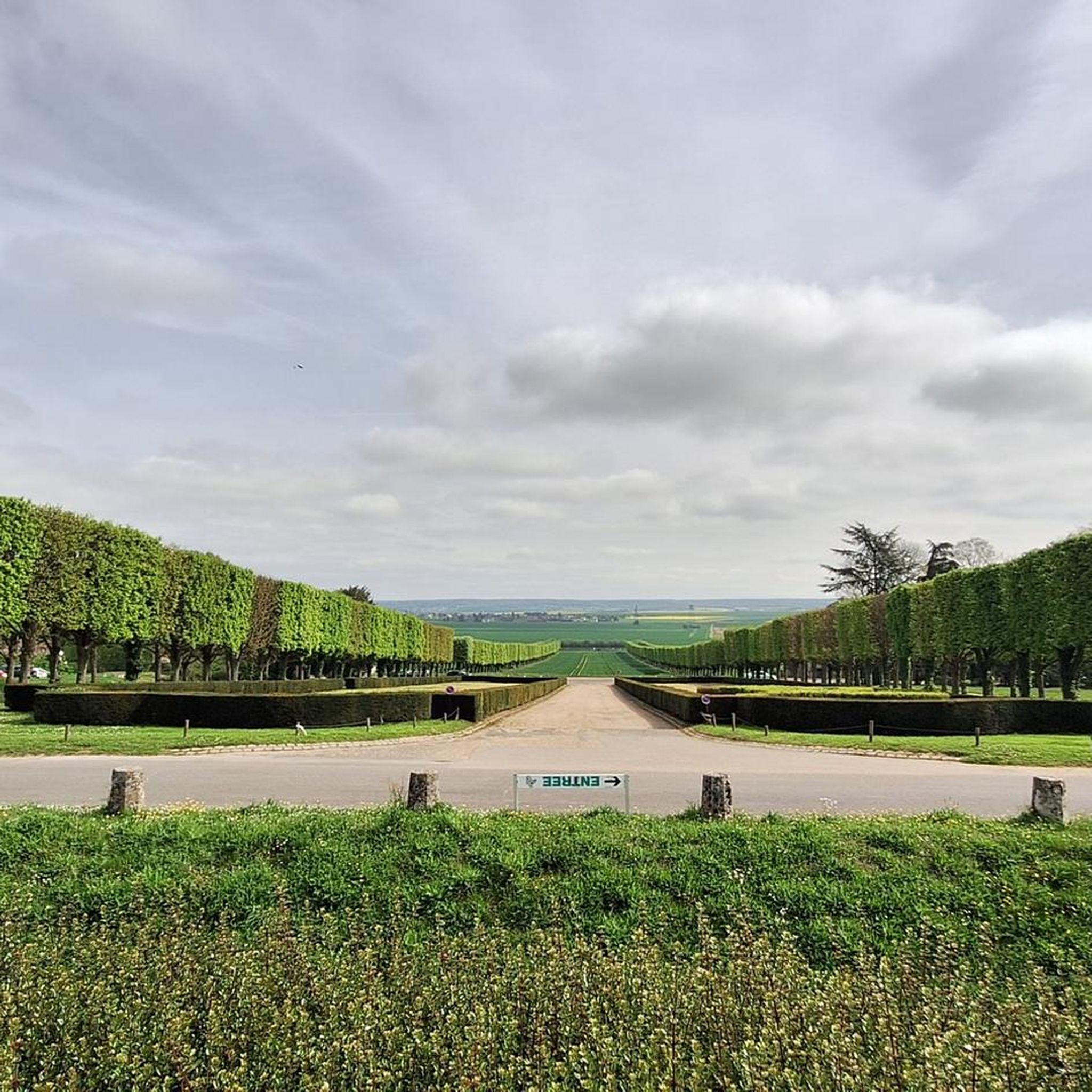


Tips from the Community

Beneath our feet, a circuit that carries water to Paris from the Eure-et-Loir region. Inaugurated in 1893, it delivers 80 million liters of drinking water (out of a total of 680 million liters) per day.
0
0
You can see bison, Przewalski horses, etc. there.
0
0
Located at the crossroads, a small restored washhouse.
0
0
The Avre aqueduct is one of the structures that supplies the city of Paris with drinking water. Inaugurated in 1893, it carries 80 million liters (out of a total of 680 million liters) per day from the Drouais in Eure-et-Loir. The water is transported by simple gravity: the altitude of the springs in the Avre region is 40 m higher than the level of the Saint-Cloud reservoir, their point of arrival. Several springs are captured in the Dreux region, in the Avre catchment basin.
0
0
Away from the road, a very pleasant place to stop in the shade of the pergola.
0
0
Tradition has it that Saint Sanctin, a missionary born in 270, bishop of Verdun and Meaux, passed through Auteuil. This small chapel was built on the site of the preaching in the 15th or 16th century. Above the door you can see a shell, indicating a stop on the road to Compostela. On the gable of the chapel is a bas-relief representing Saint Sanctin as a horseman blessing the faithful. Every year, on September 22, a procession joins the chapel from the church. On other days, the chapel is closed.
0
0

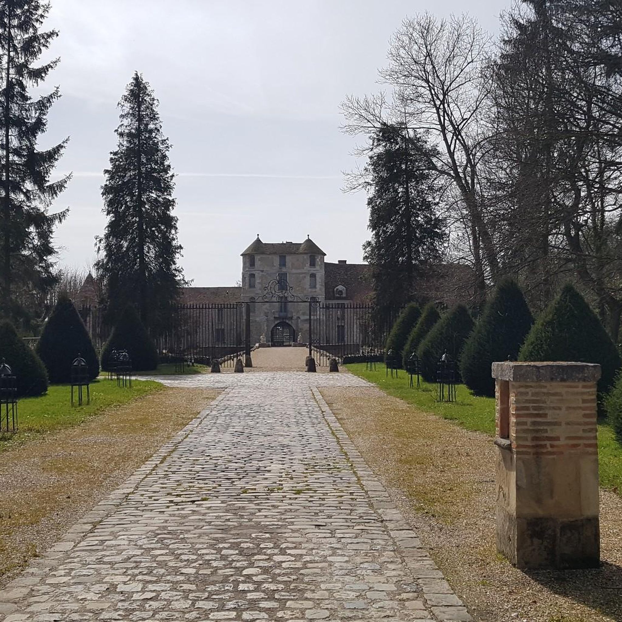
We often think of the zoological park but the Chateau is also remarkable
0
0
Frequently Asked Questions
What kind of terrain can I expect on hiking trails around Villiers-Le-Mahieu?
The region around Villiers-Le-Mahieu is characterized by tranquil countryside, featuring fields, valleys, and serene river paths, particularly along the Vaucouleurs river. Trails often lead through quaint villages and offer a mix of natural landscapes and historical sites. You'll find a generally bucolic and poetic setting.
Are there many circular hiking routes available in Villiers-Le-Mahieu?
Yes, many of the hiking routes in Villiers-Le-Mahieu are designed as loops, offering convenient circular walks. For example, you could try the moderate Pond loop from Villiers-le-Mahieu, which covers 8.2 km.
What historical landmarks or attractions can I see while hiking in the area?
Hiking around Villiers-Le-Mahieu offers opportunities to explore several historical sites. You can visit the 17th-century Notre-Dame du Chêne Chapel, known for its ancient oak tree. In nearby Beynes, you'll find the 13th-century Saint Martin's Church and the Ruins of the Château de Beynes. The area also features several other castles like Château des Mesnuls and Château de Jouars-Pontchartrain.
Are there any easy hiking trails suitable for families?
Yes, Villiers-Le-Mahieu offers a good selection of easy trails perfect for families. There are 67 easy routes in total. An example is the Autouillet Washhouse loop from Auteuil, an easy 6.1 km path that takes about 1 hour 37 minutes to complete.
What do other hikers say about the trails in Villiers-Le-Mahieu?
The hiking routes in Villiers-Le-Mahieu are highly regarded by the komoot community, holding an average score of 4.5 stars from over 270 reviews. Hikers often praise the tranquil countryside, the scenic river paths, and the well-maintained routes that connect historical sites.
How many hiking trails are there in Villiers-Le-Mahieu?
There are nearly 200 hiking trails around Villiers-Le-Mahieu, offering a wide variety of options for different preferences and fitness levels. This includes 67 easy, 118 moderate, and 14 difficult routes.
Is it possible to access hiking trails using public transport?
While specific public transport links directly to every trailhead might vary, Villiers-Le-Mahieu is located in the Yvelines department, which has regional transport options. It's advisable to check local bus schedules or train connections to nearby towns for access points to the trails.
Are there options for parking near the trailheads?
Many trailheads in and around Villiers-Le-Mahieu, especially those starting from villages or popular attractions, typically offer designated parking areas. It's recommended to check the specific route details on komoot for information on parking availability at the start of your chosen hike.
Are there any challenging hikes for experienced hikers?
Yes, for those seeking a more strenuous experience, there are 14 difficult routes available around Villiers-Le-Mahieu. These trails typically feature greater distances or more significant elevation changes, providing a good challenge for experienced hikers.
Can I find places to eat or stay near the hiking routes?
The region around Villiers-Le-Mahieu, including its quaint villages, offers various options for dining and accommodation. You can find hotels and guesthouses catering to outdoor enthusiasts, and local establishments for meals or refreshments after your hike.
What is the best time of year to go hiking in Villiers-Le-Mahieu?
The serene and bucolic landscapes of Villiers-Le-Mahieu are enjoyable throughout much of the year. Spring and autumn offer pleasant temperatures and beautiful scenery, while summer provides longer daylight hours. Even in winter, the trails can be explored, though conditions may vary.
Are dogs allowed on the hiking trails?
Generally, dogs are welcome on many hiking trails in the French countryside, especially if kept on a leash. However, it's always best to check specific regulations for nature reserves or private properties that some trails might cross to ensure a pleasant experience for everyone.
Most popular routes around Villiers-Le-Mahieu
Most popular attractions around Villiers-Le-Mahieu

Get inspired with the komoot mobile app


Explore more
Browse the best Hikes in other regions.
