The best walks and hikes around Cravant
4.5
(176)
931
hikers
149
hikes
Hiking around Cravant offers diverse landscapes, from the wine-growing hillsides and riverbanks of Cravant-les-Côteaux to the historical sites and vineyards of Cravant in Burgundy. The terrain includes verdant forests, gentle slopes, and the broader Burgundian countryside, providing varied natural features for exploration. This region is characterized by its blend of agricultural scenery and historical landmarks, making it suitable for different types of outdoor activities.
Best hiking trails around Cravant
- The most popular hiking route is Around the Ponds loop from…
Last updated: August 28, 2026
3.8
(4)
20
hikers
6.40km
01:37
10m
10m
Easy hike. Great for any fitness level. Easily-accessible paths. Suitable for all skill levels.
5.0
(5)
18
hikers
12.5km
03:21
150m
150m
Moderate hike. Good fitness required. Easily-accessible paths. Suitable for all skill levels.

Sign up for free
4.4
(5)
21
hikers
Easy hike. Great for any fitness level. Easily-accessible paths. Suitable for all skill levels.
4.5
(2)
13
hikers
4.59km
01:21
130m
130m
Easy hike. Great for any fitness level. Easily-accessible paths. Suitable for all skill levels.
4.0
(1)
16
hikers
15.4km
04:26
380m
380m
Moderate hike. Good fitness required. Easily-accessible paths. Suitable for all skill levels.
Get access to more routes and recommendations from other explorers.
Sign up for free
Already have an account?
Our route recommendations are based on thousands of hikes, rides, and runs completed by other people on komoot.
Start today with a free account
Your next adventure awaits.
Login or Signup


Tips from the Community

The washhouse was built in 1863 and extensively restored in 2016. It has two separate entrances. To prevent a possible rise in the river water, the floor of the washhouse is 80 cm higher than the level of the small spring, whose very regular supply had to be ensured by pumping. The water level in the basin rises daily around 4 p.m. and then stabilizes again.
1
0

This small sacred monument, which the hiker encounters here at a crossroads on the historic Way of St. James, is in need of renovation, as the body of the crucified Christ is unfortunately damaged. The stone base from which the cross extends is covered with some stones that were obviously left there. This custom comes from the well-known "Crux de ferro" on the "Camino Frances" in northern Spain. According to tradition, the pilgrims also lay aside their worries and troubles with the stones that they carry there, sometimes over many days and weeks.
2
0

Church from the 12th/13th century, monument historique since 1920
0
0
beautiful old washhouse
0
0


Unfortunately the church is locked. But you will find a rest area here and a hiking map of the region in front of a wonderful backdrop.
2
0
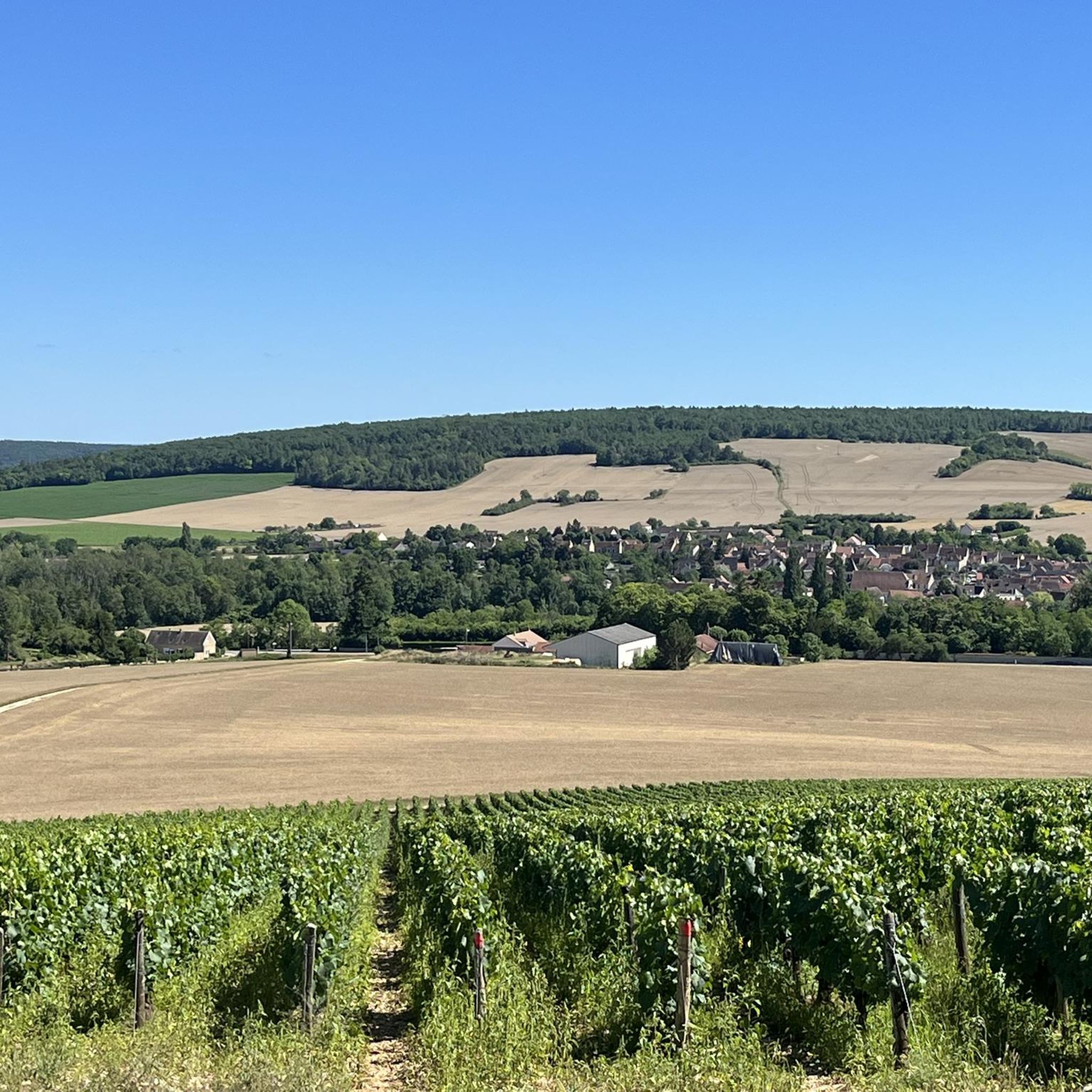
A large rest area and a vantage point with an orientation table.
1
0
There is a small brewery to stop by the beautiful 12C church in Irancy. One of the rental stations in the Auxerre region for e-bikes has also been located here since 2023.
2
1
Frequently Asked Questions
How many hiking trails are available around Cravant?
Cravant and its surrounding area offer a wide variety of hiking experiences, with over 130 trails to choose from. These routes cater to all levels, from easy strolls along the riverbanks to more challenging treks through the hills and forests.
What kind of terrain can I expect on hikes near Cravant?
The terrain around Cravant is wonderfully diverse. You'll find picturesque paths along the Yonne River and the historic Canal du Nivernais, offering flat and easy walking. The region also features rolling hills, dense forests, and open valleys, including the dramatic ancient coral reef cliffs of the Saussois Rocks. Many trails also traverse vineyards and agricultural landscapes, providing a rich mix of scenery.
Are there easy hiking options suitable for beginners or families?
Absolutely! Cravant is well-suited for easy walks. You can enjoy tranquil paths along the Canal du Nivernais, which are flat and accessible. For a specific route, consider the Around the Ponds loop from Vincelles, an easy 6.4 km trail that takes you around local water features with minimal elevation gain. There are 44 easy routes in total to explore.
Are there challenging hikes for experienced trekkers?
Yes, for those seeking a greater challenge, Cravant offers several demanding routes. While not directly in the provided data, the region research mentions a 23.7 km hard hike, "Cravant médiéval — loop from Champs-sur-Yonne," with 300m of elevation. Additionally, the area around the Saussois Rocks provides more strenuous options with significant elevation changes and panoramic views. In total, there are 16 difficult routes available.
What are some moderate hiking trails in the area?
For a moderate challenge, you can explore trails that combine varied terrain and some elevation. A popular choice is the Lavoir de la Grande Fontaine – Cure Island loop from Vermenton, a 12.5 km path that explores riverine landscapes and historical washhouses. Another option is the Douzein Orientation Table – Panorama loop from Irancy, a 15.4 km route offering scenic views. There are 71 moderate routes in the region.
What landmarks or points of interest can I see along the hiking trails?
Many trails in Cravant integrate historical and natural landmarks. You can discover sites like the Cravant Keep, a 14th-century fortified building, or the impressive Church of Saints Peter and Paul in Cravant. Other notable attractions include Belombre Castle and Château du Chastenay. The dramatic Saussois Rocks also offer breathtaking natural vistas over the Yonne Valley.
Are there any circular hiking routes around Cravant?
Yes, many of the trails around Cravant are designed as circular loops, allowing you to start and end at the same point. Examples include the Around the Ponds loop from Vincelles, the Lavoir de la Grande Fontaine – Cure Island loop from Vermenton, and the Saint-Germain d'Irancy church loop from Irancy. These loops are perfect for exploring without needing to retrace your steps.
What do other hikers enjoy the most about hiking in Cravant?
The hiking experience in Cravant is highly regarded by the komoot community, with an average rating of 4.6 stars from over 130 reviews. Hikers often praise the diverse landscapes, from the tranquil riverbanks and canals to the scenic vineyards and historical villages. The well-maintained paths and the blend of natural beauty with cultural heritage are frequently highlighted as key attractions.
Is Cravant a good destination for family-friendly hikes?
Cravant is an excellent choice for family-friendly hikes, especially with its numerous easy and moderate trails. The flat towpaths along the Canal du Nivernais are ideal for leisurely strolls with children. Routes like the "River loop" around Cravant-Les-Côteaux (5.33 km) are perfect for beginners or families seeking a relaxed outdoor experience on easily accessible paths.
What is the best time of year to go hiking in Cravant?
The best time to hike in Cravant is generally during the spring (April to June) and autumn (September to October). During these seasons, the weather is typically mild and pleasant, and the natural scenery is at its most beautiful, with blooming flowers in spring and vibrant foliage in autumn. Summer can also be enjoyable, but it's advisable to start early to avoid the midday heat.
Are there options for dog-friendly trails near Cravant?
While specific regulations for dogs on every trail can vary, many of the natural paths and towpaths along the Yonne River and Canal du Nivernais are generally suitable for dogs, provided they are kept on a leash. It's always a good idea to check local signage and be respectful of wildlife and other hikers. The varied terrain offers plenty of opportunities for you and your canine companion to explore together.
Most popular attractions around Cravant

Get inspired with the komoot mobile app


Explore more
Browse the best Hikes in other regions.
