The best running trails around Saint-Aubin-De-Terregatte
4.0
(39)
2,246
runners
215
runs
Jogging routes around Saint-Aubin-De-Terregatte offer diverse natural landscapes in the Manche department of Normandy. The terrain features rolling countryside, tranquil wooded areas, and riverine environments along the Beuvron, Sélune, and Livet stream. Elevations range from 12 to 181 meters, providing varied options for runners. The area includes extensive trail networks suitable for running, often along quiet country lanes.
Best jogging routes around Saint-Aubin-De-Terregatte
- The most popular jogging route is Voie verte de la Véloscénie – Route de la Veloscénie loop…
Last updated: July 9, 2026
5.0
(2)
51
runners
12.2km
01:27
50m
50m
Moderate run. Good fitness required. Mostly paved surfaces. Suitable for all skill levels.
5.0
(1)
32
runners
14.6km
01:45
50m
50m
Moderate run. Good fitness required. Mostly paved surfaces. Suitable for all skill levels.

Sign up for free
21
runners
Moderate run. Good fitness required. Mostly paved surfaces. Suitable for all skill levels.
20
runners
29.9km
03:34
500m
500m
Hard run. Very good fitness required. Sure-footedness, sturdy shoes and alpine experience required.
28
runners
9.68km
01:09
20m
20m
Moderate run. Good fitness required. Mostly paved surfaces. Suitable for all skill levels.
Get access to more routes and recommendations from other explorers.
Sign up for free
Already have an account?
Our route recommendations are based on thousands of hikes, rides, and runs completed by other people on komoot.
Start today with a free account
Your next adventure awaits.
Login or Signup

Tips from the Community


Beautiful route but there are no water points for the cans! Otherwise it's magnificent
0
0


great spot just past here to stop for a coffee or 2km further on in Isigby Le but there is a Boulangerie and a tabac for great sandwiches and coffee there is also a coccimarket
0
0

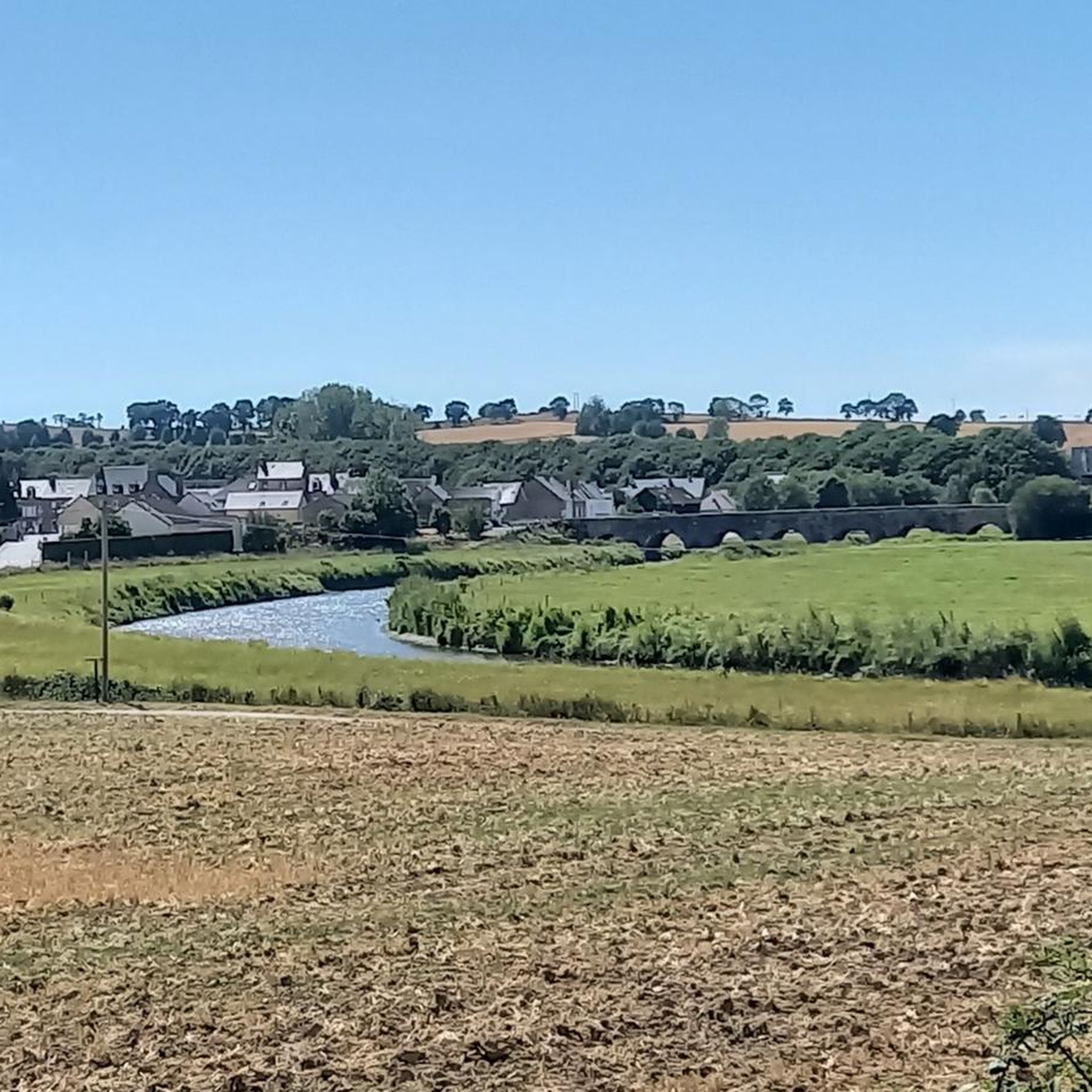
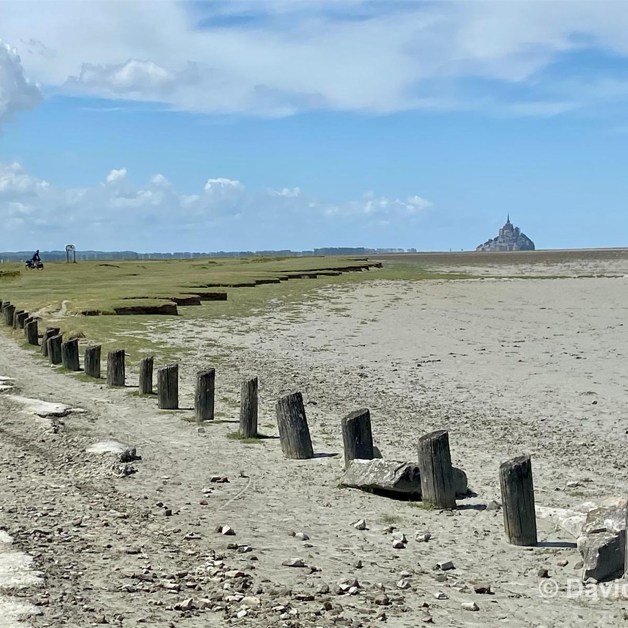
A bridge with a long history! Even the Romans passed along here! And at the end of World War II, American troops passed through here to liberate France. Today, people make pilgrimages past the bridge on their way to Mont St. Michel.
1
0
And we saw the 15th edition of the art trails! So many creative ideas!
0
0


Montgommery Castle was built in the 17th century by the Montgommery family, prominent Protestants involved in the death of King Henry II of France. The castle is Renaissance style, with a terrace, a balcony and a chapel dedicated to Saint Marguerite. You can explore the castle and its surroundings, and learn more about its history and architecture. You can also play a game of Ducey-Code, a live investigation game that mixes puzzles and history in the castle. The castle is open from Wednesday to Sunday, from 2:00 p.m. to 6:00 p.m.
3
0
Frequently Asked Questions
How many running routes are available in Saint-Aubin-De-Terregatte?
Saint-Aubin-De-Terregatte offers a wide selection of running routes, with over 180 trails documented on komoot. These routes cater to various fitness levels, including 15 easy, 152 moderate, and 21 difficult options.
What kind of terrain can I expect on the jogging routes?
The region is characterized by picturesque rolling countryside, tranquil wooded areas, and riverine environments. You'll find paths alongside the Beuvron, Sélune, and Livet streams, offering varied scenery. Elevations range from 12 to 181 meters, providing options from gentle jogs to more challenging trail runs.
Are there running routes suitable for beginners or families?
Yes, there are 15 easy running routes in the area, perfect for beginners or families looking for a relaxed jog. These trails typically feature gentler inclines and well-maintained paths, allowing everyone to enjoy the natural beauty of Saint-Aubin-De-Terregatte.
Can I bring my dog on the running trails?
Many trails in the Saint-Aubin-De-Terregatte area are suitable for running with dogs. However, it's always recommended to check local regulations and ensure your dog is on a leash, especially in nature reserves or near livestock. The tranquil rural lanes and wooded paths often provide a pleasant environment for you and your canine companion.
Are there any circular running routes in the area?
Yes, many of the running routes around Saint-Aubin-De-Terregatte are circular, allowing you to start and finish at the same point. An example is the Voie verte de la Véloscénie – Route de la Veloscénie loop from Ducey-les-Chéris, a moderate 7.6-mile (12.3 km) trail.
What landmarks or points of interest can I see while running?
While jogging, you can discover several interesting landmarks. For instance, the Pontaubault Bridge – Voie verte de la Véloscénie loop from Ducey-les-Chéris passes by the historic Pontaubault Bridge. Other notable sites in the vicinity include Montgommery Castle and the scenic La Roche Torin viewpoint.
How can I access the running trails, regarding parking or public transport?
Many running trails in Saint-Aubin-De-Terregatte are accessible from various points, often with convenient parking available in nearby villages like Ducey-les-Chéris, which serves as a common starting point for several routes. While public transport options might be limited directly to trailheads, local bus services connect to larger towns in the region. Planning your route in advance on komoot can help identify specific starting points and parking areas.
What is the best time of year to go jogging in Saint-Aubin-De-Terregatte?
The varied landscapes of Saint-Aubin-De-Terregatte make it suitable for jogging year-round. Spring and autumn offer pleasant temperatures and vibrant scenery, while summer provides longer daylight hours. Even in winter, the trails can be beautiful, though some paths might be muddy, especially in wooded or riverine areas. Always check local weather conditions before heading out.
What do other runners say about the routes in Saint-Aubin-De-Terregatte?
The running routes in Saint-Aubin-De-Terregatte are highly rated by the komoot community, with an average score of 3.8 stars from over 27 reviews. Runners often praise the tranquil rural lanes, the scenic views along the rivers, and the diverse natural landscapes that make for an enjoyable and varied running experience.
Are there options for more challenging runs with elevation gain?
Yes, with elevations ranging up to 181 meters, Saint-Aubin-De-Terregatte offers routes with more significant elevation changes for those seeking a challenge. There are 21 difficult routes available, providing opportunities for intense workouts amidst the rolling countryside.
Are there any running routes that follow the rivers?
Absolutely. The region is watered by the Beuvron, Sélune, and Livet streams, and several routes run alongside these waterways. For example, the Along the Sélune – Bois d'Ardennes loop from Ducey-les-Chéris takes you through wooded areas and along the Sélune river, offering refreshing views.
What are the typical distances and durations of the running routes?
The routes vary significantly in length and duration. For instance, the Voie verte de la Véloscénie – Route de la Veloscénie loop from Ducey-les-Chéris is about 7.6 miles (12.3 km) and takes around 1 hour 24 minutes. Shorter options like the Along the Sélune loop from Ducey-les-Chéris cover about 3.7 miles (6 km) in roughly 43 minutes, catering to different time availabilities and fitness levels.
Most popular routes around Saint-Aubin-De-Terregatte
Most popular attractions around Saint-Aubin-De-Terregatte

Get inspired with the komoot mobile app


Explore more
Browse the best Running Trails & Routes in other regions.
