The best walks and hikes around Saint-Jean-D'Angle
4.6
(125)
890
hikers
86
hikes
Hiking trails around Saint-Jean-D'Angle, situated in the Charente-Maritime department of France, offer a blend of natural features and historical sites. The area is characterized by accessible paths and varied landscapes, including river and marshland environments influenced by the Boutonne river. Hikers can explore the slightly hilly Aquitaine basin, which features forests and the historic marshes of the former Gulf of Santons. The terrain provides options for various skill levels, from leisurely walks to more challenging routes.
Best hiking trails in…
Last updated: October 18, 2026
4.7
(10)
144
hikers
4.49km
01:08
10m
10m
Easy hike. Great for any fitness level. Easily-accessible paths. Suitable for all skill levels.
3.8
(6)
38
hikers
10.4km
02:38
20m
20m
Moderate hike. Good fitness required. Easily-accessible paths. Suitable for all skill levels.

4.7
(10)
34
hikers
Moderate hike. Good fitness required. Easily-accessible paths. Suitable for all skill levels.
5.0
(1)
28
hikers
25.0km
06:23
80m
80m
Hard hike. Very good fitness required. Easily-accessible paths. Suitable for all skill levels.
4.9
(9)
15
hikers
Easy hike. Great for any fitness level. Easily-accessible paths. Suitable for all skill levels.
Get access to more routes and recommendations from other explorers.
Already have an account?
Our route recommendations are based on thousands of hikes, rides, and runs completed by other people on komoot.
Start today with a free account
Your next adventure awaits.

Tips from the Community

fortified village, former port of departure for the Americas, today it is located approximately 1.5km from the shore...
0
0

Pleasant walk in the autumn sun....a good balance between roads and paths....
0
0

The city gate facing north or Rochfort. Here, for example, the climb up to the city wall.
1
0

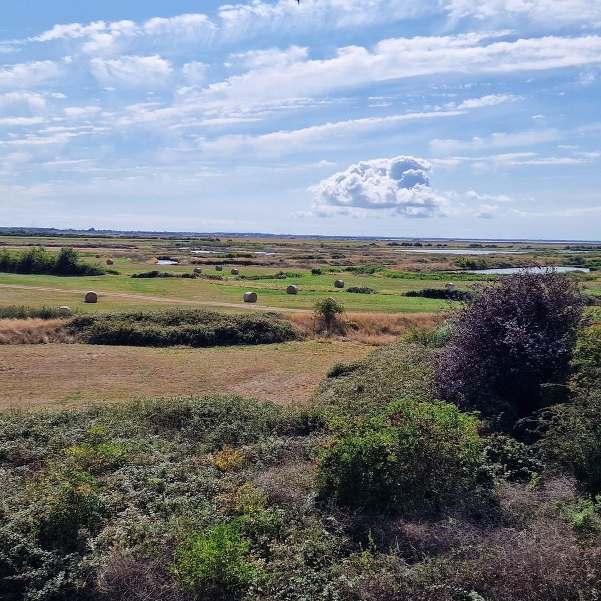
Right in the middle of the Poitou-Charente marshes, the pretty village of Brouage enhances the landscape with its 16th century fortifications.
0
0

More information can be found here: https://meinfrance.com/brouage-schoenste-doerfer-zitadelle/
0
1

The stronghold of Brouage is a former salt trading port named Jacopolis-sur-Brouage, which became a Catholic war port wanted by Cardinal Richelieu who named it Brouage in 1627 to compete with the Huguenot stronghold of La Rochelle. Brouage is also considered to be perhaps the birthplace of the geographer Samuel de Champlain who participated in the founding and colonization of New France, and who is the founder of the city of Quebec in Canada. A military port on the edge of the Atlantic Ocean until the beginning of the 18th century, the town is today inland and surrounded by marshes. Attention: inside the citadel the streets are almost exclusively paved.
2
0

Small town best known among cyclists for its river shuttle to Rochefort. The town remained for a long time an important crossing point for crossing the Charente between and the ocean, one of the only crossing points of the Charente with the Saint-Savinien ferry between Taillebourg and the ocean, until construction in 1842 of the Tonnay-Charente Suspension Bridge. The ferry was located at the current marina. The first mention of this ferry in the archives dates from 1477 but it existed well before. While the Rochefort lifting span bridge was put into service, the crossing of the Charente on the ferry stopped on February 5, 1967. The two stone slipways on either side of the river, where a road from Rochefort ended on the right bank, are still visible today at the village level and are used for launching boats. A ferry or ferry boat, the Rohan, has been back in service since June 2013 for the summer period. It has a transport capacity of 12 people including the pilot and 11 passengers on foot or by bike (2-3 Euro). At an altitude of 13 meters, on a spur overlooking the Charente which naturally lends itself to defense, there was a castle with a village enclosed by a surrounding wall like on the other bank at Rochefort. The castle is attested from 1092 with a first siege, and its destruction by a first fire. It is one of the first rocky banks encountered coming from the sea, on the left (south) bank of the Charente. On a seal dated 1383 there is this inscription in Latin: “subissia prima urbs insularum est sub borea” which can be translated as: “Soubise is the first town in the lee of the islands”. This is why in 1665, Jean-Baptiste Colbert proposed to the Duke of Rohan to sell his lordship or exchange it with the king to build a war port to arm and repair ships to protect them from attacks. English, but he refused and the project was finally carried out in Rochefort which is further from the estuary with a smaller draft. https://fr.wikipedia.org/wiki/Soubise_(Charente-Maritime)
1
1
Frequently Asked Questions
How many hiking trails are available around Saint-Jean-D'Angle?
There are over 80 hiking trails around Saint-Jean-D'Angle, offering a wide range of options for different skill levels and interests. These routes are highly rated by the komoot community, with an average score of 4.6 stars from nearly 100 reviews.
What kind of terrain can I expect on hikes in Saint-Jean-D'Angle?
The terrain around Saint-Jean-D'Angle is varied, featuring accessible paths through riverine areas, historic marshlands, and slightly hilly landscapes. You'll find routes that explore the former Gulf of Santons, as well as green spaces and forests, providing a mix of environments for your walks.
Are there any family-friendly hiking options in Saint-Jean-D'Angle?
Yes, Saint-Jean-D'Angle offers several family-friendly options. Many trails are suitable for leisurely strolls, and the grounds of the Château de Saint-Jean-d'Angle feature a unique 'barefoot trail,' medieval garden, barnyard animals, and ancient games, creating an engaging outdoor experience for all ages.
What historical landmarks can I discover while hiking in the area?
The region is rich in history. You can explore the fortified Château de Saint-Jean-d'Angle, which dates back to 1047. The area is also part of the historic Via Turonensis, one of the Ways of Saint James pilgrimage routes. Additionally, the Brouage Citadel is a notable historical site you can visit, with routes like Porte d'Hiers – Brouage Citadel loop from Hiers exploring its surroundings.
Are there any circular hiking routes near Saint-Jean-D'Angle?
Yes, many of the trails around Saint-Jean-D'Angle are circular loops, making them convenient for day trips. Examples include the Porte Royal – Spaziergang auf der Stadtmauer loop from Hiers and the Brouage and its marshes – Porte Royal loop from Brouage, which takes you through marshland environments.
What natural features are prominent on the hiking trails?
Hikers in Saint-Jean-D'Angle will encounter diverse natural features, including river and marshland environments influenced by the Boutonne river. You can explore the historic marshes of the former Gulf of Santons and enjoy green spaces, including nearby forests like the Double-Saintongeaise, offering varied scenery throughout your hike.
What is the best time of year to go hiking in Saint-Jean-D'Angle?
Saint-Jean-D'Angle offers pleasant hiking conditions for much of the year. Spring and autumn provide mild temperatures and beautiful scenery, ideal for exploring the marshlands and historical sites. Summer is also suitable, especially for shaded forest paths or early morning/late afternoon walks to avoid the midday heat.
Are there any dog-friendly hiking trails in Saint-Jean-D'Angle?
Many trails in the Saint-Jean-D'Angle area are suitable for walking with dogs, provided they are kept on a leash and you adhere to local regulations regarding pet access in natural areas and protected sites. It's always advisable to check specific trail rules before heading out.
What are some longer, more challenging hiking options in the region?
While many routes are easy to moderate, there are longer options for those seeking more challenge. For example, the Romanesque Church of St. Symphorien – The castle loop from La Couture is a moderate 12.2 km route, and the Hiking loop from Base aérienne 721 Rochefort covers 12.4 km with some elevation gain, offering a more extensive exploration of the countryside.
Where can I find parking for hiking trails in Saint-Jean-D'Angle?
Parking is generally available near trailheads and popular attractions in and around Saint-Jean-D'Angle. For specific routes, it's recommended to check the tour details on komoot, as many start points are accessible by car with designated parking areas nearby, especially in villages or near historical sites like the Château.
What do other hikers enjoy most about hiking in Saint-Jean-D'Angle?
The area is highly rated by the komoot community, with an average score of 4.6 stars. Reviewers often praise the accessible paths, the blend of natural beauty with historical sites, and the peaceful atmosphere of the marshlands and riverine routes. The variety of easy to moderate loops also makes it popular for different fitness levels.
Can I reach hiking trails in Saint-Jean-D'Angle using public transport?
While Saint-Jean-D'Angle is a rural area, some public transport options might connect to nearby towns. However, for direct access to many trailheads, especially those in more secluded natural areas, a car is generally recommended. It's best to check local bus schedules for connections to the main villages if you plan to rely on public transport.
Most popular routes around Saint-Jean-D'Angle
Most popular attractions around Saint-Jean-D'Angle

Get inspired with the komoot mobile app


Explore more
Browse the best Hikes in other regions.
