The best running trails around Barésia-Sur-L'Ain
4.1
(159)
4,205
runners
265
runs
Jogging routes around Barésia-Sur-L'Ain traverse a diverse natural landscape, characterized by numerous lakes, dense forests, and varied topography. The region, part of the "country of lakes," features prominent bodies of water like Lac de Vouglans, offering waterside running opportunities. Situated in a mid-mountain area, elevations range from 423m to 567m, providing options for both flatter paths and more challenging, hilly runs. Converted railway lines, known as "voies vertes," also offer smooth surfaces for running.
Best jogging routes around Barésia-Sur-L'Ain
- The…
Last updated: July 6, 2026
11
runners
10.4km
01:13
170m
170m
Moderate run. Good fitness required. Mostly paved surfaces. Suitable for all skill levels.
4.0
(1)
9
runners
9.85km
01:04
150m
150m
Moderate run. Good fitness required. Mostly paved surfaces. Suitable for all skill levels.

Sign up for free
19
runners
7.12km
00:47
160m
160m
Moderate run. Good fitness required. Mostly paved surfaces. Suitable for all skill levels.
13
runners
Moderate run. Good fitness required. Mostly paved surfaces. Suitable for all skill levels.
3.0
(2)
6
runners
14.4km
01:38
280m
280m
Moderate run. Good fitness required. Mostly paved surfaces. Suitable for all skill levels.
Get access to more routes and recommendations from other explorers.
Sign up for free
Already have an account?
Our route recommendations are based on thousands of hikes, rides, and runs completed by other people on komoot.
Start today with a free account
Your next adventure awaits.
Login or Signup

Tips from the Community


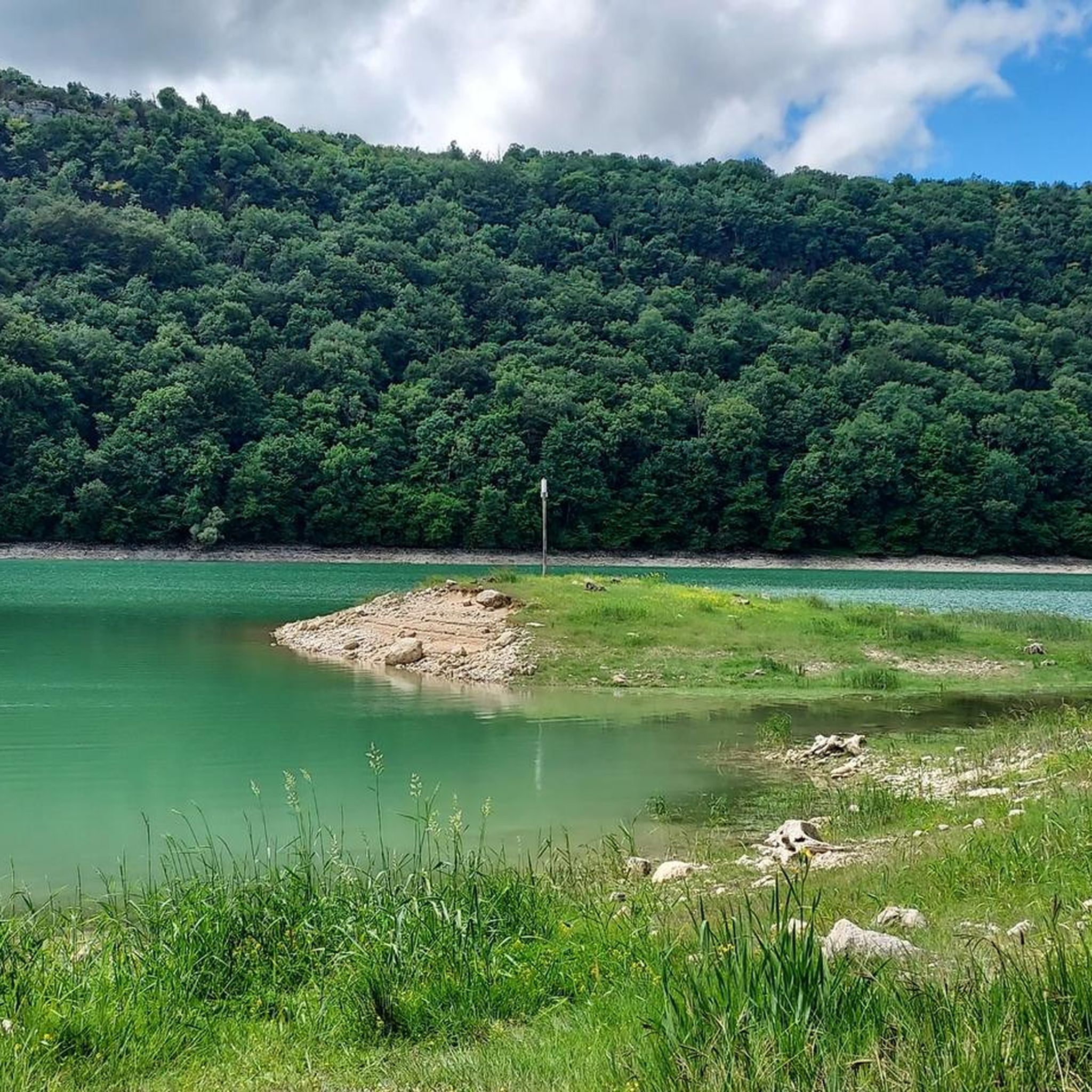
Around Lake Vouglans, the forest mixes with Jura geology marked by cliffs and rock. This gives rise to rock formations navigating in a universe that is both mineral and vegetal.
1
0
Located in a small natural setting, the Domaine de la Fraite seems cut off from time. Embedded in the middle of the slopes of Lake Vouglans, its buildings are enhanced by the perspective and the surrounding forest. For people wishing to hike over several days, the area offers accommodation, such as cabins or tents. More information is available on the website: http://www.alafraite.com/
0
0

Mossy trees, like in a fairy tale.
0
0

Along the Vouglans lake, the path between the Surchauffant campsite and Pont-de-Poitte leads you from forests to cliffs. By following it, you will collect views of the lake and the Jura massif with its immense green expanses.
0
0

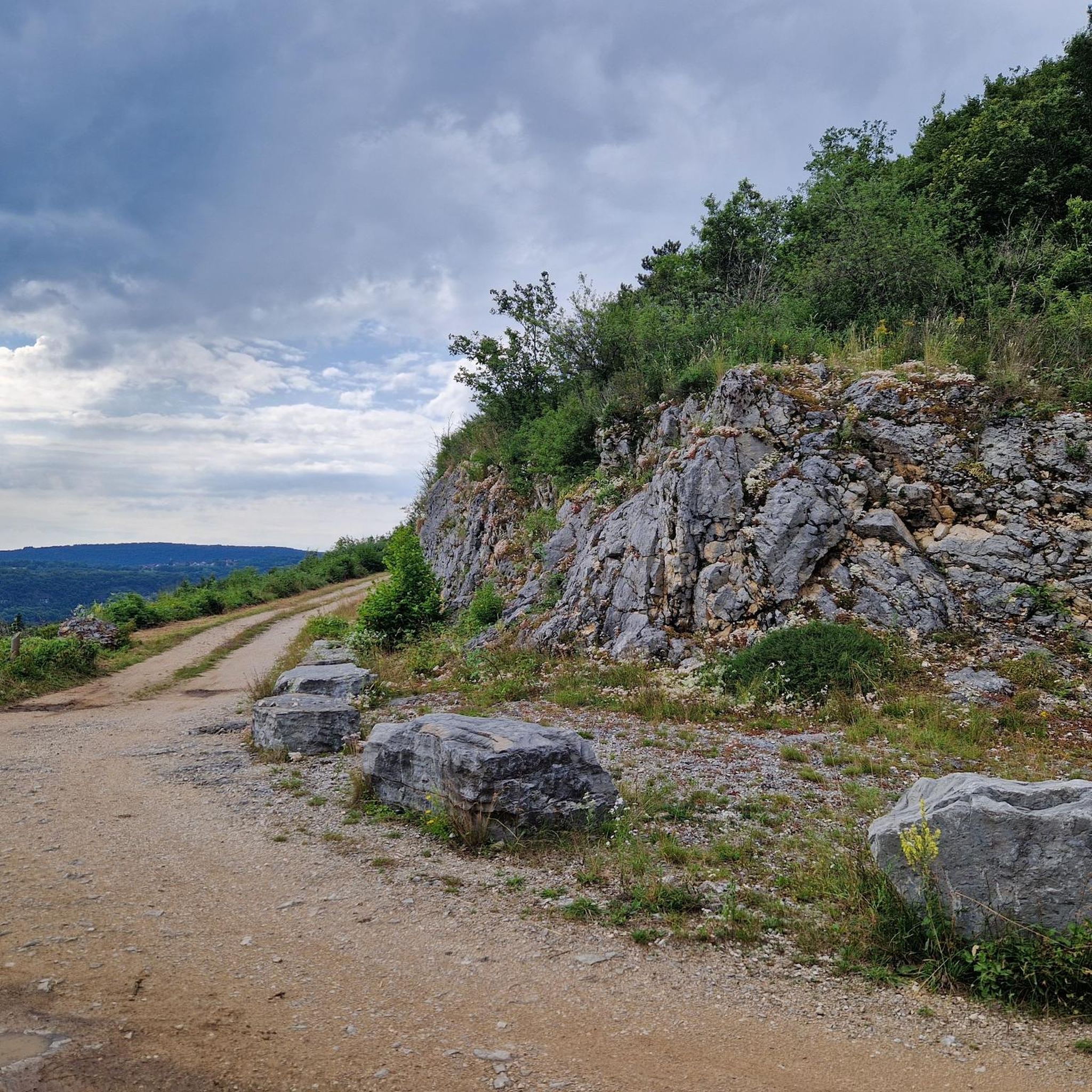
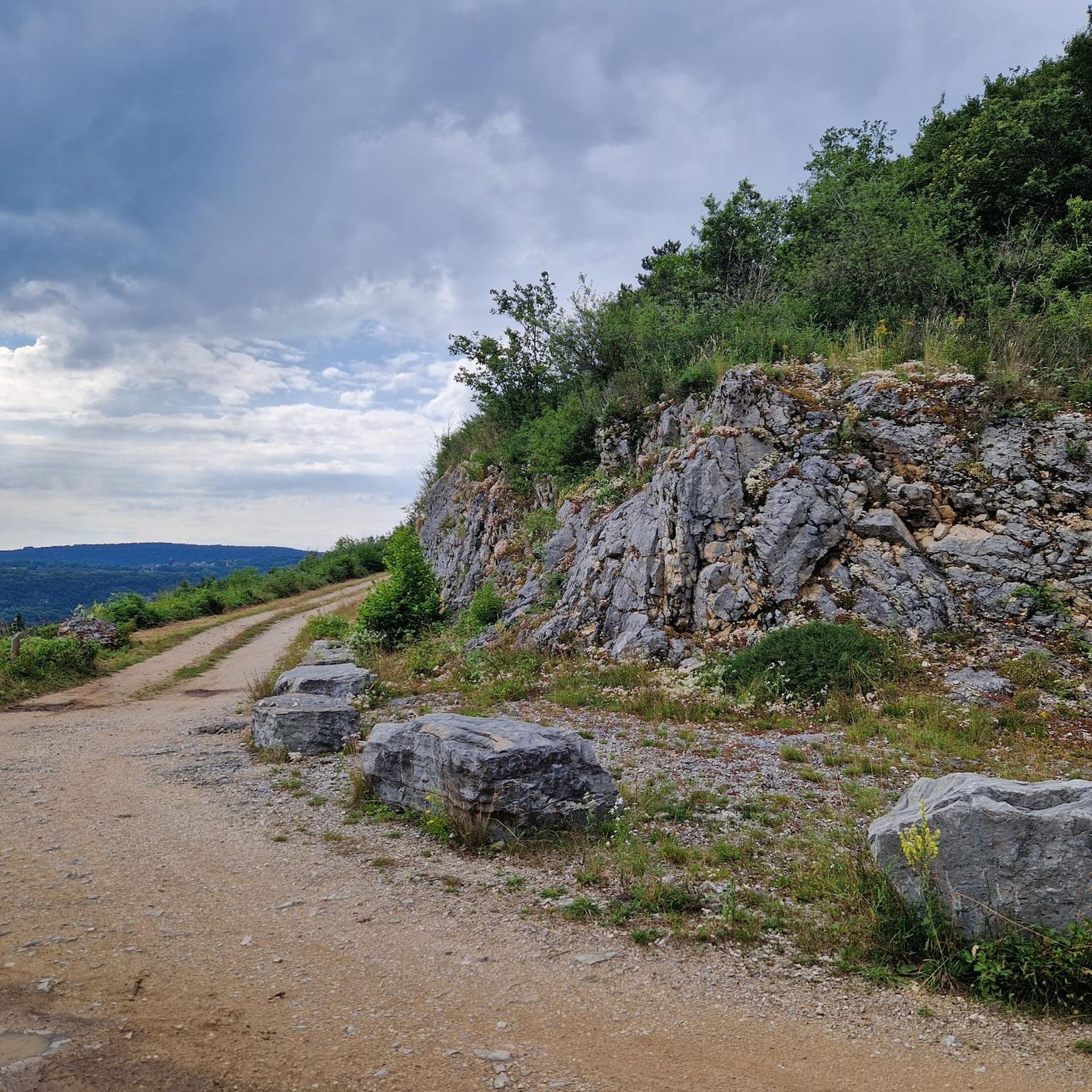
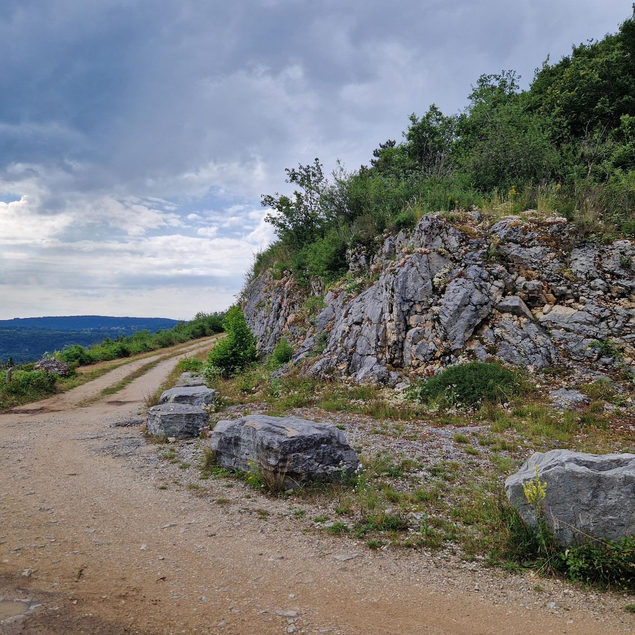
This scenic trail includes a rather large platform, as there are several along the way. It offers a panoramic view of the region, of Lake Vouglans and also of the campsite's marina.
3
0
If you manage to observe or marvel at rocks next to the strenuous incline, this is the right place for you. Water is also splashing somewhere.
0
0
Here the main path leads to La Tour du Meix. Many side roads lead out of the forest and a bright meadow with a birch grove opens up.
0
0
Frequently Asked Questions
How many running routes are available in Barésia-Sur-L'Ain?
Barésia-Sur-L'Ain offers a wide selection of over 250 running routes, catering to various preferences and fitness levels. These trails traverse the region's diverse natural landscape, including lakeshores, forests, and varied mid-mountain terrain.
Are there easy running paths suitable for beginners or families?
Yes, Barésia-Sur-L'Ain has over 20 easy running routes perfect for beginners or families looking for a gentle jog. Many paths along the lakes, such as Lac de Vouglans, offer relatively flat and well-marked surfaces. The converted railway line, known as the Voie Verte PLM cycle path, also provides a smooth and enjoyable experience.
Can I find routes with scenic viewpoints in the area?
Absolutely! The region is dotted with stunning viewpoints that can be incorporated into your runs. For example, the La Fratte Viewpoint offers secure views of turquoise waters and expansive forests. Other notable spots include Belvédère du Regardoir and Belvédère de la Roche aux Corneilles, both providing beautiful panoramas of Lac de Vouglans.
Are there any running trails that pass by waterfalls?
Yes, the Jura region is known for its impressive waterfalls. While specific routes in this guide might not directly feature them, the wider area boasts natural wonders like the Hérisson waterfalls and the Quinquenouille Waterfall. You can often find trails nearby that offer refreshing views and sounds of cascading water.
What kind of terrain can I expect on the jogging routes around Barésia-Sur-L'Ain?
You can expect a varied terrain in Barésia-Sur-L'Ain. As a mid-mountain region, altitudes range from 423m to 567m, offering both flatter paths, especially along the lakes and greenways, and more challenging, hilly runs through dense forests. Many trails are well-maintained, but some may involve natural forest paths.
Are there any circular running routes available?
Yes, many of the running routes in Barésia-Sur-L'Ain are circular, allowing you to start and finish at the same point. An example is the View of the castle ruins loop from Thoiria, which is a moderate 6.4-mile (10.4 km) trail offering historical views.
Can I bring my dog on the running trails?
Generally, dogs are welcome on many trails in the Barésia-Sur-L'Ain region, especially in natural forest areas. However, it's always advisable to keep them on a leash, particularly in protected areas or near livestock, and to check local regulations for specific routes or nature reserves.
Is there public transport access to any of the running routes?
While Barésia-Sur-L'Ain is primarily accessed by car, some larger towns in the Jura department may offer public transport connections. For specific trailheads, public transport options might be limited, making personal vehicle access or carpooling the most convenient way to reach many starting points.
Where can I park my car when accessing the trails?
Parking is generally available at popular trailheads, especially near lakes like Lac de Vouglans or at designated starting points for well-known routes. For instance, areas around La Mercantine Beach often have amenities and parking, making them convenient starting points for runs.
What is the best time of year to go running in Barésia-Sur-L'Ain?
The spring and autumn months are ideal for running in Barésia-Sur-L'Ain, offering pleasant temperatures and beautiful scenery. Summer can also be great, especially for shaded forest trails or early morning/late evening runs to avoid the midday heat. Winter running is possible, but some trails might be icy or snowy, requiring appropriate gear.
Are there any unique or historical features I might encounter on a run?
Yes, the region offers several interesting features. You can run along parts of the Voie Verte PLM cycle path, a converted old railway line that includes illuminated tunnels. The Col de la Joux, a mountain pass, offers a charming ascent and was even part of the Tour de France. Additionally, routes like the Cave – View of the castle ruins loop from Thoiria can lead you past historical sites.
What do other runners say about the trails in Barésia-Sur-L'Ain?
The running routes in Barésia-Sur-L'Ain are highly rated by the komoot community, with an average score of 4.1 stars from over 140 reviews. Reviewers often praise the diverse landscapes, from quiet woodlands to scenic lake views, and appreciate the variety of terrain suitable for different fitness levels. Over 3,700 runners have used komoot to explore the area.
Are there any longer, more challenging routes for experienced runners?
Certainly! While many routes are moderate, the mid-mountain topography means you can find trails with significant elevation gain for a more challenging run. The Nice path in the forest – View of the Pont de la Pyle loop from Largillay-Marsonnay, for example, is a 7.5-mile (12.0 km) trail with over 230 meters of elevation gain, offering a good workout through forest paths and views of Pont de la Pyle.
Most popular routes around Barésia-Sur-L'Ain
Most popular attractions around Barésia-Sur-L'Ain

Get inspired with the komoot mobile app


Explore more
Browse the best Running Trails & Routes in other regions.
