The best walks and hikes around Hauterive
4.6
(69)
554
hikers
98
hikes
Hiking around Hauterive offers a variety of trails through diverse natural settings. The region features a mix of woodlands and open landscapes, providing opportunities for both leisurely strolls and more extended walks. Trails often traverse rolling terrain, with some routes offering views over the surrounding countryside. The area's natural environment supports a range of outdoor activities focused on exploration and enjoyment of the local scenery.
Best hiking trails around Hauterive
- The most popular hiking route is Perseigne Viewpoint loop from…
Last updated: July 5, 2026
4.0
(2)
14
hikers
6.67km
01:53
140m
140m
Easy hike. Great for any fitness level. Easily-accessible paths. Suitable for all skill levels.
4.0
(2)
8
hikers
10.8km
02:50
90m
90m
Moderate hike. Good fitness required. Easily-accessible paths. Suitable for all skill levels.

Sign up for free
2
hikers
5.03km
01:20
50m
50m
Easy hike. Great for any fitness level. Easily-accessible paths. Suitable for all skill levels.
5.0
(1)
7
hikers
4.19km
01:05
20m
20m
Easy hike. Great for any fitness level. Easily-accessible paths. Suitable for all skill levels.
5.0
(1)
3
hikers
6.79km
01:45
40m
40m
Easy hike. Great for any fitness level. Easily-accessible paths. Suitable for all skill levels.
Get access to more routes and recommendations from other explorers.
Sign up for free
Already have an account?
Our route recommendations are based on thousands of hikes, rides, and runs completed by other people on komoot.
Start today with a free account
Your next adventure awaits.
Login or Signup



Tips from the Community

Beautiful climb north of Sarthe
0
0

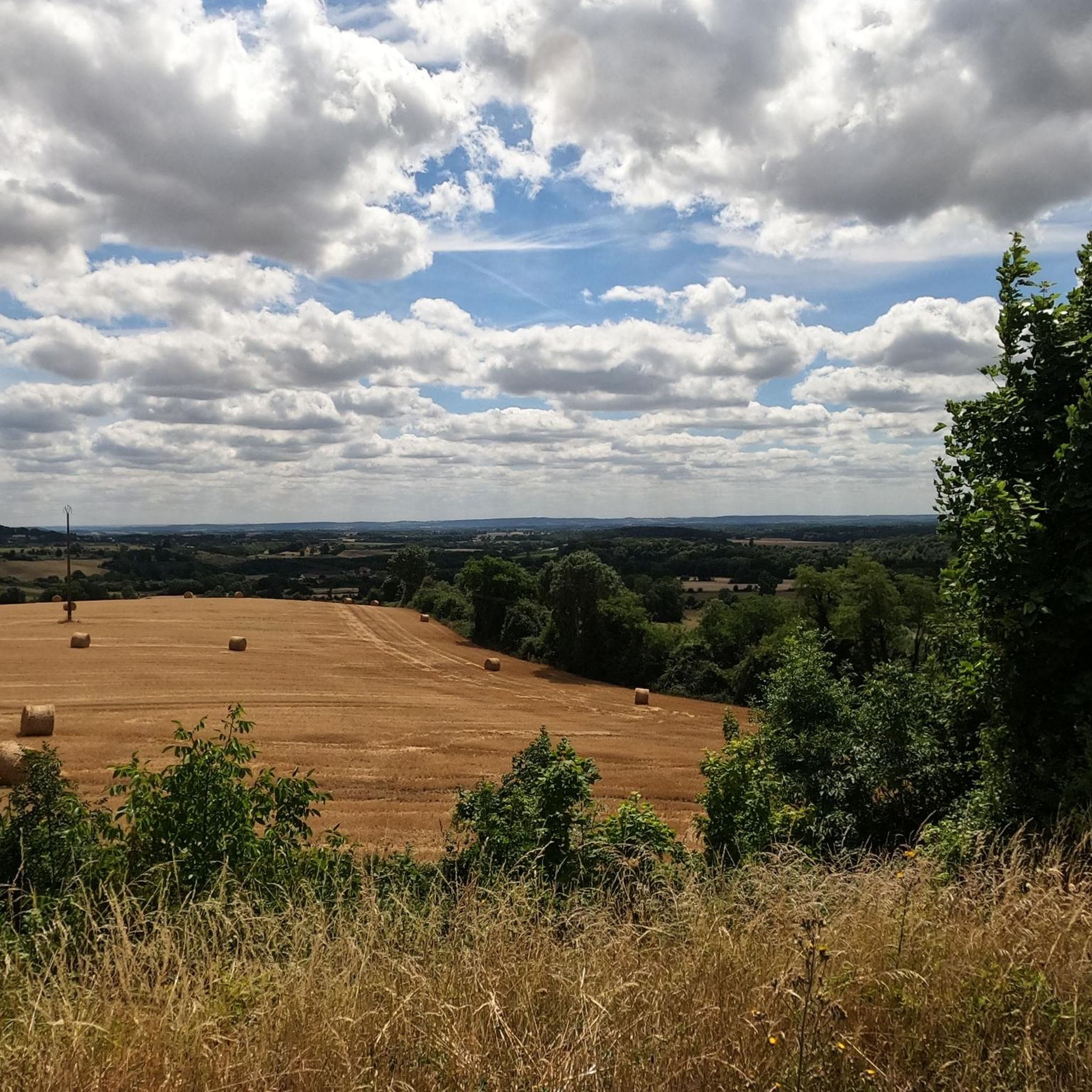
A must-have that is earned by the strength of the calves. But the climb is in a beautiful wooded environment with the gentle field of birds.
0
0

This 30 meter high tower allows you to admire the canopy of the 5,000 hectare forest in which it is located. The plain of Alençon is also visible there. On the site, it is possible to play molki and badminton or to rent bicycles thanks to the equipment provided. The belvedere opening dates and times are available on the following website: https://www.sarthetourisme.com/patrimoine-culturel/belvedere-de-perseigne/
0
0

Located in the heart of the Perseigne forest, at a height of 30 meters, the Belvedere is built on the highest point of the Sarthe department, at 340 m. It is certainly not an architectural model, but the large surrounding trees hide this large concrete tube, repainted and decorated in order to better integrate. Thus, you have to go a few meters into the forest from the road to see it. It should be noted that this high point and its panoramic view had already been spotted by the occupying troops: in 1943, the German army had set up a listening post there, and an observatory against Allied aviation. Nothing remains today. The new tower dates from 1964.
0
0

The Belvédère de Perseigne is located at the top of the Perseigne forest. From the top of its 340 meters, this belvedere represents the highest point of the Sarthe! It therefore undoubtedly offers a magnificent view of the Sartois as well as the Oregon landscape.
1
0
Frequently Asked Questions
What types of landscapes can I expect to see while hiking in Hauterive?
Hauterive offers a diverse mix of natural settings. Depending on whether you're in Switzerland or France, you can find trails along the Saane River with impressive sandstone cliffs, through rolling beech forests and meadows, or along the shores of Lake Neuchâtel with views of the Jura mountains. In the French Hauterives, you'll encounter the Galaure valley and distant Vercors mountains.
Are there any easy, family-friendly hiking options in Hauterive?
Yes, Hauterive has several easy paths suitable for families. For instance, the Bois de Montperroux loop from La Demi Lune is an easy 3.1-mile trail through woodlands. In Swiss Hauterive, easy, family-friendly walks are also available around the Laténium, Switzerland's largest archaeological museum.
What are some notable points of interest or attractions I can visit near the hiking trails?
Around Hauterive, you can explore various attractions. The Castle of the Dukes of Alençon offers a historical visit, while the Perseigne Viewpoint provides scenic vistas. In Swiss Hauterive, the historic Hauterive Cistercian Abbey is surrounded by scenic trails, and in French Hauterives, the extraordinary Palais Idéal du Facteur Cheval is a unique cultural landmark.
Are there any circular hiking routes in the Hauterive area?
Yes, many of the trails in Hauterive are designed as loops. For example, the Perseigne Viewpoint loop from La Fresnaye-sur-Chédouet is a popular easy route. Another option is the Étang de Bois Roger loop from Bursard, which offers varied terrain around a lake and through woodlands.
What is the general difficulty level of hiking trails in Hauterive?
Hauterive offers a range of difficulties. The majority of routes are either easy (39 trails) or moderate (41 trails), making them accessible for various fitness levels. There are also a few more challenging routes for experienced hikers.
What do other hikers say about the trails in Hauterive?
The hiking routes in Hauterive are highly rated by the komoot community, with an average score of 4.4 stars from over 50 reviews. Hikers often praise the diverse terrain, from quiet woodlands to open fields, and the well-maintained paths suitable for different ability levels.
Can I find trails that feature water bodies like lakes or rivers?
Absolutely. In Swiss Hauterive, trails often follow the Saane River, offering views of its impressive sandstone cliffs, or lead along the picturesque shores of Lake Neuchâtel. The Zihl Canal also provides comfortable hiking paths connecting Lake Neuchâtel with Lake Biel. In the French Hauterives, you can find loops around the étangs du Bancel.
Are there any trails that offer panoramic views?
Yes, for panoramic views, consider trails in Swiss Hauterive that ascend to higher paths, offering vistas over Neuchâtel and the Jura mountains. The Perseigne Viewpoint is a specific highlight known for its scenic outlooks.
What kind of terrain should I expect on Hauterive's hiking trails?
The terrain in Hauterive is varied, typically featuring woodlands, open fields, and gentle hills. Some trails may include sections along riverbanks or lake shores. The region's natural environment supports a range of outdoor activities focused on exploration and enjoyment of the local scenery.
Are there any historical or cultural trails in Hauterive?
Yes, in Swiss Hauterive, 'The Quarry Trail' delves into the history of the region's limestone extraction, providing a unique historical context. Additionally, trails around the Hauterive Cistercian Abbey offer a blend of nature and history. In French Hauterives, trails like the 'Palais Idéal simply brilliant – Wood artwork loop' combine natural exploration with cultural interest around the unique Palais Idéal du Facteur Cheval.
What is the typical length and duration of hikes in Hauterive?
Hikes in Hauterive vary in length and duration. You can find shorter, easy walks like the Hiking loop from Le Ménil-Broût, which is about 1.5 miles (2.4 km) and takes less than an hour. Longer, moderate trails, such as the Étang de Bois Roger loop from Bursard, can be around 8.3 miles (13.4 km) and take several hours to complete.
Is Hauterive suitable for dog-friendly hiking?
While specific dog-friendly trail designations are not provided, the natural and varied terrain of Hauterive, with its woodlands and open spaces, generally offers good opportunities for hiking with dogs. It's always recommended to keep dogs on a leash and follow local regulations regarding pets on trails.
Most popular routes around Hauterive
Most popular attractions around Hauterive

Get inspired with the komoot mobile app


Explore more
Browse the best Hikes in other regions.
