The best MTB trails around Curtil-Sous-Buffières
4.7
(15)
60
riders
22
rides
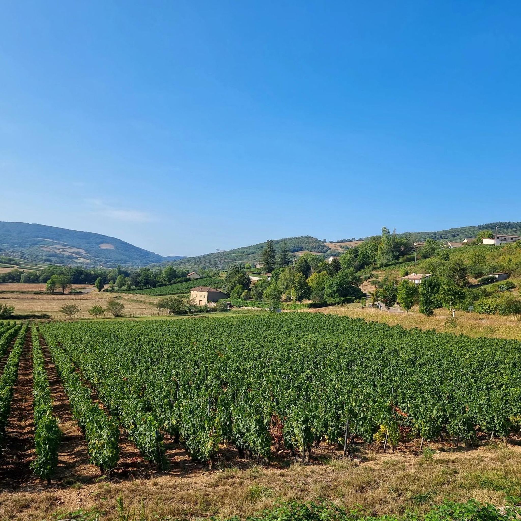
Mountain biking around Curtil-Sous-Buffières offers access to varied terrain in Southern Burgundy, France. The region features rolling hills, scenic valleys, and extensive greenways, including sections suitable for mountain bikes. Riders can explore wooded landscapes and areas characterized by vineyards and limestone formations. The network of routes provides options for different skill levels, from gentle paths to more challenging ascents.
Best mountain bike trails around Curtil-Sous-Buffières
- The most popular mountain bike trail is Vergezicht loop from Sivignon, an 18.1 miles…
Last updated: June 27, 2026
4.0
(1)
8
riders
32.0km
02:59
710m
710m
Moderate mountain bike ride. Good fitness required. Suitable for all skill levels.
5.0
(2)
3
riders
28.4km
02:24
510m
510m
Moderate mountain bike ride. Good fitness required. Suitable for all skill levels.

Sign up for free
2
riders
25.6km
02:30
720m
720m
Moderate mountain bike ride. Good fitness required. Suitable for all skill levels.
5.0
(2)
4
riders
40.2km
03:48
990m
990m
Hard mountain bike ride. Very good fitness required. Suitable for all skill levels.
5.0
(1)
6
riders
38.9km
03:06
700m
700m
Moderate mountain bike ride. Good fitness required. Suitable for all skill levels.
Get access to more routes and recommendations from other explorers.
Sign up for free
Already have an account?
Our route recommendations are based on thousands of hikes, rides, and runs completed by other people on komoot.
Start today with a free account
Your next adventure awaits.
Login or Signup


Tips from the Community

The Tour des Fromages is a preserved defensive tower from the 11th century, which originally belonged to the ramparts of the powerful Abbey of Cluny. In the Middle Ages, the structure was still called Tour des Fèves (Bean Tower), as supplies were stored there. It got its current, curious name in the 19th century because a merchant used the tower to dry her homemade cheeses. Today, the tower is a popular attraction. Visitors can climb the 120 steps to the top. From up there, you have a beautiful 360-degree panoramic view over the entire medieval monastic city and the surrounding Burgundy landscape. Access to the tower is directly through the local Cluny tourist office.
1
0
Mont Saint-Cyr is located in southern Burgundy (Département Saône-et-Loire) in the municipality of Montmelard and, at 771 meters, is the highest point in the Mâconnais mountains. From the summit, there is a wide panoramic view of the surrounding landscapes of Charolais, Brionnais, and Clunisois. In very clear weather, the view to the east even extends to Mont Blanc in the Alps. On the mountain are the historical remains of a 10th-century monastery that was destroyed during the Huguenot Wars. There is a picnic area in the forest, as well as orientation panels that are helpful in identifying the surrounding peaks and valleys.
0
0
Mont Saint-Cyr is located in southern Burgundy (Saône-et-Loire department) in the municipality of Montmelard and, at 771 meters, is the highest point of the Mâconnais mountains. From the summit, there is a wide panoramic view of the surrounding landscapes of Charolais, Brionnais, and Clunisois. In very clear weather, the view extends eastwards to Mont Blanc in the Alps. On the mountain are the historical remains of a 10th-century monastery, which was destroyed during the Huguenot Wars. There is a picnic area in the forest as well as orientation panels that are helpful in identifying the surrounding peaks and valleys.
0
0
In the Middle Ages, the abbey was one of the most influential spiritual and cultural centers in Europe. Cluny was the mother house of the Cluniac Reform and headed a federation of over 1,200 monasteries. The third abbey church (Cluny was the largest church in the Christian world until the construction of St. Peter's Basilica in Rome). Of the once-mighty complex, only parts of the southern transept remain today, as the abbey was largely used as a quarry and demolished after the French Revolution.
1
0

The town of Cluny developed around the Benedictine monastery (Abbey of Cluny) founded in 910. The abbey was the origin and center of the Cluniac reform at the beginning of the 10th century. Cluny reached its peak membership at the beginning of the 12th century with about 400 monks. The last abbey church (Cluny 3) was the world's largest Romanesque basilica and, until the construction of the present-day St. Peter's Basilica in Rome, the largest church in Christendom. The church had seven towers. Although large parts of the structure were destroyed, the remaining relics are absolutely remarkable and make a visit to Cluny an unforgettable experience!
2
0

The town of Cluny was based on the Benedictine monastery (Cluniac Abbey), founded in 910. The abbey was the starting point and center of the Cluniac reform at the beginning of the 10th century. Cluny reached its peak membership at the beginning of the 12th century with approximately 400 monks. The last abbey church (Cluniac 3) was the world's largest Romanesque basilica and, until the construction of today's St. Peter's Basilica in Rome, the largest church in Christendom. The church had seven towers. Although large parts of the building were destroyed, the remaining relics are absolutely remarkable and make a visit to Cluny an unforgettable experience!
2
0

I wanted to go there at the beginning of October but it was too muddy for my gyroroue. I'll try again in summer
0
0

Founded in 910, Cluny Abbey was a powerful centre of the Benedictine order and influenced the spiritual and cultural life of all of Europe at its height. Today, although much of the abbey was destroyed during the French Revolution, you can still explore the remaining parts of the vast complex, including the majestic bell tower and restored cloister.
2
0
Frequently Asked Questions
What kind of terrain can I expect on mountain bike trails around Curtil-Sous-Buffières?
The region offers a diverse landscape for mountain biking, characterized by rolling hills, green valleys, and wooded areas. You'll find paths that meander through vine-covered slopes and sections of repurposed railway lines, like the Voie Verte de Bourgogne du Sud. Some parts, especially towards Mâcon, can feature more challenging, steeper stretches and limestone formations, suitable for experienced riders.
How difficult are the mountain bike trails in this area?
Mountain bike trails around Curtil-Sous-Buffières cater to various skill levels. Out of 23 available tours, 2 are considered easy, 16 are moderate, and 5 are difficult. This means you can find everything from gentle paths suitable for a relaxed ride to more challenging ascents and descents. For example, the Mount St. Cyr – Mount Saint-Cyr loop from Verosvres is rated as difficult, offering a significant challenge.
Are there any family-friendly mountain bike trails near Curtil-Sous-Buffières?
While specific 'family-friendly' designations aren't always explicit, the presence of easy-rated trails and sections of the Voie Verte (Greenway) suggests options for families. The greenways, being repurposed railway lines, often provide flatter, safer paths away from traffic. Look for the 2 easy-rated tours available in the area for suitable options.
What are the typical lengths and durations of mountain bike routes here?
The mountain bike routes around Curtil-Sous-Buffières vary in length and duration. For instance, the Vergezicht loop from Sivignon is about 29 km (18 miles) and takes approximately 2 hours 30 minutes. Longer routes like La chapelle de Collonges – Cormatin Castle loop from Jalogny can be up to 76 km (47 miles) and take over 5 hours to complete, offering options for both shorter excursions and full-day adventures.
What notable landmarks or attractions can I see along the mountain bike trails?
The region is rich in both natural and historical attractions. A unique feature is the Tunnel du Bois Clair, Europe's longest cycling tunnel, which is part of the Voie Verte. You can also explore the historic town of Cluny, home to the impressive Cluny Abbey. Other natural points of interest include Suin Hill, offering scenic views.
When is the best time of year to go mountain biking in Curtil-Sous-Buffières?
The best time for mountain biking is generally from spring through autumn. It's important to note that the Tunnel du Bois Clair, a significant feature of the greenway, closes during winter months (mid-October to late March) to protect a bat colony. An alternative route is available when the tunnel is closed, but for the full experience and most pleasant weather, plan your trip outside of winter.
Are dogs allowed on the mountain bike trails?
While there isn't specific data on dog restrictions for every trail, many outdoor areas in France, especially on public paths like greenways, are generally dog-friendly, provided dogs are kept on a leash. It's always recommended to check local signage or specific route details for any restrictions before heading out with your dog.
What do other mountain bikers enjoy most about mountain biking in Curtil-Sous-Buffières?
The area is highly rated by the komoot community, with an average score of 4.4 stars from over 5 reviews. More than 50 mountain bikers have used komoot to explore the varied terrain. Riders often praise the diverse landscape, which includes rolling hills, green valleys, and wooded areas, offering a good mix of challenge and scenic beauty.
Are there any loop trails available for mountain biking?
Yes, many of the mountain bike routes around Curtil-Sous-Buffières are designed as loops, allowing you to start and end at the same point. Examples include the Cluny – Notre-Dame Church loop from Château and the Montagne Saint-Cyr – Mount St. Cyr loop from Dompierre-les-Ormes, providing convenient options for exploration.
Can I find places to eat or drink along the mountain bike routes?
The region offers opportunities for refreshments, especially in towns and villages along the routes. The historic town of Cluny, a significant attraction in the area, is likely to have cafes, restaurants, and other amenities where you can refuel during your ride. Many routes pass through or near such settlements.
Is public transport an option for accessing mountain bike trails in Curtil-Sous-Buffières?
While the region is well-known for its cycling infrastructure, particularly the Voie Verte, specific public transport options for accessing mountain bike trails with bikes directly from Curtil-Sous-Buffières are not extensively detailed. It's advisable to research local bus or train services in the broader Southern Burgundy area, as some might accommodate bikes, especially for reaching larger towns like Cluny or Mâcon, from where you can connect to the cycling network.
Where can I find parking for mountain biking in the area?
Parking availability will vary depending on your chosen starting point. For routes that begin in or near villages and towns, such as those around Cluny or Dompierre-les-Ormes, you can typically find public parking. When planning your route, check the specific starting location for designated parking areas or suitable roadside parking options.
Most popular routes around Curtil-Sous-Buffières
Most popular attractions around Curtil-Sous-Buffières

Get inspired with the komoot mobile app


Explore more
Browse the best MTB trails in other regions.
