The best road cycling routes around Saint-Ambreuil
4.5
(186)
5,281
riders
251
rides
Road cycling around Saint-Ambreuil, located in France's Bourgogne-Franche-Comté region, offers diverse terrain suitable for various fitness levels. The area features gentle undulations with elevations ranging from 175 to 217 meters, alongside extensive vineyards, rivers like the Grosne, and canals. The broader Burgundy region provides well-developed cycling infrastructure, including dedicated cycle paths and routes through forests and along waterways.
Best road cycling routes around Saint-Ambreuil
- The most popular road cycling route is Pistole Pass – View of Royer loop from Varennes-le-Grand…
Last updated: July 10, 2026
29
riders
77.2km
03:48
1,090m
1,090m
Hard road ride. Very good fitness required. Mostly well-paved surfaces and easy to ride.
5.0
(1)
21
riders
54.7km
02:18
420m
420m
Moderate road ride. Good fitness required. Mostly well-paved surfaces and easy to ride.

Sign up for free
4.5
(6)
15
riders
63.2km
02:36
240m
240m
Moderate road ride. Good fitness required. Some segments of this route may be unpaved and difficult to ride.
8
riders
64.8km
02:58
590m
590m
Moderate road ride. Good fitness required. Mostly well-paved surfaces and easy to ride.
9
riders
25.5km
01:03
100m
100m
Easy road ride. Great for any fitness level. Mostly well-paved surfaces and easy to ride.
Get access to more routes and recommendations from other explorers.
Sign up for free
Already have an account?
Our route recommendations are based on thousands of hikes, rides, and runs completed by other people on komoot.
Start today with a free account
Your next adventure awaits.
Login or Signup
Tips from the Community

The Abbey of La Ferté (also known as the Abbey Palace of La Ferté) is the very first daughter foundation of the famous Cistercian Order from the year 1113. It is located in the idyllic South Burgundy, in the municipality of Saint-Ambreuil. The original medieval abbey was heavily destroyed during the Wars of Religion. The present magnificent building was constructed at the end of the 17th century as a stately abbey palace for the abbot. After the French Revolution, the abbey church was demolished and the building was converted into a private residential castle. A long, elegant stone building is visible, flanked by two large pavilions.
0
0
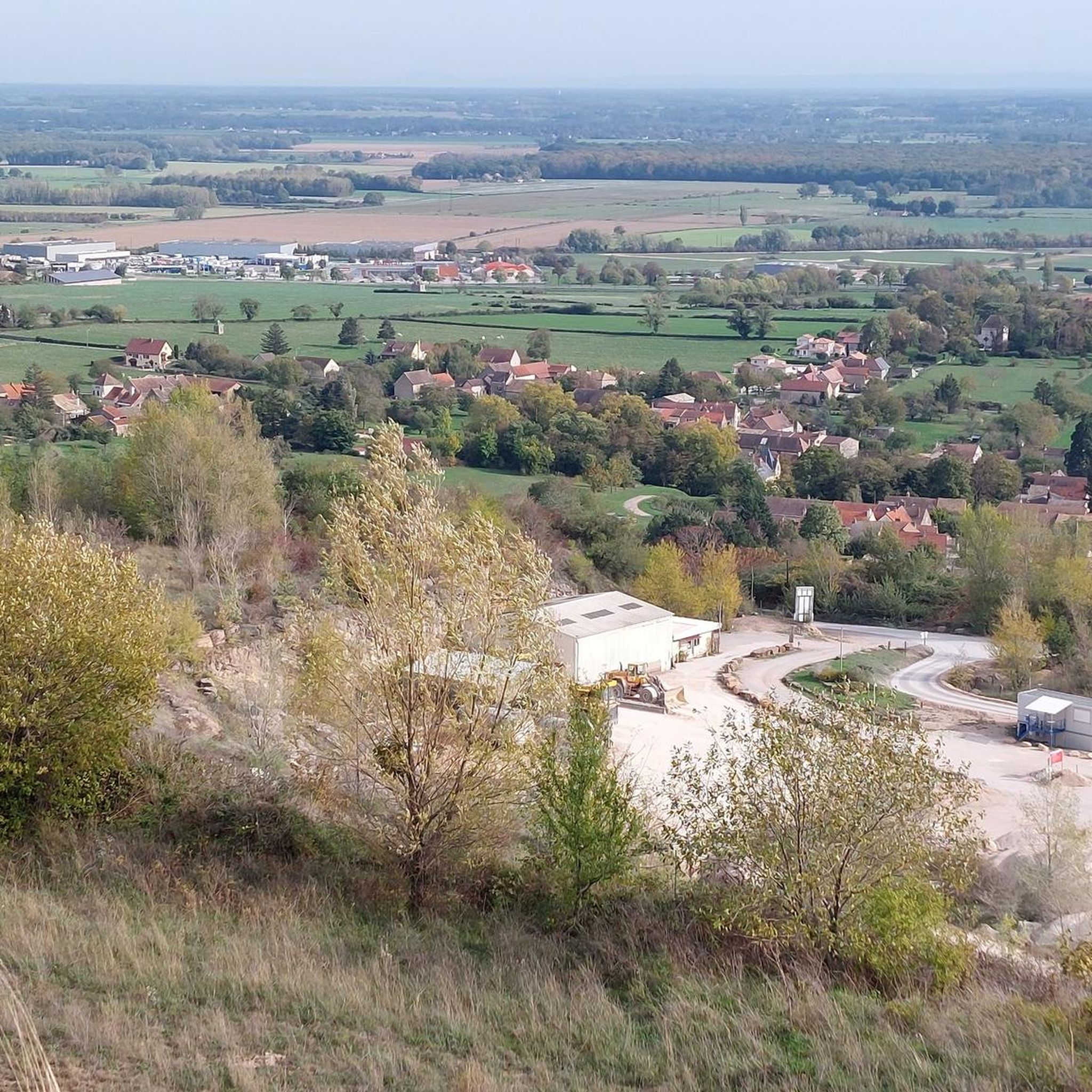
The classic ascent from Mancey is considered a tough short climb in Category 3. Over a distance of 2.2 kilometers, 166 meters of altitude must be overcome. The average gradient is 7.55%, with peak sections of up to 14%. The path junction leads to various hiking trails and gravel paths through the wooded and wine-rich hilly landscape of the Mâconnais.
0
0
The pass is located on Rue des Maquisards in the municipality of Nanton. It is a popular destination for cycling tours. The ascent from the municipality of Mancey covers a distance of 2.2 kilometers. Cyclists overcome 166 meters of altitude on this tough route with an average gradient of 7.55%. The surrounding area also offers a versatile network of trails for easy to medium-difficulty hikes through rolling hills, mixed forests, and to nearby viewpoints such as Roche d'Aujou.
0
0
The striking Romanesque structure dates from the 12th century. The church towers protectively over the valley and houses valuable wall paintings from the late 13th century.
0
0


Romanesque church from the 12th century
0
0
Free admission, it is written.
0
0

The beautiful bridge is also one of the landmarks of Chalon sur Saone
0
0
Frequently Asked Questions
How many road cycling routes are available around Saint-Ambreuil?
There are over 250 road cycling routes around Saint-Ambreuil, catering to various skill levels. This includes 58 easy routes, 171 moderate routes, and 25 difficult routes, ensuring options for every cyclist.
Are there any easy road cycling routes suitable for beginners or families?
Yes, Saint-Ambreuil offers 58 easy road cycling routes. The region's flat canal towpaths, such as sections of the 'Voie Bleue cycle route' mentioned in the broader Burgundy context, are particularly well-suited for leisurely rides and families. Routes that follow old train tracks, converted into public cycling trails, also provide accessible and gentle options.
What kind of challenging road cycling routes can I find near Saint-Ambreuil?
For those seeking a challenge, there are 25 difficult road cycling routes around Saint-Ambreuil. These routes often feature significant elevation gain through the region's hills and wooded areas. An example is the Pistole Pass – View of Royer loop from Varennes-le-Grand, which covers 76.9 km with over 1000 meters of ascent.
What are the typical distances and durations for road cycling routes in this area?
Road cycling routes around Saint-Ambreuil vary significantly in length and duration. You can find shorter, easy rides like the Lalheue – La Ferté Castle loop from Beaumont-sur-Grosne at 25.5 km, taking just over an hour. Longer, more challenging routes, such as the Pontus de Tyard Castle – Saint-Gengoux-le-National loop from Varennes-le-Grand, can extend to over 91 km and take more than four hours to complete.
What natural features and landscapes will I encounter on road cycling routes?
Road cycling routes around Saint-Ambreuil showcase diverse landscapes. You'll frequently pass through picturesque vineyards, along the Grosne river, and beside canals. The terrain includes gentle undulations, with some routes venturing into hills and wooded areas like the forest of La Ferté, offering varied and scenic backdrops.
Are there any notable attractions or landmarks to see along the routes?
Yes, many routes offer opportunities to see historical and cultural landmarks. You might cycle near the historic Sercy Castle or the significant Chalon-sur-Saône, which features a cathedral and the Nicéphore Niépce Museum. The Chalon-sur-Saône – Chalon-sur-Saône loop from Lalheue is an example of a route that passes near this town.
What do other road cyclists say about the routes in Saint-Ambreuil?
The road cycling routes in Saint-Ambreuil are highly regarded by the komoot community, holding an average rating of 4.3 stars from over 150 reviews. Cyclists often praise the varied terrain, from scenic vineyards to peaceful canal paths, and the well-maintained surfaces suitable for road bikes.
Are there circular road cycling routes available?
Yes, many of the road cycling routes around Saint-Ambreuil are designed as loops, allowing you to start and finish at the same point. Examples include the View of Royer loop from Varennes-le-Grand and the Chalon-sur-Saône – Chalon-sur-Saône loop from Lalheue, which are popular choices among local cyclists.
What is the best time of year for road cycling in Saint-Ambreuil?
The best time for road cycling in Saint-Ambreuil is typically from spring through early autumn (April to October). During these months, the weather is generally mild and pleasant, ideal for enjoying the vineyards, canals, and countryside. The autumn also offers beautiful foliage, particularly in wooded areas.
Can I find places to eat or rest along the road cycling routes?
While specific cafes are not detailed for every route, the region is dotted with small villages and towns. Chalon-sur-Saône, just 10 km from Saint-Ambreuil, offers a pedestrianized center with numerous options. Local markets in nearby towns like Sennecey-le-Grand and Saint-Germain-du-Plain also provide opportunities for refreshments and experiencing local cuisine.
Are there any routes that offer particularly good viewpoints?
Many routes in the Saint-Ambreuil area offer scenic views, especially those traversing the vineyard landscapes and along the rivers and canals. While specific named viewpoints are not always marked, the gentle undulations and open countryside often provide expansive vistas of the Bourgogne-Franche-Comté region's characteristic beauty.
How accessible are the road cycling routes by public transport?
The broader Burgundy region is known for its cycling infrastructure, and while specific public transport links directly to trailheads in Saint-Ambreuil are not detailed, major towns like Chalon-sur-Saône are well-connected. Cyclists often travel to these hubs and then begin their rides, utilizing the extensive network of cycle paths and itineraries.
Most popular routes around Saint-Ambreuil
Most popular attractions around Saint-Ambreuil

Get inspired with the komoot mobile app


Explore more
Browse the best Road cycling routes in other regions.
