The best walks and hikes around Saint-Pierre-Le-Vieux
4.5
(310)
1,388
hikers
132
hikes
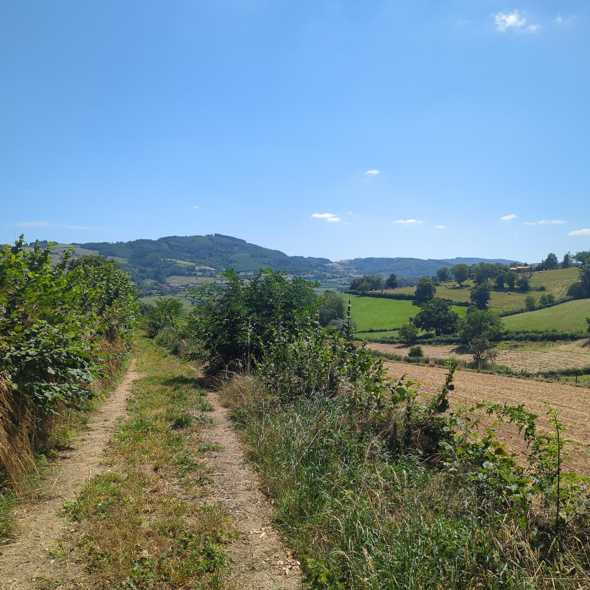
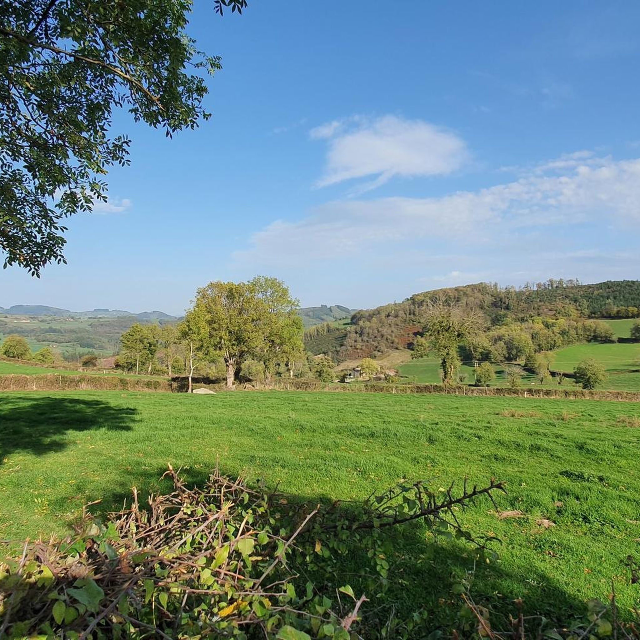
Hiking around Saint-Pierre-Le-Vieux offers diverse opportunities to explore varied landscapes. The region is characterized by a mix of river valleys, agricultural hills, and dense woodlands. Hikers can encounter features such as limestone cliffs, peat bogs, and subarctic grasslands, depending on the specific area. The terrain provides a range of elevations, from gentle slopes to more challenging ascents.
Best hiking trails around Saint-Pierre-Le-Vieux
- The most popular hiking route is Montagne de Saint-Cyr Loop from Matour, a 10.1 miles (16.2 km)…
Last updated: July 3, 2026
4.0
(1)
3
hikers
16.2km
04:55
530m
530m
Hike the moderate 10.1-mile Montagne de Saint-Cyr loop from Matour for panoramic views and diverse forest and meadow terrain.
4.5
(13)
60
hikers
29.7km
08:32
700m
700m
Hard hike. Very good fitness required. Easily-accessible paths. Suitable for all skill levels.

Sign up for free
5.0
(6)
17
hikers
8.47km
02:31
250m
250m
Moderate hike. Good fitness required. Easily-accessible paths. Suitable for all skill levels.
4.5
(4)
11
hikers
8.61km
02:28
200m
200m
Moderate hike. Good fitness required. Easily-accessible paths. Suitable for all skill levels.
4.5
(2)
14
hikers
10.8km
03:11
320m
320m
Moderate hike. Good fitness required. Easily-accessible paths. Suitable for all skill levels.
Get access to more routes and recommendations from other explorers.
Sign up for free
Already have an account?
Our route recommendations are based on thousands of hikes, rides, and runs completed by other people on komoot.
Start today with a free account
Your next adventure awaits.
Login or Signup
Tips from the Community

Mont Saint-Cyr is located in southern Burgundy (Saône-et-Loire department) in the municipality of Montmelard and, at 771 meters, is the highest point in the Mâconnais mountains. From the summit, there is a wide panoramic view of the surrounding landscapes of Charolais, Brionnais, and Clunisois. In very clear weather, the view extends eastwards to Mont Blanc in the Alps. On the mountain are the historical remains of a 10th-century monastery, which was destroyed during the Wars of Religion. There is a picnic area in the forest, as well as orientation panels that help identify the surrounding peaks and valleys.
0
0
Mont Saint-Cyr is located in southern Burgundy (Département Saône-et-Loire) in the municipality of Montmelard and, at 771 meters, is the highest point in the Mâconnais mountains. From the summit, there is a wide panoramic view of the surrounding landscapes of Charolais, Brionnais, and Clunisois. In very clear weather, the view to the east even extends to Mont Blanc in the Alps. On the mountain are the historical remains of a 10th-century monastery that was destroyed during the Huguenot Wars. There is a picnic area in the forest, as well as orientation panels that are helpful in identifying the surrounding peaks and valleys.
0
0
Mont Saint-Cyr is located in southern Burgundy (Saône-et-Loire department) in the municipality of Montmelard and, at 771 meters, is the highest point of the Mâconnais mountains. From the summit, there is a wide panoramic view of the surrounding landscapes of Charolais, Brionnais, and Clunisois. In very clear weather, the view extends eastwards to Mont Blanc in the Alps. On the mountain are the historical remains of a 10th-century monastery, which was destroyed during the Huguenot Wars. There is a picnic area in the forest as well as orientation panels that are helpful in identifying the surrounding peaks and valleys.
0
0

Mont Saint-Cyr 771 m, the highest point in the Mâconnais mountains with a superb view.
1
0

Beautiful church of Tramayes
0
0

very beautiful church
0
0

I can only agree: great hotel, very nice rooms, comfortable beds and delicious food👌🌸
1
0
Frequently Asked Questions
How many hiking trails are available in Saint-Pierre-Le-Vieux?
The Saint-Pierre-Le-Vieux region offers a wide variety of hiking opportunities, with over 130 trails recorded on komoot. These routes cater to different skill levels, from easy walks to more challenging long-distance hikes.
What types of landscapes can I expect to see while hiking in Saint-Pierre-Le-Vieux?
The region boasts diverse landscapes. Depending on the specific location, you might encounter river valleys, agricultural hills, and dense woodlands. Some areas feature unique natural environments like limestone cliffs, peat bogs, and subarctic grasslands, particularly in the Saint-Pierre (and Miquelon) archipelago, which also offers views of numerous ponds and streams.
Are there easy hiking trails suitable for beginners or families?
Yes, Saint-Pierre-Le-Vieux has over 35 easy hiking trails, perfect for beginners or families looking for a relaxed outing. These routes often lead through woodlands and open fields, providing gentle slopes and enjoyable scenery. For example, the View of Matour loop from Matour is a moderate trail that can be a good option for those looking for a slightly longer but still manageable walk.
Can I find challenging long-distance hikes in the area?
Absolutely. For experienced hikers seeking a challenge, there are 14 difficult routes available. One notable option is the Tramayes – Saint-Jacques-des-Arrêts loop from Germolles-sur-Grosne, an 18.5-mile (29.7 km) path that offers extensive views and covers a wide range of natural environments.
Are there circular hiking routes in Saint-Pierre-Le-Vieux?
Yes, many of the trails in the region are designed as circular routes, allowing you to start and end at the same point. A popular example is the Montagne de Saint-Cyr Loop from Matour, a 10.1-mile (16.2 km) moderate trail that takes you through varied forest and open terrain.
What historical sites or cultural points of interest can I explore while hiking?
The region offers several historical and cultural points of interest. In Saint-Pierre-sur-Erve, you can visit the Gô mill, a 15th or 16th-century water mill, and the Saint-Sylvain chapel. The Saulges caves and prehistory museum are also nearby. In Saint-Pierre-le-Vieux in Seine-Maritime, an 11th-century church tower and a 16th-century château add historical charm. On Île-aux-Marins (part of Saint-Pierre and Miquelon), walking routes pass by a fort, shipwreck, and lighthouse.
What do other hikers say about the trails in Saint-Pierre-Le-Vieux?
The trails in Saint-Pierre-Le-Vieux are highly regarded by the komoot community, holding an average rating of 4.5 stars from over 280 reviews. Hikers often praise the varied terrain, from river valleys to dense woodlands, and the opportunities to explore both natural beauty and historical sites.
Are there specific viewpoints or scenic spots along the trails?
Yes, many trails offer scenic vistas. For instance, the Saint-Sylvain chapel in Saint-Pierre-sur-Erve provides panoramic views of the Coëvrons hills. In Saint-Pierre (and Miquelon), the Vallée des 7 étangs offers splendid views of Ile-aux-Marins, and trails like Anse à Henry and Anse à Dinand provide views of Miquelon-Langlade and potential marine mammal sightings.
Is Saint-Pierre-Le-Vieux a good destination for nature observation and wildlife?
Yes, the diverse natural environments make it excellent for nature observation. In the Saint-Pierre (and Miquelon) archipelago, areas like Tête Pelée are peaceful spots to observe local fauna and flora, including roe deer and hares. The Marais Poitevin, near Saint-Pierre-le-Vieux in Vendée, is known for its rich biodiversity and is often called the 'Green Venice'.
What is the best time of year to hike in Saint-Pierre-Le-Vieux?
The best time to hike generally depends on the specific Saint-Pierre-Le-Vieux location. Spring and autumn often offer pleasant temperatures and vibrant scenery. For coastal or island locations like Saint-Pierre (and Miquelon), summer can be ideal, though it's always wise to check local weather conditions as they can vary significantly across the different regions.
Are there any specific natural attractions or features worth visiting?
Certainly. The Regional Natural Park of the Marais Poitevin, near Saint-Pierre-le-Vieux in Vendée, is a significant natural attraction. In the Saint-Pierre (and Miquelon) archipelago, you can explore the unique 'moon-like' landscapes, the Cap au Diable, and the Vallée des 7 étangs. The Erve valley in Saint-Pierre-sur-Erve is characterized by green hills, forests, streams, and limestone cliffs.
Can I find trails that are less crowded?
While some popular routes attract more visitors, the extensive network of over 130 trails means you can often find quieter paths, especially outside peak seasons or by exploring some of the less-trafficked moderate and difficult routes. Exploring areas like the agricultural hills or lesser-known forest paths can offer a more solitary experience.
Most popular routes around Saint-Pierre-Le-Vieux
Most popular attractions around Saint-Pierre-Le-Vieux

Get inspired with the komoot mobile app


Explore more
Browse the best Hikes in other regions.
