The best cycling routes around Neuvireuil
4.4
(280)
1,918
riders
205
rides
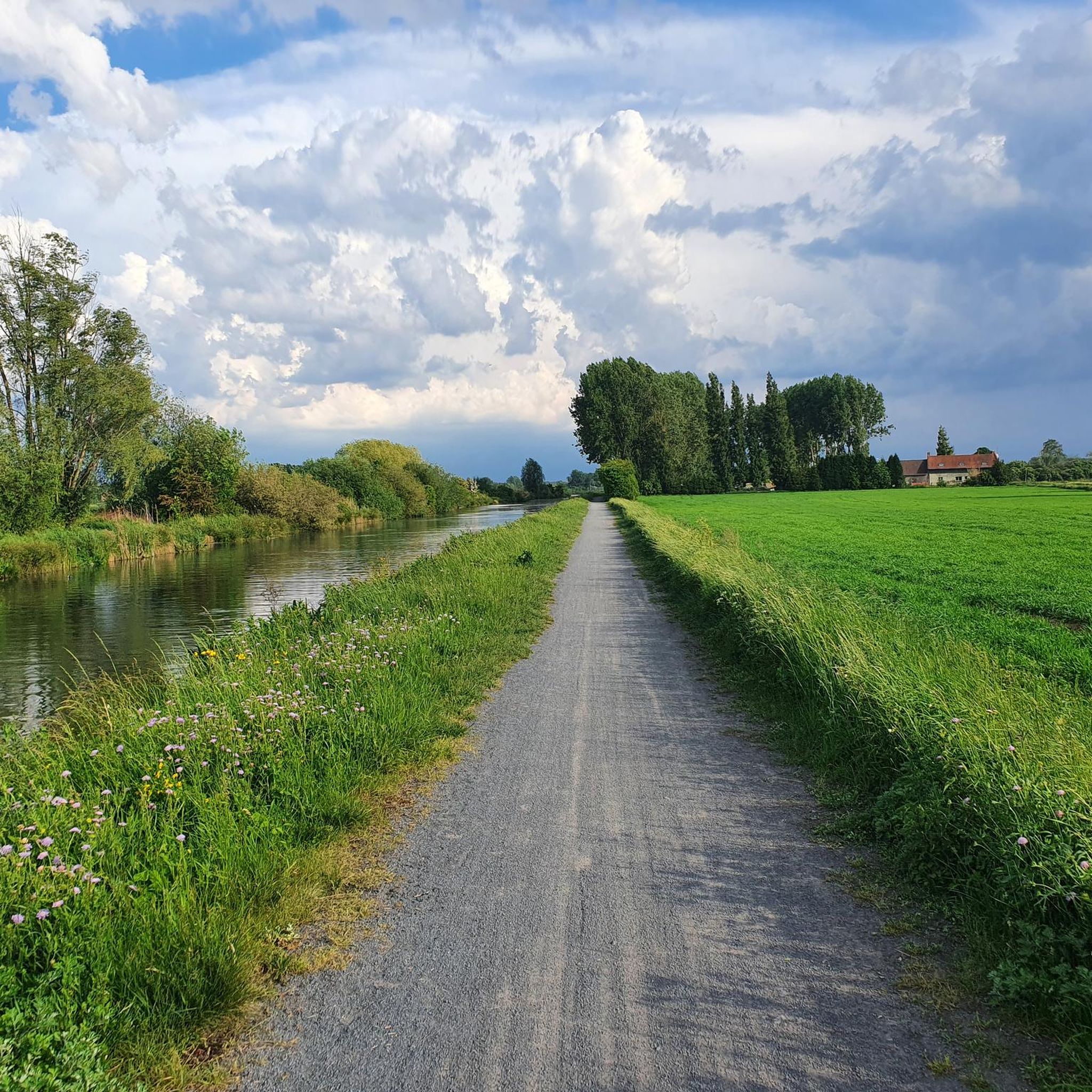
Touring cycling routes around Neuvireuil traverse a region characterized by gentle topography, with elevations ranging from 40 to 61 meters, making it suitable for accessible rides. The landscape features serene riverbanks, particularly along the Scarpe River, and extensive greenways like the Scarpe Canal Towpath. This area is also situated near diverse regional natural parks, offering a mix of meadows, farmlands, and valleys for exploration.
Best touring cycling routes around Neuvireuil
- The most popular touring cycling route is Harnes Lagoons –…
Last updated: June 26, 2026
46
riders
Moderate bike ride. Good fitness required. Mostly paved surfaces. Suitable for all skill levels.
22
riders
Moderate bike ride. Good fitness required. Mostly paved surfaces. Suitable for all skill levels.

Sign up for free
17
riders
47.2km
03:05
200m
200m
Moderate bike ride. Good fitness required. Mostly paved surfaces. Suitable for all skill levels.
5.0
(1)
14
riders
Easy bike ride. Great for any fitness level. Mostly paved surfaces. Suitable for all skill levels.
5.0
(2)
6
riders
40.1km
02:25
200m
200m
Moderate bike ride. Good fitness required. Mostly paved surfaces. Suitable for all skill levels.
Get access to more routes and recommendations from other explorers.
Sign up for free
Already have an account?
Our route recommendations are based on thousands of hikes, rides, and runs completed by other people on komoot.
Start today with a free account
Your next adventure awaits.
Login or Signup


Tips from the Community

Very beautiful place, calm and peaceful.
0
0

A remarkable story about the Canadian trenches concerns the preparations for the attack on Vimy Ridge in April 1917. The Canadian divisions used an underground quarry and created additional corridors towards the front. These tunnels and trenches played a crucial role in the success of the attack, with the Canadians managing to retake the strategically important ridge in just three days.
7
0
A remarkable story about the Vimy Memorial concerns its unveiling in 1936. More than 50,000 people, including 6,200 Canadians, attended the ceremony. The presence of so many veterans and survivors underscored the profound impact of the war and the enduring bond between Canada and France. The memorial has since become a symbol of Canadian courage and sacrifice.
6
0
The Mémorial national du Canada à Vimy is an impressive war memorial, commemorating the members of the Canadian Expeditionary Force who died during the First World War. The memorial, designed by Walter Seymour Allward, was unveiled on 26 July 1936 by King Edward VIII. It commemorates the 11,169 Canadian soldiers who died in France and have no known grave.
7
0
A special story about the monument concerns the two colonels, Pein and Cros, who were both killed during the division's actions in May 1915. Their names are inscribed on the monument, along with an inscription commemorating the courage and determination of the soldiers: "Aux morts de la division marocaine, sans peur, sans pitié". This tribute emphasises the heavy losses and heroic efforts of the Moroccan Division during the battle.
7
0
The Monument à la Division Marocaine in Givenchy-en-Gohelle commemorates the courage and sacrifice of the Moroccan Division during the First World War. This monument was erected in honour of the breakthrough made by the division during the Battle of Artois on 9 May 1915. The Moroccan Division, led by General Georges Louis Humbert, played a crucial role in breaking through the German lines and capturing strategic terrain.
8
0

Organized hike, lots of fields, no forest, shame 😏
0
0

Did you know that you can be on Canadian territory in Northern France? The Mémorial de Vimy is located between Lens and Arras. An area of 110 hectares that France lent to Canada shortly after WWI. It is the place where Canadian troops reclaimed a ridge from the Germans in 1917. An unexpected and spectacular victory. But also a precious one. Because in 3 days 3,600 Canadians died and 7,000 men were injured.
5
3
Frequently Asked Questions
How many touring cycling routes are available around Neuvireuil?
There are over 220 touring cycling routes around Neuvireuil, offering a wide range of options for different preferences and skill levels. More than 2,600 touring cyclists have already explored this area using komoot.
What is the general terrain like for touring cycling near Neuvireuil?
The region around Neuvireuil features a generally gentle topography, with elevations typically ranging from 40 to 61 meters. This makes it ideal for accessible touring cycling without extreme climbs. You'll find serene riverbanks, extensive greenways like the Scarpe Canal Towpath, and varied terrain within nearby regional natural parks, including meadows and farmlands.
Are there easy or beginner-friendly touring cycling routes in Neuvireuil?
Yes, Neuvireuil offers a good selection of easy routes, with over 100 tours classified as easy. An example of an easy route is the Marais de Biache St Vaast loop from Plouvain, which is just over 12 km long and features minimal elevation gain.
What is the best time of year to go touring cycling in Neuvireuil?
Given the gentle topography and green landscapes, spring and autumn are generally excellent times for touring cycling in Neuvireuil, offering pleasant temperatures and beautiful scenery. Summer can also be enjoyable, especially along the shaded sections of the Scarpe Canal Towpath.
What interesting landmarks or natural features can I see while cycling around Neuvireuil?
While cycling, you can explore the tranquil Scarpe riverbanks and the unique Les Bonnettes, a site featuring stone pillars linked to local legends. The Scarpe by bike greenway itself is a major attraction, offering scenic views along the water's edge.
What do other touring cyclists enjoy most about cycling in Neuvireuil?
The touring cycling routes in Neuvireuil are highly rated by the komoot community, with an average score of 4.4 stars from over 300 reviews. Cyclists often praise the accessible greenways, the peaceful riverine landscapes, and the variety of terrain found within the regional natural parks, making for enjoyable and varied rides.
Are there family-friendly touring cycling routes near Neuvireuil?
Yes, the gentle terrain and dedicated greenways, such as sections of the Scarpe Canal Towpath, make many routes suitable for families. The stabilized dolomite surface of the towpath ensures a smooth ride for all types of bicycles, providing a safe environment away from traffic.
Are there circular touring cycling routes available?
Yes, many touring cycling routes around Neuvireuil are designed as loops, allowing you to start and end at the same point. Examples include the Harnes Lagoons – Greenway loop from Rouvroy and the Scarpe riverbanks – The Scarpe by bike loop from Biache-Saint-Vaast.
What kind of surface can I expect on the cycling paths, especially on the Scarpe Canal Towpath?
The Scarpe Canal Towpath, known as 'The Scarpe by bike,' features a stabilized dolomite surface. This makes it suitable for all types of bicycles, providing a smooth and pleasant ride. Other routes may include a mix of paved roads and compacted natural paths.
Are there parking facilities available near the touring cycling routes?
While specific parking facilities for every route are not detailed, many routes start from towns or villages like Rouvroy or Biache-Saint-Vaast, where public parking is generally available. It's advisable to check local parking options in your chosen starting point.
How can I reach the touring cycling routes around Neuvireuil using public transport?
Neuvireuil is situated about 11 km northeast of Arras. Public transport options, such as regional buses, may connect Neuvireuil or nearby towns to larger hubs like Arras, which has a train station. From these points, you can cycle to access the routes.
Are there places to eat or stay near the cycling routes in Neuvireuil?
Neuvireuil is a small commune, but its proximity to larger towns like Arras (11 km away) and Lens (10 km away) means you can find various cafes, pubs, and accommodations within a short distance. Some routes may pass through smaller villages with local establishments.
Can I bring my dog on the touring cycling routes around Neuvireuil?
Many natural paths and greenways in the region are generally dog-friendly, provided dogs are kept on a leash and owners clean up after them. It's always best to observe local signage and regulations, especially when passing through protected natural areas or private lands.
Most popular routes around Neuvireuil
Most popular attractions around Neuvireuil

Get inspired with the komoot mobile app


Explore more
Browse the best Cycling routes in other regions.
