The best cycling routes around Villers-Brûlin
4.5
(61)
888
riders
123
rides
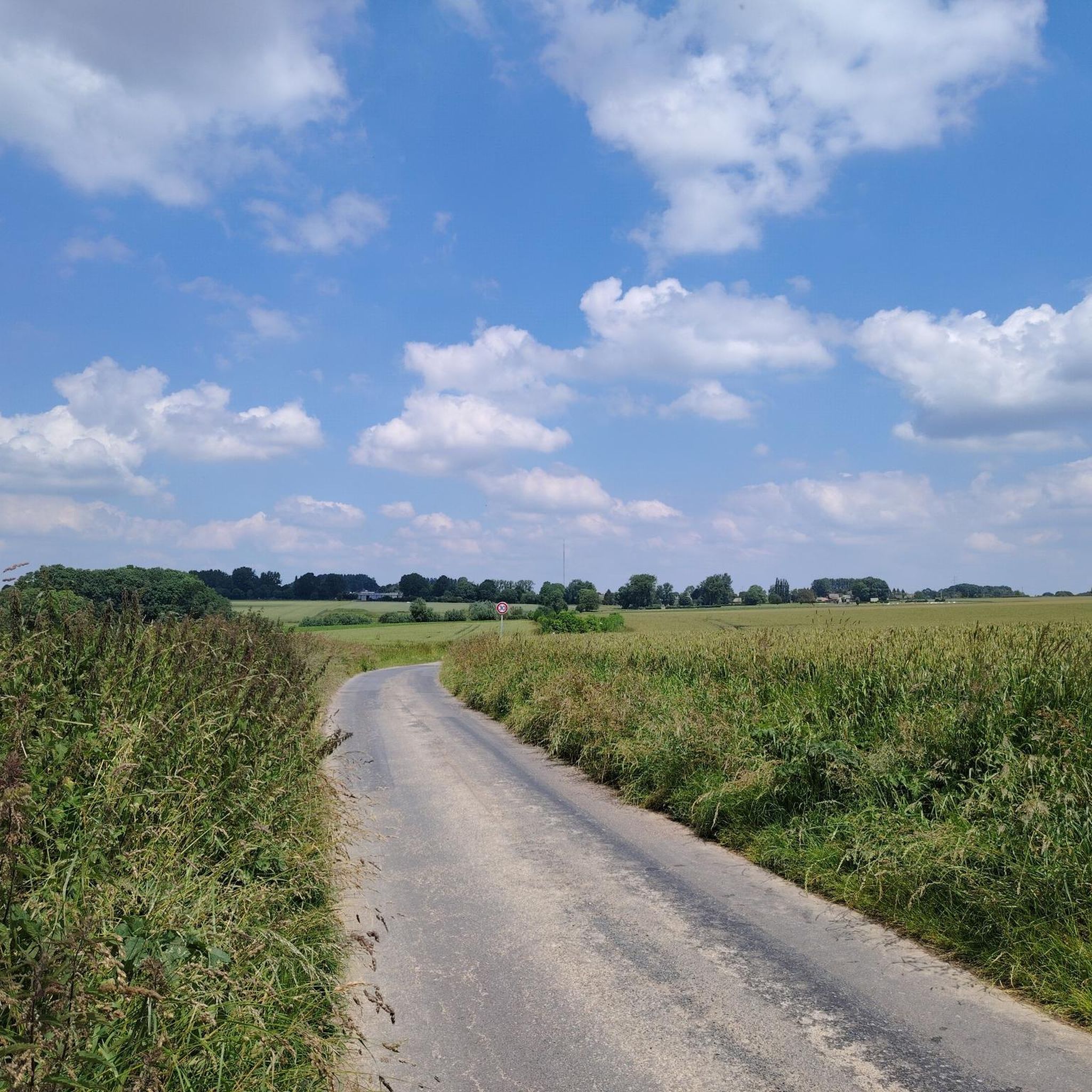
Touring cycling routes around Villers-Brûlin traverse a tranquil rural landscape characterized by gentle, rolling hills and expansive fields. The area's average altitude of 125 meters ensures moderate terrain, ideal for enjoyable rides without extreme gradients. Cyclists will find quiet country roads connecting villages, offering a blend of natural scenery and local heritage. This region in Pas-de-Calais provides a network of cycling paths suitable for various preferences.
Best touring cycling routes around Villers-Brûlin
- The most popular touring cycling route is Commune…
Last updated: October 13, 2026
5.0
(2)
21
riders
39.4km
02:54
330m
330m
Moderate bike ride. Good fitness required. Mostly paved surfaces. Suitable for all skill levels.
5.0
(1)
15
riders
64.0km
04:52
670m
670m
Hard bike ride. Very good fitness required. You may need to push your bike for some segments of this route.

4.0
(1)
5
riders
33.4km
02:39
310m
310m
Moderate bike ride. Good fitness required. Mostly paved surfaces. Suitable for all skill levels.
6
riders
40.9km
03:05
410m
410m
Hard bike ride. Good fitness required. You may need to push your bike for some segments of this route.
6
riders
44.7km
02:41
310m
310m
Moderate bike ride. Good fitness required. Mostly paved surfaces. Suitable for all skill levels.
Get access to more routes and recommendations from other explorers.
Already have an account?
Our route recommendations are based on thousands of hikes, rides, and runs completed by other people on komoot.
Start today with a free account
Your next adventure awaits.




Tips from the Community

Nice little rather peaceful countryside.
0
0
Very pleasant and quiet passage. Well-stabilized ground.
0
0


The ruins of the old church of Ablain-Saint-Nazaire are an impressive and symbolic remnant of the First World War. This church, built in the 16th century in flamboyant Gothic style by Jacques Le Caron, was heavily damaged during the fighting in 1915. The ruins have been preserved as a monument to commemorate the horrors of war.
7
0
The National Necropolis of Notre-Dame-de-Lorette is located on Mont Hernu (173m) and opposite the necropolis, next to the anneau de la Mémoire you have a balcony set up as a lookout point.
6
0
A remarkable event occurred on April 9, 1917, when Canadian troops launched their famous assault on Vimy Ridge, a pivotal battle that resulted in the capture of strategically important heights. The cemetery commemorates the sacrifices of these and other soldiers who fought in the region.
7
0
The Givenchy-en-Gohelle Canadian Cemetery is a military cemetery managed by the Commonwealth War Graves Commission (CWGC). This cemetery was established in March 1917 by the Canadian Corps and contains the graves of soldiers who died during World War I. Givenchy-en-Gohelle was captured by the 2nd Canadian Division on April 13, 1917, and remained in British hands for the rest of the war.
8
0
A remarkable story about the ruins concerns the decision not to rebuild the church after the war. Although the church had been classified as a historical monument in 1908, the Commission for Historical Monuments decided that the ruins should remain as a testimony to the German destruction. Ironically, it was the French guns that had destroyed the church, but the ruins became a symbol of the war and the reconstruction.
6
0
Frequently Asked Questions
How many touring cycling routes are available around Villers-Brûlin?
There are over 120 touring cycling routes around Villers-Brûlin, offering a wide range of options for different skill levels. This includes 33 easy routes, 72 moderate routes, and 22 difficult routes.
What kind of terrain can I expect on touring cycling routes in Villers-Brûlin?
The terrain around Villers-Brûlin is characterized by gentle, rolling hills and expansive fields, with an average altitude of 125 meters. You'll find quiet country roads connecting villages, providing enjoyable rides without extreme gradients. The region offers a mix of flat sections and gentle ascents.
Are there any circular touring cycling routes in the area?
Yes, many routes around Villers-Brûlin are circular, allowing you to start and end at the same point. An example is the Commune Acq – Bray Chalk Quarry loop from Aubigny-en-Artois, a moderate 39.4 km ride.
What are some notable landmarks or attractions I can see along the cycling routes?
Cyclists can explore various historical and natural attractions. You might encounter the historic château and Notre-Dame church within Villers-Brûlin itself. Nearby, consider visiting Olhain Castle, The Caucourt Ford and Watermill, or the belvedere at Olhain Park for scenic views.
What do other touring cyclists enjoy most about cycling in Villers-Brûlin?
The area is highly rated by the komoot community, with an average score of 4.6 stars from over 50 reviews. Reviewers often praise the tranquil rural landscape, the gentle rolling hills, and the network of quiet country roads that make for a pleasant cycling experience.
Are there any challenging touring cycling routes for experienced riders?
Yes, for more experienced riders, there are routes with challenging ascents and longer distances. The Bray Chalk Quarry – Bluebells in Bois de Noulette loop from Aubigny-en-Artois is a difficult 64.2 km path featuring varied terrain and more significant elevation gains.
Can I find routes that follow old railway lines?
Yes, the region offers routes that utilize former railway lines, providing generally flat or easy-sloped paths. An example is the Old Railway Line – La Lawe loop from Tincques, which is a moderate 33.4 km trail leading through rural fields.
What is the best time of year for touring cycling in Villers-Brûlin?
The region's gentle topography makes it enjoyable for cycling through much of the year. Spring and autumn offer pleasant temperatures and beautiful scenery, with fields bursting with color. Summer is also suitable, though it's advisable to cycle during cooler parts of the day.
Are there family-friendly cycling options around Villers-Brûlin?
Yes, the gentle topography and network of quiet country roads make many routes suitable for families. Greenways (Voies Vertes) in the broader Hauts-de-France region, often utilizing former railway lines or canal towpaths, provide traffic-free or low-traffic options that are generally flat, perfect for relaxed family rides.
Where can I park my car when starting a cycling tour in Villers-Brûlin?
While specific parking areas for each route are not detailed, Villers-Brûlin and surrounding villages typically offer public parking options. It's advisable to check local village centers or near trailheads for available parking spaces.
Are there any routes that pass by historical ruins?
Yes, you can find routes that incorporate historical sites. For instance, the Ruins of Saint-Bertin Abbey – Commune Acq loop from Tincques is a moderate 43.7 km route that allows you to explore historical elements of the region.
What is the typical duration of a touring cycling route in this area?
Route durations vary depending on distance and difficulty. Many moderate routes, like the Allée des Tilleuls – Château de Lignereuil loop from Tincques (39.8 km), can be completed in about 2.5 to 3 hours. Longer, more difficult routes can take up to 5 hours or more.
Most popular routes around Villers-Brûlin
Most popular attractions around Villers-Brûlin

Get inspired with the komoot mobile app


Explore more
Browse the best Cycling routes in other regions.
