The best cycling routes around Villers-Lès-Cagnicourt
4.5
(30)
322
riders
80
rides
Touring cycling around Villers-Lès-Cagnicourt offers routes through a landscape characterized by gentle rolling terrain and agricultural fields. The region features a network of quiet country roads and paths, often following historical routes or waterways. Elevation changes are generally modest, making it suitable for various fitness levels. The area provides a tranquil setting for exploring the French countryside by bike.
Best touring cycling routes around Villers-Lès-Cagnicourt
- The most popular touring cycling route is Beaumetz Cross Roads Cemetery – Chemin du Canal…
Last updated: July 2, 2026
43
riders
50.7km
03:51
330m
330m
Moderate bike ride. Good fitness required. Mostly paved surfaces. Suitable for all skill levels.
21
riders
27.3km
02:08
210m
200m
Moderate bike ride. Good fitness required. Mostly paved surfaces. Suitable for all skill levels.

Sign up for free
4.3
(3)
17
riders
Easy bike ride. Great for any fitness level. Mostly paved surfaces. Suitable for all skill levels.
4.7
(3)
5
riders
22.6km
01:23
110m
110m
Easy bike ride. Great for any fitness level. Mostly paved surfaces. Suitable for all skill levels.
9
riders
15.7km
01:12
30m
30m
Easy bike ride. Great for any fitness level. Mostly paved surfaces. Suitable for all skill levels.
Get access to more routes and recommendations from other explorers.
Sign up for free
Already have an account?
Our route recommendations are based on thousands of hikes, rides, and runs completed by other people on komoot.
Start today with a free account
Your next adventure awaits.
Login or Signup




Tips from the Community


Wancourt was captured on 12 April 1917 after very heavy fighting and the advance was continued on the following days. The cemetery, called at first Cojeul Valley Cemetery, or River Road Cemetery, was opened about ten days later; it was used until October 1918, but was in German hands from March 1918 until 26 August, when the Canadian Corps recaptured Wancourt. At the Armistice, the cemetery contained 410 graves, but was very greatly increased in the following years when graves were brought in from a number of small cemeteries and isolated positions on the battlefields south-east of Arras. The cemetery now contains 1936 burials and commemorations of the First World War. 829 of the burials are unidentified but there are special memorials to 76 casualties known or believed to be buried among them, and to 20 who were buried in Signal Trench Cemetery whose graves were destroyed in later battles.
9
0

Sailly-en-Ostrevent is a French commune located in the Hauts-de-France region. A point of interest in Sailly-en-Ostrevent is the church of St. Albin, which, together with a large part of the village, was rebuilt after the First World War. A more special attraction is the special location Cromlech "Les sept bonnettes" with remains of the megalithic era.
4
0
The image is really small. We had to search after driving past it for the first time.
6
0
Small statue of Menhir Bouteroue by Palluel near the roundabout. The Sensée valley is known for its mysterious menhirs and dolmens: stones from Lécluse or Aubigny-au-Bac, large boulder from Oisy-le-Verger, ... Most monoliths testify to a primitive religion. Now legends are resurfacing, tongues are wagging and myths still have bright days ahead.
6
0
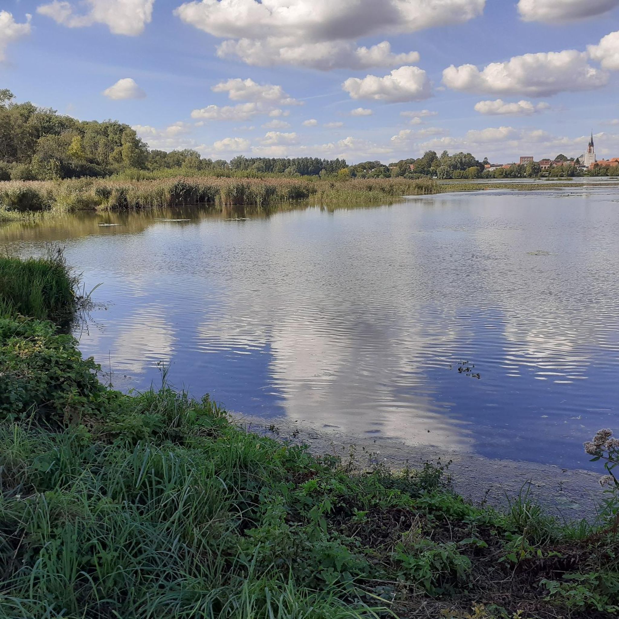
Arleux is a commune in the north of France, between Douai and Cambrai, in the heart of the Sensée valley. It is a green oasis and a true haven of peace with vast ponds, swamps as far as the eye can see, rivers and canals that delight nature lovers with their exceptional biodiversity. The municipal pond of Arleux is a popular spot for fishermen, where pontoons have been installed for people with reduced mobility. There are many coarse fish such as roach, bream, tench, carp, eel, bleak and gudgeon, but also predatory fish such as pike, zander and perch.
5
0
Arleux is a commune in the north of France, between Douai and Cambrai, in the heart of the Sensée valley. It is a green oasis and a true haven of peace with vast ponds, swamps as far as the eye can see, rivers and canals that delight nature lovers with their exceptional biodiversity. The municipal pond of Arleux is a popular place for fishermen, where pontoons have been installed for people with reduced mobility. There are many white fish such as roach, bream, tench, carp, eel, eel and goby, but also predatory fish such as pike, pike-perch and perch.
3
0
Frequently Asked Questions
How many touring cycling routes are available around Villers-Lès-Cagnicourt?
There are over 70 touring cycling routes in the Villers-Lès-Cagnicourt area. This includes a variety of options, with 40 routes classified as easy, 33 as moderate, and 3 as difficult, catering to different skill levels.
Are there easy touring cycling routes suitable for beginners in Villers-Lès-Cagnicourt?
Yes, the region offers a good selection of easy touring cycling routes, with 40 options available. These routes typically feature gentle terrain and quiet country roads, making them ideal for beginners or those seeking a relaxed ride. An example is the View of the Haut Pont marsh – Jetty on the Aubigny Marsh loop from Écourt-Saint-Quentin, which is 16.2 miles (26.1 km) long.
What are the typical lengths and durations of touring cycling routes in this area?
Route lengths vary, but many popular tours range from 16 to 32 miles (26 to 51 km). For instance, the Chemin du Canal – Hermies Hill British Cemetery loop from Quéant is 20.8 miles (33.5 km), while the Beaumetz Cross Roads Cemetery – Chemin du Canal loop from Quéant is 31.5 miles (50.7 km). Durations can range from under 2 hours for shorter, easy routes to almost 4 hours for longer, moderate ones, depending on your pace.
Are there circular touring cycling routes around Villers-Lès-Cagnicourt?
Many of the touring cycling routes in the area are designed as loops, allowing you to start and finish at the same point. This is convenient for exploring the countryside without needing to retrace your steps. Examples include the Passage between two ponds – Etangs communaux d'Arleux loop from Étaing and the Wancourt British Cemetery – Croisilles loop from Haucourt.
What kind of scenery can I expect on touring cycling routes near Villers-Lès-Cagnicourt?
The region is characterized by open agricultural landscapes, tranquil canal paths, and gentle rolling terrain. You'll often cycle through vast fields, alongside waterways, and past historical points of interest, including numerous WWI cemeteries and memorials that dot the countryside.
What do other touring cyclists enjoy most about cycling in Villers-Lès-Cagnicourt?
The area is highly rated by the komoot community, with an average score of 4.6 stars from over 40 reviews. Reviewers often praise the peaceful atmosphere, the well-maintained country roads, and the opportunity to combine cycling with visits to historical sites and natural marshlands.
When is the best time of year to go touring cycling in Villers-Lès-Cagnicourt?
The best time for touring cycling is typically from spring to early autumn (April to October). During these months, the weather is generally mild and pleasant, with longer daylight hours. Spring offers blooming fields, while autumn provides comfortable temperatures and colorful foliage. Summer can be warm but is also suitable.
Are there any cafes or places to stop for refreshments along the cycling routes?
While the routes primarily traverse rural agricultural areas, many villages and small towns along or near the routes will have local bakeries (boulangeries), cafes, or small restaurants where you can stop for refreshments. It's advisable to check opening hours, especially in smaller communities, or pack some snacks and drinks.
What historical landmarks or points of interest can I see while cycling?
The region is rich in history, particularly related to World War I. Many routes pass by or near significant sites such as British cemeteries (e.g., Hermies Hill British Cemetery, Wancourt British Cemetery) and memorials. The canal paths themselves also offer a glimpse into the region's industrial and agricultural past.
Is it possible to cycle in Villers-Lès-Cagnicourt during the winter months?
Cycling is possible in winter, but conditions can be challenging. Days are shorter, temperatures are colder, and there's a higher chance of rain, frost, or even light snow. If cycling in winter, ensure your bike is well-maintained, wear appropriate warm and waterproof clothing, and be prepared for potentially muddy or slippery sections on unpaved paths.
What should I bring for a touring cycling trip in Villers-Lès-Cagnicourt?
Beyond your touring bicycle, essential items include a helmet, water bottles, snacks, a basic repair kit (spare tube, pump, tire levers), and navigation tools (like the komoot app). Depending on the weather, layers of clothing, rain gear, and sun protection are also recommended. Don't forget a camera to capture the scenic countryside and historical sites.
Most popular routes around Villers-Lès-Cagnicourt
Most popular attractions around Villers-Lès-Cagnicourt

Get inspired with the komoot mobile app


Explore more
Browse the best Cycling routes in other regions.
