The best cycling routes around Yzengremer
4.3
(667)
4,010
riders
190
rides
Touring cycling routes around Yzengremer traverse a varied landscape, characterized by coastal panoramas, cliffside views, and sections that may include gravel paths. The region features moderate elevation changes, with some routes offering significant climbs. Cyclists can expect a mix of open coastal stretches and routes that pass through local villages and near natural areas like forests and parks. The terrain provides options for different skill levels, from easier paths to more challenging ascents.
Best touring cycling routes around Yzengremer
- The…
Last updated: June 26, 2026
4.0
(2)
14
riders
42.8km
02:52
320m
320m
Moderate bike ride. Good fitness required. Mostly paved surfaces. Suitable for all skill levels.
5.0
(1)
6
riders
25.9km
01:37
170m
170m
Moderate bike ride. Good fitness required. Mostly paved surfaces. Suitable for all skill levels.

Sign up for free
5.0
(1)
10
riders
11.0km
00:45
30m
30m
Easy bike ride. Great for any fitness level. Mostly paved surfaces. Suitable for all skill levels.
4.9
(10)
4
riders
35.1km
02:39
240m
240m
Moderate bike ride. Good fitness required. Mostly paved surfaces. Suitable for all skill levels.
6
riders
91.4km
05:23
320m
320m
Hard bike ride. Very good fitness required. Mostly paved surfaces. Suitable for all skill levels.
Get access to more routes and recommendations from other explorers.
Sign up for free
Already have an account?
Our route recommendations are based on thousands of hikes, rides, and runs completed by other people on komoot.
Start today with a free account
Your next adventure awaits.
Login or Signup



Tips from the Community

This cycle path leads from the sea to the glassworks, always along small lakes and the river.
0
0


Hourdel Lighthouse is a lighthouse on the common Cayeux-sur-Mer, it is built on the south side of the Bay of Somme, at the end of the point of Hourdel.
4
0

The church in Ault is a beautiful building. Its interior is simple yet beautiful.
3
0
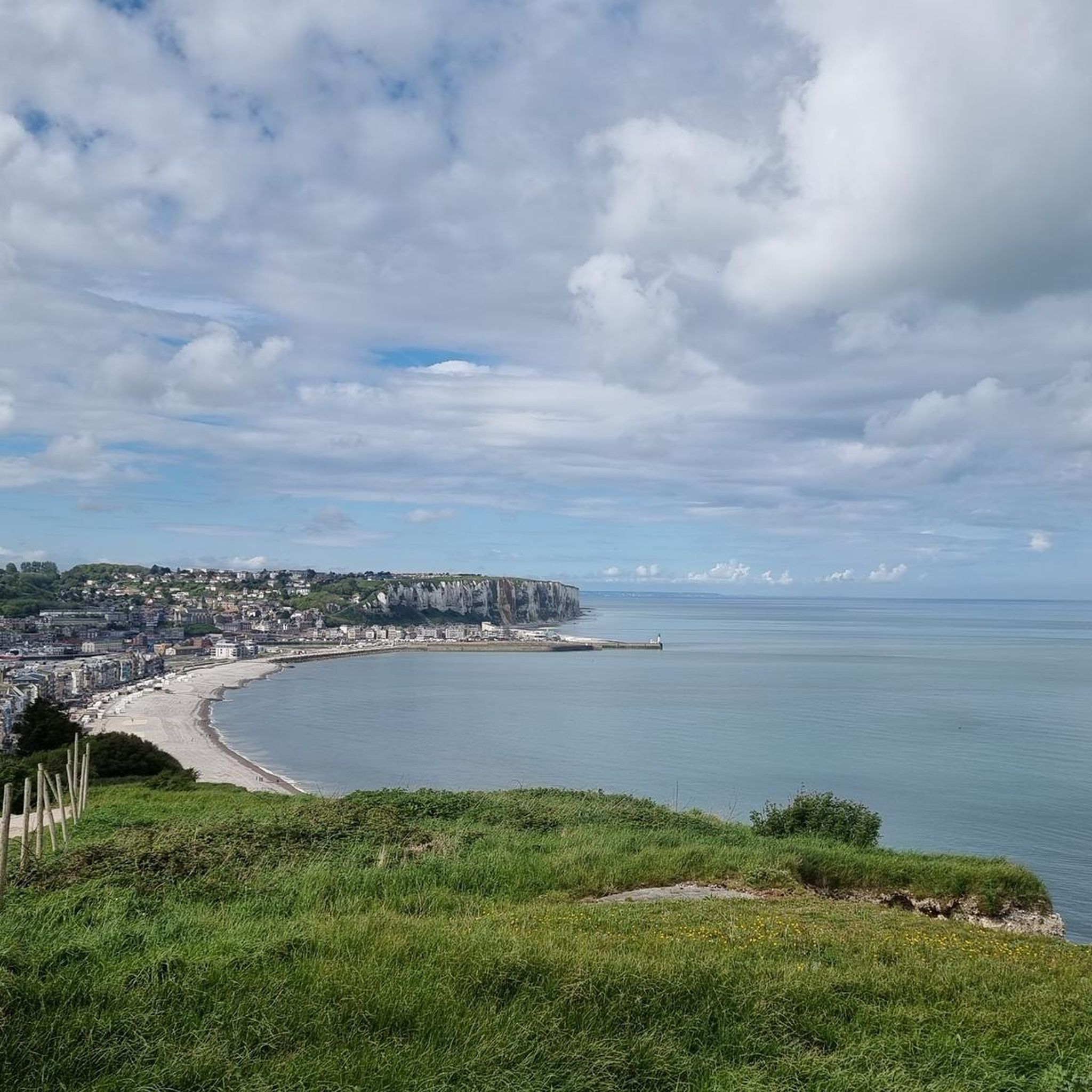
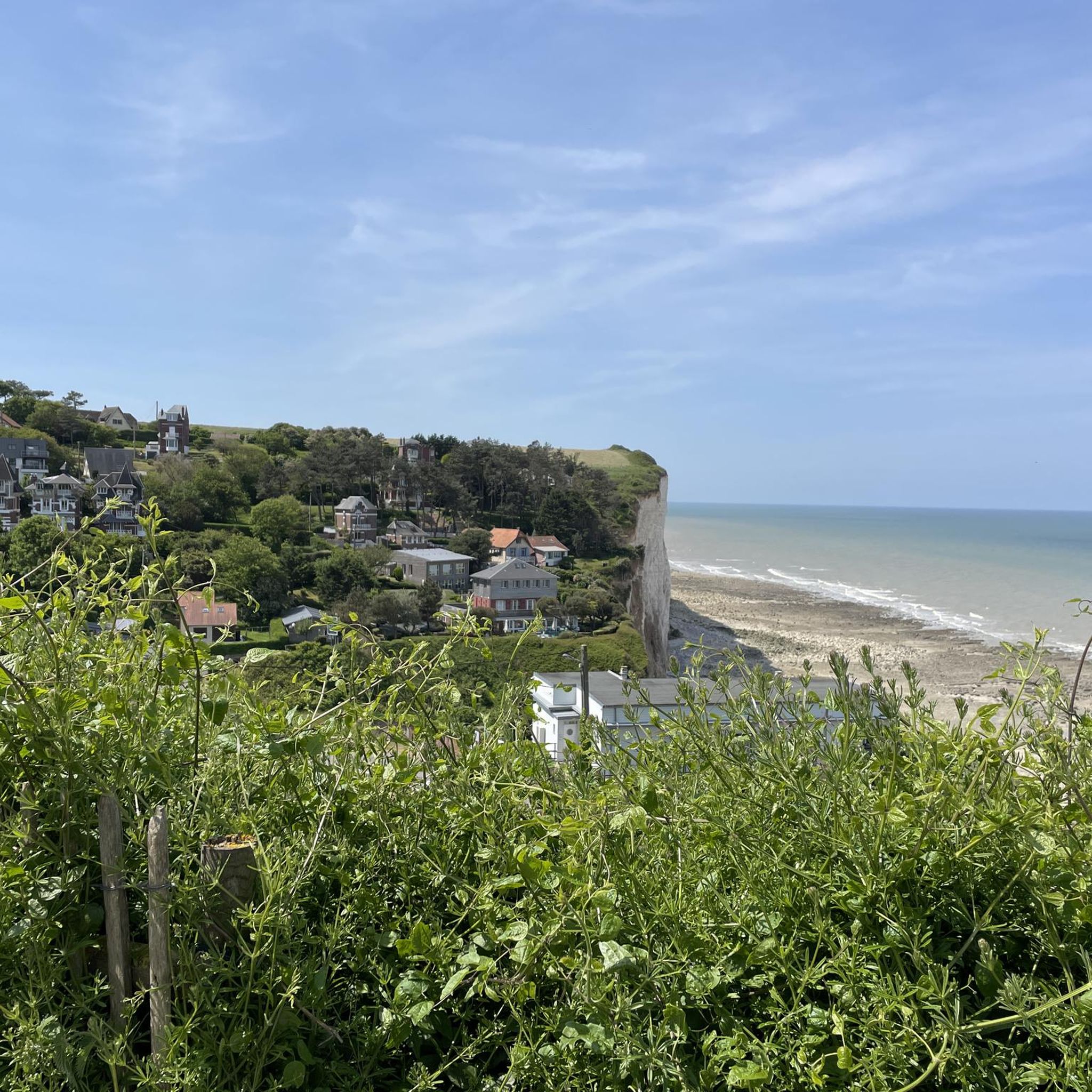
The cliffs are made of chalk and are impressive to look at.
3
0
Here in Ault begin the chalk cliffs, which stretch all the way to Normandy and repeatedly appear as enormous cliffs.
4
0

The cliffs around the beach of Ault are composed of chalk from the Upper Cretaceous, more precisely from the Turonian and Coniacian (around 83 million years ago to 90 million years ago). They are strewn with flint nodules which highlight the subhorizontal stratification planes (the formation of flint has already been discussed in Discovery of the geology of the cliffs of Étretat, presentation of an excursion from the beach of Tilleul (Antifer) to the Porte d'Amont (Étretat Nord)). The relative proportion of chalk and flint is around 90-95% chalk to 5-10% flint. Flint horizons are stratigraphic markers. On the cliffs of Ault, the regular flint band called Seven Sisters is recognizable and characterizes the boundary between the Middle Coniacian and the Upper Coniacian (around 87 million years ago). The boundary between the lower and middle Coniacian is marked by the Shoreham 2 marl level, which is more difficult to identify. These lithostratigraphic markings allow in particular the correlation of distant deposits, such as between the Normandy and Picardy coasts, or between the French and English coasts.
3
0
The cliffs around the beach of Ault are composed of chalk from the Upper Cretaceous, more precisely from the Turonian and Coniacian (around 83 million years ago to 90 million years ago). They are strewn with flint nodules which highlight the subhorizontal stratification planes (the formation of flint has already been discussed in Discovery of the geology of the cliffs of Étretat, presentation of an excursion from the beach of Tilleul (Antifer) to the Porte d'Amont (Étretat Nord)). The relative proportion of chalk and flint is around 90-95% chalk to 5-10% flint. Flint horizons are stratigraphic markers. On the cliffs of Ault, the regular flint band called Seven Sisters is recognizable and characterizes the boundary between the Middle Coniacian and the Upper Coniacian (around 87 million years ago). The boundary between the lower and middle Coniacian is marked by the Shoreham 2 marl level, which is more difficult to identify. These lithostratigraphic markings allow in particular the correlation of distant deposits, such as between the Normandy and Picardy coasts, or between the French and English coasts.
2
0
Frequently Asked Questions
How many touring cycling routes are available around Yzengremer?
There are over 180 touring cycling routes around Yzengremer, offering a wide range of options for different skill levels and preferences. You'll find paths traversing coastal panoramas, cliffside views, and charming local villages.
Are there easy touring cycling routes suitable for beginners or families in Yzengremer?
Yes, Yzengremer offers several easier touring cycling routes. While the region features varied terrain, including some challenging climbs, there are 49 routes classified as easy. These typically have moderate elevation changes and can be a great way to explore the area at a relaxed pace.
What kind of terrain can I expect on touring cycling routes in Yzengremer?
The touring cycling routes around Yzengremer feature a varied landscape. You can expect coastal paths with expansive views, sections near cliffs, and routes that pass through local villages. Some paths may include gravel sections, adding to the diverse riding experience.
Are there any circular touring cycling routes around Yzengremer?
Many of the touring cycling routes in Yzengremer are designed as loops, allowing you to start and end at the same point. For example, the Cayeux-sur-Mer Church – Segment Gravel Hautebut loop from Friville-Escarbotin is a popular circular option that includes gravel sections and passes by local landmarks.
What are some notable viewpoints or natural attractions I can visit while cycling in Yzengremer?
Yzengremer's touring cycling routes offer stunning natural attractions. You can enjoy expansive coastal views and cliffside panoramas. Consider routes that pass by highlights such as the Ault Chalk Cliffs or the La Cise Cliff. The Architecture balnéaire – View over the cliffs loop from Yzengremer specifically highlights coastal architecture and viewpoints.
Are there any challenging touring cycling routes for experienced riders in Yzengremer?
Yes, Yzengremer offers 37 difficult touring cycling routes for experienced riders seeking a challenge. These routes often feature significant climbs and longer distances. An example is the Ault viewpoint – Eastern end of Falaises d'Albâtre, Ault coastal panorama loop from Yzengremer, which covers over 30 miles with considerable elevation gain.
What do other touring cyclists enjoy most about cycling in Yzengremer?
The touring cycling routes in Yzengremer are highly rated by the komoot community, with an average score of 4.3 stars from over 480 reviews. Cyclists often praise the diverse coastal paths, the stunning cliffside viewpoints, and the varied terrain that offers options for all abilities.
Can I find routes that pass by lakes or natural reserves in the Yzengremer area?
Yes, some touring cycling routes in the wider Yzengremer area can lead you near beautiful natural areas. You might find routes that pass by locations like Marais de Gousseauville or the Bouvaincourt-sur-Bresle Ponds, offering a chance to enjoy tranquil waterscapes.
Are there touring cycling routes that are suitable for dogs in Yzengremer?
While komoot routes don't specifically filter for dog-friendly cycling, many paths in natural areas around Yzengremer are generally accessible. It's always best to check local regulations for specific trails, especially those passing through nature reserves or private land, and ensure your dog is comfortable with the distance and terrain, which can include gravel sections.
Are there any touring cycling routes that explore local villages or historical sites?
Many routes in Yzengremer pass through or near local villages, offering a glimpse into the regional charm. For instance, the Church of Dargnies – Parc de la Rue de la Forêt loop from Woincourt takes you through the countryside and past local landmarks, providing a cultural element to your ride.
What is the best time of year to go touring cycling in Yzengremer?
The best time for touring cycling in Yzengremer is generally during the spring and autumn months when the weather is milder and the natural scenery is vibrant. Summer can also be pleasant, especially along the coast, but can be busier. Always check the local forecast before heading out, as coastal weather can be variable.
Are there touring cycling routes that offer views of the famous Falaises d'Albâtre (Alabaster Cliffs)?
Absolutely. The region's touring cycling routes are known for their proximity to these iconic cliffs. The Eastern end of Falaises d'Albâtre, Ault coastal panorama – Bois de Cise loop from Woincourt is a great option that provides stunning views of the Falaises d'Albâtre and the coastal panorama.
Most popular routes around Yzengremer
Most popular attractions around Yzengremer

Get inspired with the komoot mobile app


Explore more
Browse the best Cycling routes in other regions.
