The best MTB trails around Martainneville
4.3
(12)
215
riders
37
rides
Mountain biking around Martainneville, located in the Somme department of France, offers access to a varied topography suitable for outdoor activities. The region features river valleys, hedgerows, ponds, and forests, providing diverse terrain for mountain bikers. The landscape around Martainneville is gently undulating, with altitudes ranging from 84m to 114m, contributing to a network of trails that mix ascents and descents. This area is part of a broader network of cycling opportunities within the Somme region.
Best mountain bike trails…
Last updated: June 30, 2026
24
riders
47.2km
03:36
460m
460m
Moderate mountain bike ride. Good fitness required. Suitable for all skill levels.
5.0
(2)
21
riders
43.3km
03:20
530m
530m
Moderate mountain bike ride. Good fitness required. Suitable for all skill levels.

Sign up for free
21
riders
69.7km
05:17
880m
880m
Hard mountain bike ride. Very good fitness required. Advanced riding skills necessary.
4
riders
44.2km
03:37
540m
540m
Moderate mountain bike ride. Good fitness required. Suitable for all skill levels.
16
riders
40.4km
03:02
380m
380m
Moderate mountain bike ride. Good fitness required. Suitable for all skill levels.
Get access to more routes and recommendations from other explorers.
Sign up for free
Already have an account?
Our route recommendations are based on thousands of hikes, rides, and runs completed by other people on komoot.
Start today with a free account
Your next adventure awaits.
Login or Signup


Tips from the Community

There is a nice Parc, beautiful place for a picknick
0
0

An ideal place for a picnic
0
0
Breathtaking view of the Yères valley
0
0


The ruins of Pont-Rémy Castle are located on an island between the old Somme and the canalized Somme.
0
0

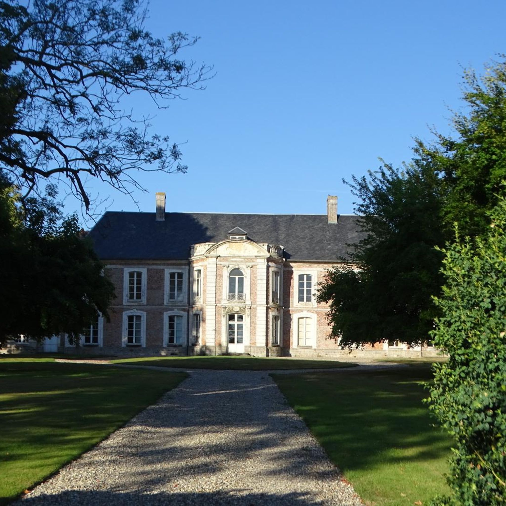
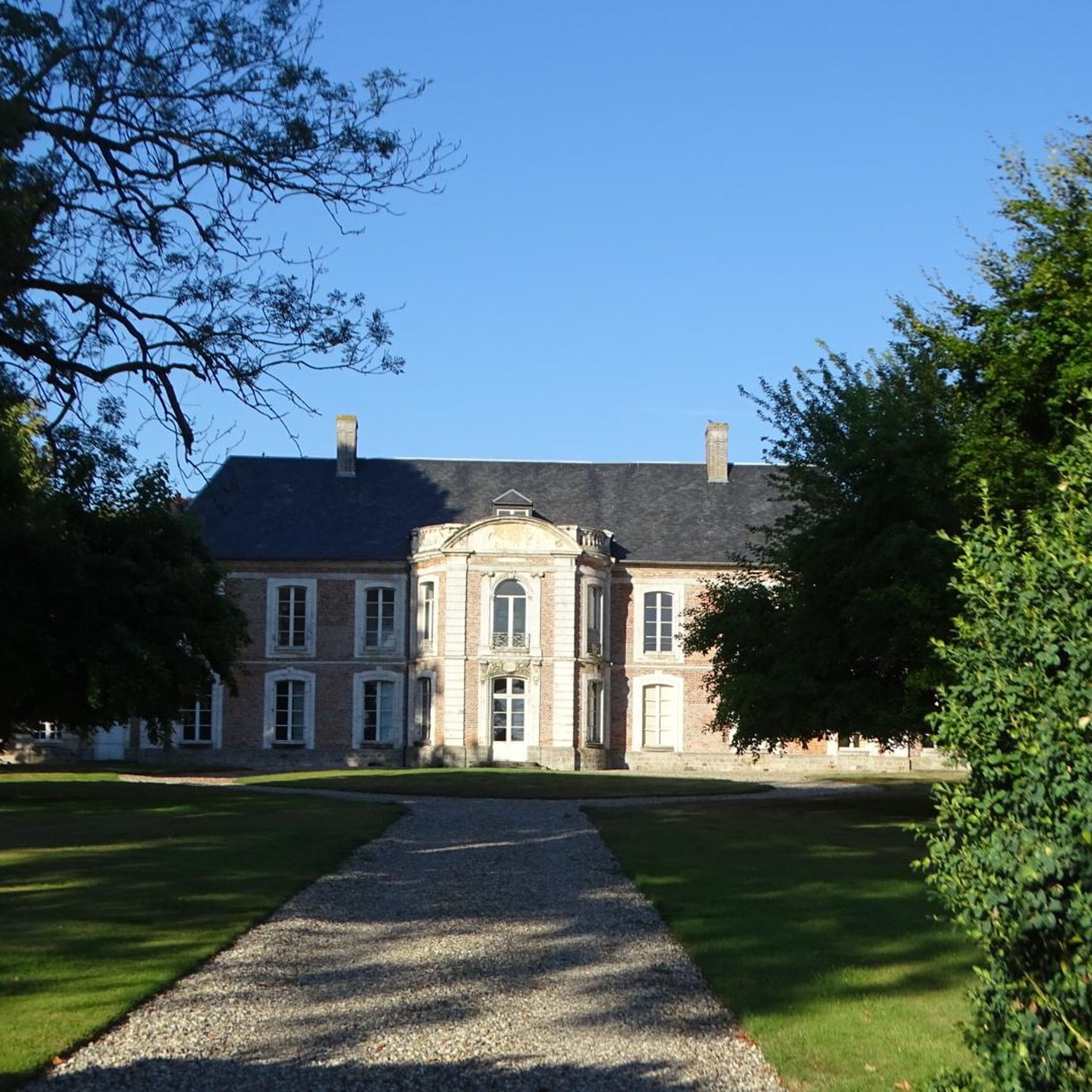
A dilapidated mansion with what was once a beauty.
2
0

Frequently Asked Questions
What kind of terrain can I expect when mountain biking near Martainneville?
The region around Martainneville offers a varied topography, characterized by river valleys, traditional hedged farmlands (bocages), ponds, and forests. While the immediate area of Martainneville is gently undulating with altitudes ranging from 84m to 114m, the broader Somme department provides a mix of ascents and descents suitable for mountain biking. You'll find paths along towpaths in river valleys, through rural countryside, and within woodlands.
How many mountain bike trails are available around Martainneville?
There are over 30 mountain bike trails available around Martainneville, offering a diverse range of experiences for different skill levels. The komoot community has explored these routes over 200 times, indicating a well-used and appreciated network.
Are there mountain bike trails suitable for beginners around Martainneville?
Yes, there are several options for beginners. The guide lists 7 easy mountain bike routes that are perfect for those new to the sport or looking for a more relaxed ride. These trails typically feature gentler gradients and less technical terrain.
What are some options for more experienced mountain bikers looking for a challenge?
For experienced mountain bikers seeking a challenge, there are 2 difficult routes available. One notable option is the Castle – Panorama of Mont Gaubert loop from Fresnes-Tilloloy. This 72.1 km trail features significant elevation changes and typically takes over 5 hours to complete, offering a demanding ride through rural countryside with panoramic views.
What can I see along the mountain bike trails around Martainneville?
Many routes pass by historical and natural points of interest. You can explore several castles, such as Rambures Castle or Château de Bouillancourt-en-Sery. Some trails also offer scenic viewpoints, like those found on the Yères Valley Viewpoint – Poteau Saint-Remi loop from Blangy-sur-Bresle, providing picturesque vistas over the surrounding valleys and countryside.
Are there any family-friendly mountain biking options near Martainneville?
While specific 'family-friendly' designations aren't always explicit, the presence of 7 easy routes suggests suitable options for families with varying skill levels. These trails often follow less technical paths through forests and rural areas, providing a pleasant experience for all. Always check the route details for distance and elevation to ensure it matches your family's capabilities.
Can I bring my dog on the mountain bike trails around Martainneville?
Many rural trails in France are dog-friendly, especially if your dog is well-behaved and kept on a leash. Given the region's natural landscapes of forests and open countryside, it's generally possible to bring your dog. However, always be mindful of local regulations, private land, and livestock, and ensure your dog is fit enough for the ride.
What is the best time of year to go mountain biking in Martainneville?
The spring and autumn months generally offer the most pleasant conditions for mountain biking in the Somme region. Temperatures are milder, and the natural landscapes are vibrant. Summer can be enjoyable, but be prepared for warmer weather. Winters can be damp and muddy, making some trails more challenging. Always check local weather forecasts before heading out.
Are there places to eat or stay near the mountain bike trails?
Martainneville and nearby towns like Blangy-sur-Bresle and Oisemont offer various amenities. You can find local cafes, pubs, and accommodation options in these villages. It's advisable to check in advance for opening hours, especially in smaller communities, and consider routes that pass through or near these towns if you plan to stop for refreshments or an overnight stay.
How well are the mountain bike trails around Martainneville rated by other riders?
The mountain bike trails around Martainneville are highly rated by the komoot community, with an average score of 4.6 stars from more than 10 reviews. Riders often praise the varied terrain, the scenic views, and the opportunity to explore the peaceful French countryside.
Are there any circular mountain bike routes available?
Yes, many of the mountain bike trails around Martainneville are designed as loops, allowing you to start and finish at the same point. Examples include the Glass vallée team bike loop from Blangy-sur-Bresle and the Bois de Forceville – Bois Hédron loop from Oisemont. These circular routes are convenient for planning your ride without needing shuttle arrangements.
Is there public transport access to the mountain biking areas near Martainneville?
While Martainneville is a rural area, the broader Somme region has some public transport options. However, direct public transport to specific trailheads might be limited. It's often more convenient to access the trails by car, especially if you're bringing your own bike. For regional cycling information, you can consult resources like Somme Tourisme.
Most popular routes around Martainneville
Most popular attractions around Martainneville

Get inspired with the komoot mobile app


Explore more
Browse the best MTB trails in other regions.
