The best walks and hikes around Saint-Cyr-Sur-Morin
4.4
(121)
569
hikers
93
hikes
Hiking around Saint-Cyr-Sur-Morin offers a network of trails through varied terrain. The region features a mix of rural landscapes, gentle hills, and historical points of interest such as abbeys and churches. Elevation changes are generally moderate, with some routes presenting more significant climbs. The area's trails provide opportunities to explore both natural surroundings and cultural landmarks.
Best hiking trails around Saint-Cyr-Sur-Morin
- The most popular hiking route is The crypts of Jouarre – Jouarre Abbey loop from Jouarre, a 5.8…
Last updated: July 9, 2026
4.3
(3)
15
hikers
9.23km
02:36
180m
180m
Moderate hike. Good fitness required. Easily-accessible paths. Suitable for all skill levels.
4.5
(2)
15
hikers
17.4km
04:47
280m
280m
Moderate hike. Good fitness required. Easily-accessible paths. Suitable for all skill levels.

Sign up for free
4.8
(4)
12
hikers
11.0km
02:55
100m
100m
Moderate hike. Good fitness required. Easily-accessible paths. Suitable for all skill levels.
5
hikers
5.51km
01:28
60m
60m
Easy hike. Great for any fitness level. Easily-accessible paths. Suitable for all skill levels.
4.7
(3)
7
hikers
12.7km
03:18
80m
80m
Moderate hike. Good fitness required. Easily-accessible paths. Suitable for all skill levels.
Get access to more routes and recommendations from other explorers.
Sign up for free
Already have an account?
Our route recommendations are based on thousands of hikes, rides, and runs completed by other people on komoot.
Start today with a free account
Your next adventure awaits.
Login or Signup



Tips from the Community

Very beautiful view that is well worth it!!! My Wahoo is seeing red!
0
0

A journey through time in the Jouarre crypt, a unique Merovingian jewel in Europe! Dating from the 7th century AD, the crypt is one of the oldest in Europe. It was built during the second half of the 7th century, during the Merovingian era, at the request of Bishop Agilbert under the reign of Clotaire III. The Crypt contains the tombs of the founding family of the Abbey of Notre Dame de Jouarre, founded around 635. The Merovingian sculpture in the crypt rests on two rows of three Gallo-Roman columns, topped by magnificent Merovingian capitals in white marble. So come to Jouarre to discover the history of a crypt reflecting the prosperous era of the village! Full price: €4. Free for children under 6. Opening hours: Wednesday, Friday and Saturday from 9:30 a.m. to 12:30 p.m. and from 2 p.m. to 5:30 p.m. Closed on Monday, Tuesday, Thursday and Sunday.
0
0
The Notre Dame de Jouarre Abbey, created nearly 14 centuries ago, is still in operation. Its community of Benedictine nuns opens the doors of the old bell tower to show you their daily life and their products. The Romanesque Tower, the old bell tower of the abbey church built in the 12th century, was restored and fitted out by the Benedictine community as a window on monastic life. It is one of the rare vestiges of the medieval abbey. On the garden level, the monastic craft shop presents various products made by religious communities – from Jouarre or elsewhere. The specialty of the Benedictine community of the abbey being terracotta, many santons were made, but also tableware and statues. On the floors, a thematic tour allows the visitor to discover the history of the abbey and the community as well as the current life of the nuns. Full price: €5 Reduced price: €4.50 (under 18s, seniors, job seekers, PRMs, students). Free for under 12s. Open all year round on Monday, Tuesday, Wednesday, Thursday and Friday from 10am to 12:30pm and from 2pm to 5:30pm. Saturday from 10am to 12:15pm and from 2pm to 5:30pm. Sunday from 11am to 12:15pm and from 2pm to 5:30pm.
0
0

13% on one side and 9% on the other because it is located on a hill.
0
0

Située en hauteur, au sommet de la célèbre butte de Doue, l'église Saint-Martin de Doue se dresse sur un lieu de culte déjà utilisé du temps des Celtes. La fondation de l'église daterait elle de l'époque de Saint-Martin (VIe siècle), même si aucune trace n'en subsiste aujourd'hui. Le bâtiment actuel de l'église Saint-Martin date du XIIIe siècle et n'a subit que peu de modification au fil du temps. A la nef, basse et classique à charpente de bois, succède une nef élevée - comparable à celle de Vaudoy-en-Brie - dont les hautes baies vitrées fournissent une importante lumière au bâtiment. Les transepts sont eux aussi agrémenté de larges ouvertures et complète l'aspect monumental de l'édifice. Seul élément ultérieur au XIIe siècle, le clocher porche de l'église est construit vers 1827 en remplacement d'un flèche qui surmontait le transept et frappée par la foudre. Il abrite les cloches de l'église. A l'intérieur, la décoration de l'édifice est riche, et surtout marqué par certains chapiteaux de colonne sculptés et peints de la fin de l'époque romane. Les boiseries du choeur, datées du XVIIIe siècle, ont la particularité d'avoir été offerte à sanctuaire par Louis XVI en personne, encore Dauphin de France, à l'occasion d'une chasse dans les forêts environnantes. Eglise du ; XIIIe siècle, clocher-porche du XIXe siècle Architecture ; Gothique. Visite le Dimanche Après Midi : http://www.balades-en-brie.com/brie/doue/eglise-saint-martin.html] Redescendons la butte par la route nous sommes toujours sur le GR 11. Nous débouchons face au château (grosse propriété que j’ai pris pour une ferme). Nous débouchons sur une route que nous prenons à gauche, laissons une rue sur la droite puis coupons la D 37 poursuivons en face par un chemin dans les champs nous buttons sur une parcelle et notre chemin tourne à gauche. Nous longeons la Chevrie ferme ou ancienne ferme devenue chambre d’hôte et nous prenons la route sur la droite, nous sommes toujours sur le GR 11. Après les vallons du Petit & du Grand Morin nous retrouvons le plateau de brie avec ses betteraves. Laissons les routes que nous rencontrons et traversons les Petits Montgoins, nous coupons la D 204 et prenons le chemin après avoir longé un dépôt de pierre faisant rapidement fourche ou nous prenons la branche de gauche. Nous descendons sur un chemin caillouteux faisant souffrir les chevilles dans le bois Marcou. Nous débouchons sur un chemin que nous prenons à gauche toujours le GR 11 et retrouvons un balisage jaune. Heureusement que je ne suis pas le GR de Saint Jacques de Compostelle la branche Reims – Paris, je ne vois que des croix bleu et jaune mais aucune balises indiquant l’itinéraire à suivre. Cela doit dérouter les Jacquaires il est si bien tracé, et matérialisé par des chambres d’hôtes dans les Ardennes, qu’ici on a un désert de balise. Après un virage longeons le ru Choisel (dans ce lieu j’ai l’impression d’être dans les Monts d’Ambazac). Dans mon topo oral le PR ne porte pas ce nom là, il porte le nom du hameau le Ru de Vrou situé en limite du plateau. Quittons une branche du jaune remontant sur la gauche traversons le ru et poursuivons le GR 11 notre chemin fait fourche nous rencontrons encore des croix jacquaires, nous prenons à gauche. Nous longeons une aire de mobil-homes et de petits chalets. Nous débouchons sur un chemin formant Té et prenons la branche de Gauche, nous grimpons la colline et ce n’est pas facile sur ses cailloux de meulières et cette marne qui glisse sous les chaussures. Traversons la D 204 poursuivons en face. Le chemin fait fourche laissons la branche de droite à la seconde fourche il y a un trou dans le balisage du GR, il passe d’après la carte par la D 114, seulement je n’ai pas vu de balisage. Je suis donc redescendu les quelques mètres pour suivre le balisage jaune (sur la droite lorsque l’on monte) le chemin n’est pas facile en automne ; ornières pleines d’eau et terrain très glissant, mais c’est mieux que le bitume. Nous longeons des prairies et laissons les chemins descendant sur la droite desservant des propriétés privés. Après une énième fourche nous prenons à gauche. Nous débouchons malgré tout sur la D 114 ou nous retrouvons les marques du GR à l’entrée de Romeny, que nous prenons à droite sur quelques centaines de mètres rue grande puis à gauche la rue du cloud. nous prenons ensuite à droite le sentier intra muros qui devient à son extrémité rue Albert Besnard nous sommes toujours à Romeny. Traversons la Grande Rue (D114) puis la rue de la mare, prenons en face le chemin alternant entre champs et bois. Après un virage nous débouchons sur un chemin formant Té et prenons à droite, puis à la rencontre de la fourche encore la branche de droite, On aperçois sur la gauche Jouarre [La ville est située sur un plateau à 150 m d'altitude. Avec 4 219 hectares, c'est en termes de superficie la seconde commune de Seine-et-Marne après celle de Fontainebleau. La racine toponymique de Jouarre renvoie sans doute à une ancienne occupation celte, peut-être le gaulois duro, "porte" d'où "forteresse", ou divoduro, "forteresse divine"".Domus Dei de Jotro - Jouerre-en-Brie - Juere - Jouarre-Balleau et Courcelles. Au cours de la Révolution française, la commune porte le nom de Jouarre-la-Montagne. l’essor jotrancien est à rechercher dans la première moitié du VIIe siècle, lorsque saint Adon fonde à cet endroit une abbaye, encore en activité à l’heure actuelle. Les invasions normandes du IXe siècle, les dégradations de la guerre de Cent Ans au XVe siècle, la Révolution française, autant d’événements majeurs qui ont touché cette commune. Mais le patrimoine local est resté intact, et si chaque époque a laissé sa trace, c’est pour mieux révéler ce qui avait été fait antérieurement… Ainsi Jouarre reste l’une des rares communes de la région à conserver autant de vestiges des temps révolus. Joyau du patrimoine et de l’art mérovingien, les cryptes de Jouarre demeurent un ensemble unique en Europe de par leur conservation et de par leur âge. En 1915, les bâtiments de l'abbaye de Jouarre sont réquisitionnés pour servir d'hôpital militaire à l'arrière du front.
0
0

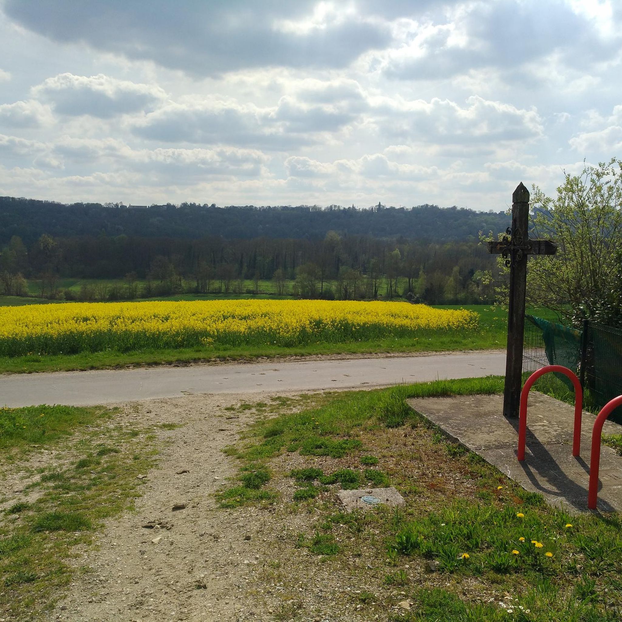
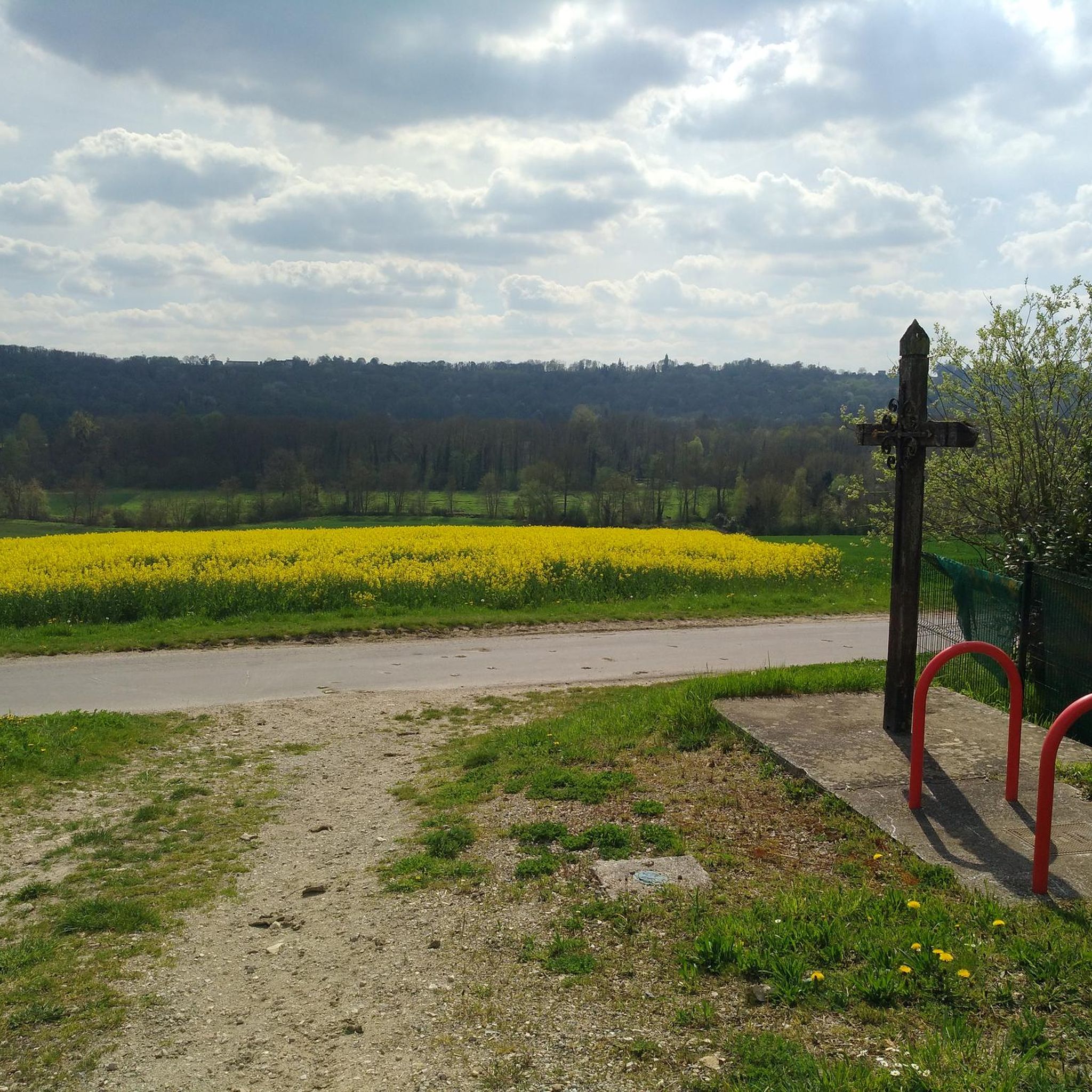
Located on a high point, lovely view guaranteed
1
0

This church is distinguished by its location at the top of the Butte de Doue. In addition to offering beautiful views, this place of particular geological interest allows you to learn about the sedimentary layers of the region.
0
0

Small village where is found aa house of Pierre Mac Orlan, French writer born on February 26, 1882 in Péronne and died on June 27, 1970 right here in Saint-Cyr-sur-Morin.
0
0
Frequently Asked Questions
How many hiking trails are there in Saint-Cyr-Sur-Morin?
There are over 80 hiking routes available around Saint-Cyr-Sur-Morin, offering a wide variety of distances and difficulty levels to explore the region's rural landscapes and historical sites.
Are there easy hiking trails suitable for beginners or families?
Yes, Saint-Cyr-Sur-Morin offers 26 easy hiking routes. A good option for a gentle walk is the Hiking loop from Saint-Ouen-sur-Morin, which is 3.5 miles (5.7 km) long with minimal elevation gain, perfect for a relaxed outing.
Where can I find longer, more challenging hikes in the area?
For those seeking a challenge, there are 12 difficult routes around Saint-Cyr-Sur-Morin. The Saint-Cyr-sur-Morin – Côte de Jouarre loop from Saint-Cyr-sur-Morin is a demanding 11.6 miles (18.7 km) path featuring significant elevation changes and expansive views over the Côte de Jouarre.
Are there any circular walks available?
Many of the trails in Saint-Cyr-Sur-Morin are designed as circular routes, allowing you to start and end at the same point. An example is the Jouarre Abbey – The crypts of Jouarre loop from Jouarre, a 6.9 miles (11.0 km) trail that explores historical sites and rural landscapes.
What interesting landmarks or attractions can I see along the hiking trails?
The region is rich in historical sites. You can explore places like the The crypts of Jouarre, the The Templar Commandery, or the Saint-Authaire Church. Many routes incorporate these cultural highlights into their paths.
When is the best time of year to go hiking in Saint-Cyr-Sur-Morin?
The best time to hike in Saint-Cyr-Sur-Morin is typically during spring (April to June) and autumn (September to October) when the weather is mild and the natural scenery is at its most vibrant. Summer can also be pleasant, but it's advisable to start early to avoid the midday heat.
Is hiking possible during winter?
Yes, hiking is generally possible during winter in Saint-Cyr-Sur-Morin, as the region experiences relatively mild winters. However, always check local weather conditions for ice or mud, and ensure you have appropriate gear for colder temperatures.
Are dogs allowed on the hiking trails?
Most hiking trails in the Saint-Cyr-Sur-Morin area are dog-friendly. It is generally expected that dogs are kept on a leash, especially when passing through agricultural areas or near wildlife, and that owners clean up after their pets.
Is parking available near the trailheads?
Parking is generally available in or near the villages and starting points of many trails in Saint-Cyr-Sur-Morin. Look for designated parking areas in towns like Jouarre or Saint-Cyr-sur-Morin itself.
What do other hikers enjoy the most about hiking in Saint-Cyr-Sur-Morin?
The area is highly rated by the komoot community, with an average score of 4.4 stars from over 80 reviews. Hikers often praise the varied terrain, the blend of natural beauty with historical sites, and the well-maintained rural paths that offer a peaceful escape.
Are there any accessible trails for wheelchairs or strollers?
While many trails in Saint-Cyr-Sur-Morin feature rural paths and some elevation changes, which may not be fully accessible, some sections of village paths or riverside promenades might be suitable for strollers. For specific wheelchair-accessible routes, it's best to check individual trail descriptions for surface and gradient details.
Are there any hikes that pass by places to eat or drink?
Many routes in Saint-Cyr-Sur-Morin start or pass through charming villages where you can find local bakeries, cafes, or restaurants. Planning your hike to coincide with a village stop can be a great way to enjoy local refreshments.
Most popular routes around Saint-Cyr-Sur-Morin
Most popular attractions around Saint-Cyr-Sur-Morin

Get inspired with the komoot mobile app


Explore more
Browse the best Hikes in other regions.
