The best cycling routes around Orvillers-Sorel
4.7
(14)
188
riders
72
rides
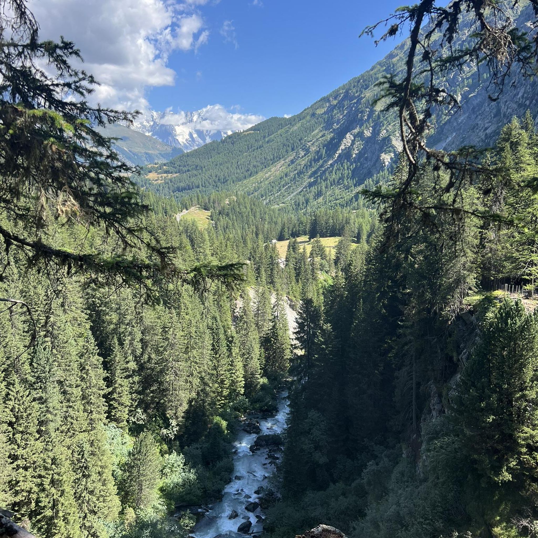
Touring cycling routes around Orvillers-Sorel offer access to a diverse area within the Oise department of the Hauts-de-France region. The landscape features varied terrain, including dense woodlands and green countryside, providing a natural environment for cyclists. Routes often follow river valleys, such as those near the Oise and Seine rivers, and canals like parts of the Canal du Nord, which offer mostly flat, paved surfaces. The region's gentle elevation changes make it suitable for touring cyclists of varying fitness levels.
Best touring cycling routes around Orvillers-Sorel
- The most popular touring cycling route is On the banks of the Oise – Compiègne Town Hall loop from Ressons-sur-Matz, a 36.3 miles (58.4 km) trail that takes 3 hours 28 minutes to complete. This route follows the Oise river and passes historical sites.
- Another top favourite among local touring cyclists is Castle – Château de Boulogne-la-Grasse loop from Orvillers-Sorel, an easy 19.6 miles (31.5 km) path. This route explores historical châteaux and the surrounding green countryside.
- Local touring cyclists also love the Montagne du Paradis – Le lavoir loop from Gury, a 18.8 miles (30.3 km) trail leading through varied terrain with significant elevation, often completed in about 2 hours 52 minutes.
- Touring cycling around Orvillers-Sorel is defined by varied terrain, dense woodlands, and river valleys. The network offers options for different ability levels, from easy rides along canals to more challenging routes with greater elevation.
- The routes in Orvillers-Sorel are highly rated by the komoot community with an average score of 4.9 stars from over 10 reviews. More than 160 touring cyclists have used komoot to explore Orvillers-Sorel's varied terrain.
Last updated: July 5, 2026
4.5
(2)
9
riders
31.5km
01:52
150m
150m
Moderate bike ride. Good fitness required. Mostly paved surfaces. Suitable for all skill levels.
10
riders
59.4km
03:33
390m
390m
Moderate bike ride. Good fitness required. Mostly paved surfaces. Suitable for all skill levels.

Sign up for free
5.0
(1)
6
riders
31.5km
02:55
520m
520m
Hard bike ride. Very good fitness required. You may need to push your bike for some segments of this route.
3
riders
20.8km
01:33
310m
310m
Moderate bike ride. Good fitness required. Mostly paved surfaces. Suitable for all skill levels.
3
riders
Moderate bike ride. Good fitness required. Mostly paved surfaces. Suitable for all skill levels.
Get access to more routes and recommendations from other explorers.
Sign up for free
Already have an account?
Our route recommendations are based on thousands of hikes, rides, and runs completed by other people on komoot.
Start today with a free account
Your next adventure awaits.
Login or Signup


Tips from the Community


Created in 1919, the Méry-la-Bataille national necropolis contains the remains of 1,538 soldiers who died for France during the Battle of Matz in June 1918. Adjacent to the municipal cemetery, it brings together the bodies exhumed from various temporary cemeteries in the Oise, of which 1,286 are buried in individual graves and 254 in two ossuaries. This memorial pays tribute to the soldiers who fell during one of the decisive offensives of the First World War, which helped halt the German advance towards Paris.
0
0


One of the largest bridges in the city of Compiègne owes its construction to Louis XV. An obelisk was erected in the center of the bridge during its reconstruction in 1949.
2
0
The square itself houses a statue of Joan of Arc, a tribute to the city's historical connection to this iconic figure. The Town Hall, with its rich history and stunning architecture, continues to captivate visitors, offering a glimpse into the past while remaining a vibrant part of Compiègne's present.
2
0
The architecture of the town hall is a true feast for the eyes. The central structure is dominated by a tall bell tower, flanked by two turrets connected by a decorative railing. This imposing façade, 47 meters high and 24 meters wide, is decorated with striking Gothic elements such as pinnacles and basket arches. The large niche now houses a high relief depicting the equestrian statue of Louis XII. It is an original creation from 1869 by the sculptor Henri-Alfred Jacquemart in the realistic style so prevalent at the time. However, contrary to the usual appearance of equestrian statues during the reign of Louis XII, Henri-Alfred Jacquemart chose not to build a horse walking "à l'amble," that is, with both straight legs raised simultaneously. On October 12, 1530, a clock was placed on the summit of the bell tower. From that time on, every quarter of an hour, she animated three wooden jaquemarts with bell hammers. The Compiègneis quickly gave them three nicknames corresponding to the enemies of the time: Langlois for the English, Flandrin for the Flemish, and Lansquenet for the Germans. Even today, they chant the life of the city by "punching the time," that is, by striking their hammer to strike the hours.
2
0

Gravel course, excellent condition required
0
0
Frequently Asked Questions
How many touring cycling routes are available around Orvillers-Sorel?
There are over 75 touring cycling routes available around Orvillers-Sorel, catering to various preferences and skill levels. This includes 26 easy routes, 34 moderate routes, and 15 difficult routes.
What kind of terrain can I expect on touring cycling routes near Orvillers-Sorel?
The region around Orvillers-Sorel offers diverse terrain for touring cyclists. You can expect to ride through dense woodlands, green countryside, and along river valleys like the Oise and Seine. Some routes also follow canals, such as parts of the Canal du Nord, which typically provide flatter, paved surfaces. The area features gentle elevation changes, making it suitable for various fitness levels.
What historical sites or landmarks can I explore by touring bike around Orvillers-Sorel?
Touring cycling routes in the area can lead you to a wealth of historical sites. You might encounter abbeys like Ourscamp Abbey or Morienval Abbey, and impressive castles such as the Château de Boulogne-la-Grasse. The broader region also offers access to towns with significant history, like Compiègne with its palace, or Noyon with its cathedral. One route, Castle – Château de Boulogne-la-Grasse loop from Orvillers-Sorel, specifically explores historical châteaux.
Are there any circular touring cycling routes available?
Yes, many touring cycling routes around Orvillers-Sorel are designed as loops. For example, the On the banks of the Oise – Compiègne Town Hall loop from Ressons-sur-Matz is a popular circular route that follows the Oise river. Another option is the Montagne du Paradis – Le lavoir loop from Gury, which offers varied terrain and significant elevation.
What do other cyclists say about touring cycling in Orvillers-Sorel?
The touring cycling routes around Orvillers-Sorel are highly rated by the komoot community, with an average score of 4.9 stars from over 12 reviews. More than 160 touring cyclists have used komoot to explore the area, often praising the varied terrain, dense woodlands, and river valleys that define the network of routes.
Are there any easy touring cycling routes suitable for beginners or families?
Yes, there are 26 easy touring cycling routes around Orvillers-Sorel. These often follow flatter sections along canals or through the green countryside. An example of an easy path is the Castle – Château de Boulogne-la-Grasse loop from Orvillers-Sorel, which is 19.6 miles (31.5 km) long and explores historical châteaux.
What is the best time of year for touring cycling in Orvillers-Sorel?
The region's green landscapes and diverse terrain are enjoyable throughout much of the year. Spring and autumn generally offer pleasant temperatures and beautiful scenery, with fewer crowds. Summer is also suitable, though it can be warmer. The varied terrain, including woodlands, provides shade on hotter days, while river valleys offer refreshing rides.
Are there any specific natural features or viewpoints along the routes?
While specific viewpoints are not detailed for every route, the region is rich in natural beauty. You can expect to cycle through dense woodlands, such as those found in areas like the Forêt de l'Hautil, which feature springs, wetlands, and forest ponds. Routes along the Oise and Seine rivers can also offer panoramic views, especially near their confluence.
Where can I find parking for touring cycling routes near Orvillers-Sorel?
While specific parking locations for each route are not detailed here, many routes start from towns or villages like Orvillers-Sorel, Ressons-sur-Matz, Gury, or Mareuil-la-Motte. These locations typically offer public parking facilities suitable for accessing the cycling trails. It is advisable to check local parking options in your chosen starting point.
Can I reach the touring cycling routes using public transport with my bike?
The Oise department and Hauts-de-France region generally have public transport options, including regional trains, that may allow bike carriage. However, specific details regarding bike transport to Orvillers-Sorel or individual route starting points would require checking the local public transport provider's website, such as SNCF for train services, for their current policies and schedules.
Are there any challenging touring cycling routes with significant elevation?
Yes, for more experienced touring cyclists, there are 15 difficult routes available. An example is the Montagne du Paradis – Le lavoir loop from Gury, which is 18.8 miles (30.3 km) long and features significant elevation changes. Another challenging option is the Montagne du Paradis – Le lavoir loop from Conchy-les-Pots, which covers 57.1 miles (91.9 km) with over 800 meters of ascent.
Are there any cafes or places to stop for refreshments along the touring cycling routes?
While specific cafes are not listed for every route, many touring cycling routes pass through or near charming towns and villages in the Oise department. These settlements, such as Compiègne, Noyon, or Senlis, offer various amenities including cafes, restaurants, and bakeries where you can stop for refreshments. It's a good idea to plan your route and check for services in the towns you'll pass through.
Most popular routes around Orvillers-Sorel
Most popular attractions around Orvillers-Sorel

Get inspired with the komoot mobile app


Explore more
Browse the best Cycling routes in other regions.
