The best running trails around Savières
4.7
(10)
586
runners
23
runs
Jogging routes Savières are primarily defined by the serene Canal de Savières, offering flat and picturesque paths ideal for running. This region, situated near Lake Bourget, features gentle terrain with minimal elevation changes, making it suitable for various fitness levels. Runners can enjoy routes along the canal banks, which often connect to broader networks and provide views of the surrounding natural landscape. The area's natural features include waterways and open countryside, providing a calm environment for outdoor activity.
Best jogging…
Last updated: July 5, 2026
3.0
(1)
16
runners
5.08km
00:34
20m
20m
Moderate run. Good fitness required. Mostly paved surfaces. Suitable for all skill levels.
16
runners
9.95km
01:06
10m
10m
Moderate run. Good fitness required. Mostly paved surfaces. Suitable for all skill levels.

Sign up for free
8
runners
8.54km
00:55
20m
20m
Moderate run. Good fitness required. Mostly paved surfaces. Suitable for all skill levels.
3
runners
5.85km
00:37
20m
20m
Moderate run. Good fitness required. Mostly paved surfaces. Suitable for all skill levels.
3
runners
5.13km
00:32
10m
10m
Moderate run. Good fitness required. Mostly paved surfaces. Suitable for all skill levels.
Get access to more routes and recommendations from other explorers.
Sign up for free
Already have an account?
Our route recommendations are based on thousands of hikes, rides, and runs completed by other people on komoot.
Start today with a free account
Your next adventure awaits.
Login or Signup
Tips from the Community

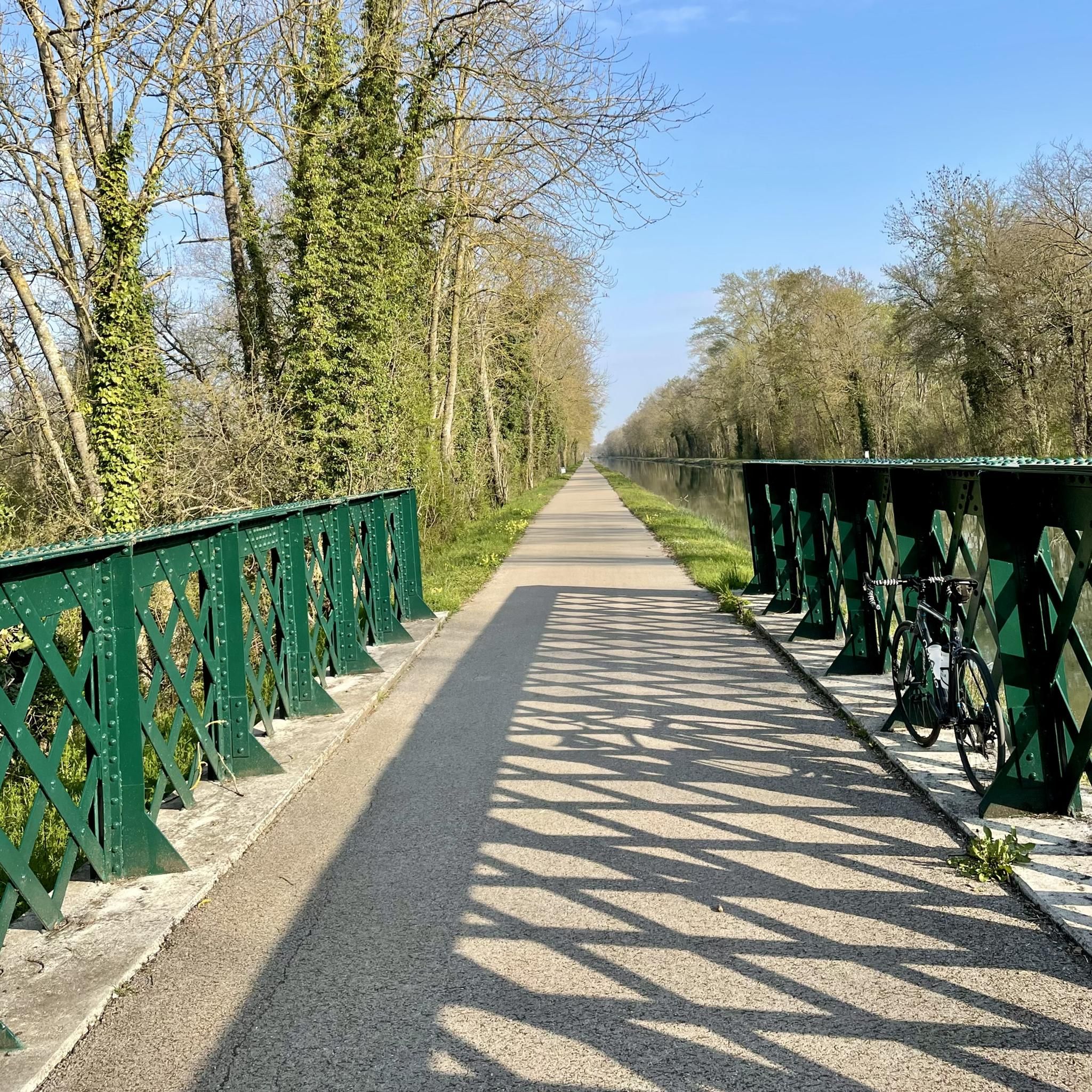
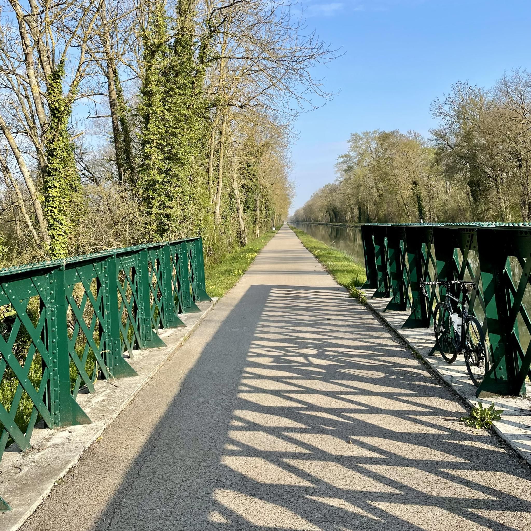
A "chemin de halage", in German "treidelpfad", which runs alongside the waterway right next to the bed of the river or canal, was an indispensable part of the transport infrastructure in earlier times. Before ships could move using motor power, horses ran along the bank and pulled the ship against the current. This was called "treideln", and this is how the "treidelpfads" got their name, which has been passed down to this day. Where these paths directly on the bank have been preserved, they are often used by hikers and cyclists.
0
0

do not hesitate to return to the main road then onto the canal at each crossing
0
0

This path, which was used to tow barges from the shore, offers a variety of landscapes, from forests to fields. The path is largely flat and easy to follow, and you can enjoy views of the river and surrounding countryside.
3
0
Frequently Asked Questions
How many running routes are available in Savières?
There are over 20 running routes available around Savières, offering a variety of options for different preferences and fitness levels. Most of these routes are rated as moderate, with a few easy and difficult options.
What kind of terrain can I expect on jogging routes in Savières?
Jogging routes in Savières are primarily characterized by flat and gentle terrain, especially along the serene Canal de Savières. This makes them suitable for various fitness levels, with minimal elevation changes. You'll find well-maintained paths ideal for running.
Are there any family-friendly running routes in Savières?
While specific 'family-friendly' routes aren't explicitly categorized, the generally flat and gentle terrain along the Canal de Savières makes many paths suitable for families. Routes with minimal elevation and scenic views, such as the Running loop from Saint-Mesmin, could be good options for a family outing.
Can I bring my dog on the running trails in Savières?
The natural environment of Savières, particularly along the Canal de Savières, is generally welcoming for dogs. However, it's always recommended to keep dogs on a leash and be mindful of local regulations and other trail users. The open countryside and canal banks provide ample space for you and your canine companion.
Are there circular running routes available in Savières?
Yes, Savières offers several circular running routes. A popular choice is the Running loop from Saint-Mesmin, which is 3.2 miles (5.1 km) long. Another option is the Château de Payns loop from Payns, a 5.3 miles (8.5 km) trail.
Where can I park when going for a run in Savières?
While specific parking locations for each route are not detailed, the presence of charming villages like Chanaz and the general accessibility of the Canal de Savières suggest that parking is available in or near these areas. It's advisable to check local signage upon arrival.
What natural features or landmarks can I see while jogging in Savières?
While jogging in Savières, you can enjoy the serene beauty of the Canal de Savières itself, known for its clear waters. The canal connects to Lake Bourget, offering stunning backdrops of the snow-capped Alps. You might also pass by the charming village of Chanaz. For specific points of interest, consider exploring the Towpath or the Upper Seine Canal.
What do other runners say about the routes in Savières?
The running routes in Savières are highly rated by the komoot community, with an average score of 4.7 stars from 7 reviews. Over 400 runners have used komoot to explore the area, often praising the tranquil canal paths, open countryside, and gentle terrain that define the jogging experience here.
Are there any longer running routes for more experienced runners?
Yes, for those looking for a longer run, the Towpath loop from Payns is a great option. This moderate route spans 7.3 miles (11.8 km) and follows a scenic towpath, providing flat terrain ideal for extended runs.
Are there any cafes or refreshment stops along the running routes?
While specific cafes directly on every route are not guaranteed, the charming village of Chanaz, located on the banks of the Canal de Savières, offers a pleasant destination where you might find refreshment options. Additionally, the Café de l'Écluse No. 8 is a highlight in the area.
What is the best time of year to go jogging in Savières?
Savières offers a pleasant environment for jogging throughout much of the year. The natural beauty of the Canal de Savières and Lake Bourget can be enjoyed in various seasons. Spring and autumn typically offer mild temperatures, while summer provides longer daylight hours. Winter jogging is also possible, with the snow-capped Alps providing a stunning backdrop.
Are there routes suitable for beginner runners in Savières?
Yes, the gentle terrain and minimal elevation changes along the Canal de Savières make it an excellent location for beginner runners. Many of the paths are flat and scenic, providing an accessible and enjoyable introduction to jogging. The Running loop from Savières is a moderate 5.1 km route that could be a good starting point.
Most popular attractions around Savières

Get inspired with the komoot mobile app


Explore more
Browse the best Running Trails & Routes in other regions.
