The best walks and hikes around Mont-Sur-Meurthe
4.3
(154)
913
hikers
121
hikes
Hiking around Mont-Sur-Meurthe offers diverse landscapes within the Meurthe-et-Moselle department of France. The region features expansive forests, such as the Forêt Domaniale de Mondon, and the Meurthe River, which is integrated into several hiking circuits. Varied terrain includes wooded valleys, agricultural plateaus, and proximity to the Lorraine Regional Nature Park. This area provides a network of trails suitable for exploring its natural environment.
Best hiking trails in Mont-sur-Meurthe
- The most popular hiking route is Forêt de Vitrimont loop from Blainville-sur-l'Eau…
Last updated: October 9, 2026
5
hikers
12.0km
03:10
110m
110m
Moderate hike. Good fitness required. Easily-accessible paths. Suitable for all skill levels.
4.0
(1)
7
hikers
12.4km
03:16
110m
110m
Moderate hike. Good fitness required. Easily-accessible paths. Suitable for all skill levels.

4.7
(3)
9
hikers
8.63km
02:15
60m
60m
Moderate hike. Good fitness required. Easily-accessible paths. Suitable for all skill levels.
4.0
(2)
6
hikers
9.31km
02:29
100m
100m
Moderate hike. Good fitness required. Easily-accessible paths. Suitable for all skill levels.
3.0
(2)
2
hikers
9.57km
02:34
110m
110m
Moderate hike. Good fitness required. Easily-accessible paths. Suitable for all skill levels.
Get access to more routes and recommendations from other explorers.
Already have an account?
Our route recommendations are based on thousands of hikes, rides, and runs completed by other people on komoot.
Start today with a free account
Your next adventure awaits.



Tips from the Community

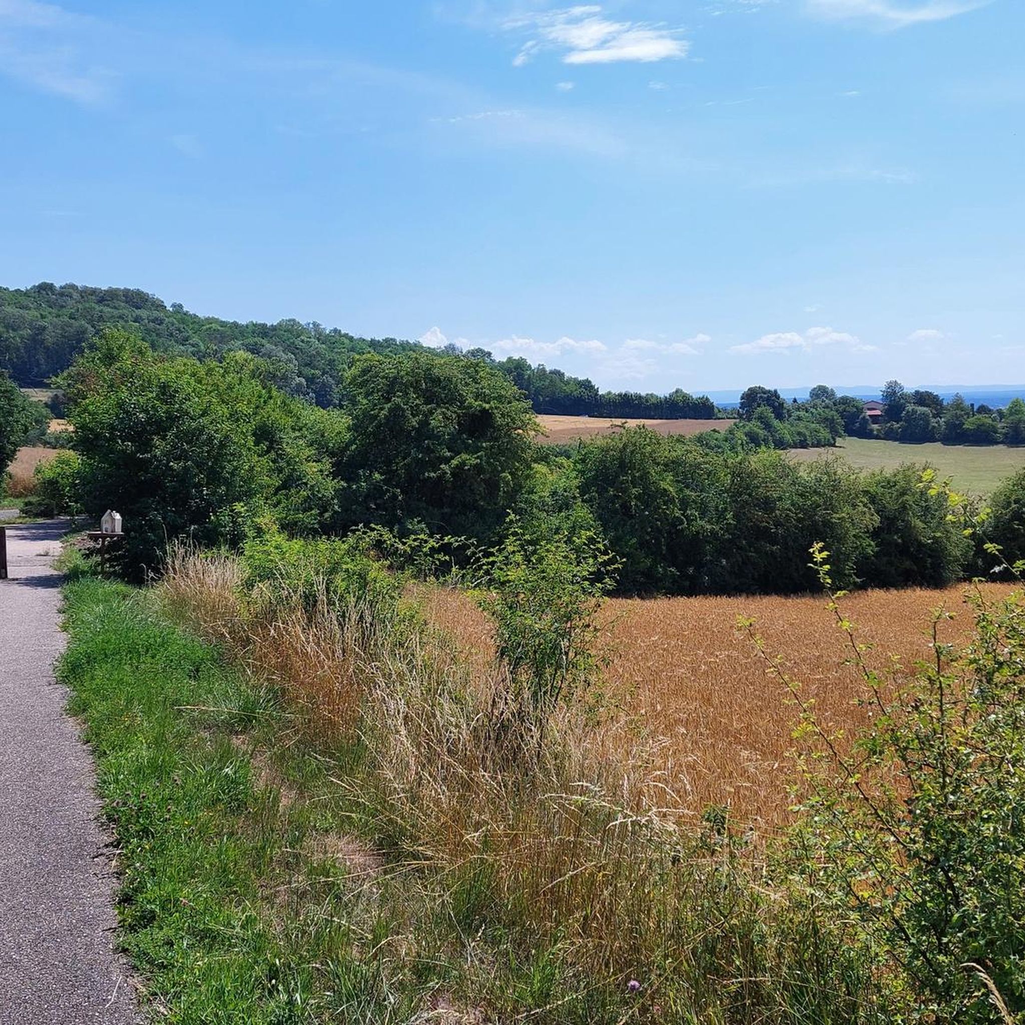
This beautiful forest constitutes more than half of the village of Vitrimont. It's a great place to walk around if you're looking for peace and solitude.
3
0
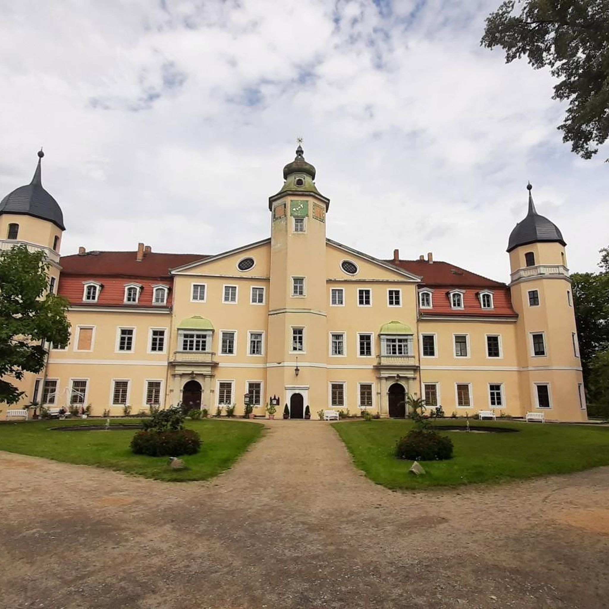
This castle is now a 4-star luxury hotel. A feast for the eyes during your visit or perhaps you will stop?
4
1

Very nice forest with numerous deciduous trees, many quite large gravel and dirt paths. Worth a ride if you are in the area and want a shadowy ride when it's sunny :) Sorry for the only photo I took on my way (a noticeable oak tree). I should have taken a couple more.
2
0
Frequently Asked Questions
What kind of terrain can I expect on hiking trails around Mont-sur-Meurthe?
The region offers a diverse landscape, from expansive forests like the Forêt Domaniale de Mondon to paths along the Meurthe River. You'll find varied terrain including wooded valleys, agricultural plateaus, and areas within the Lorraine Regional Nature Park, which features wetlands and ponds. Trails range from relatively flat to those with moderate elevation changes.
How many hiking routes are available in the Mont-sur-Meurthe area?
There are over 110 hiking routes available around Mont-sur-Meurthe. These include a mix of easy strolls and more challenging treks, ensuring options for various fitness levels.
Are there any family-friendly hiking options in Mont-sur-Meurthe?
Yes, Mont-sur-Meurthe offers many easy trails suitable for families. For instance, the Forêt de Vitrimont loop from Blainville-sur-l'Eau is an easy 5.1 km (3.2 miles) route through the forest, perfect for a family outing.
Can I bring my dog on the hiking trails?
Many trails in the Mont-sur-Meurthe area are suitable for dogs, especially those through forests and along river paths. It's always recommended to keep your dog on a leash and follow local regulations regarding pet access in natural areas, particularly within the Lorraine Regional Nature Park.
What are the best times of year to go hiking in Mont-sur-Meurthe?
The region is enjoyable for hiking throughout much of the year. Spring and autumn offer pleasant temperatures and beautiful scenery, with vibrant foliage or blooming wildflowers. Summer provides shaded paths in the extensive forests, while winter can offer unique, crisp views, though some trails might be muddy or require appropriate gear.
Are there any circular hiking routes available?
Yes, many routes in the area are circular. For example, the Hiking loop from Mont-sur-Meurthe is a 11.3 km (7.0 miles) circular trail that takes you through local landscapes. Another option is the Hiking loop from Blainville-sur-l'Eau, a moderate 11.8 km (7.3 miles) path with varied terrain.
What natural features or landmarks can I see while hiking?
Hikers can explore expansive forests like the Forêt Domaniale de Mondon and follow the Meurthe River. The region is also close to the Lorraine Regional Nature Park, offering diverse ecosystems. For panoramic views, consider visiting Panoramic View from Léomont Hill. You can also find historical routes that integrate remnants of the First World War into the natural scenery around Léomont.
What do other hikers say about the trails in Mont-sur-Meurthe?
The hiking routes in Mont-sur-Meurthe are highly rated by the komoot community, with an average score of 4.3 stars from over 120 reviews. Hikers often praise the varied terrain, the peaceful forest paths, and the well-integrated river crossings.
Are there any historical sites or cultural attractions near the hiking trails?
Yes, the area has historical significance. You can visit Lunéville Castle, a grand 18th-century château. Some routes, particularly around Léomont, also pass by sites related to the First World War. Additionally, the region features emblematic local farms and charming villages.
Where can I find parking for the hiking trailheads?
Many trailheads in and around Mont-sur-Meurthe, including those starting from villages like Blainville-sur-l'Eau, typically offer designated parking areas. It's advisable to check specific route details on komoot for precise parking information at the starting points.
Are there any challenging long-distance hikes in the area?
While many routes are easy to moderate, the broader network of trails in Meurthe-et-Moselle, including segments of the Tour du Grand Nancy, offers opportunities for longer and more challenging treks. The region has one difficult route out of 114, indicating options for experienced hikers seeking a greater challenge.
Can I access the hiking trails using public transport?
Information on specific public transport access to every trailhead can vary. However, Mont-sur-Meurthe and surrounding villages are generally connected by local transport networks. For detailed information on public transport options to specific starting points, it's best to consult local transport schedules or tourist information resources.
Most popular routes around Mont-Sur-Meurthe
Most popular attractions around Mont-Sur-Meurthe

Get inspired with the komoot mobile app


Explore more
Browse the best Hikes in other regions.
