The best cycling routes around Gijounet
4.8
(4)
104
riders
27
rides
Touring cycling around Gijounet features routes through a landscape characterized by hills, lakes, and mountain passes. The terrain includes varied elevations, with routes often incorporating climbs to cols and descents around water bodies. This region offers a mix of challenging ascents and more moderate paths, suitable for different cycling preferences.
Best touring cycling routes around Gijounet
- The most popular touring cycling route is Nages – Lac du Laouzas loop from Montaigut, a 35.9 miles (57.8 km) trail that takes…
Last updated: July 8, 2026
5.0
(1)
16
riders
21.6km
01:45
420m
420m
Moderate bike ride. Good fitness required. Mostly paved surfaces. Suitable for all skill levels.
5.0
(1)
11
riders
Hard bike ride. Very good fitness required. Mostly paved surfaces. Suitable for all skill levels.

Sign up for free
5.0
(1)
16
riders
48.7km
03:07
620m
620m
Hard bike ride. Very good fitness required. Mostly paved surfaces. Suitable for all skill levels.
13
riders
47.4km
03:21
860m
860m
Hard bike ride. Very good fitness required. Mostly paved surfaces. Suitable for all skill levels.
5
riders
28.1km
01:58
530m
530m
Hard bike ride. Very good fitness required. Mostly paved surfaces. Suitable for all skill levels.
Get access to more routes and recommendations from other explorers.
Sign up for free
Already have an account?
Our route recommendations are based on thousands of hikes, rides, and runs completed by other people on komoot.
Start today with a free account
Your next adventure awaits.
Login or Signup
Tips from the Community

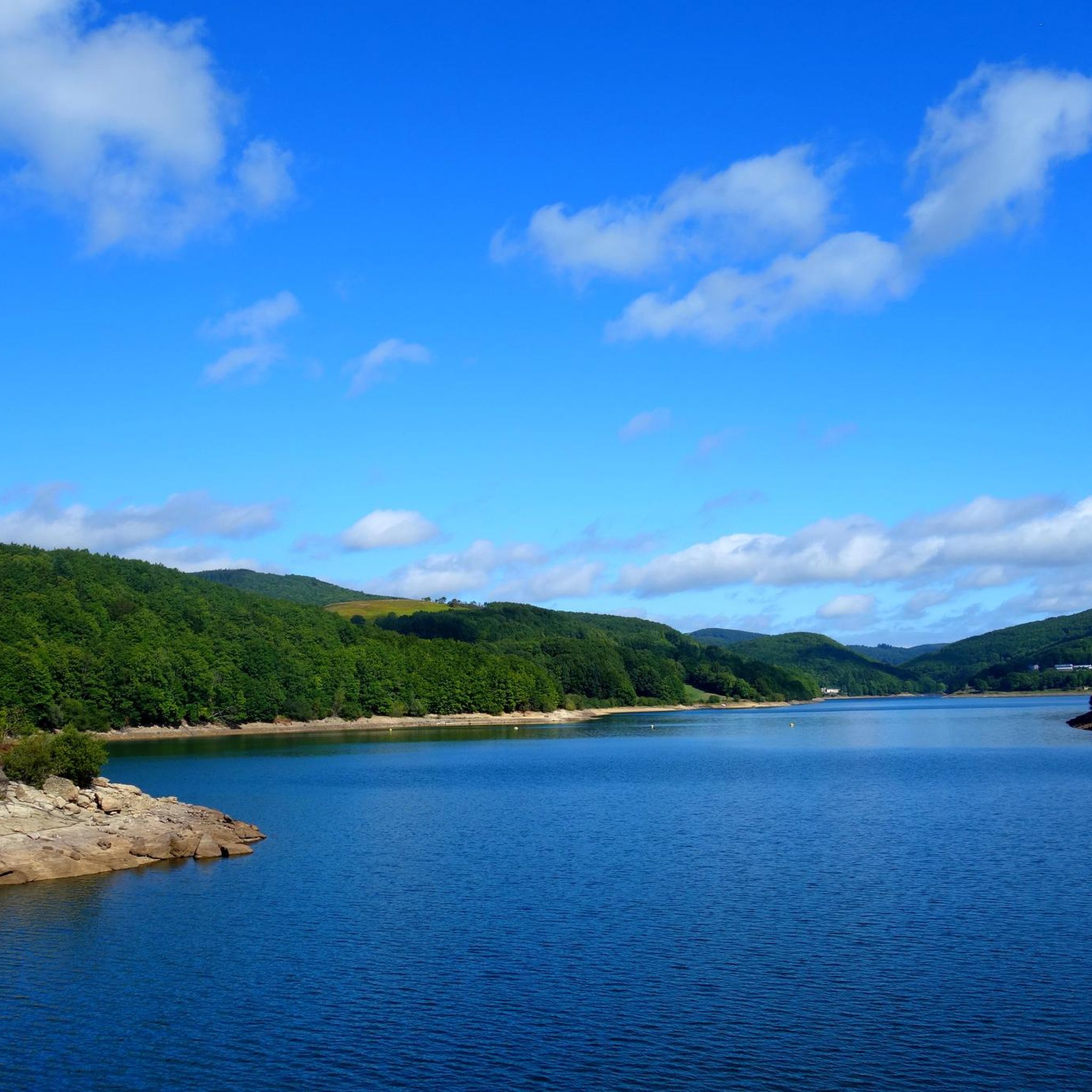
The lake is located at an altitude of 790 m, in the Lacaune mountains in the Occitanie region. It is fed by the Vèbre river, which is a tributary of the Agout, as well as its right bank tributaries, including the Viau, and the streams of Rieufrech, Ramières and Pradas. Different villages border the lake: Rieumontagné, Villelongue, Naujac and Peyroux.
0
0

One of the 3 magnificent lakes in the South-East of Tarn. Although artificial, it catches the eye with its wild appearance. Worth seeing on sunny days or to escape the heatwave
0
0


Very large and well-preserved menhir from the Neolithic period
0
0

This tiny village is located on the Santiago trail. Besides the peaceful setting, you might encounter a few pilgrims.
0
0
Ideally located one kilometer from Lake Laouzas, this small village offers beautiful views of the surrounding countryside. You will find on site, in an old farm, the museum of peasant life.
0
0


Located at an altitude of 800 meters in the heart of the Lacaune mountains, this pretty little lake is in the center of a wooded environment. For hiking enthusiasts, a 21-kilometer trail goes all the way around it in a Canadian atmosphere.
0
0
Frequently Asked Questions
How many touring cycling routes are available around Gijounet?
There are over 25 touring cycling routes around Gijounet, offering a diverse range of experiences through hills, lakes, and mountain passes. These routes cater to various skill levels, from moderate to difficult.
Are there easy touring cycling routes suitable for beginners in Gijounet?
While Gijounet is known for its challenging terrain, there is at least one easy touring cycling route available. Most routes feature varied elevations, including climbs to cols and descents around water bodies, making them generally more suited for cyclists with some experience.
What options are there for experienced touring cyclists seeking a challenge?
Experienced touring cyclists will find plenty of challenging routes in Gijounet, with 19 routes rated as difficult. For instance, the Montalet Peak – Lake Laouzas loop from Lacaune is a demanding 47.4 km path with significant elevation changes, offering a rewarding experience.
Are there any circular touring cycling routes in the Gijounet area?
Yes, many of the touring cycling routes around Gijounet are circular, allowing you to start and end at the same point. A popular example is the Nages – Lac du Laouzas loop from Montaigut, which is 57.8 km long and features significant elevation changes around the lake.
What kind of terrain can I expect on touring cycling routes around Gijounet?
The terrain around Gijounet is characterized by hills, scenic lakes, and mountain passes. You can expect varied elevations, with routes often incorporating challenging climbs to cols and enjoyable descents, offering a mix of paved roads and sometimes quieter country lanes.
What are some scenic viewpoints or natural attractions along the touring cycling routes?
The region offers beautiful natural scenery, particularly around its lakes and mountain peaks. You can enjoy views of Montalet Peak and the serene Lac du Laouzas. The routes often pass through picturesque landscapes, providing many opportunities for scenic stops.
Are there any historical points of interest accessible by touring bike?
While the primary focus is on natural landscapes, the region has charming towns and villages. For example, the town of Lacaune, often a starting point for routes like the Lac du Laouzas – Lake Laouzas loop from Lacaune, offers local history and amenities. You might also encounter historical structures like the Old Bridge of Brassac.
What do other touring cyclists enjoy most about cycling in Gijounet?
The touring cycling routes in Gijounet are highly rated by the komoot community, with an average score of 4.8 stars. Cyclists often praise the challenging ascents, the beautiful lake views, and the varied hilly terrain that makes for an engaging ride.
Is there public transport available to reach the starting points of touring cycling routes?
Public transport options directly to the specific starting points of all touring cycling routes in Gijounet may be limited due to the rural nature of the region. It is generally recommended to travel by car to reach the main towns like Lacaune or Montaigut, which serve as common starting points.
Where can I find parking for touring cycling routes in Gijounet?
Parking is typically available in the villages and towns that serve as starting points for the routes, such as Lacaune or Pintou. Look for designated parking areas within these communities, which are usually well-suited for leaving your vehicle while you cycle.
Are there any family-friendly touring cycling paths in the area?
Given the prevalence of hills and mountain passes, many routes around Gijounet are more suited for experienced cyclists. However, families might find shorter, less strenuous sections or local roads within villages that are more manageable. Always check the route's difficulty and elevation profile before setting out with children.
What is a good moderate touring cycling route to try?
For a moderate challenge, consider the Col de la Bassine – Picotalen Pass loop from Pintou. This 23.7 km route leads through mountain passes and offers a good balance of effort and scenic beauty, typically completed in about 2 hours 15 minutes.
Are there any routes that feature multiple mountain passes?
Yes, the region is known for its mountain passes. The Col de la Bassine – Lacaune loop from Lacaune is a challenging 33.9 km route that includes the Col de la Bassine, offering a good test of climbing ability and rewarding views.
Most popular attractions around Gijounet

Get inspired with the komoot mobile app


Explore more
Browse the best Cycling routes in other regions.
