The best running trails in the Amargosa Range
5.0
(1)
94
runners
9
runs
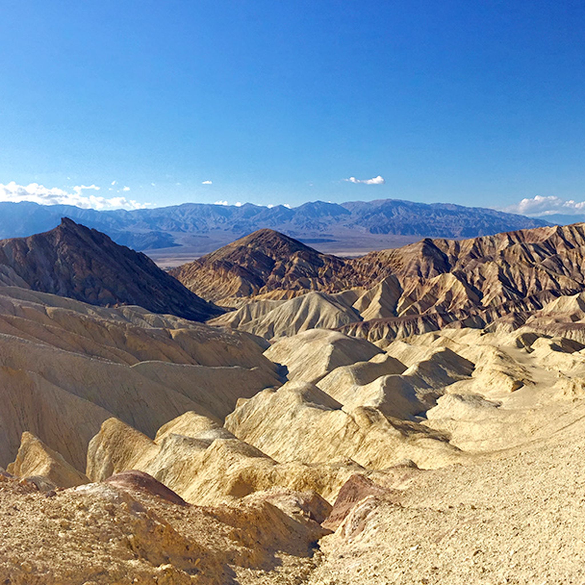
Jogging routes in the Amargosa Range traverse a challenging desert landscape characterized by rugged mountains, deep canyons, and unique geological formations. The region includes distinct mountain groups such as the Grapevine, Funeral, and Black Mountains, offering varied elevations. Runners can explore areas close to Death Valley, featuring colorful badlands and dramatic desert scenery. The Amargosa River also creates rare riparian areas and oases, providing a contrast to the arid surroundings.
Best jogging routes in the Amargosa Range
- The most popular…
Last updated: June 23, 2026
17
runners
4.76km
00:39
160m
160m
Moderate run. Good fitness required. Mostly paved surfaces. Suitable for all skill levels.
4
runners
10.6km
01:15
260m
260m
Moderate run. Good fitness required. Mostly paved surfaces. Suitable for all skill levels.

Sign up for free
3
runners
6.02km
00:51
240m
240m
Moderate run. Good fitness required. Mostly paved surfaces. Suitable for all skill levels.
11.9km
01:19
40m
40m
Moderate run. Good fitness required. Mostly paved surfaces. Suitable for all skill levels.
25
runners
Moderate run. Good fitness required. Mostly paved surfaces. Suitable for all skill levels.
25
runners
9.16km
00:57
50m
50m
Moderate run. Good fitness required. Mostly paved surfaces. Suitable for all skill levels.
7
runners
6.49km
00:41
60m
60m
Moderate run. Good fitness required. Mostly paved surfaces. Suitable for all skill levels.
5.0
(1)
7
runners
5.81km
00:37
20m
20m
Moderate run. Good fitness required. Mostly paved surfaces. Suitable for all skill levels.
Our route recommendations are based on thousands of hikes, rides, and runs completed by other people on komoot.
Start today with a free account
Your next adventure awaits.
Login or Signup
Popular around Amargosa Range
Tips from the Community

Harmony Borax Works and the famous Twenty mule teams brought the desert of Death Valley to homes across America. After borax was discovered near Furnace Creek Ranch (then called Greenland) in 1881, William T. Coleman built the Harmony Works and began processing the ore in late 1883 or early 1884. When fully operational, the Harmony Borax Works employed 40 men, producing three tons of borax daily. The little evidence that remains indicates that the majority of this workforce were Chinese laborers. The Chinese workers collected the impure mineral fragments from the valley floor and loaded them into horse-drawn wagons for transport to the borax works.
4
0

a beautiful facility or accommodation to enjoy Death Valley
1
0

Furnace Creek Visitor Center offers information to visitors about the Death Valley and the small community of Furnace Creek. Here you can find water fountains, bathrooms, food services and small exhibitions about the ecosystem and the village.
0
0

The Golden Canyon Trail is a popular path that leads to Red Cathedral. The path is lined with beautiful, colorful rock formations.
0
0

The Red Cathedral is a crimson cliff that stands out 183 meters above and behind the yellow and brown slopes and walls of the Golden Canyon. The origin of the name comes from the red rocks that have eroded into pillars in some places
0
0
The Ibex Dunes are a beautiful but remote dunes in Death Valley National Park. The dunes are formed at the southern end of part of the dry Amargosa River Valley.
0
0
Zabriskie Point is one of the most popular spots in Death Valley National Park. It can be reached by several trails, including the Zabriskie Point Trial, which is not too challenging. The viewpoint gives you a perfect view of the Furnace Creek formation, which is emblematic of the park.
0
0

Gower Gulch Trail leads to a maze of golden colored hills and winding narrow canyons. The Gower Gulch is about 1.5 miles one-way. The most popular routes like the Badlands Loop and Golden Canyon can be combined with one another for longer adventures. There is no water and the canyon can be very hot during to summer months.
0
0
Frequently Asked Questions
How many running routes are available in the Amargosa Range?
There are over 9 dedicated jogging routes in the Amargosa Range featured in this guide. These routes traverse a challenging desert landscape, offering a variety of experiences for runners.
What kind of terrain can I expect on jogging routes in the Amargosa Range?
Jogging routes in the Amargosa Range feature diverse terrain, from relatively flat canyon floors to paths with moderate elevation changes. You'll encounter rugged mountains, deep canyons, and unique geological formations. For example, the Golden Canyon, Gower Gulch and Badlands Loop combines colorful rock formations with varied desert terrain.
Are there any easy or beginner-friendly running routes in the Amargosa Range?
While all routes in this guide are rated as moderate due to the desert environment, some offer less extreme elevation changes. For a unique desert running experience with relatively mild elevation, consider Ibex Dunes Road, which takes you through a landscape of sand dunes.
What is the best time of year to go jogging in the Amargosa Range?
The best times for jogging in the Amargosa Range are during the milder spring (March to May) and fall (September to November). Summers are extremely hot, with temperatures often reaching 100 to 120 degrees Fahrenheit, making outdoor activities dangerous. Always prioritize hydration and sun protection due to the arid climate.
Can I find routes with scenic viewpoints or natural landmarks?
Absolutely! The Amargosa Range is rich in dramatic desert landscapes and unique geological features. Many routes offer stunning views and pass by notable landmarks. For instance, the Golden Canyon Trail to Red Cathedral leads through a narrow canyon with striking red rock formations. You can also find panoramic views from points like Dante's View, which overlooks Death Valley.
Are there any loop running trails in the Amargosa Range?
Yes, several routes offer a loop experience. A popular option is the Golden Canyon, Gower Gulch and Badlands Loop, which allows you to explore varied terrain and colorful rock formations in a circular fashion.
What are some of the longer running routes available?
For a longer run, the Ibex Dunes Road is a moderate 7.4 miles (11.9 km) path. Another option is the Golden Canyon, Gower Gulch and Badlands Loop, which covers 6.6 miles (10.6 km).
Are the jogging routes in the Amargosa Range suitable for families?
The Amargosa Range offers varied terrain, and some trails might be suitable for families depending on their fitness levels and preparedness for a desert environment. While specific 'family-friendly' ratings aren't provided for these jogging routes, trails with milder grades and hard-packed surfaces, such as parts of the Amargosa Canyon Trail (not in this guide, but mentioned in research), could be considered. Always check route details for distance and elevation before heading out with children.
What kind of wildlife might I see while jogging in the Amargosa Range?
While jogging, you might spot unique desert wildlife. Areas along the Amargosa River, though not directly featured in these routes, are known for supporting unique plant and animal life, including endemic species and migratory birds. Always observe wildlife from a respectful distance.
Are there any routes that feature water or greenery?
The Amargosa Range is primarily arid, but the Amargosa River creates rare riparian areas and oases within the Mojave Desert. These areas, particularly in Amargosa Canyon, offer dense greenery and even small waterfalls, providing a stark contrast to the arid surroundings. While the routes in this guide focus on the more typical desert landscape, these oases exist within the broader region.
What should I consider regarding parking or access for these trails?
Access to trails in the Amargosa Range often involves driving to trailheads, many of which are within or near Death Valley National Park. Parking availability can vary by trailhead. It's always advisable to check specific park regulations and trailhead information before your visit, especially concerning permits or fees if applicable to certain areas.
What are the typical elevations and difficulty levels of these running routes?
The running routes in this guide are generally rated as 'moderate' difficulty. Elevation gains vary; for example, Golden Canyon Trail to Red Cathedral has an elevation gain of about 160 meters, while Desolation Canyon Trail features around 237 meters of ascent. These routes offer a good balance of challenge and scenic reward.
What do other runners enjoy the most about jogging in the Amargosa Range?
Runners using komoot to explore the Amargosa Range often praise the dramatic desert canyons, rugged mountain backdrops, and the unique experience of running through such a distinct landscape. The variety of terrain, from canyon floor paths to routes with moderate elevation changes, is also highly appreciated, offering options for different ability levels.
Most popular routes in the Amargosa Range
Most popular attractions in the Amargosa Range

Get inspired with the komoot mobile app


Explore more
Browse the best Running Trails & Routes in other regions.
