The best walks and hikes around Le Poinçonnet
4.5
(92)
638
hikers
36
hikes
Hiking around Le Poinçonnet offers access to a significant natural heritage, primarily centered around the Forêt Domaniale de Châteauroux. This expansive state forest, covering thousands of hectares, provides a diverse ecosystem with ancient trees and varied flora and fauna. The terrain features numerous trails and forest roads, offering a range of experiences from gentle walks to more challenging paths with elevation changes. The region's landscape is characterized by its dense woodlands and peaceful natural environment.
Best hiking trails around Le…
Last updated: June 25, 2026
4.5
(2)
10
hikers
4.42km
01:08
20m
20m
Easy hike. Great for any fitness level. Easily-accessible paths. Suitable for all skill levels.
4.5
(2)
7
hikers
12.5km
03:12
40m
40m
Moderate hike. Good fitness required. Easily-accessible paths. Suitable for all skill levels.

Sign up for free
5.0
(2)
6
hikers
Easy hike. Great for any fitness level. Easily-accessible paths. Suitable for all skill levels.
5.0
(1)
7
hikers
Easy hike. Great for any fitness level. Easily-accessible paths. Suitable for all skill levels.
4
hikers
3.17km
00:49
10m
10m
Easy hike. Great for any fitness level. Easily-accessible paths. Suitable for all skill levels.
Get access to more routes and recommendations from other explorers.
Sign up for free
Already have an account?
Our route recommendations are based on thousands of hikes, rides, and runs completed by other people on komoot.
Start today with a free account
Your next adventure awaits.
Login or Signup
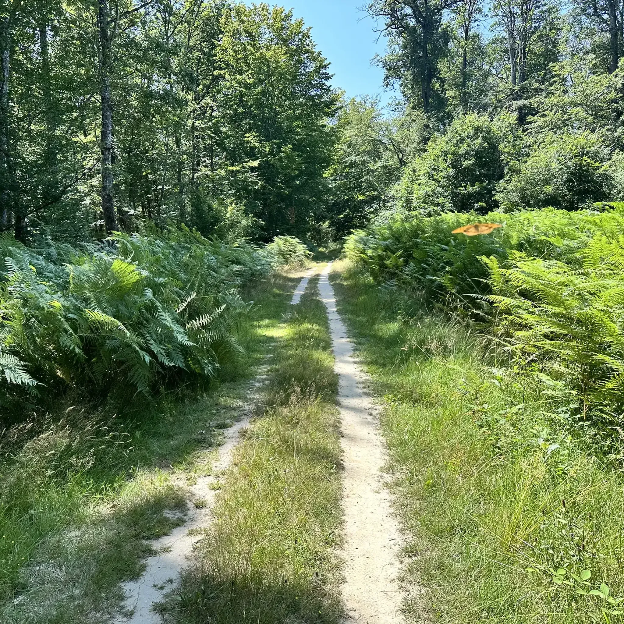
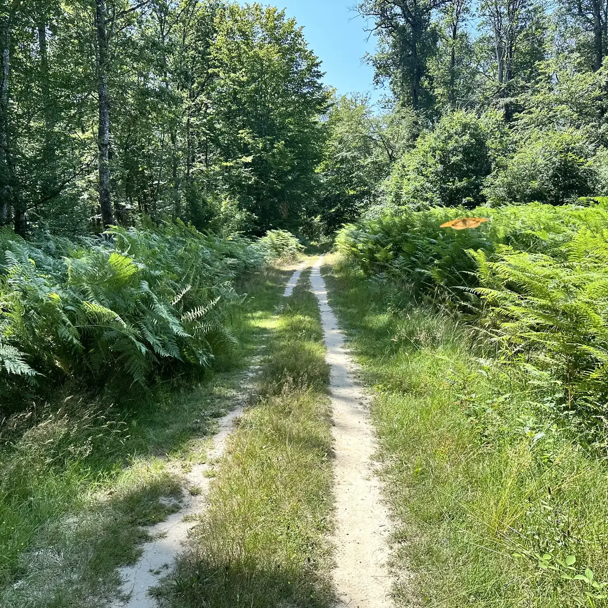


Tips from the Community

The Châteauroux Forest (around Le Poinçonnet) is a truly beautiful place to hike, get some fresh air, and escape the hustle and bustle. There are many hiking, running, and mountain biking trails, ranging from easy to medium in distance and difficulty.
2
0

This small village not far from Chateauroux, Le Poinçonnet is a gateway to access an important nature center. Rich in trees, sometimes centuries old, with diverse flora and fauna, the forest is accessible for walks, by bike or on horseback, on its trails and via a forest road, part of which is closed to traffic, for make it suitable for walking.
0
0
Frequently Asked Questions
What kind of terrain can I expect when hiking around Le Poinçonnet?
The hiking trails around Le Poinçonnet primarily traverse the extensive Forêt Domaniale de Châteauroux. You can expect diverse woodland paths, ranging from gentle forest roads to more varied trails with some elevation changes. The landscape is characterized by its dense woodlands and a peaceful natural environment.
Are there hiking routes suitable for beginners or those looking for an easy walk?
Yes, Le Poinçonnet offers many easy hiking options. For example, the Étang de Berthommiers loop from Forge Basse is an easy 7.9 km path that takes you around tranquil waterside scenery. Another easy option is the Hiking loop from Le Poinçonnet, a 4.4 km trail through local woodlands.
How many hiking trails are available in the Le Poinçonnet area?
There are over 80 hiking routes available around Le Poinçonnet, catering to various skill levels. This includes more than 50 easy trails, 30 moderate routes, and a few more challenging options.
Are there any circular hiking routes in Le Poinçonnet?
Yes, many of the trails in Le Poinçonnet are circular, allowing you to start and end at the same point. A popular moderate circular route is the Le Poinçonnet and its forest loop from Le Poinçonnet, which covers 12.5 km through the Forêt Domaniale de Châteauroux.
What natural features or landmarks can I see while hiking in Le Poinçonnet?
The primary natural feature is the vast Forêt Domaniale de Châteauroux, with its centuries-old trees and diverse flora and fauna. You can also explore areas like the Étang de Berthommiers, offering tranquil waterside views. Historically, the forest contains remnants such as the moats and keep of the medieval Château de la Motte, and the ruins of the Abbaye de Grammont, which can be explored on routes like the 'Promenade de la Motte'.
Are there any family-friendly hiking trails in Le Poinçonnet?
Yes, many of the easier trails are suitable for families. The Biegden Playground loop from Le Poinçonnet is an easy 4.8 km route that could be a good option for families, especially with its proximity to a playground.
Can I bring my dog on the hiking trails in Le Poinçonnet?
Generally, dogs are welcome on trails in the Forêt Domaniale de Châteauroux, but it's always advisable to keep them on a leash, especially given the presence of wildlife like deer and roe deer. Always check local signage for specific restrictions on individual paths.
What do other hikers say about the trails in Le Poinçonnet?
The trails in Le Poinçonnet are highly regarded by the komoot community, with an average rating of 4.5 stars from over 70 reviews. Hikers often praise the peaceful forest environment, the well-maintained paths, and the variety of routes suitable for different fitness levels.
Are there any nearby attractions or points of interest to visit after a hike?
Yes, beyond the trails, you can explore nearby historical sites. Consider visiting Châteauroux, or the Raoul Castle. The Cordeliers Convent is also a notable point of interest in the wider area.
Is there public transport access to the hiking areas in Le Poinçonnet?
While Le Poinçonnet is a commune, direct public transport links specifically to trailheads within the Forêt Domaniale de Châteauroux might be limited. It's generally recommended to check local bus schedules or consider driving to access the various starting points for hikes.
What is the best time of year to go hiking in Le Poinçonnet?
The Forêt Domaniale de Châteauroux offers pleasant hiking conditions throughout much of the year. Spring and autumn provide mild temperatures and beautiful foliage, while summer offers shaded paths under the dense tree canopy. Winter walks can also be serene, though some paths might be muddy.
Most popular routes around Le Poinçonnet
Most popular attractions around Le Poinçonnet

Get inspired with the komoot mobile app


Explore more
Browse the best Hikes in other regions.
