The best walks and hikes around Saint-Vincent-De-Lamontjoie
4.5
(63)
334
hikers
32
hikes
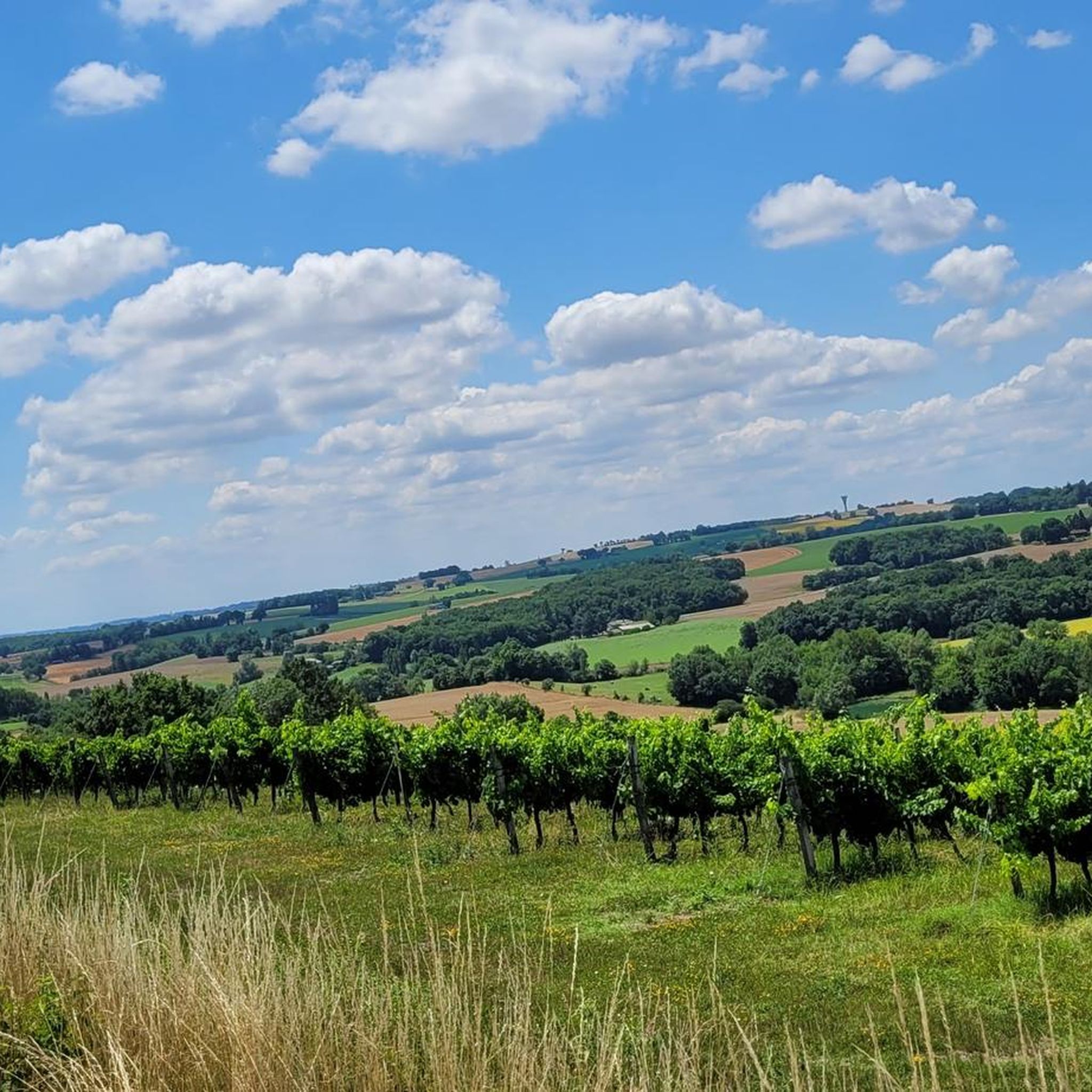
Hiking around Saint-Vincent-De-Lamontjoie offers a network of trails through a landscape characterized by gentle rolling hills, agricultural land, and local water features like Lac de Lambronne. The region provides varied terrain with moderate elevation changes, making it suitable for easy hikes and longer circular walks. Views often extend over valleys and rural scenery, connecting small villages and historical points of interest.
Best hiking trails around Saint-Vincent-De-Lamontjoie
- The most popular hiking route is Notre-Dame Church of Moirax loop from Aubiac,…
Last updated: August 18, 2026
4.7
(20)
72
hikers
6.69km
01:53
140m
140m
Enjoy an easy 4.2-mile hike around Moirax, France, featuring historical sites like the Cluniac priory and rural landscapes.
5.0
(2)
25
hikers
15.9km
04:38
420m
420m
Moderate hike. Good fitness required. Easily-accessible paths. Suitable for all skill levels.

Sign up for free
4.8
(4)
16
hikers
15.8km
04:31
370m
370m
Moderate hike. Good fitness required. Easily-accessible paths. Suitable for all skill levels.
15
hikers
5.63km
01:36
130m
130m
Easy hike. Great for any fitness level. Easily-accessible paths. Suitable for all skill levels.
15
hikers
5.84km
01:36
90m
90m
Easy hike. Great for any fitness level. Easily-accessible paths. Suitable for all skill levels.
Get access to more routes and recommendations from other explorers.
Sign up for free
Already have an account?
Our route recommendations are based on thousands of hikes, rides, and runs completed by other people on komoot.
Start today with a free account
Your next adventure awaits.
Login or Signup

Tips from the Community

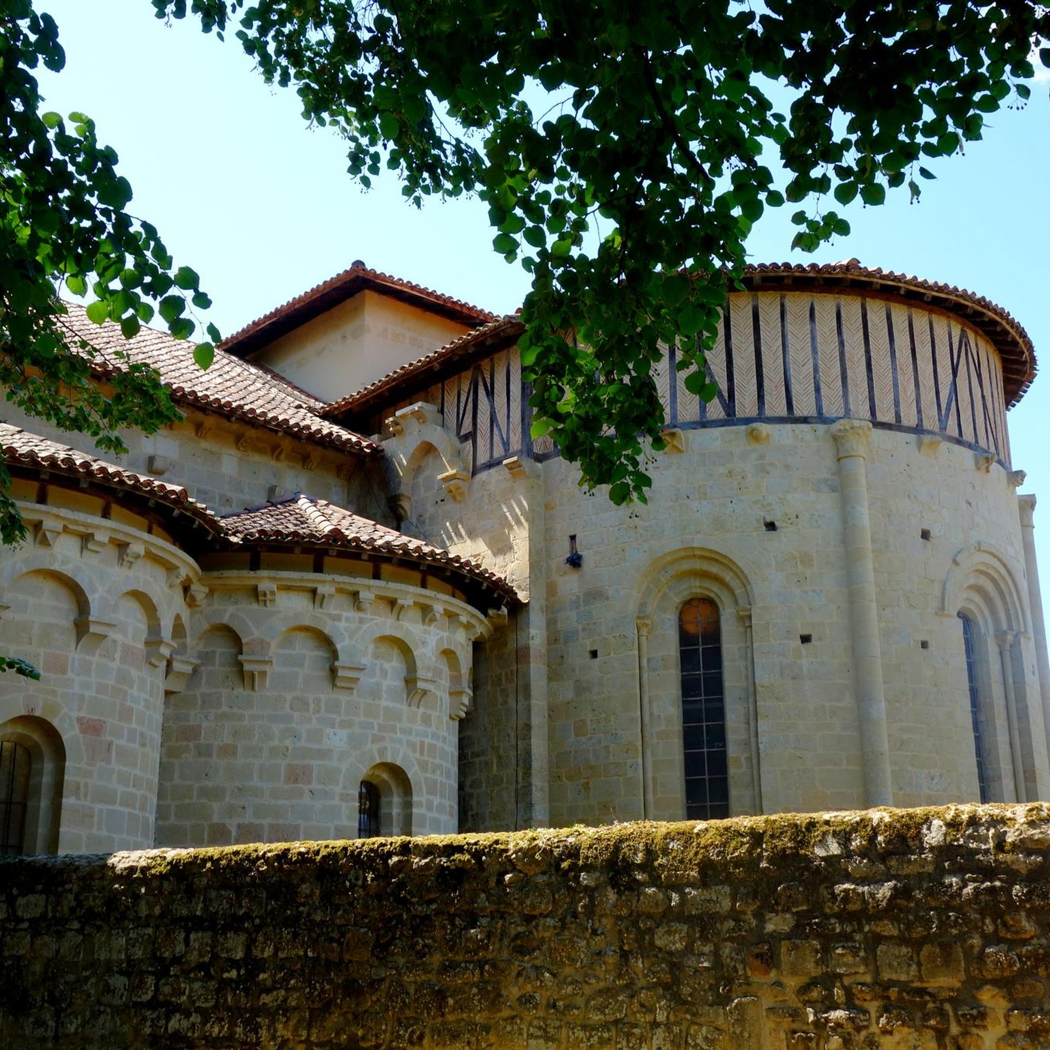
The Sainte-Marie de Moirax church is the most remarkable vestige of the former Cluniac priory founded in the 11th century. Classified as a Historic Monument, it preserves superb Romanesque architecture, with its sculpted portal, finely worked capitals, and imposing nave.
0
0
Moirax is one of the most beautiful villages in Lot-et-Garonne. Perched on a hill overlooking the Garonne valley, it is best known for its remarkable Cluniac priory founded in the 11th century. Its narrow streets lined with stone houses, its viewpoints over the Agenais hills, and the peaceful atmosphere around the abbey church make it a charming stopover.
0
0


Moirax is located on top of a hill, a few kilometers south of Agen and the Garonne. A medieval village dominated by the Cluniac Priory from the 11th century. A jewel of Romanesque art, the imposing Notre-Dame church remaining from the Priory is a real architectural marvel. It has been perfectly restored and has been listed as a historical monument since 1846.
3
0
Moirax is a commune in the French department Lot-et-Garonne (Nouvelle-Aquitaine region) and has 1061 inhabitants (2005). The place is part of the arrondissement of Agen.
3
0

Moirax is a commune in the south-west of France, located in the department of Lot-et-Garonne.
0
0

This church was a milestone on the way to Santiago de Compostela and a stopover for pilgrims. The land on which it stands was donated by the Viscount of Bruilhois in 1049. Believing that he had failed during his life as a warrior, he wanted to try to save his soul by donating of this land.
3
0
Frequently Asked Questions
How many hiking trails are there in Saint-Vincent-De-Lamontjoie?
There are over 35 hiking routes available around Saint-Vincent-De-Lamontjoie. These trails range from easy strolls to more moderate excursions, offering a variety of options for different fitness levels.
Are there easy hikes suitable for beginners or families in Saint-Vincent-De-Lamontjoie?
Yes, the region offers several easy hikes perfect for beginners or families. For a gentle walk, consider the Lac de Lambronne loop from Saint-Vincent-de-Lamontjoie, which is an easy 2.1-mile (3.3 km) path around the lake. Another accessible option is the Hiking loop from Saint-Vincent-de-Lamontjoie, a 3.6-mile (5.8 km) trail through the local countryside.
What kind of terrain can I expect on the hiking trails?
The hiking trails around Saint-Vincent-De-Lamontjoie are characterized by gentle rolling hills, agricultural land, and quiet valley paths. You'll often find yourself walking through rural scenery, connecting small villages and passing by local water features like Lac de Lambronne. The elevation changes are generally moderate.
Are there any challenging hikes in the area?
While most trails are easy to moderate, some routes offer more significant elevation gain. The Notre-Dame Church of Moirax loop from Aubiac is a moderate 10.2-mile (16.4 km) trail featuring the highest elevation gain in the area, providing expansive views and a more demanding experience.
What are some notable landmarks or attractions to see while hiking?
The region features several points of interest. You can visit the historic Notre-Dame Church of Moirax, explore the Château de Madirac, or enjoy the scenic views around Estillac. Many trails also offer glimpses of the Garonne Riverside and the GR652 route.
Are there circular walks available in Saint-Vincent-De-Lamontjoie?
Yes, many of the trails in Saint-Vincent-De-Lamontjoie are designed as circular routes, allowing you to start and end at the same point. Examples include the Lac de Lambronne loop from Saint-Vincent-de-Lamontjoie and the Hiking loop from Saint-Vincent-de-Lamontjoie, which are popular choices for their convenience.
What do other hikers enjoy most about the trails here?
The area is highly rated by the komoot community, with an average score of 4.2 stars from over 60 reviews. Hikers often praise the quiet countryside, the varied terrain with moderate elevation changes, and the scenic views over valleys and agricultural landscapes. The presence of local water features like Lac de Lambronne is also frequently mentioned as a highlight.
Is there parking available at the trailheads?
While specific parking details for every trailhead are not provided, many routes in rural areas like Saint-Vincent-De-Lamontjoie typically have informal parking spots near village centers or designated areas at popular starting points. It's advisable to check the individual route descriptions on komoot for more precise parking information before you go.
What is the best time of year to go hiking in Saint-Vincent-De-Lamontjoie?
The region's climate makes spring and autumn ideal for hiking, with pleasant temperatures and vibrant natural scenery. Summer can also be enjoyable, especially in the mornings or late afternoons, though it can get warm. Winter hiking is possible, but some paths might be muddy, and daylight hours are shorter.
Are dogs allowed on the hiking trails?
Generally, dogs are welcome on most public hiking trails in rural France, including those around Saint-Vincent-De-Lamontjoie. However, it's always recommended to keep them on a leash, especially when passing through agricultural land or near livestock, and to clean up after them. Check specific trail regulations if you plan to enter any protected natural areas.
Are there any cafes or restaurants near the hiking trails?
Saint-Vincent-De-Lamontjoie and its surrounding villages offer local amenities where you might find cafes or small restaurants. Many trails connect these small villages, providing opportunities for refreshments. It's a good idea to check local opening hours, especially in smaller communities.
Do I need a permit to hike in Saint-Vincent-De-Lamontjoie?
No, you do not typically need a permit to hike on the general trails around Saint-Vincent-De-Lamontjoie. The trails are publicly accessible, traversing agricultural land and local countryside. Always respect private property and follow local signage.
Most popular routes around Saint-Vincent-De-Lamontjoie
Most popular attractions around Saint-Vincent-De-Lamontjoie

Get inspired with the komoot mobile app


Explore more
Browse the best Hikes in other regions.
