The best mountain hikes around Massongex
4.0
(2)
102
hikers
4
hikes
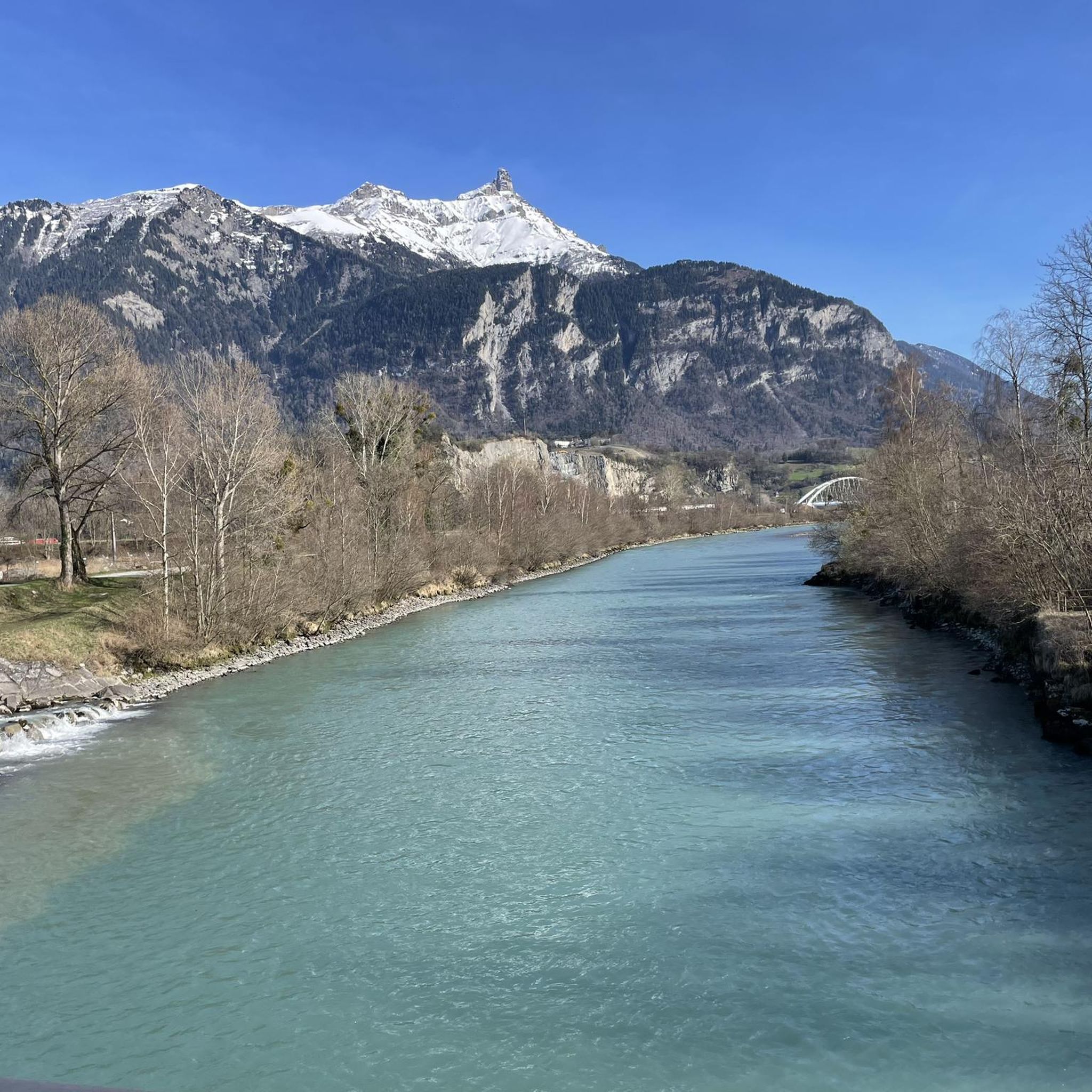
Mountaineering routes around Massongex are set within a mountainous region characterized by numerous peaks, valleys, and ridges. The area features soaring summits, craggy passes, and extensive forests, offering diverse terrain for mountaineers. Notable natural features include crystalline alpine lakes, glaciers, and waterfalls, alongside the majestic Dents du Midi Massif. This landscape provides varied challenges and rewarding panoramic views of the Rhone Valley and Lake Geneva.
Best mountaineering routes around Massongex
- The most popular mountaineering route is Pointe d'Euzanne – Col…
Last updated: June 27, 2026
24
hikers
12.2km
05:37
1,040m
1,040m
Hard mountaineering route. Very good fitness required. Sure-footedness, sturdy shoes and alpine experience required.
9
hikers
12.6km
04:38
750m
750m
Moderate mountaineering route. Good fitness required. Mostly accessible paths. Sure-footedness required.

Sign up for free
10
hikers
9.43km
03:44
530m
530m
Moderate mountaineering route. Good fitness required. Mostly accessible paths. Sure-footedness required.
9
hikers
Moderate mountaineering route. Good fitness required. Mostly accessible paths. Sure-footedness required.
8
hikers
16.8km
06:01
900m
900m
Hard mountaineering route. Very good fitness required. Mostly accessible paths. Sure-footedness required.
Our route recommendations are based on thousands of hikes, rides, and runs completed by other people on komoot.
Start today with a free account
Your next adventure awaits.
Login or Signup

Tips from the Community

The Croix d'Incrène offers numerous panoramas. Both on the Barme plateau and on the Dents du Midi.
0
0
A path goes up along the torrent. As you gain altitude towards the Barme plateau, the view of the watercourse becomes more and more spectacular.
0
0
Superb little waterfall, easy to access from Champéry.
0
0

Magnificent refuge located between the Dents du Midi and the Dents Blanches. The view of the Illiez valley and the Ruan glacier is breathtaking. The refuge is open between May and September. It has 18 places in dormitories. You must reserve your place. Evening catering is also by reservation.
0
0

Fine cake, friendly service👌✌️
0
0

The Plateau de Barme is located close to the French border. It was once a place of smuggling. Today it reveals beautiful meadows and a gentleness dear to Swiss mountain pastures. There you will find a few canteens to enjoy good local meals, all in a sumptuous alpine setting.
1
0
Located on the Plateau de Barme, the Dents Blanches canteen offers good meals made from regional products in a magnificent setting. It is an ideal stopover when cycling or when you want to tour the Dents Blanches.
1
0
This gravel track winds through the mountain pastures and offers beautiful perspectives of the surrounding mountains. The slope is regular and does not present any difficulty. The path leaves the banks of the Vièze to reach the Col de Cou located at an altitude of 1117 meters.
0
0
Frequently Asked Questions
What is the general difficulty level of mountaineering routes around Massongex?
Massongex offers a diverse range of mountaineering routes, catering to various skill levels. While there are 5 difficult routes for experienced mountaineers, you can also find 2 moderate routes that provide a rewarding challenge without extreme technical demands. The region's terrain includes soaring summits, craggy passes, and extensive forests, ensuring varied experiences.
Are there any routes suitable for beginners or those looking for a moderate challenge?
Yes, for those seeking a moderate challenge, routes like Villars-sur-Ollon – Villars loop from Villars-sur-Ollon (7.8 miles, 12.6 km) and La Truche – Pertuis Chetrain loop from Bec du Corbeau (5.5 miles, 8.9 km) are excellent choices. These paths traverse varied mountain landscapes and offer beautiful views without the most extreme technical difficulties.
What kind of challenges can advanced mountaineers expect in the Massongex area?
Advanced mountaineers will find plenty of challenging terrain, including routes with significant elevation gain through alpine landscapes. For example, the Pointe d'Euzanne – Col des Pauvres loop from Les Plans-sur-Bex, Le Chamois is a difficult 8.5-mile (13.6 km) route with over 1,190 meters of ascent. The region's mountainous terrain, including the Dents du Midi Massif, offers opportunities for technical ascents and demanding ridge walks.
What kind of natural features and landscapes can I expect to see on these routes?
The Massongex region is rich in natural beauty. Mountaineering routes often feature soaring summits, craggy passes, and extensive forests. You can also expect to encounter crystalline alpine lakes, glaciers, and waterfalls. Many trails offer breathtaking panoramic views of the Rhone Valley, Lake Geneva, and the majestic Mont Blanc.
Which routes offer the best panoramic views?
Many routes in the Massongex area provide stunning panoramic views. The region is known for vistas of the Rhone Valley, Lake Geneva, and Mont Blanc from its peaks. While specific routes are not highlighted for views in the data, the general mountainous terrain ensures many opportunities for spectacular scenery, especially on higher elevation trails like those leading to Dent de Valerette Summit or Dent de Valère.
Are there any circular mountaineering routes in the Massongex area?
Yes, several mountaineering routes around Massongex are designed as loops, allowing you to start and finish at the same point. Examples include the Pointe d'Euzanne – Col des Pauvres loop from Les Plans-sur-Bex, Le Chamois, the Villars-sur-Ollon – Villars loop from Villars-sur-Ollon, and the La Truche – Pertuis Chetrain loop from Bec du Corbeau.
How long do mountaineering routes around Massongex typically take to complete?
The duration of mountaineering routes varies significantly based on distance and difficulty. For instance, the moderate La Truche – Pertuis Chetrain loop from Bec du Corbeau (5.5 miles, 8.9 km) can be completed in about 3 hours 18 minutes. More challenging routes, such as the difficult Pointe d'Euzanne – Col des Pauvres loop from Les Plans-sur-Bex, Le Chamois (8.5 miles, 13.6 km), typically take around 6 hours 31 minutes.
What interesting landmarks or attractions can I find near the mountaineering routes?
Beyond the natural beauty, the Massongex area offers several interesting landmarks. You can explore historical sites like Château de Saint-Maurice or Aigle Castle. For natural points of interest, consider visiting Dent de Valerette Summit or the Portes du Soleil Pass.
What do other mountaineers enjoy most about the routes in Massongex?
The mountaineering routes in Massongex are highly rated by the komoot community, with an average score of 4.0 stars from over 2 reviews. Mountaineers often praise the varied terrain, from mountain forests to open slopes, and the rewarding panoramic views of the surrounding peaks and valleys. The diverse challenges, from moderate ascents to difficult alpine routes, are also a significant draw.
Are there any dog-friendly mountaineering trails in Massongex?
While specific dog-friendly designations for each mountaineering route are not provided, many trails in mountainous regions generally welcome dogs, often requiring them to be on a leash. It's always recommended to check local regulations or specific route details before heading out with your canine companion, especially on more technical or high-alpine routes.
What is the best time of year for mountaineering in Massongex?
The best time for mountaineering in Massongex typically aligns with late spring, summer, and early autumn when trails are generally free of snow and weather conditions are more stable. The region's high-alpine character means that conditions can change rapidly, and some routes may still hold snow into early summer. Winter mountaineering is possible but requires specialized gear and experience due to snow, ice, and avalanche risks.
Are there any routes that pass by waterfalls or alpine lakes?
The Massongex region is characterized by diverse natural features, including crystalline alpine lakes and waterfalls. While specific routes are not detailed as passing directly by these features in the provided data, the general landscape description indicates their presence. Exploring the various trails will likely lead you to discover these beautiful natural elements within the mountainous terrain.
Most popular routes around Massongex
Most popular attractions around Massongex

Get inspired with the komoot mobile app


Explore more
Browse the best Mountain Hikes & Routes in other regions.
