The best walks and hikes around Houville-La-Branche
4.7
(184)
1,296
hikers
80
hikes
Hiking around Houville-La-Branche provides access to an extensive network of trails within the Eure-et-Loir department of France. The region is characterized by varied terrain, including forests, fields, and potential smaller water bodies, offering a natural setting for exploration. With a significant number of marked trails, the area is well-suited for outdoor recreation.
Best hiking trails around Houville-La-Branche
- The most popular hiking route is Eclusette de la Roguenette and old railway Chartres-Gallardon — loop from Gasville-Oisème, a 4.7 miles (7.6 km) trail that takes about 1 hour 59 minutes to complete, featuring an old railway line.
- Another top favourite among local hikers is Château et parc de l'Aval — loop from Sours, a moderate 2.5 miles (4.0 km) path. This route explores the grounds around a château and park.
- Local hikers also love the Small Lock of the Roguenette – Charles de Gaulle Page Path loop from Gasville-Oisème, a 4.5 miles (7.3 km) trail leading through areas near a small lock, often completed in about 1 hour 54 minutes.
- Hiking around Houville-La-Branche is defined by its network of trails through forests, fields, and along water bodies. The network offers options for easy and moderate ability levels.
- The routes in Houville-La-Branche are highly rated by the komoot community with an average score of 4.6 stars from over 140 reviews. More than 1000 hikers have used komoot to explore Houville-La-Branche's varied terrain.
Last updated: July 5, 2026
4.0
(3)
10
hikers
7.59km
01:59
60m
60m
Hike a 4.7-mile loop from Gasville-Oisème, exploring the Small Lock of the Roguenette and a section of the old Chartres-Gallardon railway.
4.0
(1)
10
hikers
3.99km
01:01
10m
10m
Moderate hike. Great for any fitness level. Mostly accessible paths. Sure-footedness required.

Sign up for free
22
hikers
18.8km
04:51
100m
100m
Moderate hike. Good fitness required. Easily-accessible paths. Suitable for all skill levels.
4.4
(7)
25
hikers
Easy hike. Great for any fitness level. Easily-accessible paths. Suitable for all skill levels.
4.0
(2)
8
hikers
11.9km
03:07
90m
90m
Moderate hike. Good fitness required. Easily-accessible paths. Suitable for all skill levels.
Get access to more routes and recommendations from other explorers.
Sign up for free
Already have an account?
Our route recommendations are based on thousands of hikes, rides, and runs completed by other people on komoot.
Start today with a free account
Your next adventure awaits.
Login or Signup



Tips from the Community


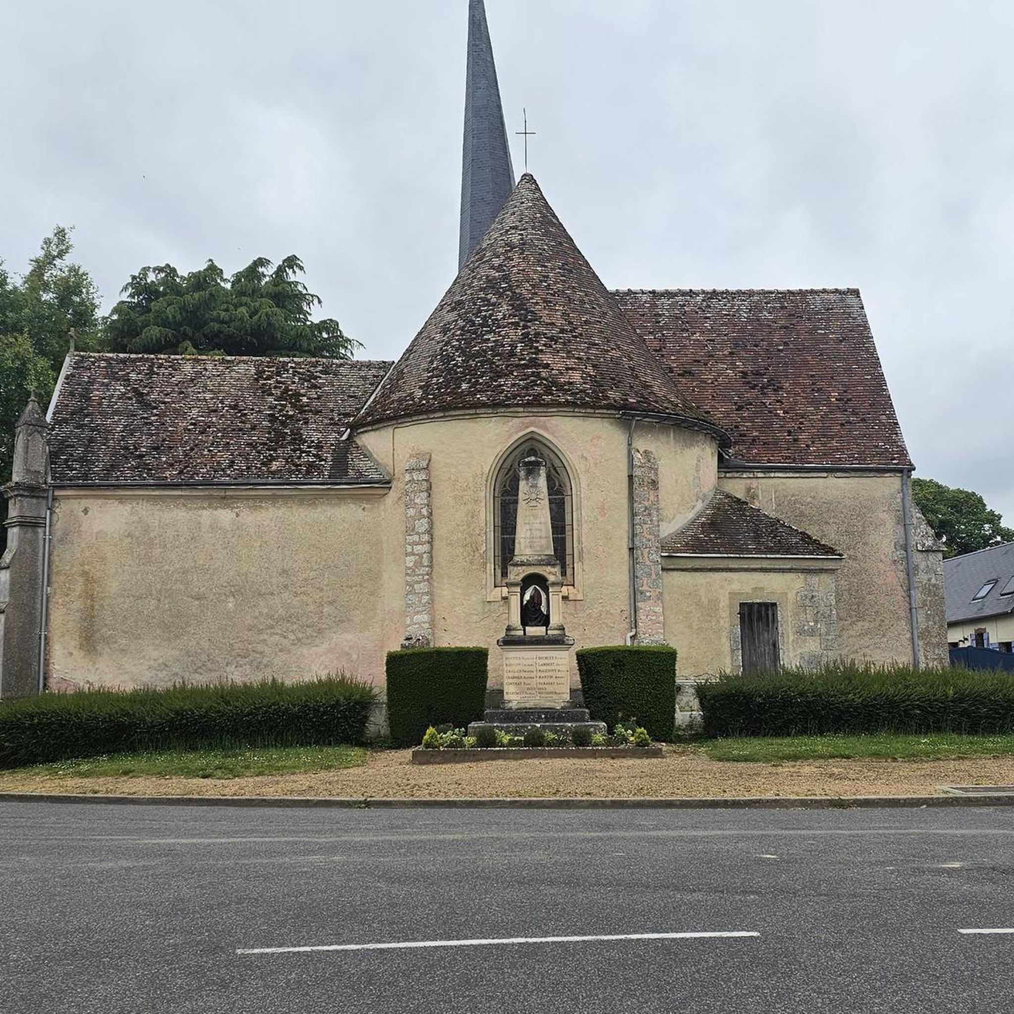
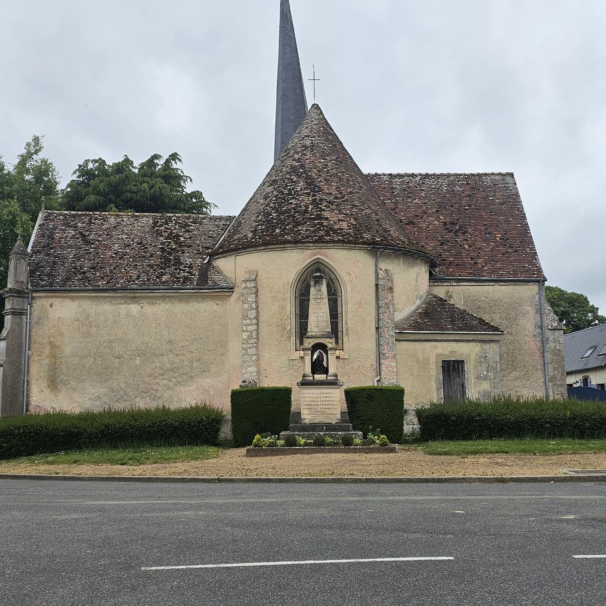
Memorial with the message "never forget this!"
1
0

The Château de l'Aval is a beautiful castle founded in the 10th century and an emblematic monument of Laval. It occupies a rocky promontory above the Mayenne and is made up of two distinct groups: the Old Castle, which corresponds to the medieval fortified castle, and the New Castle, a Renaissance gallery transformed into a courthouse in the 19th century. The park surrounding the castle is full of greenery and beautiful flowers. You might even spot some wild animals along the way!
3
0
From here you can walk out of the village to walk through beautiful and peaceful fields.
3
0


This church is dedicated to James the Elder (Saint-Jacques), probably (alongside Peter and Paul) the most prominent apostle and national saint of Spain. The European network of Ways of Saint James, usually marked by the symbol of the yellow shell on a blue background, leads pilgrims to his tomb. This is in the northern Spanish town of 'Santiago de Compostella', where he rests in a magnificent basilica built in his honor. The martyrdom (execution) of James is handed down by the evangelist Luke in the New Testament "Acts of the Apostles". The feast day of Saint James in the calendar of saints is July 25th.
1
0

The “Château de Sours”, or “Château de la Vallée” according to Cassini’s map, or “Château de l’Aval” is surrounded by a 17-hectare wooded and irrigated area located in the French commune of Sours, in Eure. -et-Loir. The construction of the current building and the development of the park date from 1653. The castle has been registered as a historic monument since 1987 and is included in the inventory of the Regional Conservation of Historic Monuments. It was probably the site of the decisions of the Treaty of Brétigny and was built as a large hunting and fishing estate for the knights and lords of Montigny. Its private part is still used as such. Its large park, divided into two parts, public and private, is home to interesting sedentary and occasional wildlife, often popular with hunters and fishermen. The estate includes a farm, still in operation, operated by a cereal farming company. source: wikipedia
1
0
During the hike, discover this small waterfall which is very nice.
1
0
Frequently Asked Questions
How many hiking trails are available around Houville-La-Branche?
There are over 70 hiking trails around Houville-La-Branche, offering a wide variety of options for exploring the Eure-et-Loir department. These trails cover a total of 327.7 kilometers, with many suitable for different skill levels.
What types of terrain can I expect on the trails in Houville-La-Branche?
The trails around Houville-La-Branche feature varied terrain, including forests, open fields, and paths along smaller water bodies. This diverse landscape provides an engaging natural environment for hikers.
Are there any easy hiking routes suitable for beginners or families?
Yes, Houville-La-Branche offers 35 easy hiking routes. An excellent option is the Small Lock of the Roguenette – Charles de Gaulle Page Path loop from Gasville-Oisème, which is 7.3 km long and takes about 1 hour 54 minutes to complete.
Are there any circular walks in the Houville-La-Branche area?
Many routes in the region are circular, allowing you to start and end at the same point. For example, consider the Garden of ideas loop from Gallardon, an easy 7.1 km trail.
What do other hikers say about the trails in Houville-La-Branche?
The hiking trails in Houville-La-Branche are highly rated by the komoot community, with an average score of 4.6 stars from over 140 reviews. Hikers often praise the varied terrain and well-maintained paths.
Are there any notable landmarks or attractions to see near the hiking trails?
Yes, the area offers several interesting landmarks. You can explore the historic Chartres Cathedral, or visit the city of Chartres itself, which is a significant settlement nearby.
Are there any routes that pass by châteaux or historical sites?
Certainly. The Château et parc de l'Aval — loop from Sours is a moderate 4.0 km path that explores the grounds around a château and its park, offering a glimpse into local history.
What is the best season for hiking in Houville-La-Branche?
While specific seasonal details are not provided, the varied terrain of forests and fields suggests that spring and autumn would be ideal for hiking, offering pleasant temperatures and beautiful natural scenery. Summer can also be enjoyable, especially on shaded forest paths.
Are there any trails that follow old railway lines?
Yes, you can experience a unique hike along an old railway line. The Eclusette de la Roguenette and old railway Chartres-Gallardon — loop from Gasville-Oisème is a moderate 7.6 km trail that incorporates this interesting feature.
Are there any longer, more challenging routes for experienced hikers?
While there are no routes classified as 'difficult', there are 37 moderate routes, some of which are longer. For a more extended moderate hike, consider The Banks of the Eure – Lèves Washhouse loop from Saint-Prest, which is 10.2 km long and takes approximately 2 hours 37 minutes.
Is public transport available to access hiking trails in Houville-La-Branche?
The region's focus on hiking suggests accessibility, but specific public transport links to trailheads are not detailed. It is generally recommended to check local transport schedules for connections to villages near the trail starting points.
Are there any trails that feature water bodies or canals?
Yes, some trails in the area run along water bodies. The Small Lock of the Roguenette – Charles de Gaulle Page Path loop from Gasville-Oisème, for instance, leads through areas near a small lock, offering pleasant waterside views.
Most popular routes around Houville-La-Branche
Most popular attractions around Houville-La-Branche

Get inspired with the komoot mobile app


Explore more
Browse the best Hikes in other regions.
