The best walks and hikes around Umpeau
4.6
(47)
300
hikers
37
hikes
Hiking around Umpeau offers a glimpse into the rural landscape of the Eure-et-Loir department in France. The commune is characterized by its quiet, agricultural setting, drained by small watercourses, and provides access to broader regional natural spaces. The surrounding area features tranquil rural paths, scenic river paths along the Eure, and nearby forests like the Forêt de Rambouillet.
Best hiking trails around Umpeau
- The most popular hiking route is Château et parc de l'Aval — loop from Sours, a…
Last updated: July 5, 2026
4.0
(1)
10
hikers
3.99km
01:01
10m
10m
Moderate hike. Great for any fitness level. Mostly accessible paths. Sure-footedness required.
2.0
(1)
1
hikers
16.4km
04:15
100m
100m
Moderate hike. Good fitness required. Easily-accessible paths. Suitable for all skill levels.

Sign up for free
5.0
(1)
5
hikers
7.90km
02:02
40m
40m
Moderate hike. Good fitness required. Easily-accessible paths. Suitable for all skill levels.
6
hikers
5.61km
01:26
20m
20m
Easy hike. Great for any fitness level. Easily-accessible paths. Suitable for all skill levels.
3
hikers
7.78km
02:02
60m
50m
Moderate hike. Good fitness required. Easily-accessible paths. Suitable for all skill levels.
Get access to more routes and recommendations from other explorers.
Sign up for free
Already have an account?
Our route recommendations are based on thousands of hikes, rides, and runs completed by other people on komoot.
Start today with a free account
Your next adventure awaits.
Login or Signup



Tips from the Community

The Château de l'Aval is a beautiful castle founded in the 10th century and an emblematic monument of Laval. It occupies a rocky promontory above the Mayenne and is made up of two distinct groups: the Old Castle, which corresponds to the medieval fortified castle, and the New Castle, a Renaissance gallery transformed into a courthouse in the 19th century. The park surrounding the castle is full of greenery and beautiful flowers. You might even spot some wild animals along the way!
3
0


The “Château de Sours”, or “Château de la Vallée” according to Cassini’s map, or “Château de l’Aval” is surrounded by a 17-hectare wooded and irrigated area located in the French commune of Sours, in Eure. -et-Loir. The construction of the current building and the development of the park date from 1653. The castle has been registered as a historic monument since 1987 and is included in the inventory of the Regional Conservation of Historic Monuments. It was probably the site of the decisions of the Treaty of Brétigny and was built as a large hunting and fishing estate for the knights and lords of Montigny. Its private part is still used as such. Its large park, divided into two parts, public and private, is home to interesting sedentary and occasional wildlife, often popular with hunters and fishermen. The estate includes a farm, still in operation, operated by a cereal farming company. source: wikipedia
1
0
During the hike, discover this small waterfall which is very nice.
1
0
The park of the castle of Laval offers something for jogging, strolling or even a play area for children. It is planted with trees and is bordered by the canal also fed by the Roguenette. A very pleasant place to discover
1
0
The Saint-Germain church was rebuilt during the French Revolution after its destruction by a storm in 1788. It was completed in 1803. It houses the stained glass windows of generous donors, made in the 19th and 20th centuries by the Lorin and Bernard Campin workshops. source: wikipedia
2
0
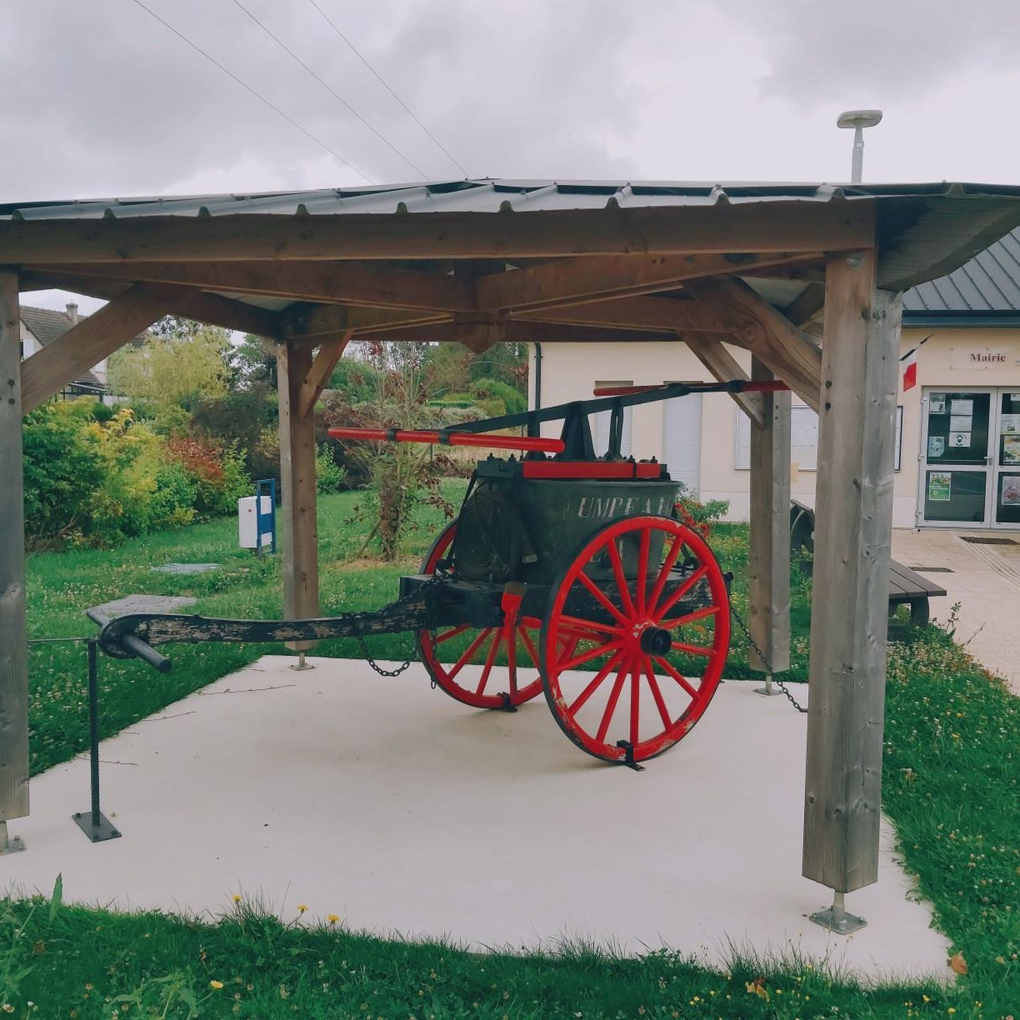
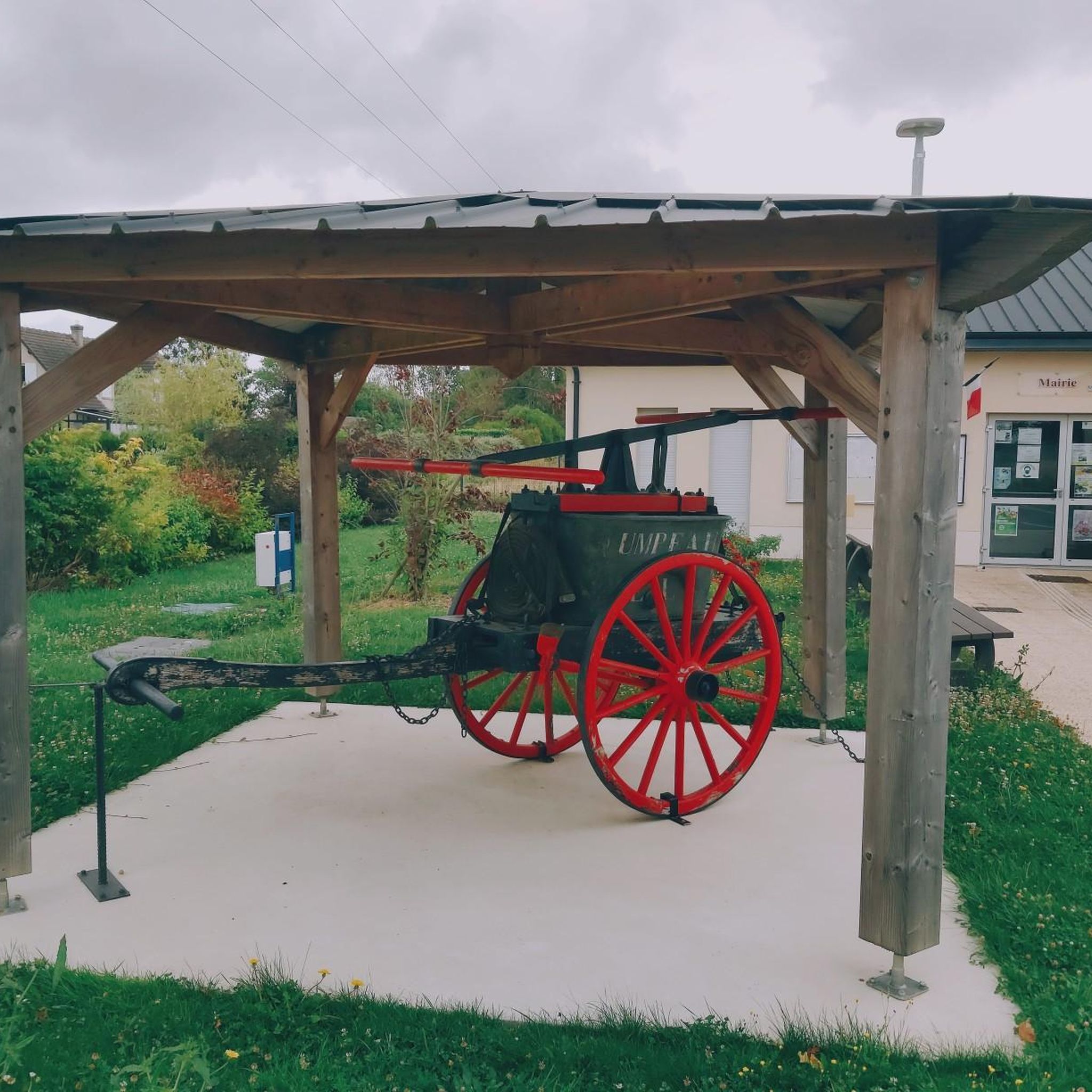
In the heart of the city, the recently redone place VERDUN gives the opportunity to admire a fortified farm, as well as the old village water pump.
1
0

The church of SOURS is located in the heart of the village, this municipal building steeped in history is placed under the patronage of Saint-Germain and Saint-Symphorien. For some people, concerts are sometimes organized there, telling the time, however, for others, it is a fundamental element of worship. The bell tower is one of the oldest parts of the building. A strong square tower surmounted by a saddleback roof and a skylight, it seems to date from the 12th or 13th century, as evidenced by the traces of wall painting which remain inside the interior room.
0
0
Frequently Asked Questions
How many hiking trails are available around Umpeau?
There are over 30 hiking routes in the Umpeau area, offering a variety of experiences through the rural landscape of Eure-et-Loir. These include 12 easy trails and 18 moderate trails, ensuring options for different fitness levels.
What kind of terrain can I expect on hikes near Umpeau?
Hikes around Umpeau typically feature quiet rural paths, agricultural fields, and small watercourses like the "fossé 01 des Prés Carrés" and the "fossé d'Aigremont." The terrain is generally gentle, characteristic of the Eure-et-Loir department, without dramatic elevation changes.
Are there any family-friendly hiking options in Umpeau?
Yes, Umpeau offers several easy routes suitable for families. For instance, the L'Épaule de Gallardon – Garden of ideas loop from Gallardon is an easy 6.5 km path that guides hikers through scenic areas, including a "Garden of ideas," which can be enjoyable for all ages.
Are there any circular walks around Umpeau?
Many of the trails in the Umpeau area are circular, allowing you to start and end at the same point. A popular example is the Château et parc de l'Aval — loop from Sours, a moderate 4.0 km trail exploring local grounds.
What do other hikers enjoy most about the trails in Umpeau?
The trails around Umpeau are highly rated by the komoot community, with an average score of 4.6 stars from over 30 reviews. Hikers often praise the quiet, accessible paths through fields and the local countryside, offering a peaceful escape into nature.
Are there any historical or cultural landmarks to see while hiking near Umpeau?
While hiking near Umpeau, you can discover several interesting landmarks. Highlights include the Saint-Piat Mill, the Saints Peter and Paul Church in Gallardon, and the Lavoir de Soulaires. These offer glimpses into the local heritage and architecture.
What is the best time of year to go hiking in Umpeau?
Umpeau's rural landscape is enjoyable throughout the warmer months, from spring to autumn, when the fields are green and the weather is mild. The quiet paths are generally accessible, but checking the weather forecast before your hike is always recommended.
Are there any longer, more challenging hikes available?
For those looking for a longer excursion, the Le Gland loop from Soulaires is a moderate 11.9 km trail that leads through rural landscapes, typically completed in about 3 hours. While there are no 'difficult' graded trails, this offers a more extended experience.
Is Umpeau a good base for exploring broader natural areas?
Umpeau serves as a quiet, rural base within the Eure-et-Loir department. While the immediate area offers gentle walks, the broader region provides access to larger natural spaces such as the Perche Regional Natural Park, known for its diverse landscapes including forests and marshes, and other areas like the Loir Valley.
Are there any specific natural features to look out for on the trails?
The natural features around Umpeau are characterized by its agricultural setting and small watercourses. You'll encounter open fields, small wooded areas, and the gentle flow of local streams like the "fossé d'Aigremont," offering a peaceful, pastoral hiking experience rather than dramatic natural landmarks.
Can I find trails that explore local châteaux or historical estates?
Yes, some routes incorporate local historical elements. The Château et parc de l'Aval — loop from Sours is a moderate trail that specifically explores the grounds around a local château, offering a blend of nature and history.
Most popular attractions around Umpeau

Get inspired with the komoot mobile app


Explore more
Browse the best Hikes in other regions.
