The best walks and hikes around Champseru
4.6
(54)
316
hikers
56
hikes
Hiking around Champseru offers routes through a gently rolling landscape, characterized by paths near waterways and historical sites. The terrain features minimal elevation changes, making it suitable for accessible walks across open fields and wooded sections. The region is defined by its mix of agricultural plains, river valleys, and varied terrain, providing diverse outdoor experiences. These landscapes contribute to a network of trails for exploring the local countryside.
Best hiking trails around Champseru
- The most popular hiking route is Small…
Last updated: May 24, 2026
4.0
(2)
8
hikers
11.9km
03:07
90m
90m
Moderate hike. Good fitness required. Easily-accessible paths. Suitable for all skill levels.
2.0
(1)
1
hikers
16.4km
04:15
100m
100m
Moderate hike. Good fitness required. Easily-accessible paths. Suitable for all skill levels.

Sign up for free
5.0
(1)
5
hikers
7.95km
02:03
40m
40m
Moderate hike. Good fitness required. Easily-accessible paths. Suitable for all skill levels.
6
hikers
5.61km
01:26
20m
20m
Easy hike. Great for any fitness level. Easily-accessible paths. Suitable for all skill levels.
4.5
(2)
2
hikers
7.86km
02:05
70m
70m
Moderate hike. Good fitness required. Easily-accessible paths. Suitable for all skill levels.
Get access to more routes and recommendations from other explorers.
Sign up for free
Already have an account?
Our route recommendations are based on thousands of hikes, rides, and runs completed by other people on komoot.
Start today with a free account
Your next adventure awaits.
Login or Signup



Tips from the Community


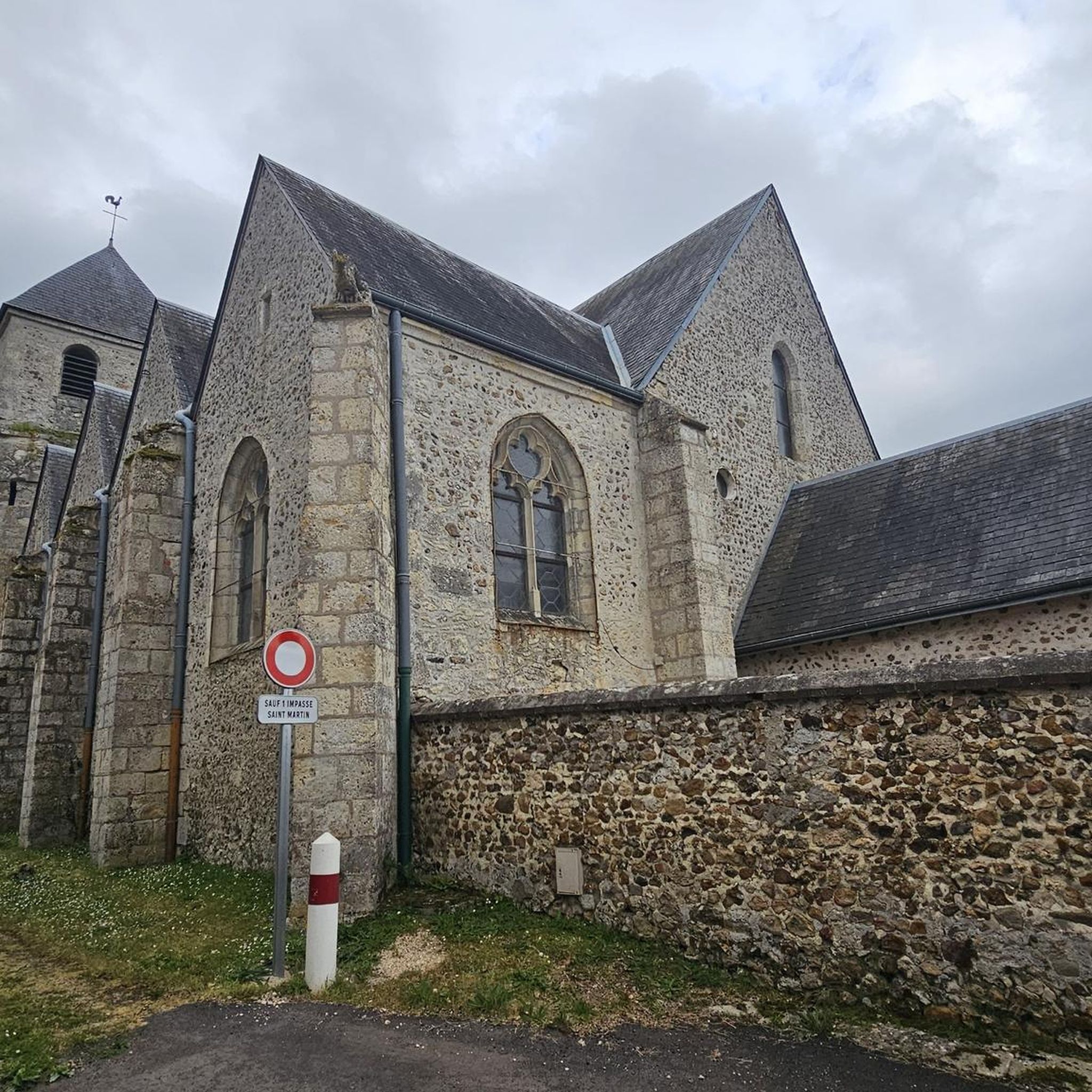
This church is dedicated to James the Elder (Saint-Jacques), probably (alongside Peter and Paul) the most prominent apostle and national saint of Spain. The European network of Ways of Saint James, usually marked by the symbol of the yellow shell on a blue background, leads pilgrims to his tomb. This is in the northern Spanish town of 'Santiago de Compostella', where he rests in a magnificent basilica built in his honor. The martyrdom (execution) of James is handed down by the evangelist Luke in the New Testament "Acts of the Apostles". The feast day of Saint James in the calendar of saints is July 25th.
1
0

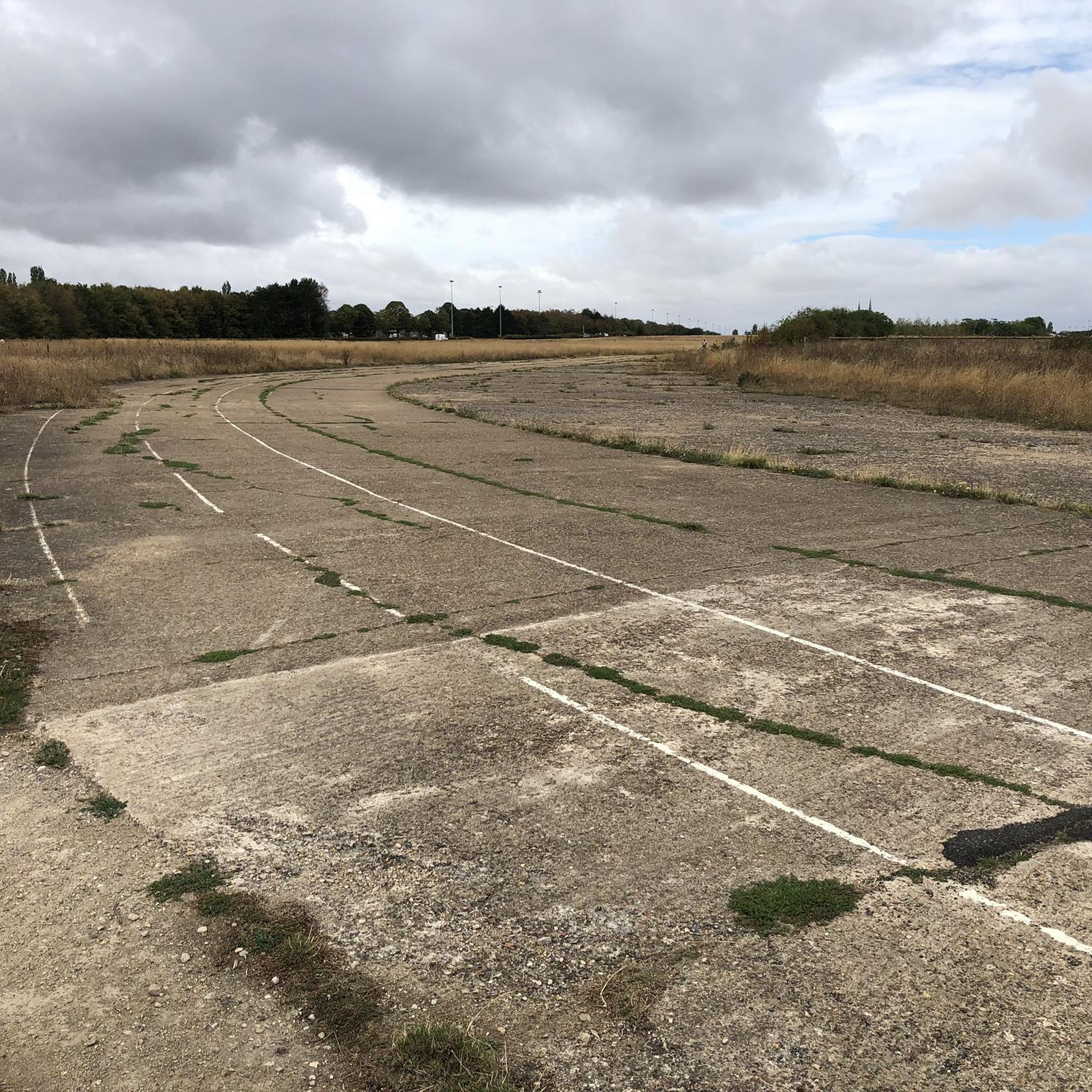
Visible from afar, the remains of this balancing act tower are astonishing and an impressive must-see.
0
0

Gallardon shoulder is a local curiosity that you absolutely must discover, if only for your personal culture.
1
0
The Gallardon shoulder is a curiosity to come and discover if you pass nearby. It's just amazing.
2
0

Soulaires is home to the 12th-century Saint-Jacques-et-Saint-Philippe church, with further construction until the 16th century. And as the name suggests, it is an old station on the way to Santiago de Compostela.
2
0
Frequently Asked Questions
What kind of landscape can I expect when hiking in Champseru?
Hiking in Champseru offers a gently rolling landscape with minimal elevation changes. You'll find paths near waterways, historical sites, and a mix of open fields and wooded sections. The region is characterized by accessible routes for exploring the local countryside.
How many hiking trails are available in Champseru?
There are over 45 hiking routes available in Champseru. The majority are classified as easy or moderate, with 20 easy trails and 26 moderate trails, making the area suitable for a wide range of hikers.
Are there any easy hiking trails suitable for beginners in Champseru?
Yes, Champseru is ideal for beginners due to its minimal elevation changes. Many trails are classified as easy, such as the L'Épaule de Gallardon – Garden of ideas loop from Gallardon, which is 4.1 miles (6.5 km) with very little elevation gain.
What are some interesting landmarks or historical sites I can see along the hiking trails in Champseru?
The region is rich in historical sites. You can explore areas around castles, such as the Esclimont Castle loop from Saint-Symphorien-le-Château. Other notable attractions nearby include Chartres, the Guillaume Gate, and the Saint-Piat Mill.
Are there any circular hiking routes in Champseru?
Yes, many of the trails in Champseru are circular, offering convenient starting and ending points. For example, the Small Lock of the Roguenette – Charles de Gaulle Page Path loop from Gasville-Oisème is a popular circular route that takes about 1 hour 55 minutes to complete.
How long do hikes typically take in Champseru?
Hikes in Champseru vary in length and duration. Many popular routes, like the Esclimont Castle loop from Saint-Symphorien-le-Château, can be completed in under 2 hours. Longer moderate trails, such as the Le Gland loop from Soulaires, might take around 3 hours.
What do other hikers enjoy most about hiking in Champseru?
The komoot community highly rates hiking in Champseru, with an average score of 4.6 stars from over 50 reviews. Hikers often praise the gentle paths, the presence of historical landmarks, and the open countryside, noting the accessibility for different ability levels.
Are the hiking trails in Champseru suitable for families with children?
Yes, the trails in Champseru are generally very family-friendly due to their gentle nature and minimal elevation changes. The easy routes, often passing by waterways and historical sites, provide engaging walks for all ages.
Can I bring my dog on the hiking trails in Champseru?
While specific regulations can vary, the generally open and rural nature of Champseru's trails often makes them suitable for dog walking. It's always recommended to keep dogs on a leash and respect local signage, especially near agricultural areas or wildlife.
What is the best time of year to hike in Champseru?
Given the region's generally mild climate and gently rolling terrain, hiking in Champseru is pleasant for much of the year. Spring and autumn offer comfortable temperatures and beautiful scenery, while summer provides long daylight hours. The region benefits from over 300 days of sunshine, contributing to pleasant outdoor conditions.
Are there any hikes that feature waterways or canals in Champseru?
Yes, many routes in Champseru feature paths alongside waterways. For instance, the Small Lock of the Roguenette – Charles de Gaulle Page Path loop from Gasville-Oisème includes a gentle path alongside a lock, offering picturesque views of the water.
Most popular routes around Champseru
Most popular attractions around Champseru

Get inspired with the komoot mobile app


Explore more
Browse the best Hikes in other regions.
