The best cycling routes around Favières
4.4
(24)
188
riders
77
rides
Touring cycling routes around Favières offer varied terrain, characterized by gentle ascents and descents across rural landscapes. The region provides a network of paths suitable for exploring the local countryside and passing through charming villages. Cyclists can expect a mix of paved roads and possibly some unpaved sections, catering to different preferences for touring cyclists. The area's topography supports routes ranging from easy, relatively flat rides to more challenging options with moderate elevation changes.
Best touring cycling routes around Favières
…Last updated: July 2, 2026
5.0
(1)
36
riders
52.9km
03:42
310m
310m
Moderate bike ride. Good fitness required. Mostly paved surfaces. Suitable for all skill levels.
10
riders
Hard bike ride. Good fitness required. You may need to push your bike for some segments of this route.

Sign up for free
4
riders
29.0km
01:43
130m
130m
Easy bike ride. Great for any fitness level. Mostly paved surfaces. Suitable for all skill levels.
3
riders
18.2km
01:06
60m
60m
Easy bike ride. Great for any fitness level. Mostly paved surfaces. Suitable for all skill levels.
4
riders
32.4km
01:51
120m
120m
Easy bike ride. Great for any fitness level. Mostly paved surfaces. Suitable for all skill levels.
Get access to more routes and recommendations from other explorers.
Sign up for free
Already have an account?
Our route recommendations are based on thousands of hikes, rides, and runs completed by other people on komoot.
Start today with a free account
Your next adventure awaits.
Login or Signup



Tips from the Community

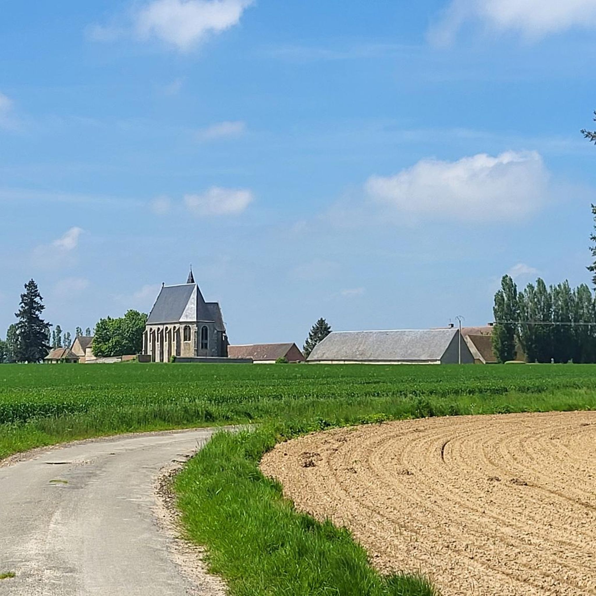
The Saint-Eloi Saint-Jean-Baptiste church in Crécy-Couvé is currently being restored. The spire of its bell tower, which was leaning dangerously, has been dismantled and is currently stored in the church awaiting restoration.
0
0

The Church of Saint-Éloi-Saint-Jean-Baptiste is believed to have originally been the chapel of the Château de Couvé, the first known mention of which dates back to 1215. This château belonged to the Abbey of Saint Père de Chartres. The layout of this chapel is currently unknown. Observing the architectural features of the current church allows us to place its construction between the 15th and 16th centuries. Improvement and modernization work were undertaken in the second half of the 18th century when Louis XV offered the Crécy estate to the Marquise de Pompadour: enlargement of the medieval windows, construction of an altarpiece forming a sacristy, a choir enclosure, and a gallery that could replace an older structure providing access to the attic. During this work, it is assumed that some of the bell tower's supports were removed to free up the nave and harmonize the interior spaces. After a prosperous period, the 19th and 20th centuries saw a slow deterioration of the building, despite some maintenance work being carried out on the roofs and other parts of the church that required it. It was only in 1901 that major work was undertaken, with the repair of the bell tower roof. This was followed in 1925 by work to consolidate the bell tower structures and repair the roofs of the western part of the nave. The bell tower and spire are tilting significantly to the south, linked to a failure of the old supports and the deterioration of the supporting structures, requiring urgent safety and restoration work.
0
0
The church dating from the 12th and 17th centuries is located in its parish enclosure occupied by the cemetery. It is made up of a nave and an aisle. To the west, the Renaissance entrance portal dating from the 1st quarter of the 16th century is in the shape of a basket handle and the two wooden leaves are each composed of four ornate panels, organized in three registers, classified as historic monuments object at the same time as the building. The five-sided apse is covered with a wooden vault with visible beams and hallmarks.
0
0

The Rond du Roi are two pyramids which mark the limits of the former royal hunting domain. The pyramids date from the 18th century and are made of sandstone blocks. They are located at the intersection of forest roads, called Rond de France and Rond du Roi. This area offers plenty of woodland running trails with stunning views of the surrounding countryside.
2
0
The Rond des Quatres Barrières is a historic monument dating from the 18th century. It was built by the Duke of Penthièvre, owner of the neighboring castle of Châteauneuf-en-Thymerais. The Rond des Quatres Barrières is made up of four stone arches which form a circle, with a fountain in the center. It is located in the middle of the forest. The Rond des Quatres Barrières is the ideal place to visit during a running race.
2
0
The Rond du Roi are two pyramids that mark the boundaries of the former royal hunting grounds. The pyramids date from the 18th century and are made of blocks of sandstone. They are located at the intersection of forest roads, called the Rond de France and the Rond du Roi. This area offers pleasant walks in the woods, with some views of the surrounding countryside.
3
0
The Rond des Quatres Barrières is a historical monument dating from the 18th century. It was built by the Duke of Penthièvre, who owned the neighboring castle of Châteauneuf-En-Thymerais. The Rond des Quatres Barrières is made up of four stone arches that form a circle, with a fountain in the center. It is located in the middle of the forest. The Rond des Quatres Barrières is a peaceful and charming place to visit, especially in the spring or fall when the trees are in bloom or changing color.
2
0

This discovery began with the old castle of Gougnault from 1300 to 1413 then the rebirth under Louis XIV and the creation of the Eure canal which crossed the park, followed by an 18th and 19th. "In 1780, four-year-old Anne Marie Reviers de Mauny planted a cedar in a kindergarten and the tree still stands in the town hall park" underlined Jacques Charron, the president of the association. This discovery ended with the period of the liberation of the village on August 15, 1944 by the Americans. source: the republican echo
1
0
Frequently Asked Questions
How many touring cycling routes are available in Favières?
There are over 75 touring cycling routes around Favières, offering a wide range of options for exploring the local countryside.
What kind of terrain can I expect on touring cycling routes around Favières?
The touring cycling routes around Favières are characterized by rural landscapes with gentle ascents and descents. You'll find a mix of paved roads and some unpaved sections, passing through charming villages and open countryside.
Are there easy touring cycling routes suitable for beginners or families?
Yes, Favières offers 39 easy touring cycling routes. A great option for a relaxed ride is the Rond du Roi – Rond des Quatres Barrières loop from Favières, which is 18.0 miles (29.0 km) long with a moderate elevation gain of 126 meters.
What are some challenging touring cycling routes in Favières for experienced riders?
For experienced riders seeking a challenge, there are 8 difficult touring cycling routes. Consider the Château de Fontaine-la-Guyon – Fleurfontaine loop from Saint-Arnoult-des-Bois, a 14.4 miles (23.1 km) path with 165 meters of ascent, offering scenic views.
Are there any circular touring cycling routes in Favières?
Many routes in Favières are circular, allowing you to start and end in the same location. For example, the popular Saulnières Town Hall loop from Favières is a 32.6 miles (52.4 km) circular route.
What do other touring cyclists enjoy most about cycling in Favières?
The touring cycling routes in Favières are highly rated by the komoot community, with an average score of 4.4 stars from over 30 reviews. Cyclists often praise the varied terrain, the peaceful rural roads, and the charming villages encountered along the way.
What historical sites or landmarks can I see along the touring cycling routes?
You can discover several interesting landmarks. Along your rides, you might pass by Vérigny Castle, the historic Château de Fontaine-la-Guyon, or the Rond du Roi historical site.
Are there any places to stop for refreshments or a break along the routes?
Yes, some routes pass by places where you can take a break. For instance, you might find the Bar de la Rivière, a cafe, which can be a convenient stop during your ride.
Is it possible to find routes that offer scenic viewpoints?
Yes, many routes offer picturesque views of the surrounding countryside. The region's rural character and gentle hills provide numerous opportunities for scenic vistas, especially on routes like the Château de Fontaine-la-Guyon – Fleurfontaine loop.
Are there any touring cycling routes that pass through woodlands?
Absolutely. Routes like the Rond du Roi – Rond des Quatres Barrières loop from Favières lead through rural paths and woodlands, offering a refreshing change of scenery.
What is the longest touring cycling route available in Favières?
The longest route listed is the Saulnières Town Hall loop from Favières, which spans 32.6 miles (52.4 km) and features an elevation gain of 295 meters.
Can I find routes that are suitable for a full day of cycling?
Yes, several routes are long enough for a full day's adventure. The Saulnières Town Hall loop from Favières, for example, typically takes around 3 hours and 42 minutes, making it a substantial ride when combined with breaks.
Most popular attractions around Favières

Get inspired with the komoot mobile app


Explore more
Browse the best Cycling routes in other regions.
