The best road cycling routes around Sagnes-Et-Goudoulet
4.6
(49)
1,117
riders
49
rides
Road cycling routes around Sagnes-Et-Goudoulet traverse the Ardèche mountains and the Ardéchois plateau, offering diverse terrain. The region is characterized by its high elevation, volcanic formations known as "sucs," and a landscape featuring rolling hills, gorges, and dense forests. Cyclists encounter challenging mountain passes and scenic plateau roads, providing varied experiences.
Best road cycling routes around Sagnes-Et-Goudoulet
- The most popular road cycling route is Lachamp-Raphaël – Col de Mézilhac (1,119 m) loop from Lachamp-Raphaël, a difficult 36.5 miles (58.8…
Last updated: July 15, 2026
83
riders
58.8km
03:15
1,240m
1,240m
Hard road ride. Very good fitness required. Mostly well-paved surfaces and easy to ride.
5.0
(2)
71
riders
73.0km
04:05
1,630m
1,630m
Hard road ride. Very good fitness required. Some segments of this route may be unpaved and difficult to ride.

Sign up for free
4.5
(2)
62
riders
39.5km
02:08
720m
720m
Moderate road ride. Good fitness required. Mostly well-paved surfaces and easy to ride.
55
riders
67.9km
03:33
1,230m
1,230m
Hard road ride. Very good fitness required. Mostly well-paved surfaces and easy to ride.
5.0
(1)
24
riders
54.9km
02:50
900m
900m
Moderate road ride. Good fitness required. Some segments of this route may be unpaved and difficult to ride.
Get access to more routes and recommendations from other explorers.
Sign up for free
Already have an account?
Our route recommendations are based on thousands of hikes, rides, and runs completed by other people on komoot.
Start today with a free account
Your next adventure awaits.
Login or Signup

Tips from the Community

The church of Usclades presents itself externally as a robust construction of grey granite, rectangular in shape, covered with lauzes (stone tiles). It is oriented and opens to the west with a very simple porch whose semi-circular arch is surmounted by a cross. In the immediate vicinity of the church is a washhouse which has been restored with the help of the Sauvegarde. On the edge of the village of Usclades, less than 500 meters from the church, is the Teste Partide thatched cottage, a beautiful building with a four-sloped broom roof that the Sauvegarde helps to preserve, in particular in conjunction with the Liger association. https://www.patrimoine-ardeche.com/visites/usclades.htm#:~:text=L'%C3%A9glise%20d'Usclades%20se,est%20surmont%C3%A9%20d'une%20croix.
0
0
The Ferme de Clastre is part of the last 15 thatched cottages still "standing" on the Mezenc-Gerbier massif and it is the last one located in the heart of the village. It has the particularity of having a double roof: mineral, made of phonolite slabs, for the two living quarters, and vegetal, dotted with broom, for the stable and hayloft part. The oldest writings found concerning the Ferme de Clastre indicate that its foundation dates back to the 11th century. Clastre, from the Latin "claustrum", was a non-conventual priory attached to the Abbey of Saint Chaffre du Monastier sur Gazeile. However, following two archaeological excavation campaigns carried out by the CNRS in Rennes in 2014 and 2016, charcoal dating has made it possible to prove human presence on this site dating back to 880-970, i.e. about 100 years earlier than the foundation of the priory. https://www.fondation-patrimoine.org/les-projets/ferme-de-clastre-a-sainte-eulalie/30888
0
0
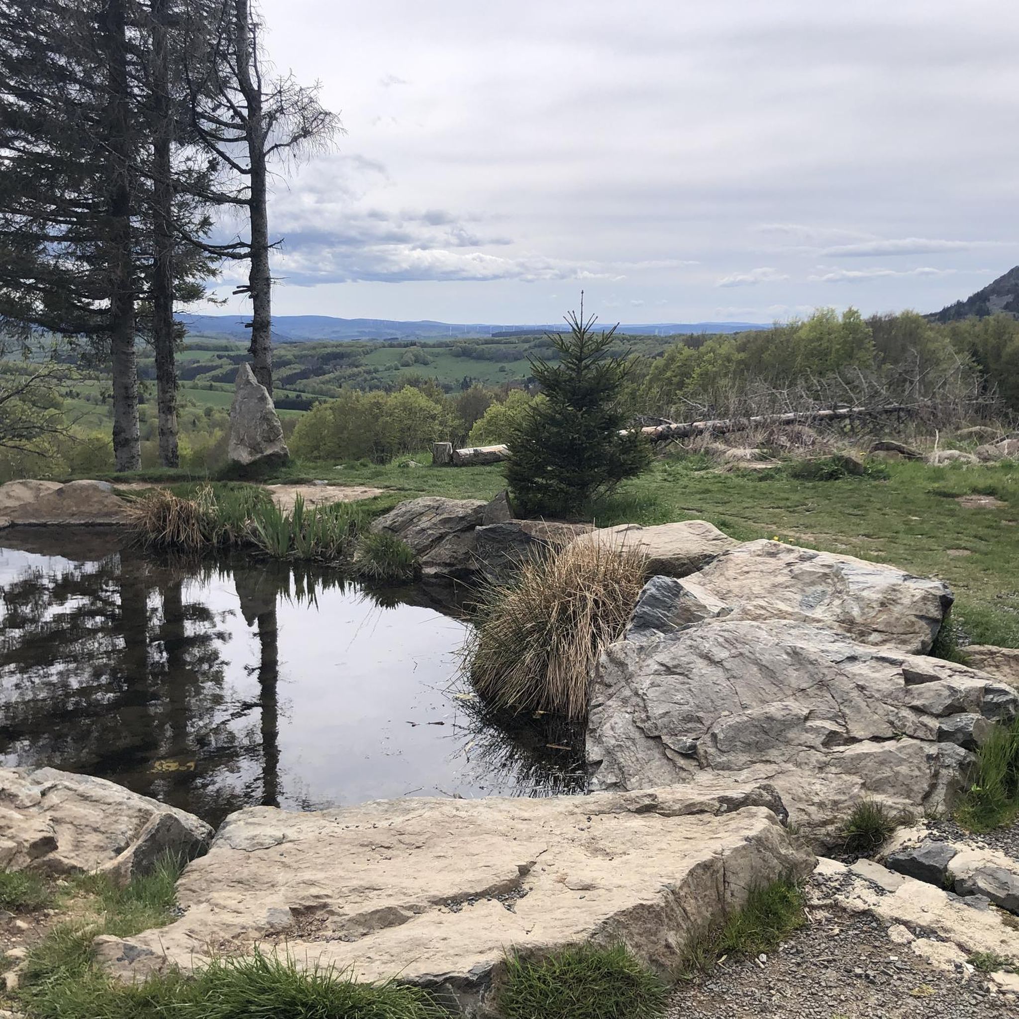
Located at an altitude of 1,330 meters, Lachamp-Raphaël is the highest village in the Ardèche. Dominated by the Montivernoux peak, the village offers exceptional panoramic views of the Alps and the Ardèche mountains. https://lachamp-raphael.fr/
0
0
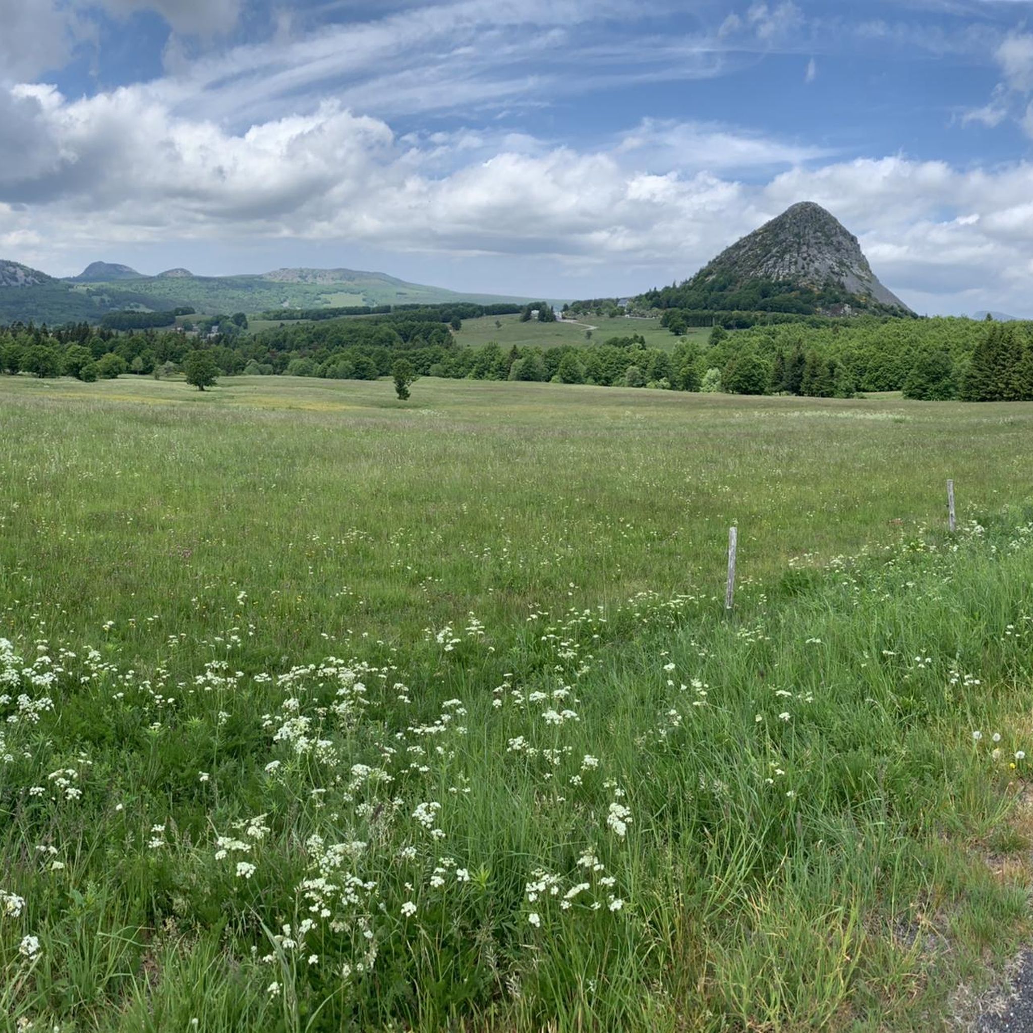
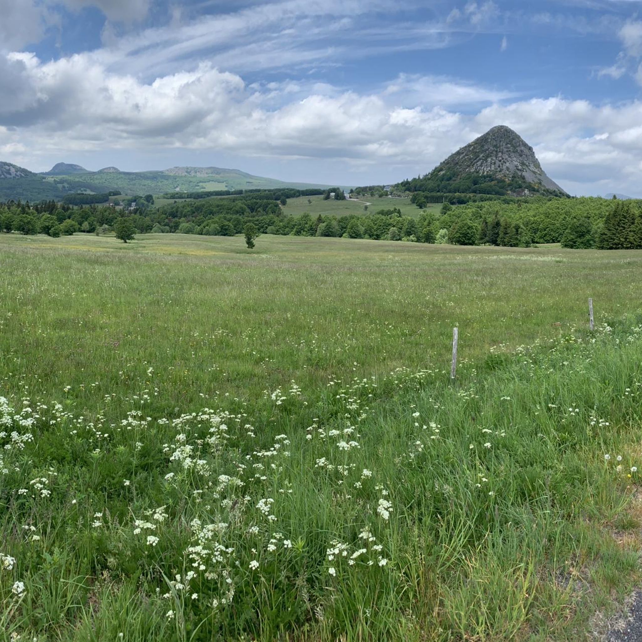
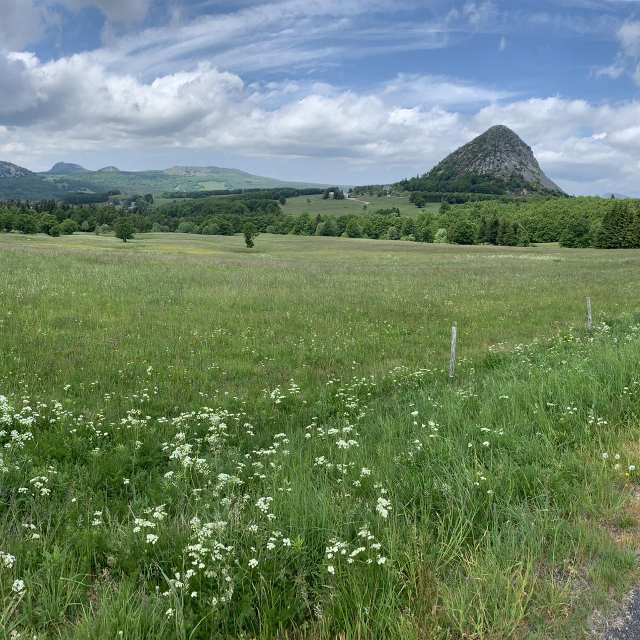
Eight million years old, Mont Gerbier-de-Jonc owes its conical shape to a viscous, cold lava that was unable to flow away. It is at its foot that the Loire River originates, in three places respectively designated as the geographical, authentic, and true sources. What if the Loire, in addition to its long journey to the Atlantic, also flowed into the Mediterranean? This is the intriguing hypothesis formulated by Gilles Clément after climbing the mountain following a period of drought, during which he nevertheless perceived a regular seepage in the rock. He imagines that Mont Gerbier-de-Jonc functions, in part, as a "water tower": a water trap based on the condensation of water vapor from clouds in desert regions. The collected water would flow at the foot of Mont Gerbier, towards the Atlantic Ocean and the Mediterranean Sea. https://www.lepartagedeseaux.fr/le-parcours-artistique/les-oeuvres-in-situ/la-tour-a-eau/
0
0

Small street, no traffic
0
0
Anyone who wants to stop for a bite to eat should stop here. There are few alternatives. A Grand Café Creme and a generous sandwich for 8 euros.
1
1
The Montivernoux peak is located in the Massif Central. It rises to an altitude of 1,441 meters in the Vivarais Mountains. It lies between the communes of Lachamp-Raphaël and Mézilhac. https://lachamp-raphael.fr/histoire-et-patrimoine/suc-de-montivernoux/
0
0
Frequently Asked Questions
How many road cycling routes are available around Sagnes-Et-Goudoulet?
There are over 50 road cycling routes around Sagnes-Et-Goudoulet, offering a wide range of experiences. These include routes catering to various skill levels, from moderate rides to challenging climbs through the Ardèche mountains and the Ardéchois plateau.
What kind of terrain can I expect when road cycling in Sagnes-Et-Goudoulet?
Road cycling in Sagnes-Et-Goudoulet features diverse terrain, characterized by high elevation, volcanic formations known as 'sucs,' rolling hills, dramatic gorges, and dense forests. You'll encounter challenging mountain passes like those leading to Mont Gerbier de Jonc and Mont Mézenc, as well as scenic plateau roads with breathtaking panoramic views.
What is the best time of year for road cycling in Sagnes-Et-Goudoulet?
The best time for road cycling in Sagnes-Et-Goudoulet is generally from late spring to early autumn. During these months, the weather is most favorable for tackling the region's mountain passes and enjoying the scenic plateau rides. The area's elevation means winters can be cold with snow, making cycling more challenging.
Are there road cycling routes suitable for beginners or families in Sagnes-Et-Goudoulet?
While many routes in Sagnes-Et-Goudoulet are challenging, there are some moderate options available. For a less strenuous experience, the broader Ardèche region offers routes like the Dolce Via, a family-friendly greenway further south. Within Sagnes-Et-Goudoulet, you can find routes like the Sainte-Eulalie Restrooms – Lac d’Issarlès loop from Sainte-Eulalie, which is rated as moderate.
What natural landmarks can I see while road cycling near Sagnes-Et-Goudoulet?
The region is rich in natural landmarks. You can cycle past the iconic Mount Gerbier de Jonc, the source of the Loire River, and enjoy views of Mont Mézenc, the highest point in the Ardèche. The volcanic past has also left numerous 'sucs' (volcanic domes) dotting the plateau, adding to the unique scenery.
Are there any historical or cultural attractions accessible by road bike?
Yes, beyond the natural beauty, you can explore local history. The Bourlatier Farm, a 17th-century farmhouse showcasing regional history and architecture, is an interesting stop. The intriguing Water Tower, echoing the Mont Gerbier de Jonc, is also a notable local feature that can be incorporated into your rides.
What are some challenging road cycling climbs in the area?
Sagnes-Et-Goudoulet is known for its challenging mountain passes. Cyclists can test their endurance on climbs like the Col de Mézilhac (1,119 m) and the Col du Gerbier de Jonc. Routes such as the Col de Mézilhac (1,119 m) – Col du Gerbier de Jonc loop from Lachamp-Raphaël offer significant elevation gain and rewarding vistas.
Are there any circular road cycling routes available?
Yes, many road cycling routes in Sagnes-Et-Goudoulet are designed as loops, allowing you to start and end in the same location. Examples include the Lachamp-Raphaël – Col de Mézilhac (1,119 m) loop from Lachamp-Raphaël and the Col de Mézilhac (1,119 m) – Col de Moucheyres (858 m) loop from Lachamp-Raphaël, providing varied distances and difficulties.
Is parking available for cyclists in Sagnes-Et-Goudoulet?
While specific dedicated cycling parking facilities are not detailed, Sagnes-Et-Goudoulet, as a small village, typically offers general parking options. It's advisable to check local signage upon arrival for the most convenient places to park your vehicle before starting your ride.
Can I reach Sagnes-Et-Goudoulet by public transport with my bike?
Public transport options directly to Sagnes-Et-Goudoulet with bike carriage might be limited due to its remote, high-altitude location in the Ardèche mountains. It's recommended to check regional bus services or train connections to larger towns in the Ardèche or Haute-Loire departments and then plan for a final leg by car or a longer cycling approach.
Are there dog-friendly road cycling options or nearby activities for dogs?
While road cycling itself might not always be ideal for dogs, the region around Sagnes-Et-Goudoulet offers other dog-friendly outdoor activities. In summer, you can enjoy hiking with dogs or even summer dog sledding on the Montagne Ardéchoise. Always ensure your dog is comfortable and safe if accompanying you on any part of a cycling route, especially on roads.
Where can cyclists find cafes or accommodation in Sagnes-Et-Goudoulet?
Sagnes-Et-Goudoulet and its surrounding villages offer local cafes, restaurants, and accommodation options catering to visitors. Given its popularity as an outdoor destination, you can expect to find guesthouses, small hotels, or holiday rentals. It's always a good idea to book accommodation in advance, especially during peak cycling seasons.
What do other road cyclists enjoy most about the routes in Sagnes-Et-Goudoulet?
The road cycling routes in Sagnes-Et-Goudoulet are highly rated by the komoot community, with an average score of 4.5 stars from over 40 reviews. Cyclists often praise the region's diverse volcanic landscapes, the challenge of its high plateaus and mountain passes, and the breathtaking views encountered along the way.
Most popular routes around Sagnes-Et-Goudoulet
Most popular attractions around Sagnes-Et-Goudoulet

Get inspired with the komoot mobile app


Explore more
Browse the best Road cycling routes in other regions.
