The best road cycling routes around Montonvillers
4.4
(17)
720
riders
148
rides
Road cycling routes around Montonvillers are characterized by a generally flat terrain, with altitudes ranging from 104m to 130m, making them accessible for various fitness levels. The region is largely defined by the Somme River and its canal, which the extensive Véloroute Vallée de Somme closely follows. This area features wetlands, marshes, and greenways, providing a scenic backdrop for cycling.
Best road cycling routes around Montonvillers
- The most popular road cycling route is La Madeleine Cemetery – Amiens Cathedral loop…
Last updated: October 13, 2026
11
riders
57.8km
02:26
340m
340m
Moderate road ride. Good fitness required. Some segments of this route may be unpaved and difficult to ride.
9
riders
56.2km
02:29
460m
460m
Moderate road ride. Good fitness required. Mostly well-paved surfaces and easy to ride.

2.0
(2)
9
riders
60.6km
02:36
430m
430m
Moderate road ride. Good fitness required. Mostly well-paved surfaces and easy to ride.
3
riders
58.2km
02:29
430m
430m
Moderate road ride. Good fitness required. Mostly well-paved surfaces and easy to ride.
8
riders
28.0km
01:11
210m
210m
Easy road ride. Great for any fitness level. Mostly well-paved surfaces and easy to ride.
Get access to more routes and recommendations from other explorers.
Already have an account?
Our route recommendations are based on thousands of hikes, rides, and runs completed by other people on komoot.
Start today with a free account
Your next adventure awaits.



Tips from the Community

The Étang Saint-Ladre Nature Reserve in Boves is located at the gates of Amiens, in the Avre Valley, a tributary of the Somme. In 1979, it became the first site in Picardy to be classified as a State Nature Reserve. The extraction of peat for heating, during the 18th and 19th centuries, created, in place of meadows, the ponds that today make up the reserve. Other activities such as cattle grazing, bleaching of woven textiles in the surrounding area on the meadows, and mowing of helophytes have also shaped the marsh and its ecological characteristics. The ecological management implemented since the 1990s has enabled the development of a complex mosaic of habitats, among the most representative of alkaline peat systems, allowing the expression of a characteristic, often heritage-worthy, flora and fauna. From the car park, the path enters the reserve and runs along the Avre. On the right, the first ponds and the reed bed appear. You will discover pollarded willows and expanses of wet meadows. These environments were shaped by human activity until the abandonment of these ancestral practices. Each year, the Conservatoire d’espaces naturels carries out work to preserve this endangered heritage. The large, now reopened areas are grazed by Nantais cows to maintain them. Observe the comings and goings of birds and dragonflies during the fine season… Listen to the song of passerines or amphibians. After the meadows, come the large bodies of water with their water lilies, moorhens, and grebes. The path makes a loop on a path along a new series of ponds until returning to the starting point. https://www.cen-hautsdefrance.org/site/rnn-letang-saint-ladre/
0
0

Stunning trompe-l'œil murals offer a subtle tribute to the Polish airmen who fell in the area during World War II. Near the church, you'll find a collection of old photographs and information about Naours as it once was. Don't forget to look at the street signs, some of which also include the name in Picard dialect – a rare find!
0
0
Site managed by the Conservatoire d'Espaces Naturels des Hauts de France (Hauts-de-France Regional Nature Reserve). A wide, stabilized gravel path, open to the public, is maintained and marked with signposts. Since 2012, an audio guide has allowed you to explore the nature reserve with a "virtual guide." QR codes placed along the path allow you to play the audio clips using your smartphone. This audio guide is available in three languages (French, English, and Dutch). https://www.cen-hautsdefrance.org/rnn-l-etang-saint-ladre
0
0
The Etang Saint-Ladre Nature Reserve in Boves is located at the gates of Amiens, in the L’Avre Valley, a tributary of the Somme. In 1979, it became the first site in Picardy to be classified as a State Nature Reserve. The ecological management implemented since the 1990s has made it possible to develop a complex mosaic of habitats among the most representative of alkaline peat systems, allowing the expression of characteristic, often heritage, flora and fauna. Find all the information concerning this site here: https://www.cen-hautsdefrance.org/site/rnn-letang-saint-ladre/
0
0

A beautiful place for a walk in nature. The bike path is perfect.
0
0

Smooth green corridor
0
0

Good Gravel spot, even better out of season
0
0
Frequently Asked Questions
How many road cycling routes are available around Montonvillers?
There are over 140 road cycling routes around Montonvillers listed on komoot, offering a wide variety of options for different preferences and skill levels. These include 33 easy routes, 103 moderate routes, and 5 more challenging options.
What kind of terrain can I expect on road cycling routes near Montonvillers?
The road cycling routes around Montonvillers are characterized by a generally flat terrain, with altitudes ranging from 104m to 130m. This makes them accessible for various fitness levels. The region is largely defined by the Somme River and its canal, which the extensive Véloroute Vallée de Somme closely follows, offering continuous water views and diverse natural environments like wetlands and marshes.
Are there family-friendly road cycling routes near Montonvillers?
Yes, the generally flat terrain and dedicated cycle paths of the Véloroute Vallée de Somme make it ideal for families. Many routes are easy and offer peaceful rides with scenic views, suitable for all fitness levels. For example, the Roadbike loop from Villers-Bocage is an easy 27.9 km route.
What scenic attractions or landmarks can I see while cycling?
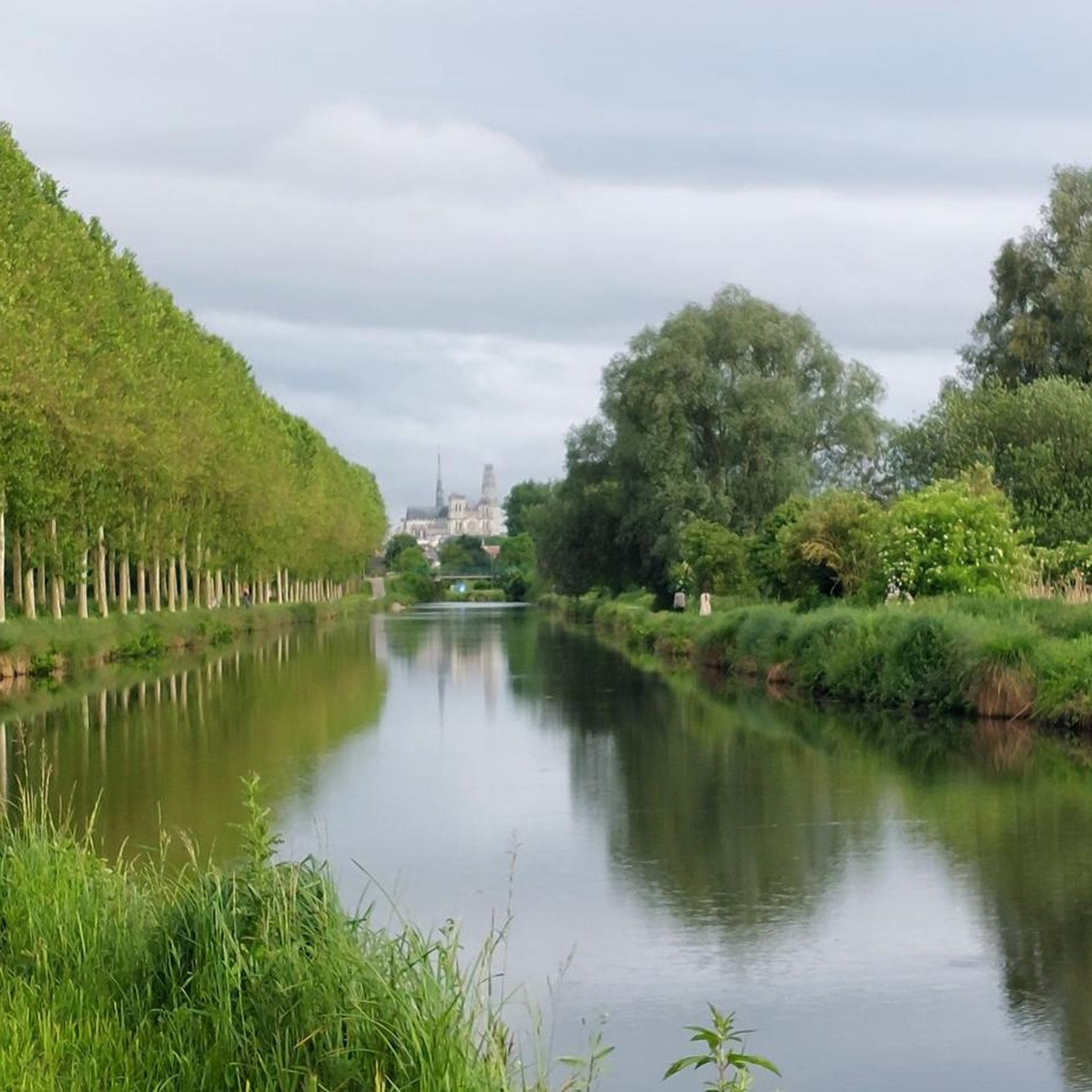
While cycling around Montonvillers, you can enjoy views of the Somme River and its canal, passing through wetlands and marshes like those at Méricourt-sur-Somme and the Etangs de la Barette. Notable attractions include the magnificent Notre-Dame Cathedral in Amiens, which can be seen on routes like the La Madeleine Cemetery – Amiens Cathedral loop from Villers-Bocage. You might also encounter historical sites such as the Naours Underground City or the Ailly-sur-Somme Lockhouse.
What is the best time of year for road cycling around Montonvillers?
The region is enjoyable for road cycling throughout much of the year, especially when the weather is mild. The flat terrain makes it less susceptible to extreme conditions. Spring and autumn offer pleasant temperatures and beautiful scenery, while summer provides longer daylight hours. Always check local weather forecasts before heading out.
How can I access the cycling routes, particularly regarding parking or public transport?
Many routes start from villages like Villers-Bocage, where parking may be available. For longer journeys or to access different sections of the Véloroute Vallée de Somme, train lines along the route accommodate unmounted bicycles, offering flexibility. Some former lock-keepers' houses along the route have been converted into service points, which may offer information on local access.
Where can I rent a bike in the Montonvillers area?
While Montonvillers itself is small, the wider Somme Valley area, particularly along the Véloroute Vallée de Somme, has services for cyclists. Some converted lock-keepers' houses ('Maisons de la Vallée') act as tourist offices and may offer bike rental services. For more detailed information on services along the Somme Valley cycle route, you can consult resources like Somme Tourisme.
Are there places to stop for refreshments or find services along the routes?
Yes, the Véloroute Vallée de Somme is equipped with amenities such as picnic areas and bike parking. Along the route, you'll find renovated former lock-keepers' cottages that welcome cyclists, often offering local products and information. Major towns like Amiens and Péronne, situated along the route, provide a wider range of cafes, restaurants, and other services.
What do other road cyclists enjoy the most about road cycling in Montonvillers?
The area is highly rated by the komoot community, with an average score of 4.3 stars from over 10 reviews. Reviewers often praise the peaceful, flat terrain, the continuous water views along the Somme River, and the diverse natural environments like wetlands. The accessibility for various fitness levels and the scenic backdrop are frequently highlighted.
Are there any routes that explore the natural wetlands and ponds?
Absolutely. The region is rich in natural wetlands and ponds. The Saint-Ladre Pond – Corbie Tours loop from Villers-Bocage is a great example, leading directly through wetlands and past the Saint-Ladre Pond. The Véloroute Vallée de Somme itself winds through exceptional natural sites such as the marshes of Méricourt-sur-Somme and the Etangs de la Barette.
Can I find longer, more challenging road cycling routes near Montonvillers?
While the area is generally flat, there are longer routes that offer a good workout. For instance, the Château de Bovelles loop from Villers-Bocage is a moderate 67.4 km route. The extensive Véloroute Vallée de Somme also allows for combining sections to create longer rides, with some routes reaching up to 200 kilometers in total length.
Are there any specific historical sites accessible by bike?
Yes, the cycling routes offer access to significant historical and cultural attractions. The city of Amiens, with its UNESCO World Heritage Notre-Dame Cathedral, is a major highlight. Further along the Somme Valley, the town of Péronne offers a historical perspective on World War I. You can also explore the Naours Underground City, a unique historical site.
Most popular routes around Montonvillers
Most popular attractions around Montonvillers

Get inspired with the komoot mobile app


Explore more
Browse the best Road cycling routes in other regions.
