The best MTB trails around Alberschweiler
4.6
(127)
782
riders
22
rides
Mountain biking around Alberschweiler offers a diverse landscape at the foot of the Palatinate Forest, characterized by significant elevation changes and varied terrain. The region features extensive woodlands, picturesque vineyards, and numerous historical castles. Riders can expect a mix of forest roads, narrow paths, and challenging single trails, with some routes involving over 1,000 meters of ascent.
Best mountain bike trails around Alberschweiler
- The most popular mountain bike trail is Picnic Table in the Forest – Belle Roche loop from Abreschviller, a 21.3 miles (34.3 km) moderate trail that takes 3 hours 50 minutes to complete. This route offers a balanced challenge with varied forest paths.
- Another top favourite among local mountain bikers is Donon Summit and Temple – Picnic Table in the Forest loop from Abreschviller, a difficult 35.4 miles (56.9 km) path. This trail includes substantial climbs and rewarding descents through the forested landscape.
- Local mountain bikers also love the Belle Roche – Donon Summit and Temple loop from Abreschviller, a 32.6 miles (52.4 km) trail leading through dense woodlands and offering panoramic views, often completed in about 4 hours 54 minutes.
- Mountain biking around Alberschweiler is defined by the Palatinate Forest, historic castle ruins, and challenging elevation changes. The network offers options for different ability levels, from moderate to difficult.
- The routes in Alberschweiler are highly rated by the komoot community with an average score of 4.6 stars from over 100 reviews. More than 650 mountain bikers have used komoot to explore Alberschweiler's varied terrain.
Last updated: October 9, 2026
4.7
(3)
65
riders
28.6km
02:29
530m
530m
Hard mountain bike ride. Good fitness required. Advanced riding skills necessary. Some portions of the route may require you to push your bike.
5.0
(4)
44
riders
Moderate mountain bike ride. Good fitness required. Suitable for all skill levels.

4.8
(4)
28
riders
54.5km
05:54
1,170m
1,170m
Hard mountain bike ride. Very good fitness required. Advanced riding skills necessary. Some portions of the route may require you to push your bike.
4.0
(2)
17
riders
54.3km
04:11
1,080m
1,080m
Hard mountain bike ride. Very good fitness required. Advanced riding skills necessary. Some portions of the route may require you to push your bike.
10
riders
52.5km
04:53
1,070m
1,070m
Hard mountain bike ride. Very good fitness required. Advanced riding skills necessary. Some portions of the route may require you to push your bike.
Get access to more routes and recommendations from other explorers.
Already have an account?
Our route recommendations are based on thousands of hikes, rides, and runs completed by other people on komoot.
Start today with a free account
Your next adventure awaits.
Popular around Alberschweiler

GR 5 – The Europe Trail from the Mediterranean to Germany
GR5 — The Europe Trail from Abreschviller to Apach
Linking Lorraine and Alsace – Stanislas-Kléber Path (GR 534)
Hiking around Alberschweiler
Cycling around Alberschweiler
Road Cycling Routes around Alberschweiler
Running Trails around Alberschweiler
Gravel biking around Alberschweiler
Other adventures around Alberschweiler


Tips from the Community

Here the red Saar begins, it unites with the white Saar near Hermelange and flows into the Moselle near Konz in Rhineland-Palatinate. The source of the white Saar is only about 1 km away, but it only unites with the red Saar near Hermelange (Jonction des deux Sarre) after 27 km.
0
0

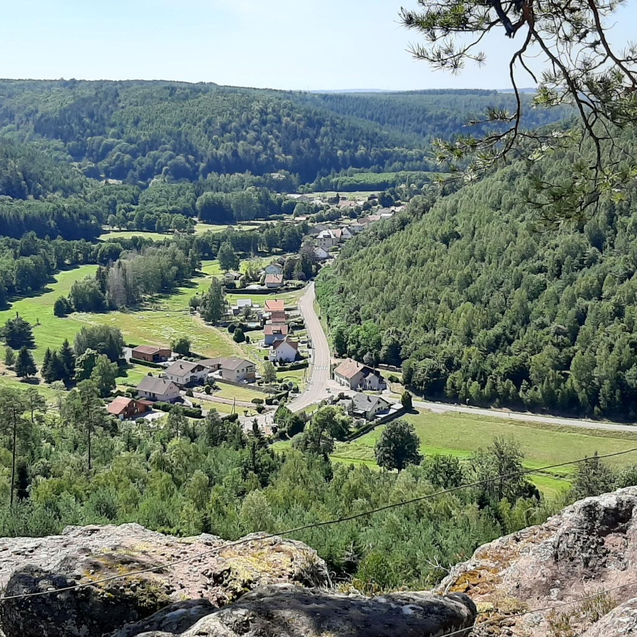
This is an unprecedented view. Where you mainly walk gratefully in the shade of the trees, you can look out here freely. You can also spend the night here, when I walked here in the early morning a hiker who had spent the night just left.
1
0

The place is good for sleeping but you will have to walk a little lower down to the water point.
2
0

Even though the two sources of the Saar headwaters are less than 1km apart, they only join after flowing for over 26km each.
1
0
The view is almost all the way around and is very impressive. Furthermore, the mountain is a kind of open-air necropolis: many inscriptions carved into the rock commemorate the fierce battles and, above all, the fallen on both sides.
1
0
The spring is located a little further up the hiking trail toward the road. You can hear the water splashing loudly from the trail.
1
0

Here is the source of the Plaine, which partly forms the border between the departments of Meurthe-Moselle and Vosges.
2
0

Very nice view with technical access
0
0
Frequently Asked Questions
How many mountain bike trails are available around Albersweiler?
There are over 20 mountain bike trails around Albersweiler, offering a diverse range of experiences for mountain bikers. These routes are highly rated by the komoot community.
What kind of terrain can I expect on mountain bike trails near Albersweiler?
The terrain around Albersweiler is diverse, featuring extensive woodlands, picturesque vineyards, and significant elevation changes. You'll encounter a mix of forest roads, narrow paths, and challenging single trails, including sections with long rock formations and demanding switchbacks. Some routes involve over 1,000 meters of ascent and descent.
Are there mountain bike trails suitable for beginners or families in Albersweiler?
While many trails around Albersweiler are moderate to difficult, there are options for less experienced riders. For example, there is at least one easy-rated trail, and some moderate routes like the Picnic Table in the Forest – Belle Roche loop from Abreschviller offer a balanced challenge on varied forest paths, which might be suitable for families with some mountain biking experience.
What are the best times of year for mountain biking in Albersweiler?
The region is beautiful throughout the year, but spring and autumn are particularly pleasant. In spring, the almond trees in the vineyards bloom, offering scenic rides. Autumn provides vibrant foliage. While winter mountain biking is possible, weather conditions can be more challenging, and some trails might be affected by snow or ice.
Are there any permits required for mountain biking in the Palatinate Forest around Albersweiler?
The trails around Albersweiler are often part of the Mountain Bike Park Pfälzerwald. Generally, mountain biking is permitted on designated trails and forest roads. It's always advisable to check local regulations or specific trail signage for any permit requirements, especially for certain protected areas or private lands.
What historical landmarks or viewpoints can I see along the mountain bike trails?
The region is rich in historical sites and offers numerous panoramic views. Many routes feature 'compact mountain bike routes with many small highlights such as castles, rocks, and beautiful views'. You can expect to see castle ruins like Neuscharfeneck Castle, and impressive sites like Trifels Castle. Notable viewpoints include the '3 Castles View' and natural features like the 'Felsenmeer Hüttenberg'. Highlights like the Donon Temple or the Rocher de Dabo and Chapel Saint-Léon IX are also accessible.
Are there any dog-friendly mountain bike trails around Albersweiler?
Many forest paths and trails in the Palatinate Forest are generally dog-friendly, provided dogs are kept on a leash and owners adhere to local wildlife protection rules. It's recommended to choose less technical routes if riding with a dog. Always ensure your dog is fit enough for the distance and elevation, and carry enough water for both of you.
Where can I find parking for mountain biking in Albersweiler?
Albersweiler, being a popular starting point for outdoor activities, typically offers designated parking areas for visitors. Look for signs indicating 'Wanderparkplatz' or 'Parkplatz' near trailheads or in the village center. Specific parking information might be available on local tourism websites or within komoot tour descriptions.
What do other mountain bikers enjoy most about the trails in Albersweiler?
The mountain bike trails around Albersweiler are highly rated by the komoot community, with an average score of 4.6 stars from over 100 reviews. Riders often praise the diverse landscape, the challenging elevation changes, and the mix of forest roads, narrow paths, and flowing single trails. The historical castles and panoramic views are also frequently highlighted as enjoyable aspects.
Are there any challenging mountain bike routes for experienced riders?
Yes, Albersweiler offers several challenging routes for experienced mountain bikers. Many trails are rated 'difficult' and feature substantial climbs and descents, with some exceeding 1,000 meters of elevation gain. Examples include the Donon Summit and Temple – Picnic Table in the Forest loop from Abreschviller (56.9 km, 995m elevation) or the even longer Hohwalsch Rock – Saint-Léon Cave loop from Abreschviller (67.6 km, 1756m elevation).
Can I access the mountain bike trails using public transport?
Albersweiler is connected to the regional public transport network. While direct access to every trailhead by public transport might vary, you can typically reach the village center by bus or train. From there, you can cycle to the starting points of various trails. It's advisable to check local bus and train schedules and policies regarding bicycle transport.
Are there any loop trails available for mountain biking?
Yes, the majority of mountain bike trails around Albersweiler are designed as loop routes, allowing you to start and finish at the same point. This makes planning your ride convenient. Examples include the Belle Roche – Donon Summit and Temple loop from Abreschviller or the Rocher de Mutzig Viewpoint – Stone Gate loop from Grand Soldat.
Most popular routes around Alberschweiler
Most popular attractions around Alberschweiler

Get inspired with the komoot mobile app


Explore more
Browse the best MTB trails in other regions.
