The best mountain hikes around Jenaz
5.0
(1)
25
hikers
2
hikes
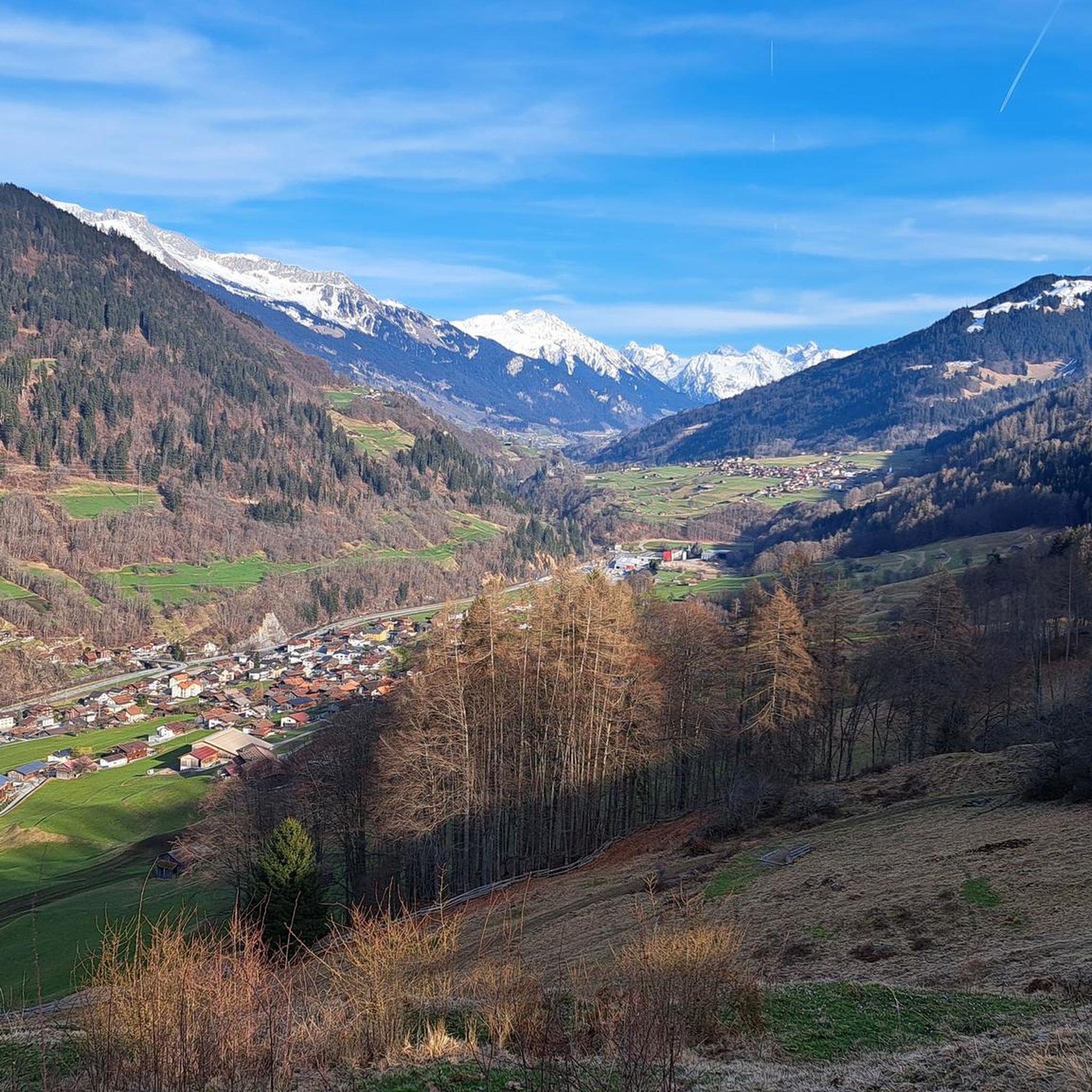
Mountaineering around Jenaz offers access to the rugged terrain of the Prättigau/Davos region in Switzerland. The area is characterized by prominent mountain ridges, deep valleys, and alpine landscapes, providing challenging ascents and panoramic views. These routes often traverse high-altitude passes and lead to impressive summits, showcasing the region's natural grandeur.
Best mountaineering routes around Jenaz
- The most popular mountaineering route is St. Antönier Joch – Ridge Trail to Riedkopf loop from Luzein, a 9.4 miles (15.2 km) trail that…
Last updated: October 10, 2026
5.0
(1)
17
hikers
15.6km
06:57
1,040m
1,040m
Hard mountaineering route. Very good fitness required. Sure-footedness, sturdy shoes and alpine experience required.
5
hikers
18.2km
06:39
830m
840m
Hard mountaineering route. Very good fitness required. Mostly accessible paths. Sure-footedness required.

3
hikers
6.31km
02:47
570m
590m
Moderate mountaineering route. Good fitness required. Easily-accessible paths. Suitable for all skill levels.
Our route recommendations are based on thousands of hikes, rides, and runs completed by other people on komoot.
Start today with a free account
Your next adventure awaits.

Tips from the Community

Short crisp detour, T3+, sure-footedness and a certain fear of heights required, as some places are sloping or a bit exposed.
0
0

This section leads you along the south face of the mighty Sulzfluh, which at 2,817 meters is one of the highest peaks in the Rätikon and marks the border with Vorarlberg. The massive limestone wall, which separates the Gauertal in Montafon from the St. Antöniental, is considered one of the most impressive mountains in the region. Below the earth's surface, an extensive network of caves, some of which can only be climbed, branches out. Particularly impressive are the Gauablick- and Seehöhle, the Abgrundhöli, or the three-kilometer-long Apollohöhle. Above, you can enjoy the view over the wonderfully open meadows of Prättigau and watch the cotton grass dance in the wind.
1
0
Below the rugged Sulzfluh, at an altitude of 2,236 meters, lies the Carschinahütte of the Swiss Alpine Club. After extensive renovation, one of the most beautiful and most visited huts in the country is now also one of the most sustainable. A solar system will ensure a reliable and environmentally friendly power supply in the future. The kitchen and sanitary facilities have been completely renewed, along with the spring capture, the filter system, and the entire wastewater infrastructure. Adapted room sizes, wider mattresses, and a dining room renovated with a lot of wood ensure additional coziness. What has remained is what has always characterized the hut: a unique location, the impressive mountain scenery of the Rätikon, the warm and rustic atmosphere, a cordial hut team, as well as the regional delicacies of excellent quality that are served here.
3
0
Nestled in the gentle slopes of the Rätikon, at around 1,400 meters above sea level, lies the picturesque village of St. Antönien. Its name derives from the parish church built in the center in the 14th century, which was dedicated to Saint Anthony. To this day, dairy farming and livestock breeding shape the cultural landscape around the Walser community, which was settled around the 13th century. Since June 2021, St. Antönien has been the first Swiss locality to bear the title "Bergsteigerdorf" (mountaineering village) – an award given by the Swiss Alpine Club together with the municipality. This recognizes communities that focus on nature-oriented mountain tourism instead of mass crowds and commit to sustainably preserving nature, culture, and traditions. Numerous tours lead from here into the surrounding mountains all year round. In addition, there are a variety of excellent refreshment and accommodation options in the municipality.
1
0

Stunning panoramic views at the top make the climb absolutely worth it. The trail conditions can change quickly depending on the season, so check the weather before heading up. Early mornings offer the quietest experience.
0
0


Wonderful holiday resort, pleasantly away from the hustle and bustle!
1
0

I think most people take a break here; it's a nice spot, but then it goes up a bit further.
4
0
Frequently Asked Questions
Are there any mountaineering routes suitable for beginners around Jenaz?
While many routes in the Jenaz area are challenging, there are options for those with some experience looking for a moderate introduction to mountaineering. Consider the Strelapass loop from Weissfluhjoch, which offers a manageable ascent and rewarding views. Another good choice is the Sassauna Summit loop from Berggasthaus Sassauna, providing a moderate challenge with beautiful alpine scenery.
What kind of terrain can I expect on mountaineering routes near Jenaz?
Mountaineering routes around Jenaz are characterized by the rugged terrain of the Prättigau/Davos region. You can expect prominent mountain ridges, deep valleys, and diverse alpine landscapes. Trails often involve sustained climbing, high-altitude passes, and can lead to impressive summits, offering expansive alpine vistas.
Are there any circular mountaineering routes in the Jenaz area?
Yes, several routes in the Jenaz area are designed as loops, allowing you to start and end at the same point. Examples include the St. Antönier Joch – Ridge Trail to Riedkopf loop from Luzein, which features a challenging ridge ascent, and the Carschina Hut – Partnunsee loop from Luzein, leading through high alpine pastures and past a scenic mountain lake.
What is the best time of year for mountaineering around Jenaz?
The best time for mountaineering in the Jenaz region is typically from late spring to early autumn (June to September). During these months, snow has usually melted from higher elevations, and weather conditions are generally more stable, offering clearer paths and better visibility for panoramic views. Always check local weather and trail conditions before heading out.
Are there any specific permits required for mountaineering in this region of Switzerland?
Generally, permits are not required for day mountaineering hikes in the Jenaz area or other parts of the Swiss Alps. However, it's always advisable to respect local regulations, especially concerning protected areas or private land. For specific routes, ensure you are aware of any access restrictions or seasonal closures.
What are some interesting natural landmarks or attractions I might see along these routes?
The Jenaz region offers several natural highlights. You might encounter the impressive Weisshorn Summit (2,653 m), or traverse the Strela Pass. Some routes also pass by the serene Upper Lake (Arosa) or the unique Tufa Spring. The Hauptertäli Rock Path is another notable feature.
How accessible are the trailheads by public transport near Jenaz?
Switzerland has an excellent public transport network. Many trailheads in the Jenaz area are accessible by bus or train, especially those starting from larger villages or towns. It's recommended to check the local public transport schedules for specific starting points, as services to more remote areas might be less frequent.
Are there any cafes or mountain huts along the mountaineering routes for refreshments?
Yes, some mountaineering routes in the region may pass by mountain huts or small cafes, especially in more frequented areas. For example, the Ochsenalp Mountain Hut is a known point of interest. These establishments often offer refreshments and sometimes overnight stays. Always check their operating hours, especially outside peak season.
What do other mountaineers enjoy most about the routes around Jenaz?
The mountaineering routes around Jenaz are highly rated by the komoot community, with an average score of 5.0 stars. Reviewers often praise the challenging ridge ascents, the expansive alpine vistas, and the varied mountain scenery, including sections known for specific flora like the Yellow Lady's Slipper Orchids loop from Arosa.
What should I pack for a summer mountaineering trip in Jenaz?
For summer mountaineering in Jenaz, essential gear includes sturdy hiking boots, layered clothing (including waterproof and windproof outer layers), sun protection (hat, sunglasses, sunscreen), sufficient water and snacks, a first-aid kit, and a map or GPS device. Even in summer, weather in the Alps can change rapidly, so be prepared for cooler temperatures and sudden rain.
Are there any routes that offer opportunities for wildlife spotting?
The alpine environment around Jenaz is home to diverse wildlife. While specific routes aren't designated solely for wildlife spotting, many trails traverse quiet, natural habitats where you might encounter chamois, ibex, marmots, or various bird species. Early mornings or late afternoons often provide the best chances for sightings.
Most popular attractions around Jenaz

Get inspired with the komoot mobile app


Explore more
Browse the best Mountain Hikes & Routes in other regions.
