The best road cycling routes around Le Vernet
4.6
(48)
1,443
riders
16
rides
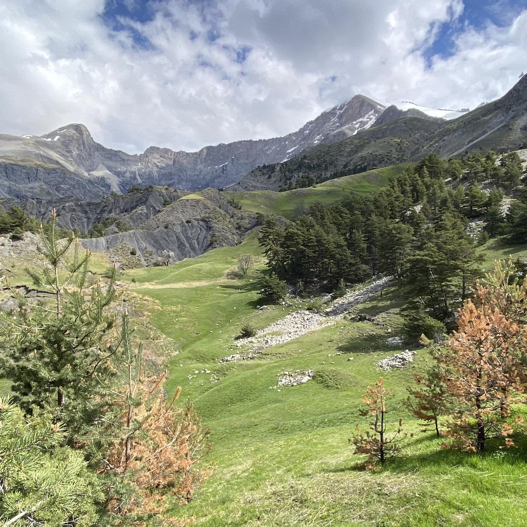
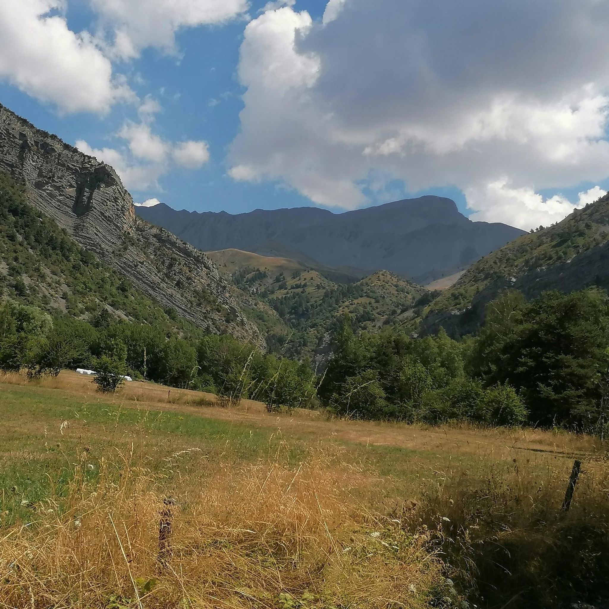
Road cycling routes around Le Vernet are situated on a vast high plateau within the Bès Valley, at an altitude of 1,200 meters. The region lies at the foot of a mountain cirque, with peaks reaching up to 2,800 meters, providing varied elevation for cyclists. This mountainous environment offers numerous road cycling routes characterized by large green meadows and the Bès river. The terrain includes challenging ascents and descents, making it suitable for experienced road cyclists.
Best road cycling routes…
Last updated: September 1, 2026
4.7
(15)
787
riders
115km
06:15
2,340m
2,350m
Hard road ride. Very good fitness required. Mostly well-paved surfaces and easy to ride.
4.3
(7)
78
riders
Moderate road ride. Good fitness required. Mostly well-paved surfaces and easy to ride.

Sign up for free
4.3
(7)
164
riders
40.3km
02:14
840m
840m
Moderate road ride. Good fitness required. Mostly well-paved surfaces and easy to ride.
4.5
(2)
94
riders
33.0km
01:42
590m
590m
Moderate road ride. Good fitness required. Mostly well-paved surfaces and easy to ride.
15
riders
41.2km
01:54
460m
460m
Moderate road ride. Good fitness required. Mostly well-paved surfaces and easy to ride.
Get access to more routes and recommendations from other explorers.
Sign up for free
Already have an account?
Our route recommendations are based on thousands of hikes, rides, and runs completed by other people on komoot.
Start today with a free account
Your next adventure awaits.
Login or Signup
Tips from the Community

Short but quite difficult climbs from both sides up to 12% gradient, minimal car traffic, Mediterranean climate. One of the 7 passes from the Ubaye Breviet collection.
0
0

Beautiful place to stop and enjoy the view of the lake
1
0

Great mountain panorama, still snow-covered in June
0
0


INCREDIBLE bike park! Take the time to stop there
2
0

A wonderful view of the lake.
19
0
A climb with gentle slopes.
14
0
Small town, here you can refill your water bottles.
14
0
Frequently Asked Questions
What kind of terrain and elevation can I expect when road cycling around Le Vernet?
Le Vernet is situated on a vast high plateau within the Bès Valley, at an altitude of 1,200 meters, and lies at the foot of a majestic mountain cirque with peaks reaching up to 2,800 meters. This means you can expect diverse and challenging terrain, featuring significant climbs and descents through mountainous landscapes, alongside picturesque green meadows and the Bès river. Routes often involve varied elevation, catering to cyclists looking for a good workout.
Are there road cycling routes suitable for experienced cyclists looking for a challenge?
Absolutely. Le Vernet's mountainous environment offers numerous challenging road cycling routes. For instance, the Lebraut Pass – Blanche Gorge loop from Seyne is a difficult 114.7 km trail with over 2,300 meters of elevation gain. Another demanding option is the Bridge Over the Ubaye – Col de Pontis loop from Seyne, covering 75.7 km with over 1,600 meters of ascent, winding through spectacular mountainous terrain.
What are the typical distances and durations for road cycling routes in the Le Vernet area?
Road cycling routes around Le Vernet vary in length and duration. You can find routes ranging from moderate distances, such as the Col Saint Jean (1332 m) – Seyne-les-Alpes loop from Seyne les Alpes - Le Grand Puy at 31.2 km, to much longer and more challenging rides like the Lebraut Pass – Blanche Gorge loop from Seyne, which is 114.7 km and typically takes over 6 hours to complete.
What natural attractions can I see along road cycling routes near Le Vernet?
The region is rich in natural beauty. Cyclists can encounter dramatic geological formations like the Clue de Barles and the Gorges d'Auzet. You might also spot the Saut de la Pie Waterfall or admire the unique Lame de Facibelle. The area is part of the Haute-Provence Geopark, showcasing remarkable geological sites.
What is the best time of year for road cycling in Le Vernet?
Le Vernet benefits from approximately 300 days of sunshine annually, making it an appealing destination for road cycling for much of the year. Spring and autumn generally offer pleasant temperatures and vibrant landscapes. While summer is also sunny, some high-altitude passes might be more challenging due to heat. Winter cycling is possible, but higher mountain passes may be closed due to snow.
Are there any circular road cycling routes available around Le Vernet?
Yes, many of the road cycling routes in Le Vernet are designed as loops, allowing you to start and finish in the same location. For example, the Blanche Gorge – View of the Gorges de la Blanche loop from Seyne is a 69.2 km circular trail that takes you through dramatic gorges and high plateaus.
What do other road cyclists say about their experience in Le Vernet?
The road cycling routes around Le Vernet are highly rated by the komoot community, with an average score of 4.6 stars from over 40 reviews. Cyclists often praise the stunning landscapes, the varied elevation that provides a good challenge, and the opportunity to explore the picturesque Alpes-de-Haute-Provence region.
Can I find moderate road cycling routes in Le Vernet, or are they all very difficult?
While Le Vernet is known for its challenging terrain, there are also moderate road cycling options available. For instance, the Seyne-les-Alpes – Col Saint Jean (1332 m) loop from Seyne is a moderate 40.3 km route with over 800 meters of elevation gain, offering a good balance of challenge and accessibility for those with good fitness.
Are there any high mountain passes accessible for road cyclists near Le Vernet?
Yes, Le Vernet serves as an excellent base for accessing several renowned high mountain passes. Experienced road cyclists can challenge themselves on nearby passes such as Col d'Allos, Col de la Cayolle, and the iconic Col de la Bonette, all offering breathtaking panoramic views and significant ascents.
What kind of landscapes will I see while cycling in the region?
You will be immersed in the magnificent landscapes of the Alpes-de-Haute-Provence. Expect to cycle through large green meadows, alongside the Bès river, and within dramatic mountain cirques. The region's botanical wealth and unique geological sites, including ancient fossils within the Haute-Provence Geopark, add to the scenic diversity.
How many road cycling routes are available in the Le Vernet area?
There are approximately 18 road cycling routes available around Le Vernet, offering a range of options from moderate to difficult. This network provides ample opportunities to explore the region's diverse terrain and stunning natural beauty.
Most popular attractions around Le Vernet

Get inspired with the komoot mobile app


Explore more
Browse the best Road cycling routes in other regions.
