The best walks and hikes around Cuq
4.6
(129)
762
hikers
18
hikes
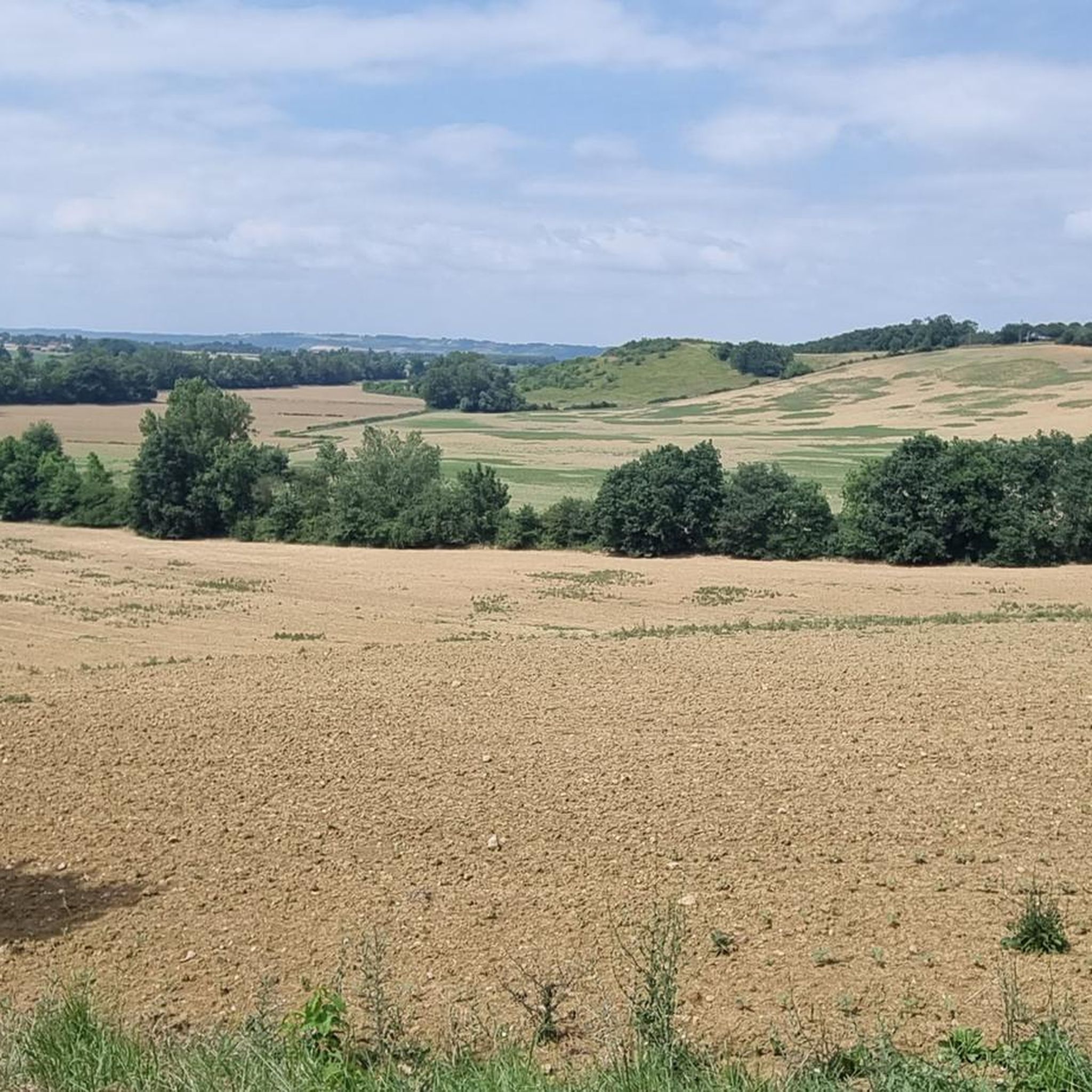
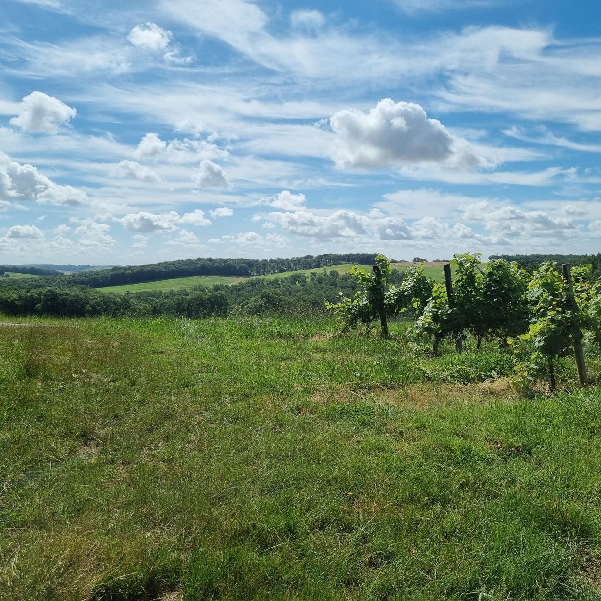
Hiking around Cuq features a landscape characterized by rolling hills and rural countryside. The area offers a mix of open fields, scattered woodlands, and paths connecting small villages. Elevation changes are generally moderate, providing accessible routes for various skill levels.
Best hiking trails around Cuq
- The most popular hiking route is Landscapes of the Gers – Saint-Saturnin Church loop from Saint-Antoine, a 16.7 miles (26.9 km) trail that takes 7 hours 30 minutes to complete. This difficult route explores…
Last updated: May 13, 2026
5.0
(1)
14
hikers
21.7km
06:07
460m
460m
Hard hike. Very good fitness required. Easily-accessible paths. Suitable for all skill levels.
8
hikers
9.40km
02:33
140m
140m
Moderate hike. Good fitness required. Easily-accessible paths. Suitable for all skill levels.

Sign up for free
4.7
(3)
8
hikers
11.3km
03:04
160m
160m
Moderate hike. Good fitness required. Easily-accessible paths. Suitable for all skill levels.
3
hikers
8.47km
02:24
190m
190m
Moderate hike. Good fitness required. Easily-accessible paths. Suitable for all skill levels.
5.0
(2)
8
hikers
10.8km
03:00
190m
190m
Moderate hike. Good fitness required. Easily-accessible paths. Suitable for all skill levels.
Get access to more routes and recommendations from other explorers.
Sign up for free
Already have an account?
Our route recommendations are based on thousands of hikes, rides, and runs completed by other people on komoot.
Start today with a free account
Your next adventure awaits.
Login or Signup

Tips from the Community

Coming from Mossiac, the town of Saint-Antoine is the 18th stage of the Camino de Santiago (Chemin de Saint-Jaques) if you follow the VIA PODIENSIS (from Le Puy-en-Velay to the Pyrenees).
2
1
On the Via Podiensis, pilgrims pass through many towns and can visit many churches. On the 19th stage (counting according to "Rother"), which leads from Saint-Antoine to Lectoure, this church is passed.
1
1

Saint-Antoine is a commune in the Gers department of France and has 174 inhabitants. The place is part of the district of Condom.
3
0
The small village of Flamarens is located in the department of Gers, in the Midi-Pyrénées region. The inhabitants are called the Flamalingois and the Flamalingoises. Surrounded by the municipalities of Miradoux, Saint-Antoine and Peyrecave, Flamarens is located 25 km southeast of Agen. The Métau and Montret streams on the one hand, tributaries of the Auroue and the Pourchet, Mouron and Teulère streams, tributaries of the Arratz on the other, are the main rivers that cross the city.
4
0
The surface of Flamarens is 14.5 km², so the population density is 8.2 inhabitants per km².
3
0
Flamarens is a commune in the French department Gers (region Occitanie) and has 119 inhabitants (2009). The place is part of the district of Condom
3
0
The church has been classified as an object of historical monuments since 1978
3
0
The church dates from the 16th and 19th centuries and was built on the site of the fortified castle, probably destroyed in the 14th century and its materials. All that remains of the military building is the keep with its spiral staircase and embrasures, which has been transformed into a bell tower, unfinished.
4
0
Frequently Asked Questions
How many hiking trails are available around Cuq?
There are over 15 hiking routes around Cuq, offering a variety of experiences through the region's rolling hills and rural countryside. These trails are highly rated by the komoot community, with an average score of 4.5 stars.
Are there hiking trails for all skill levels in Cuq?
Yes, Cuq offers a range of trails suitable for different abilities. You'll find 5 easy routes for a relaxed stroll, 9 moderate trails for a bit more challenge, and 4 difficult routes for experienced hikers seeking longer distances and more significant elevation changes.
Can I find circular hiking routes in Cuq?
Many of the trails around Cuq are designed as loops, allowing you to start and end at the same point. Examples include the Landscapes of the Gers – Saint-Saturnin Church loop from Saint-Antoine and the Hiking loop from Beruet, which takes you through varied rural terrain.
What kind of landscapes can I expect to see while hiking in Cuq?
Hiking around Cuq features a landscape characterized by rolling hills and rural countryside. You'll encounter a mix of open fields, scattered woodlands, and paths connecting small villages, offering expansive views of the Gers region.
Are there any interesting landmarks or historical sites along the hiking trails?
Yes, several routes pass by notable landmarks. For instance, the Landscapes of the Gers – Saint-Saturnin Church loop from Saint-Antoine and the Saint-Saturnin Church – Landscapes of the Gers loop from Miradoux both explore historical points like the Saint-Saturnin Church. Other highlights in the area include the Notre-Dame Church of Moirax and the Saint-Antoine Chapel of Saint-Antoine.
What is the best time of year to go hiking in Cuq?
The region's moderate elevation changes and rural character make it suitable for hiking during much of the year. Spring and autumn offer pleasant temperatures and beautiful scenery with blooming wildflowers or colorful foliage. Summer can be warm, so early morning or late afternoon hikes are recommended.
Are there any long-distance hiking options in Cuq?
For those looking for a longer challenge, routes like the Landscapes of the Gers – Saint-Saturnin Church loop from Saint-Antoine cover approximately 16.7 miles (26.9 km) and can take around 7 hours 30 minutes to complete, offering an immersive experience in the rural landscapes.
Are there any shorter, easier hikes suitable for a quick outing?
Absolutely. For a shorter and more relaxed walk, consider one of the 5 easy routes available. For example, the area offers trails that can be completed in under 2 hours, perfect for a gentle exploration of the countryside.
What amenities are available near the hiking trails, such as cafes or accommodation?
While specific amenities vary by trail, the rural setting means you'll often find small villages with local cafes or inns. For example, the Poule à Vélo Inn is a highlight in the area, offering a place to rest and refuel. It's always a good idea to check local village services before you set out.
Is parking available at the trailheads in Cuq?
Given the rural nature of Cuq and its surrounding villages, parking is generally available near trailheads or in the centers of the small communities where many routes begin. It's advisable to check specific starting points for designated parking areas.
What do other hikers enjoy most about hiking in Cuq?
The area is highly rated by the komoot community, with an average score of 4.5 stars from over 150 reviews. Hikers often praise the peaceful rural landscapes, the well-maintained paths connecting charming villages, and the opportunity to experience the authentic countryside of the Gers region.
Are there any moderate difficulty hikes that offer good views?
Yes, several moderate trails provide excellent views of the rolling hills. The Hiking loop from Bachère, for instance, is a moderate 11.4 km route that offers scenic vistas of the surrounding rural landscape.
Most popular attractions around Cuq

Get inspired with the komoot mobile app


Explore more
Browse the best Hikes in other regions.
