The best walks and hikes around Mézilhac
4.4
(540)
2,807
hikers
124
hikes
Hiking around Mézilhac offers access to the diverse landscapes of the Monts d'Ardèche Regional Natural Park, a UNESCO Global Geopark. The region is characterized by its volcanic origins, featuring extinct cones and basalt formations, alongside varied terrain including chestnut groves, dense forests, and open mountain landscapes. Rivers like the Besorgues carve through the area, contributing to its natural environment.
Best hiking trails around Mézilhac
- The most popular hiking route is Col des Quatre Vios loop from Mauras, a 7.4…
Last updated: June 25, 2026
4.7
(24)
108
hikers
Moderate hike. Good fitness required. Easily-accessible paths. Suitable for all skill levels.
5.0
(4)
25
hikers
11.9km
03:45
470m
470m
Moderate hike. Good fitness required. Easily-accessible paths. Suitable for all skill levels.

Sign up for free
4.8
(6)
16
hikers
8.03km
02:28
280m
280m
Moderate hike. Good fitness required. Easily-accessible paths. Suitable for all skill levels.
13
hikers
12.1km
03:29
290m
290m
Moderate hike. Good fitness required. Easily-accessible paths. Suitable for all skill levels.
4.3
(4)
17
hikers
2.41km
00:43
70m
70m
Easy hike. Great for any fitness level. Easily-accessible paths. Suitable for all skill levels.
Get access to more routes and recommendations from other explorers.
Sign up for free
Already have an account?
Our route recommendations are based on thousands of hikes, rides, and runs completed by other people on komoot.
Start today with a free account
Your next adventure awaits.
Login or Signup

Tips from the Community

Anyone who wants to stop for a bite to eat should stop here. There are few alternatives. A Grand Café Creme and a generous sandwich for 8 euros.
1
1

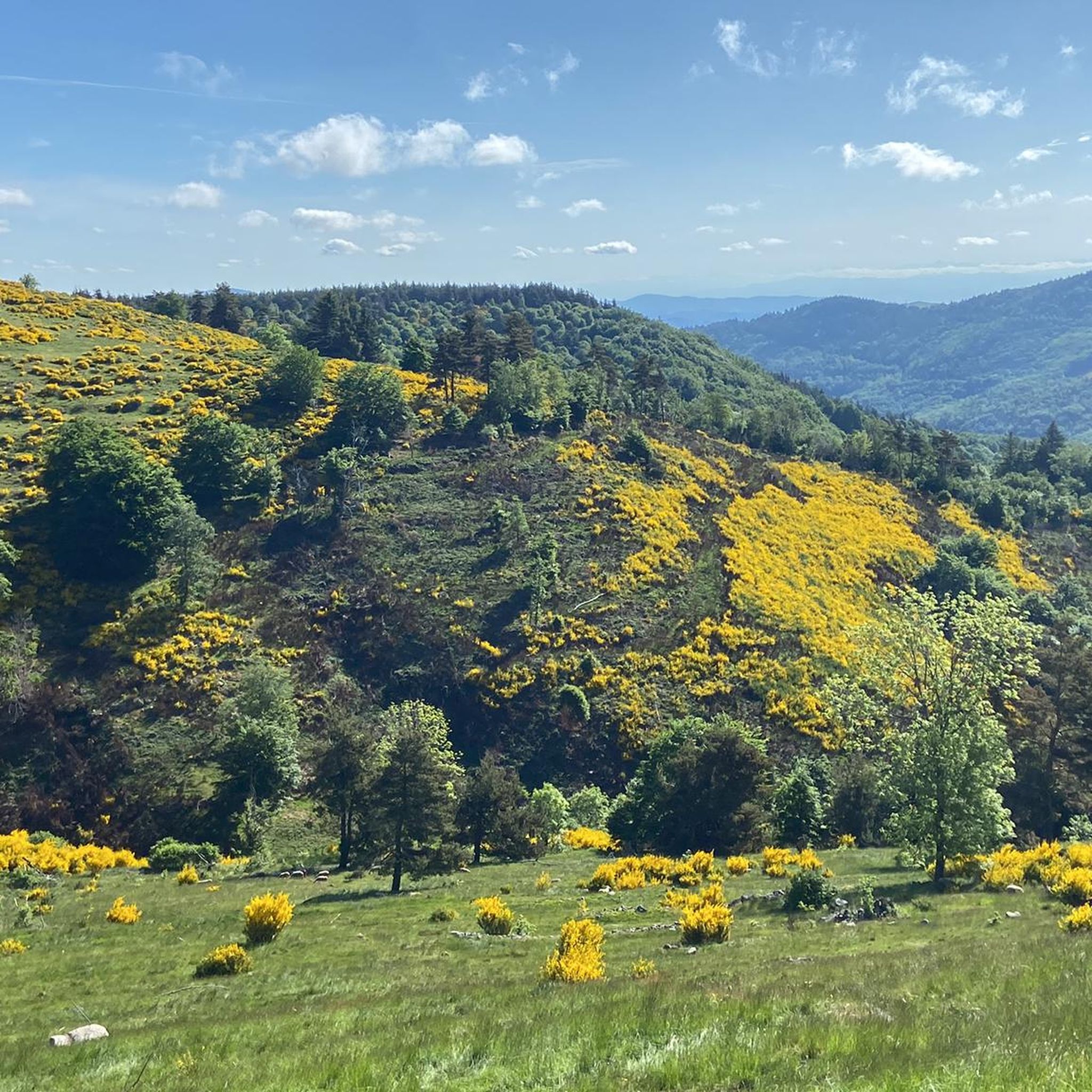
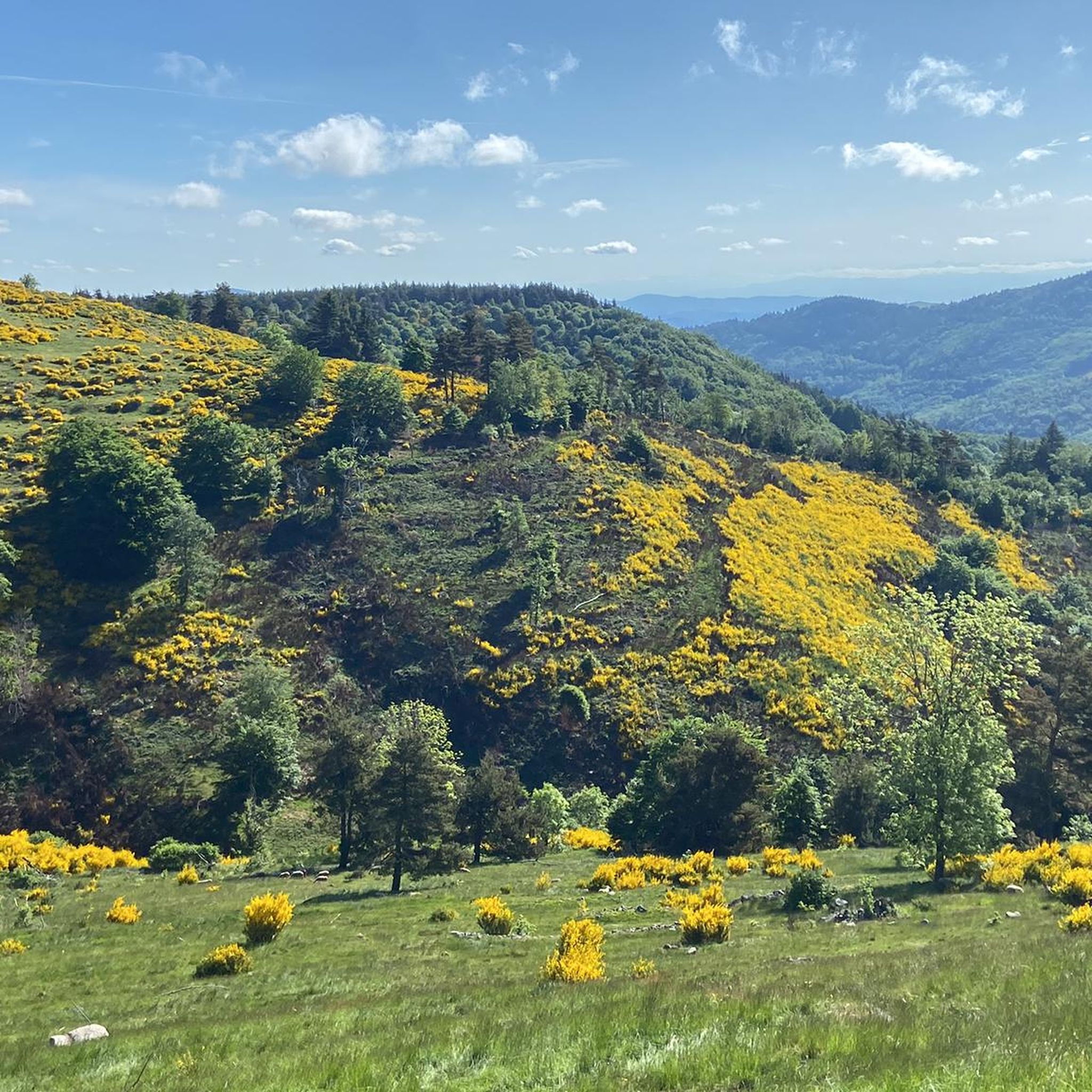
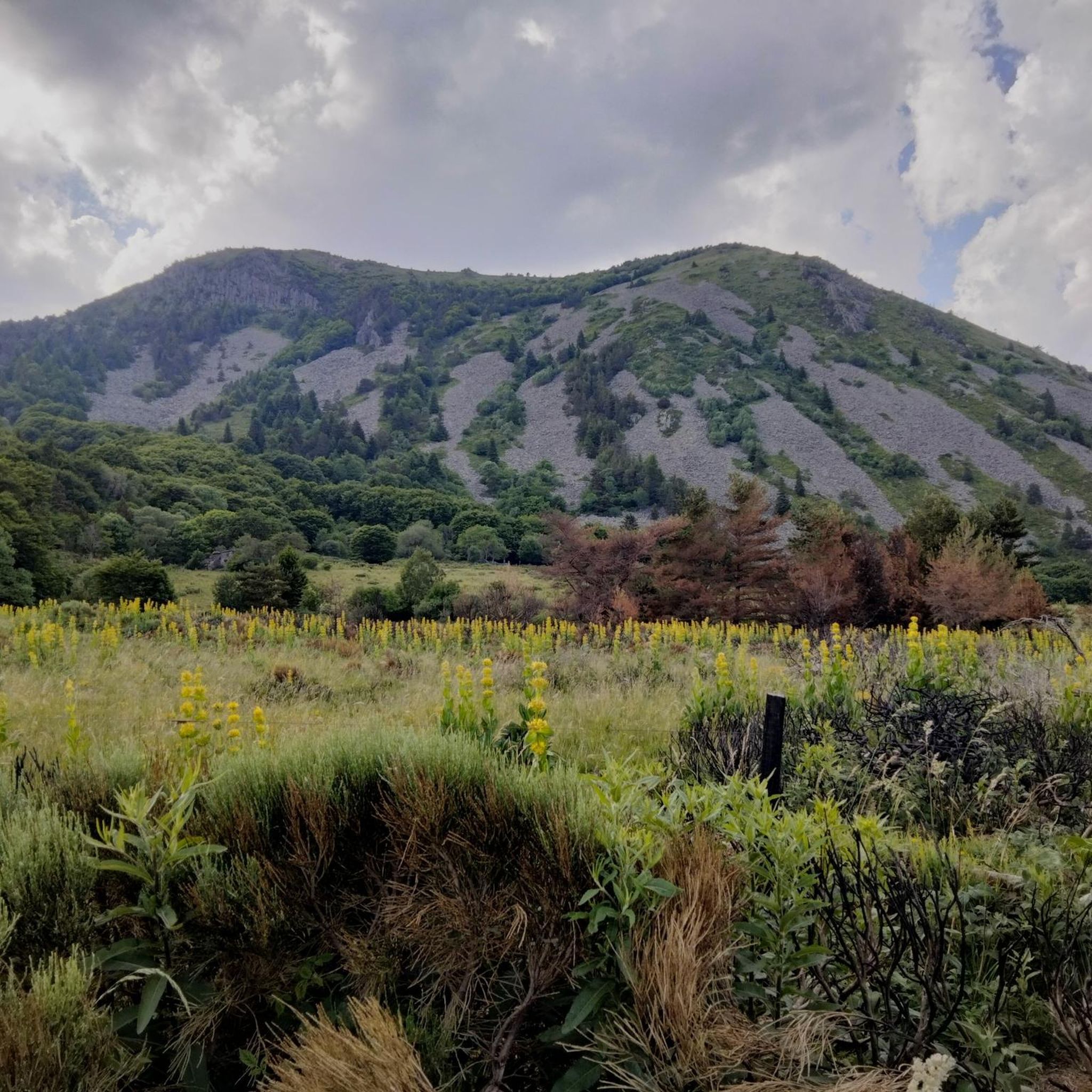
Forest tulip, mountain pea and of course broom
0
0

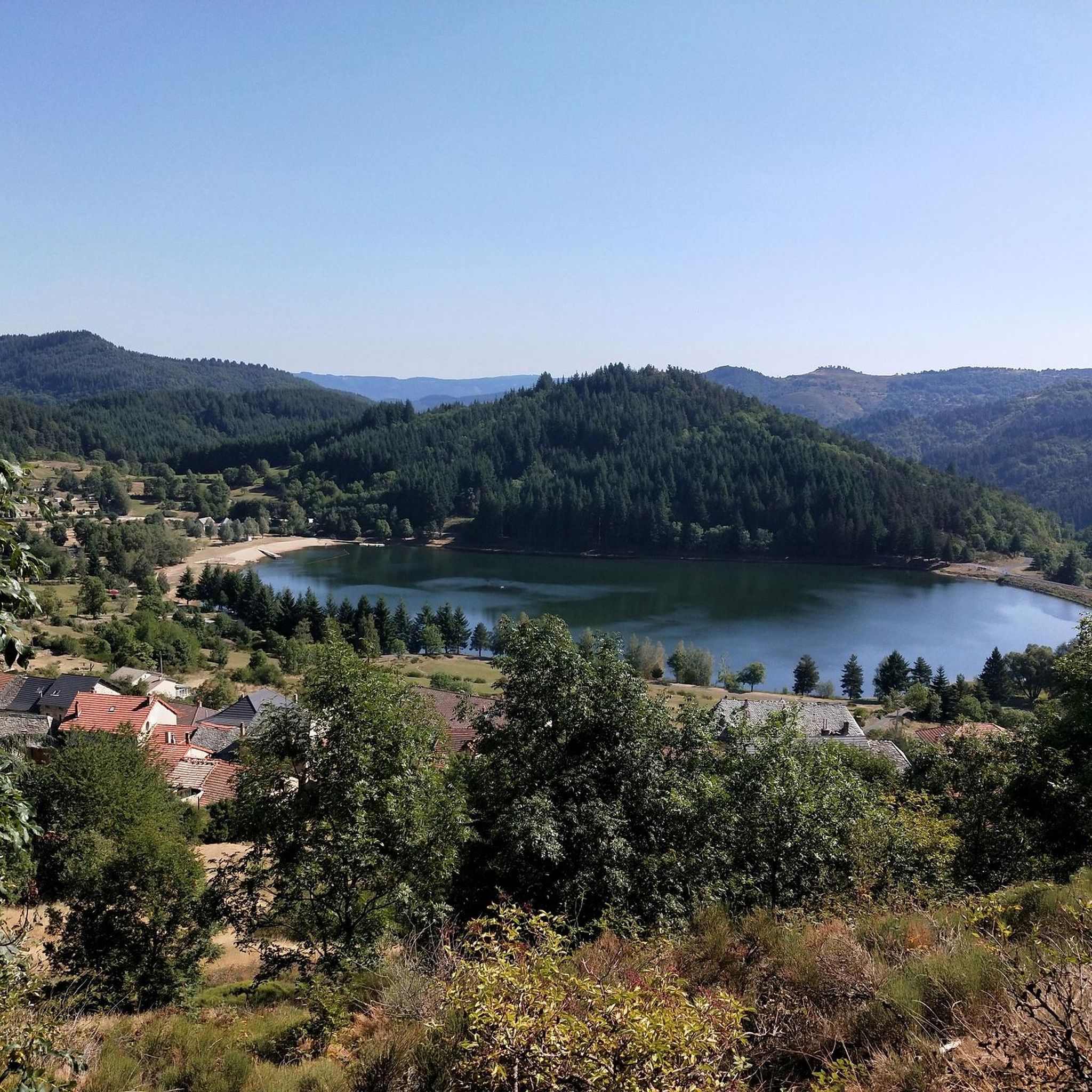
La Volane is one of the prettiest rivers in the Ardèche. Here, you can take a short break, lying by the water, and cool off in the clear water.
1
0
It is undoubtedly one of the prettiest viewpoints over the Volane Valley: the wonderful Cévennes of Ardèche with its volcanoes, its terraced agriculture and its wild rivers.
0
0
Approaching the ruins of the Rouyon farm, one can imagine the family of peasants who lived here not so long ago, almost cut off from the world, all year round, and all life long.
0
0

The Col de Mézilhac from Le Cheylard is a frequent ascent in the Ardéchoise, a cyclosportive in June. The climb is 22 km long with a total elevation gain of 700 m. The average gradient is 3.18% with maximum gradients of 7.5%.
2
0

Small source abandoned since 1970 to visit with its old facilities!
0
0

Frequently Asked Questions
How many hiking trails are available around Mézilhac, and what are their difficulty levels?
Mézilhac offers a wide range of hiking opportunities with over 120 trails. These include 35 easy routes, 60 moderate trails, and 27 more challenging options, ensuring there's something for every skill level.
What kind of landscapes can I expect to see while hiking near Mézilhac?
Hiking around Mézilhac immerses you in the diverse landscapes of the Monts d'Ardèche Regional Natural Park. You'll encounter striking volcanic features, including ancient cones and basalt formations, alongside lush chestnut groves, dense forests, and open mountain panoramas. Rivers like the Besorgues also carve through the area, adding to its natural beauty.
Are there any easy, family-friendly hikes in the Mézilhac area?
Yes, Mézilhac offers several easy routes suitable for families. For instance, the Suc de Montivernoux loop from Mézilhac is an easy 2.4 km trail with minimal elevation gain, perfect for a shorter outing. The region's extensive network includes many accessible paths ideal for all ages.
Can I bring my dog on the hiking trails around Mézilhac?
Many trails in the Monts d'Ardèche Regional Natural Park are dog-friendly, but it's always recommended to keep your dog on a leash, especially in areas with livestock or protected wildlife. Always check local signage for specific restrictions on individual routes.
Are there any notable natural attractions or landmarks to visit while hiking?
Absolutely. The region is rich in natural wonders. You can visit the iconic Mount Gerbier de Jonc, an extinct volcanic cone and the source of the Loire River. Another must-see is the Ray-Pic Waterfall, famous for its stunning basalt columns formed by ancient lava flows. The area also features several scenic mountain passes like Col de Mézilhac (1,119 m).
What do other hikers say about the trails in Mézilhac?
The hiking trails in Mézilhac are highly regarded by the komoot community, holding an average rating of 4.4 stars from over 400 reviews. Hikers frequently praise the diverse terrain, the stunning volcanic landscapes, and the well-maintained paths that offer beautiful mountain panoramas.
Are there any circular hiking routes available from Mézilhac?
Yes, many routes around Mézilhac are circular. For example, the Col des Quatre Vios loop from Mézilhac is a popular moderate 13.9 km circular path offering views of the Ardéchoise mountains. Another option is the Col de Mézilhac (1,119 m) loop from Mézilhac, a 12.1 km trail through varied terrain.
What is the best time of year to go hiking in Mézilhac?
The Ardéchoise mountains offer beautiful hiking conditions from spring through autumn. Spring brings lush greenery and wildflowers, while autumn transforms the chestnut groves into vibrant hues. Summer is also popular, but be prepared for warmer temperatures, especially at lower elevations. Winter hiking is possible but requires appropriate gear for potentially snowy or icy conditions.
Are there any trails that offer panoramic viewpoints?
Yes, the region is known for its expansive views. The ascent of Montivernoux, for instance, offers exceptional panoramas encompassing the Cévennes, the Monts Lozère, the Tanargue, and even Mont Ventoux and the Alps on a clear day. The Col du Montivernoux loop from Mézilhac is a moderate 14.9 km route that provides access to these stunning vistas.
Is there public transport or parking available for trailheads near Mézilhac?
While public transport options directly to all trailheads might be limited in this mountainous region, Mézilhac itself typically offers parking facilities. For specific routes like the Col des Quatre Vios loop from Mauras, parking is usually available at the starting points in the villages or designated areas. It's advisable to check local information for specific trailhead access.
What makes the Monts d'Ardèche Regional Natural Park unique for hiking?
The Monts d'Ardèche Regional Natural Park, where Mézilhac is located, is a UNESCO Global Geopark, distinguished by its volcanic origins with over 50 volcanoes and 4,000 kilometers of hiking trails. This unique geological history has created a diverse landscape of basalt formations, ancient cones, and river-carved valleys, supporting a rich biodiversity including rare protected species.
Most popular attractions around Mézilhac

Get inspired with the komoot mobile app


Explore more
Browse the best Hikes in other regions.
